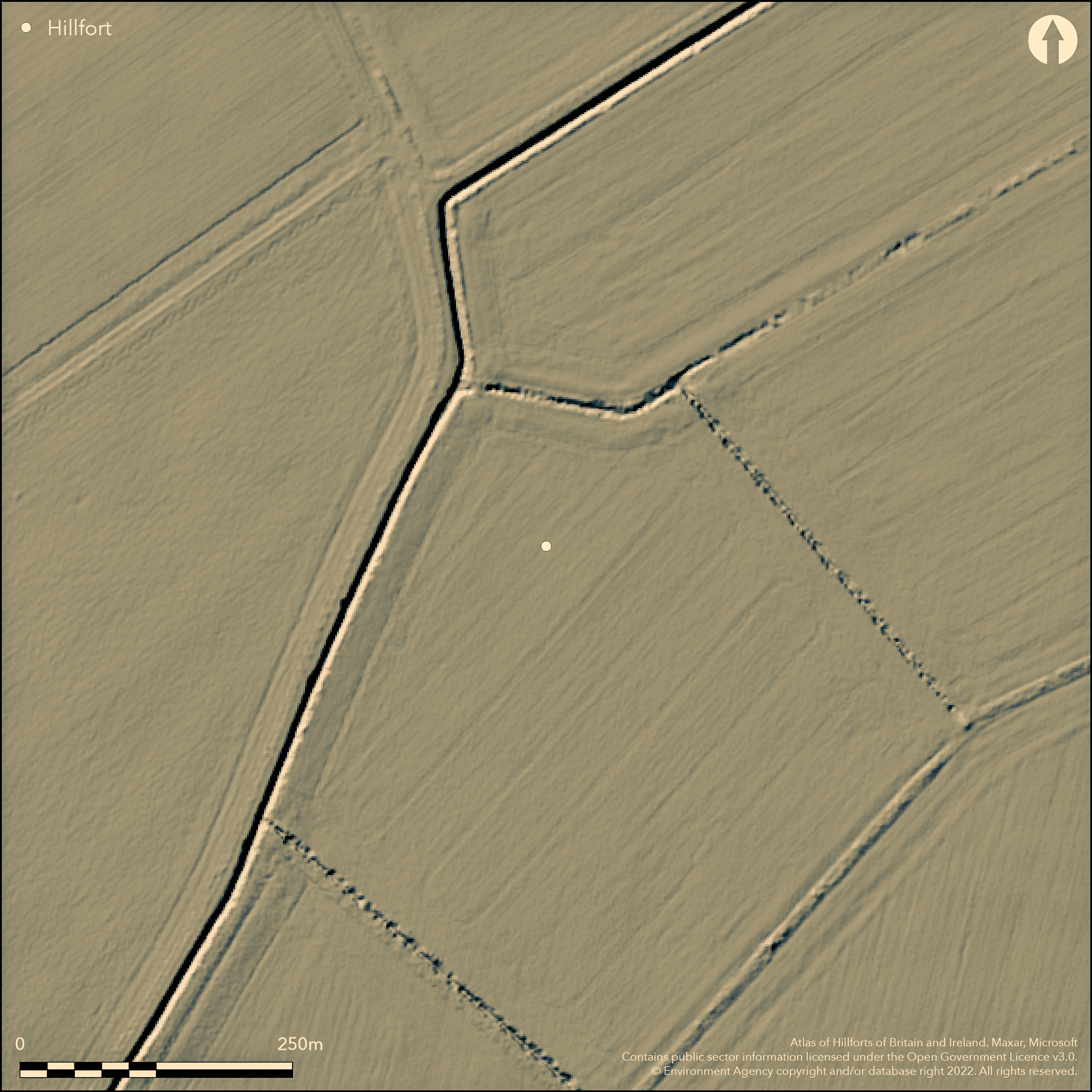
LiDAR 1m DTM Hillshade
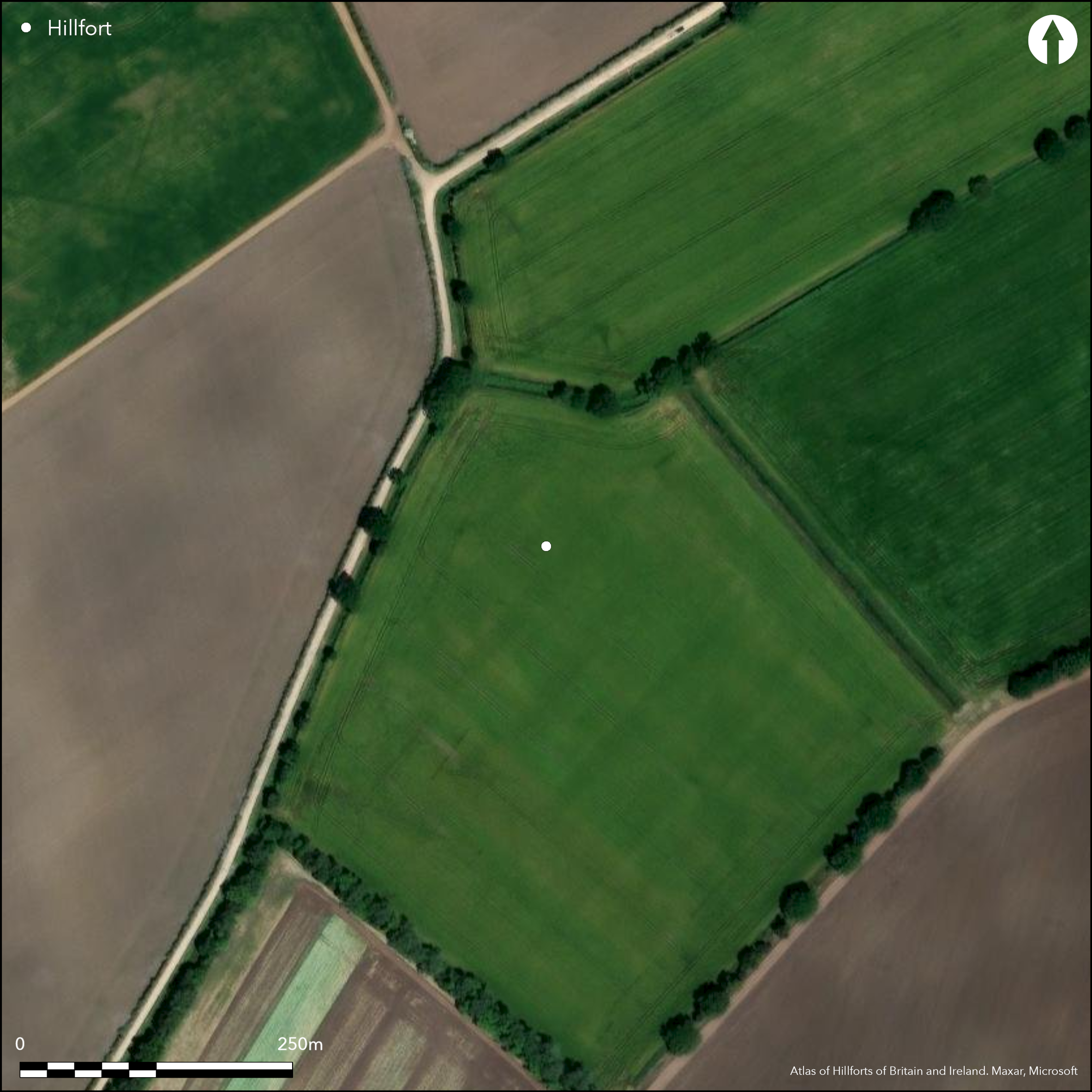
Satellite Imagery
LiDAR 1m DTM Hillshade
Satellite Imagery
Scroll left/right to view further images.
HER: Lincolnshire 40096 (None)
NMR: TF 16 SE 5 (351412)
SM: 1017880
NGR: TF 19572 60991
X: 519572 Y: 360991 (OSGB36)
An enclosure lying 60m to the E of Old Abbey Farm, scheduled as a small multivallate hillfort similar to that at Tattershall Thorpe (Atlas no. 2851). Oval in form and surviving as the cropmarks of three concentric ditches and slight banks which it is said, can still be seen in low light. It lies at approximately 8m OD on land that was possibly marshland in the prehistoric period. It is aligned NW-SE measuring 120m by 90m with the width of the defences between the inner and outer ditches at least 30m giving an overall footprint of c. 1.0ha. As with the Tattershall Thorpe enclosure, it may have had a role in stock management. Alternatively, because its location is on what would have been marshy land prior to drainage, it has been suggested it may be a medieval or post-medieval duck decoy with an elaborate arrangement of water drainage ditches which extend from the enclosure although for this record we consider it to be a hillfort. A causeway has been identified across the outer ditch and middle ditch in the SE. Breaks can be seen in the middle ditch in the S and N. No break or causeway has been identified for the inner ditch. Recorded on aerial photographs since 1948. It is not recorded on OS mapping and has not been excavated and remains undated.
Citizen Science: ✗
Reliability of Data: Confirmed
Reliability of Interpretation: Confirmed
X: -23844 Y: 7007573 (EPSG: 3857)
Longitude: -0.21419268925941803 Latitude: 53.132655225812876 (EPSG:4326)
Country: England; None
Current County or Unitary Authority: Lincolnshire
Historic County: Lincolnshire
Current Parish/Community/Council/Townland: Woodhall Spa; Tattershall Thorpe
On Heritage at Risk Register (2015).
| Extant | ✗ |
| Cropmark | ✓ |
| Likely Destroyed | ✗ |
None
| Woodland | ✗ |
| Commercial Forestry Plantation | ✗ |
| Parkland | ✗ |
| Pasture (Grazing) | ✗ |
| Arable | ✓ |
| Scrub/Bracken | ✗ |
| Bare Outcrop | ✗ |
| Heather/Moorland | ✗ |
| Heath | ✗ |
| Built-up | ✗ |
| Coastal Grassland | ✗ |
| Other | ✗ |
A level terrain fort on low lying ground at 8m OD
| Contour Fort | ✗ |
| Partial Contour Fort | ✗ |
| Promontory Fort | ✗ |
| Hillslope Fort | ✗ |
| Level Terrain Fort | ✓ |
| Marsh Fort | ✗ |
| Multiple Enclosure Fort | ✗ |
| Hilltop | ✗ |
| Coastal Promontory | ✗ |
| Inland Promontory | ✗ |
| Valley Bottom | ✗ |
| Knoll/Hillock/Outcrop | ✗ |
| Ridge | ✗ |
| Cliff/Plateau-edge/Scarp | ✗ |
| Hillslope | ✗ |
| Lowland | ✓ |
| Spur | ✗ |
Dominant Topographic Feature: None
| North | ✗ |
| Northeast | ✗ |
| East | ✗ |
| Southeast | ✗ |
| South | ✗ |
| Southwest | ✗ |
| West | ✗ |
| Northwest | ✗ |
| Level | ✓ |
Altitude: 8.0m
The parish boundaries of Woodhall Spa and Tattershall Thorpe run to the E of the enclosure
Boundary Type: Parish/Townland
Undated
Reliability: D - None
| Pre 1200BC | ✗ |
| 1200BC - 800BC | ✗ |
| 800BC - 400BC | ✗ |
| 400BC - AD50 | ✗ |
| AD50 - AD400 | ✗ |
| AD400 - AD 800 | ✗ |
| Post AD800 | ✗ |
| Unknown | ✓ |
| Pre Hillfort: | None |
| Post Hillfort: | None |
Recorded on aerial photographs since 1948. General reference in Chowne et al. (1986). Field investigation in 1965 when the inspector noted that the land would have been marsh in prehistory. Recorded as part of the Lincolnshire National Mapping Programme. Scheduled.
| Other (1965): | Field investigation |
| 1st Identified Written Reference (1986): | None |
| Other (1999): | Scheduled |
| Other (None): | RCHME: Lincolnshire NMP |
No internal features are known
None
| None | ✓ |
| Spring | ✗ |
| Stream | ✗ |
| Pool | ✗ |
| Flush | ✗ |
| Well | ✗ |
| Other | ✗ |
None
| No Known Features | ✓ |
| Round Stone Structures | ✗ |
| Rectangular Stone Structures | ✗ |
| Curvilinear Platforms | ✗ |
| Other Roundhouse Evidence | ✗ |
| Pits | ✗ |
| Quarry Hollows | ✗ |
| Other | ✗ |
None
| No Known Excavation | ✓ |
| Pits | ✗ |
| Postholes | ✗ |
| Roundhouses | ✗ |
| Rectangular Structures | ✗ |
| Roads/Tracks | ✗ |
| Quarry Hollows | ✗ |
| Other | ✗ |
| Nothing Found | ✗ |
None
| No Known Geophysics | ✓ |
| Pits | ✗ |
| Roundhouses | ✗ |
| Rectangular Structures | ✗ |
| Roads/Tracks | ✗ |
| Quarry Hollows | ✗ |
| Other | ✗ |
| Nothing Found | ✗ |
None
| No Known Finds | ✓ |
| Pottery | ✗ |
| Metal | ✗ |
| Metalworking | ✗ |
| Human Bones | ✗ |
| Animal Bones | ✗ |
| Lithics | ✗ |
| Environmental | ✗ |
| Other | ✗ |
None
| APs Not Checked | ✗ |
| None | ✓ |
| Roundhouses | ✗ |
| Rectangular Structures | ✗ |
| Pits | ✗ |
| Postholes | ✗ |
| Roads/Tracks | ✗ |
| Other | ✗ |
A causeway has been identified across the outer ditch and middle ditch in the SE. A further break can be seen in the middle ditch in the S and two in the N. No break or causeway has been identified for the inner ditch.
| 5: | Causeways |
| 2: | None |
Guard Chambers: ✗
Chevaux de Frise: ✗
| 1. Other Forms (South east): | Rampart destroyed, identified as a causeway across the middle ditch |
| 1. Other Forms (South east): | Rampart destroyed, identified as a causeway across the outer ditch |
Surviving as the cropmarks of three concentric ditches and slight banks which can still be seen in low light. It is approximately oval in form, aligned NW-SE measuring 120m by 90m with the width of the defences between the inner and outer ditches at least 30m.
| Area 1: | 1.0ha. |
| Total: | 1.0ha. |
Total Footprint Area: 1.0ha.
None
| ✗ | Area estimated |
| ✓ | None |
| NE Quadrant: | 3 |
| SE Quadrant: | 3 |
| SW Quadrant: | 3 |
| NW Quadrant: | 3 |
| Total: | 3 |
| Partial Univallate | ✗ |
| Univallate | ✗ |
| Partial Bivallate | ✗ |
| Bivallate | ✗ |
| Partial Multivallate | ✗ |
| Multivallate | ✓ |
| Unknown | ✗ |
| Partial Univallate | ✗ |
| Univallate | ✗ |
| Partial Bivallate | ✗ |
| Bivallate | ✗ |
| Partial Multivallate | ✗ |
| Multivallate | ✗ |
Very slight banks
| None | ✗ |
| Earthen Bank | ✓ |
| Stone Wall | ✗ |
| Rubble | ✗ |
| Wall-walk | ✗ |
| Evidence of Timber | ✗ |
| Vitrification | ✗ |
| Other Burning | ✗ |
| Palisade | ✗ |
| Counter Scarp Bank | ✗ |
| Berm | ✗ |
| Unfinished | ✗ |
| Other | ✗ |
None
| None | ✗ |
| Earthen Bank | ✗ |
| Stone Wall | ✗ |
| Murus Duplex | ✗ |
| Timber-framed | ✗ |
| Timber-laced | ✗ |
| Vitrification | ✗ |
| Other Burning | ✗ |
| Palisade | ✗ |
| Counter Scarp Bank | ✗ |
| Berm | ✗ |
| Unfinished | ✗ |
| No Known Excavation | ✓ |
| Other | ✗ |
| ✗ | None |
| ✓ | None |
Number of Ditches: 3
| ✗ | None |
Chowne, P, Girling, M, Greig, J. 1986. Excavations At An Iron Age Defended Enclosure At Tattershall Thorpe, Proceedings of the Prehistoric Society, Vol. 52. 159-88
Atlas of Hillforts:
Wikidata:
This work is licensed under CC BY-SA 4.0

 and should be cited as:
Lock, Gary and Ralston, Ian. 2024. Atlas of Hillforts of Britain and Ireland. Available at: https://hillforts.arch.ox.ac.uk
Document Version 1.1