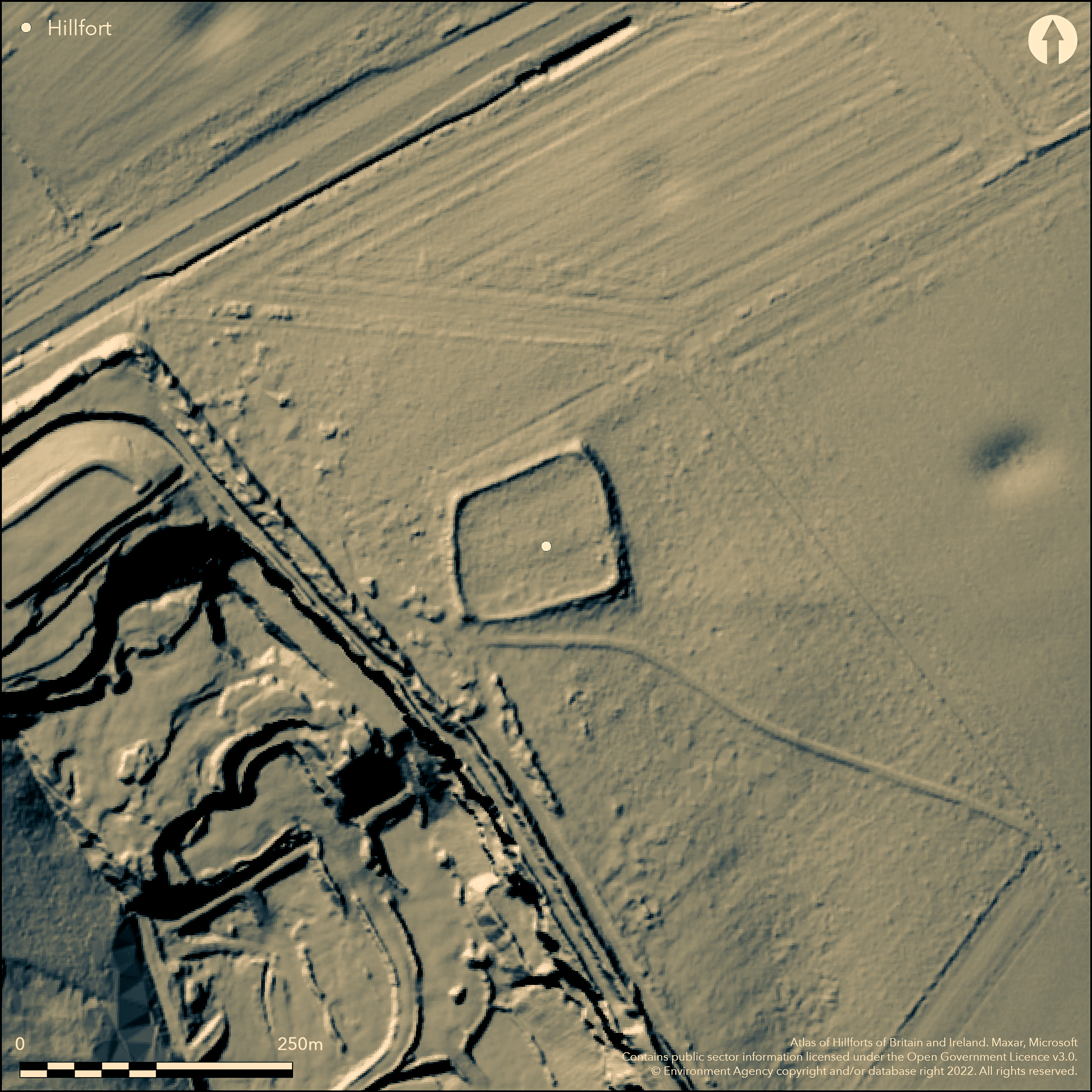
LiDAR 1m DTM Hillshade
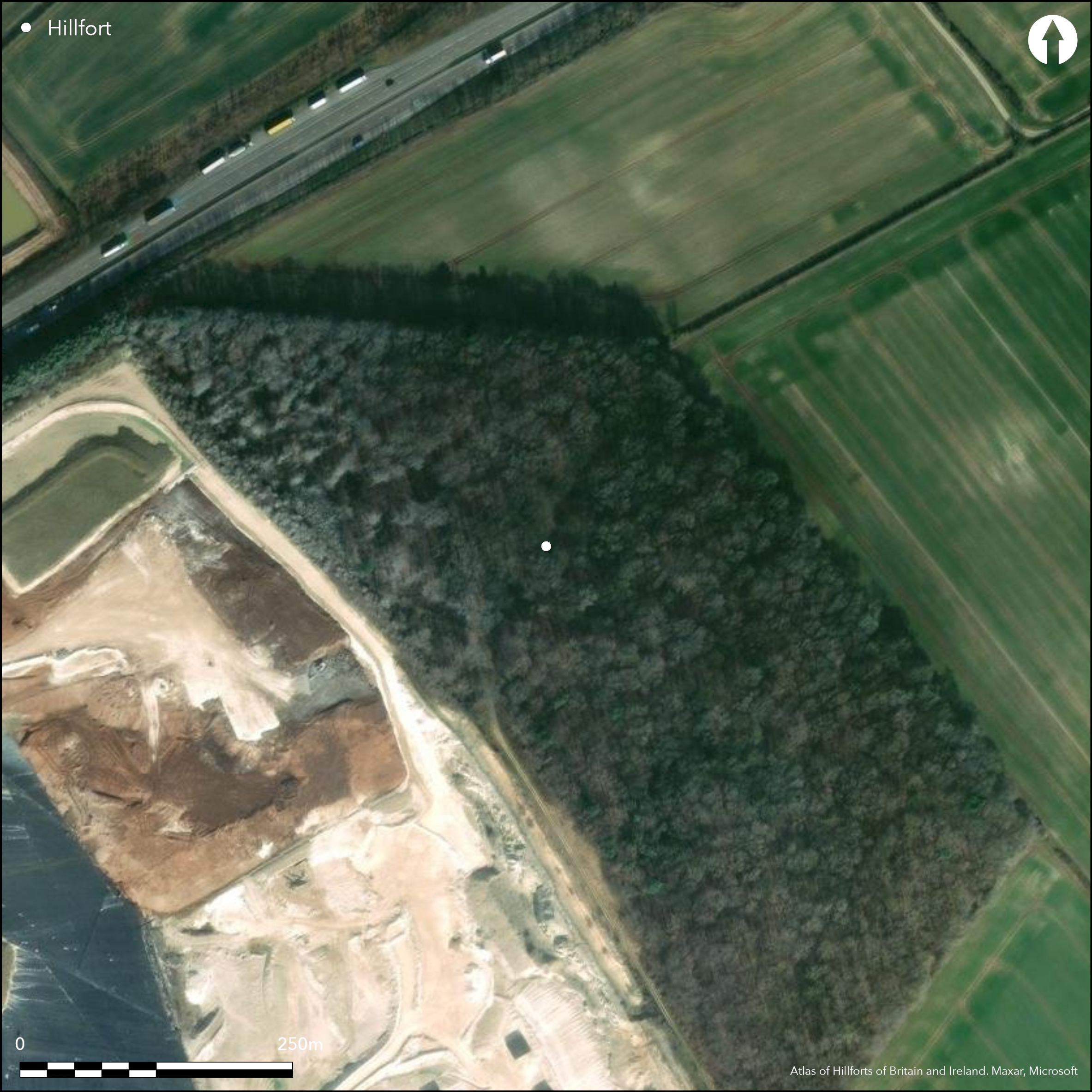
Satellite Imagery
LiDAR 1m DTM Hillshade
Satellite Imagery
Scroll left/right to view further images.
HER: North Lincolnshire 743 (None)
NMR: TA 01 SE 4 (78829)
SM: 1016427
NGR: TA 08107 12021
X: 508107 Y: 412021 (OSGB36)
Lying in woodland just over 1km to the SW of Croxton, an enclosure scheduled as a large univallate hillfort. Sited on a slight break in slope it is sub-rectangular in form measuring 80m by 60m and comprises an earth and chalk bank 10m wide and 1-1.5m high rising up to 3m at the corners and an external ditch 10m wide, now infilled. The banks are straight except in the E where it bows slightly outwards giving an overall footprint of c. 0.58ha. An entrance also lies in the E. No internal features are known. A Roman coin hoard dated AD 367-75 discussed by Stukeley (Itinerarium Curiosum, 1776, 101) was said to have been discovered within the hillfort but the coins could have been found individually on Kirmington Field (location discussed by Phillips, 1934). A concentration of Roman greyware potsherds and thumb scrapers were found on the surface in the SE corner of the camp. It lies on the line of a prehistoric track later adopted as a Roman road, and overlooks the Iron Age and Romano-British settlement of Kirmington which lies 1.7km to the SE. The site is undated but could be Roman or medieval. An evaluation in Camp Covert in 2000 cut what was possibly the eastern edge of the outer ditch (Hambly, 2000). A fragment of Iron Age or Roman pottery, horse teeth and animal bone were recovered from the ditch fill. Yarborough derives from eorpburg meaning 'earth fortification' and was recorded in Domesday (1086) as 'Gereburg'. The site is mentioned in a number of historic documents and was possibly an important meeting place in the medieval and post medieval periods, summarised in the North Lincolnshire HER record. The site is recorded on 1885-1900 OS mapping. Scheduled
Citizen Science: ✗
Reliability of Data: Confirmed
Reliability of Interpretation: Confirmed
X: -40971 Y: 7093565 (EPSG: 3857)
Longitude: -0.36805293132434846 Latitude: 53.59361561816312 (EPSG:4326)
Country: England; None
Current County or Unitary Authority: Lincolnshire
Historic County: Lincolnshire
Current Parish/Community/Council/Townland: Croxton; Melton Ross
Described in the Heritage at Register 2015 as generally unsatisfactory with major localised problems and the principal vulnerability being scrub and tree growth. On Heritage at Risk Register (2015).
| Extant | ✓ |
| Cropmark | ✗ |
| Likely Destroyed | ✗ |
Broadleaved woodland, probably managed
| Woodland | ✓ |
| Commercial Forestry Plantation | ✓ |
| Parkland | ✗ |
| Pasture (Grazing) | ✗ |
| Arable | ✗ |
| Scrub/Bracken | ✗ |
| Bare Outcrop | ✗ |
| Heather/Moorland | ✗ |
| Heath | ✗ |
| Built-up | ✗ |
| Coastal Grassland | ✗ |
| Other | ✗ |
A level terrain fort sited at 59m OD on relatively level ground on a break of slope on land sloping to the E
| Contour Fort | ✗ |
| Partial Contour Fort | ✗ |
| Promontory Fort | ✗ |
| Hillslope Fort | ✗ |
| Level Terrain Fort | ✓ |
| Marsh Fort | ✗ |
| Multiple Enclosure Fort | ✗ |
| Hilltop | ✗ |
| Coastal Promontory | ✗ |
| Inland Promontory | ✗ |
| Valley Bottom | ✗ |
| Knoll/Hillock/Outcrop | ✗ |
| Ridge | ✗ |
| Cliff/Plateau-edge/Scarp | ✗ |
| Hillslope | ✗ |
| Lowland | ✓ |
| Spur | ✗ |
Dominant Topographic Feature: On relatively level ground on a break of slope
| North | ✗ |
| Northeast | ✗ |
| East | ✓ |
| Southeast | ✗ |
| South | ✗ |
| Southwest | ✗ |
| West | ✗ |
| Northwest | ✗ |
| Level | ✗ |
Altitude: 59.0m
Parliamentary Constituencies of Brigg and Goole and Cleethorpes runs along the SW extent of the enclosure. These coincide with the parish boundaries of Melton Ross and Croxton
Boundary Type: Parish/Townland
Fragment of Iron Age or early Roman pottery recovered from a ditch fill. Roman pottery and thumbnail scrapers found within the enclosure.
Reliability: D - None
| Pre 1200BC | ✗ |
| 1200BC - 800BC | ✗ |
| 800BC - 400BC | ✗ |
| 400BC - AD50 | ✗ |
| AD50 - AD400 | ✗ |
| AD400 - AD 800 | ✗ |
| Post AD800 | ✗ |
| Unknown | ✓ |
| Pre Hillfort: | None |
| Post Hillfort: | Roman pottery recovered. It possibly continued as an important meeting place in the medieval and post medieval periods, (summarised in the North Lincolnshire HER record) |
| Artefactual: | None |
Recorded in Domesday (1086) as 'Gereburg'. Armstrong (1789) shows Yarborough Camp as a square earthwork bank, crossed by tracks and entrances in open land, although the accuracy of the depiction is doubtful. Tape and offset survey in 1986. An evaluation in Camp Covert in 2000 cut what was possibly the eastern edge of the outer ditch (Hambly 2000). Field investigations in 1963 and 1971. Scheduled
| 1st Identified Written Reference (1086): | Domesday |
| Other (1789): | Plan |
| 1st Identified Map Depiction (1819): | Ordnance Survey |
| Other (1962): | Scheduled |
| Other (1963): | Field investigation |
| Other (1971): | Field investigation |
| Earthwork Survey (1986): | Tape and offset survey |
| Excavation (2000): | Evaluation in Camp Covert |
No internal features are recorded. Surface finds of pottery and lithics.
None
| None | ✓ |
| Spring | ✗ |
| Stream | ✗ |
| Pool | ✗ |
| Flush | ✗ |
| Well | ✗ |
| Other | ✗ |
None
| No Known Features | ✓ |
| Round Stone Structures | ✗ |
| Rectangular Stone Structures | ✗ |
| Curvilinear Platforms | ✗ |
| Other Roundhouse Evidence | ✗ |
| Pits | ✗ |
| Quarry Hollows | ✗ |
| Other | ✗ |
None
| No Known Excavation | ✓ |
| Pits | ✗ |
| Postholes | ✗ |
| Roundhouses | ✗ |
| Rectangular Structures | ✗ |
| Roads/Tracks | ✗ |
| Quarry Hollows | ✗ |
| Other | ✗ |
| Nothing Found | ✗ |
None
| No Known Geophysics | ✓ |
| Pits | ✗ |
| Roundhouses | ✗ |
| Rectangular Structures | ✗ |
| Roads/Tracks | ✗ |
| Quarry Hollows | ✗ |
| Other | ✗ |
| Nothing Found | ✗ |
Surface finds
| No Known Finds | ✗ |
| Pottery | ✓ |
| Metal | ✗ |
| Metalworking | ✗ |
| Human Bones | ✗ |
| Animal Bones | ✗ |
| Lithics | ✓ |
| Environmental | ✗ |
| Other | ✗ |
None
| APs Not Checked | ✓ |
| None | ✗ |
| Roundhouses | ✗ |
| Rectangular Structures | ✗ |
| Pits | ✗ |
| Postholes | ✗ |
| Roads/Tracks | ✗ |
| Other | ✗ |
An simple gap entrance lies in the E
| 1: | None |
| 2: | None |
Guard Chambers: ✗
Chevaux de Frise: ✗
| 1. Simple Gap (East): | None |
A large univallate hillfort. Sub-rectangular in form measuring 80m by 60m and comprises an earth and chalk bank 10m wide and 1-1.5m high rising up to 3m at the corners and an external ditch 10m wide, now infilled. The banks are straight except in the E where it bows slightly outwards.
| Area 1: | 0.53ha. |
| Total: | 0.53ha. |
Total Footprint Area: 0.58ha.
None
| ✗ | Estimated from dimensions of enclosure / checked map |
| ✓ | None |
| NE Quadrant: | 1 |
| SE Quadrant: | 1 |
| SW Quadrant: | 1 |
| NW Quadrant: | 1 |
| Total: | 1 |
| Partial Univallate | ✗ |
| Univallate | ✓ |
| Partial Bivallate | ✗ |
| Bivallate | ✗ |
| Partial Multivallate | ✗ |
| Multivallate | ✗ |
| Unknown | ✗ |
| Partial Univallate | ✗ |
| Univallate | ✗ |
| Partial Bivallate | ✗ |
| Bivallate | ✗ |
| Partial Multivallate | ✗ |
| Multivallate | ✗ |
None
| None | ✗ |
| Earthen Bank | ✓ |
| Stone Wall | ✗ |
| Rubble | ✓ |
| Wall-walk | ✗ |
| Evidence of Timber | ✗ |
| Vitrification | ✗ |
| Other Burning | ✗ |
| Palisade | ✗ |
| Counter Scarp Bank | ✗ |
| Berm | ✗ |
| Unfinished | ✗ |
| Other | ✗ |
None
| None | ✓ |
| Earthen Bank | ✗ |
| Stone Wall | ✗ |
| Murus Duplex | ✗ |
| Timber-framed | ✗ |
| Timber-laced | ✗ |
| Vitrification | ✗ |
| Other Burning | ✗ |
| Palisade | ✗ |
| Counter Scarp Bank | ✗ |
| Berm | ✗ |
| Unfinished | ✗ |
| No Known Excavation | ✗ |
| Other | ✗ |
| ✗ | None |
| ✓ | None |
Number of Ditches: 1
| ✗ | None |
Hambly, J. 2000. Archaeological evaluation, land at Melton Ross Quarries. Archaeological Project Services.
Leahy, K. 1986, Yarborough Camp earthwork survey. Unpublished
Phillips, C.W. 1934. The present state of archaeology in Lincolnshire: Part II. Archaeological Journal, 91, 97-187
Atlas of Hillforts:
Wikidata:
This work is licensed under CC BY-SA 4.0

 and should be cited as:
Lock, Gary and Ralston, Ian. 2024. Atlas of Hillforts of Britain and Ireland. Available at: https://hillforts.arch.ox.ac.uk
Document Version 1.1