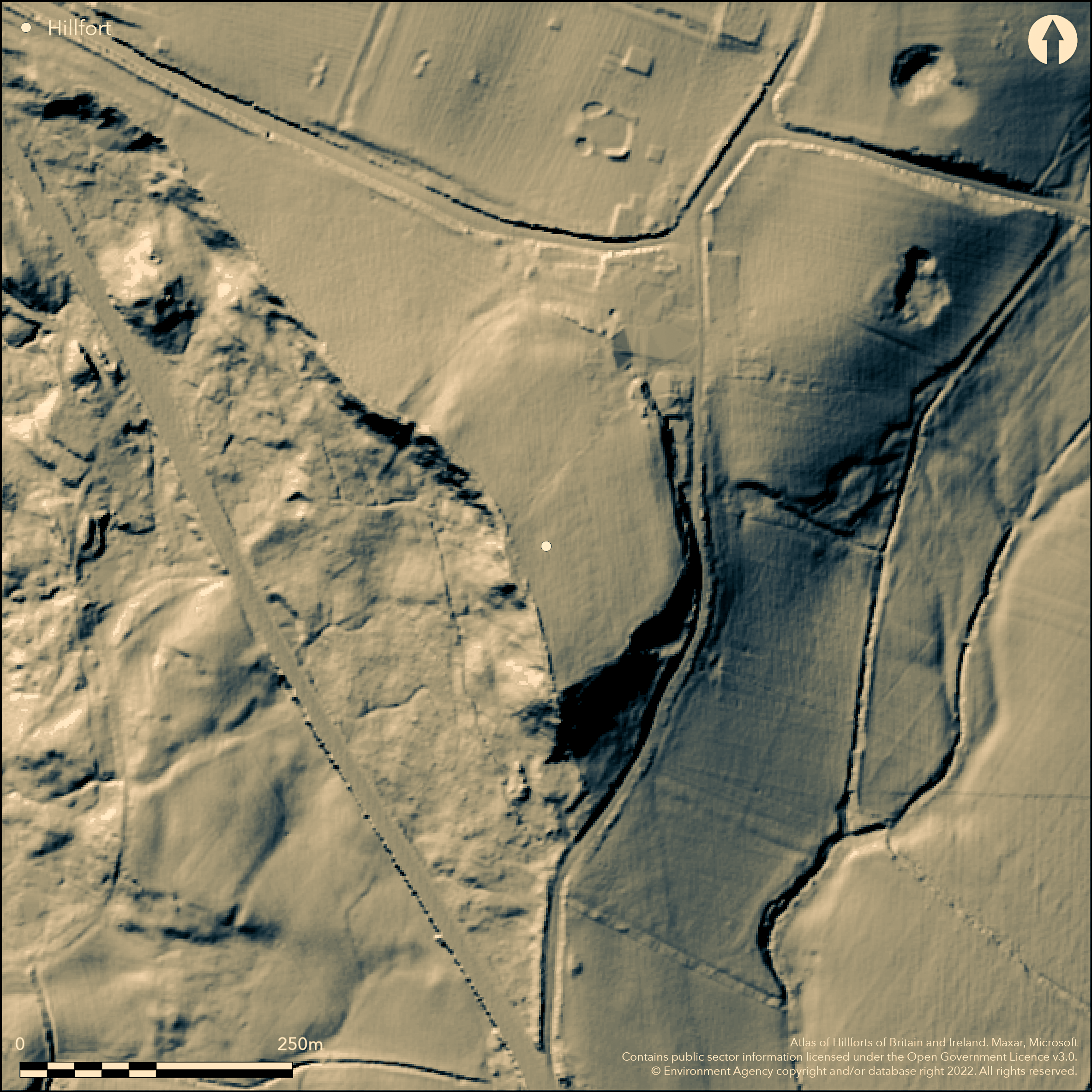
LiDAR 1m DTM Hillshade
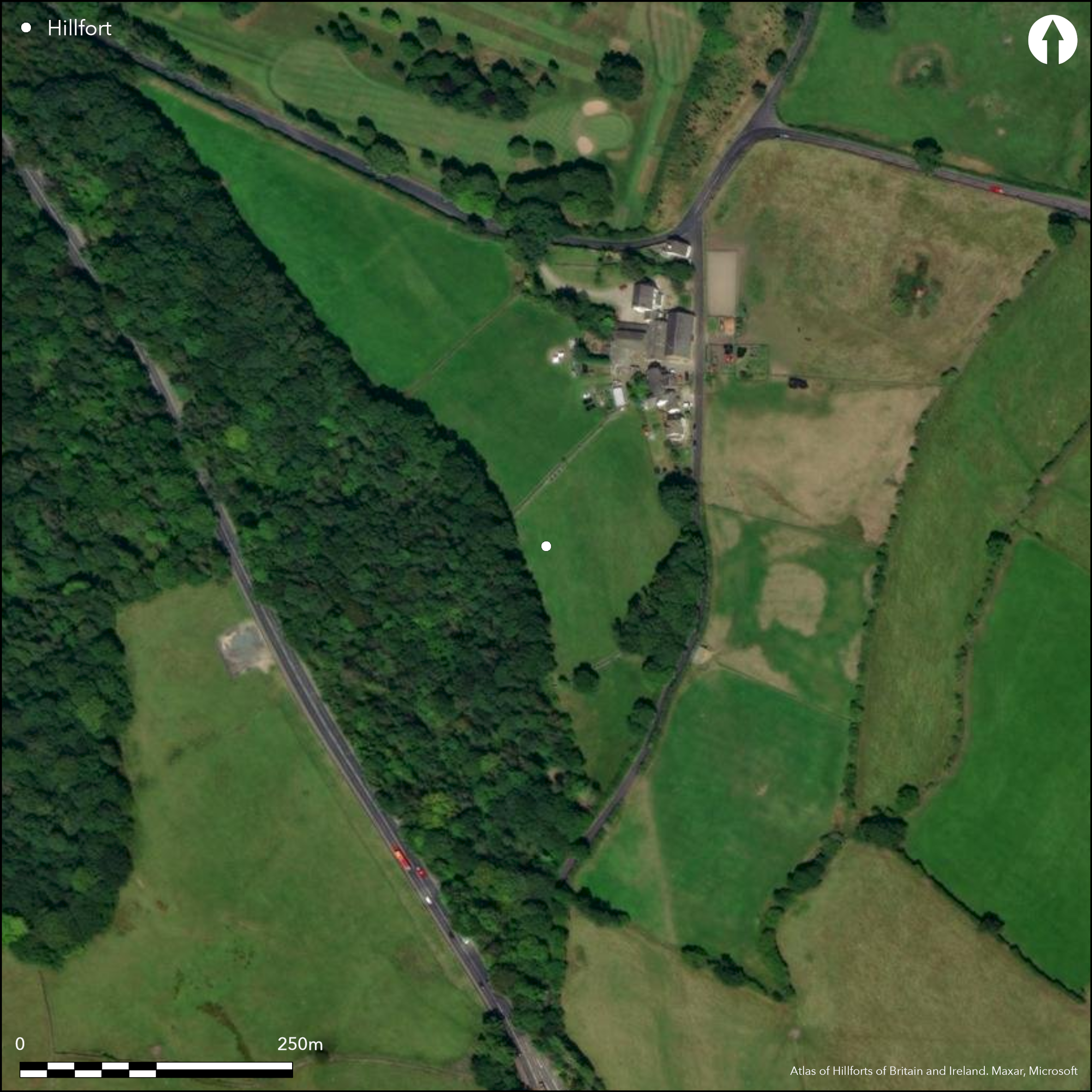
Satellite Imagery
LiDAR 1m DTM Hillshade
Satellite Imagery
Scroll left/right to view further images.
HER: Lancashire MLA181 (None)
NMR: SD 73 NW 22 (44511)
SM: 1013608
NGR: SD 74581 35499
X: 374581 Y: 435499 (OSGB36)
Lying directly to the S of Whalley Golf Club, a multivallate hillfort sited on a south-westerly-facing promontory at 122m OD. The enclosure has a maximum extent of 165m NW-SE by 110m transversely, enclosing 1.3ha. Protected by steep slopes in the W and elsewhere an inner bank with an external 6m wide berm, beyond which are three further banks and two medial ditches. The ramparts are badly mutilated except in the NW corner where the inner bank stands 1.5m high and the innermost ditch 6m wide, with the second bank 4m wide. Excavation for a water pipeline in 1957 (Tyson and Bu'Lock 1957) showed the inner bank to be constructed with a clay core revetted front and back with stone. The remaining banks are of earthen construction. The excavation also recorded an earlier rampart approximately 4m thick revetted at the front with large stones set on edge. This was later levelled and succeeded by the multivallate ramparts 6m further N at the break of slope. An entrance lies in the W which was shown to have a cobbled pavement. Pottery dated to 2nd century AD was discovered in an overlying deposit. Internally the surface appears to have been artificially levelled and excavations in 1970-1 prior to the destruction of the interior for a water trench discovered a number of stone packed postholes. Earlier in 1966 workmen laying a pipeline across the enclosure recovered a Bronze Age hoard which included gold and bronze artefacts. Subsequent excavations have unearthed further objects dating from the Neolithic to medieval periods indicating a long period of activity or occupation. The site is shown on 1885-1900 OS mapping. Probably Iron Age based on morphology.
Citizen Science: ✓
Reliability of Data: Confirmed
Reliability of Interpretation: Confirmed
X: -265782 Y: 7135224 (EPSG: 3857)
Longitude: -2.3875575795937616 Latitude: 53.81514510674799 (EPSG:4326)
Country: England
Current County or Unitary Authority: Lancashire
Historic County: Lancashire
Current Parish/Community/Council/Townland: Whalley
Severely mutilated
| Extant | ✓ |
| Cropmark | ✗ |
| Likely Destroyed | ✓ |
Grassland on the edge of Planes Wood
| Woodland | ✗ |
| Commercial Forestry Plantation | ✗ |
| Parkland | ✗ |
| Pasture (Grazing) | ✓ |
| Arable | ✗ |
| Scrub/Bracken | ✗ |
| Bare Outcrop | ✗ |
| Heather/Moorland | ✗ |
| Heath | ✗ |
| Built-up | ✗ |
| Coastal Grassland | ✗ |
| Other | ✗ |
A partial contour fort lying at 122m OD on a south-westerly-facing promontory
| Contour Fort | ✗ |
| Partial Contour Fort | ✓ |
| Promontory Fort | ✗ |
| Hillslope Fort | ✗ |
| Level Terrain Fort | ✗ |
| Marsh Fort | ✗ |
| Multiple Enclosure Fort | ✗ |
| Hilltop | ✓ |
| Coastal Promontory | ✗ |
| Inland Promontory | ✓ |
| Valley Bottom | ✗ |
| Knoll/Hillock/Outcrop | ✗ |
| Ridge | ✗ |
| Cliff/Plateau-edge/Scarp | ✓ |
| Hillslope | ✗ |
| Lowland | ✗ |
| Spur | ✗ |
Dominant Topographic Feature: South-westerly-facing promontory
| North | ✗ |
| Northeast | ✗ |
| East | ✗ |
| Southeast | ✗ |
| South | ✗ |
| Southwest | ✓ |
| West | ✗ |
| Northwest | ✗ |
| Level | ✗ |
Altitude: 122.0m
N/A
Excavations in the 1960s and 1970s recovered medieval and Roman pottery and flint and chert objects dated to the Bronze Age and Neolithic periods. A Bronze Age gold bracelet and `tress or lock' ring and bronze objects including socketed axe heads were discovered by workmen in 1966. No finds of an Iron Age date are recorded and the site is dated to the Iron Age on morphology only.
Reliability: D - None
| Pre 1200BC | ✗ |
| 1200BC - 800BC | ✗ |
| 800BC - 400BC | ✗ |
| 400BC - AD50 | ✗ |
| AD50 - AD400 | ✓ |
| AD400 - AD 800 | ✓ |
| Post AD800 | ✗ |
| Unknown | ✗ |
| Pre Hillfort: | None |
| Post Hillfort: | None |
| Morphology/Earthwork/Typology: | None |
Recorded on 1885-1900 mapping. Excavations in 1957 and 1970-71. Field investigation in 1961. Scheduled
| Excavation (1957): | None |
| Other (1961): | Field investigation |
| Other (1981): | Scheduled |
| 1st Identified Map Depiction (None): | None |
| Excavation (None): | None |
Possibly artificially levelled. Postholes discovered during excavation, plus pottery, metal and lithics
A spring is recorded in the E of the enclosure on 1937-61 OS mapping
| None | ✗ |
| Spring | ✓ |
| Stream | ✗ |
| Pool | ✗ |
| Flush | ✗ |
| Well | ✗ |
| Other | ✗ |
None
| No Known Features | ✓ |
| Round Stone Structures | ✗ |
| Rectangular Stone Structures | ✗ |
| Curvilinear Platforms | ✗ |
| Other Roundhouse Evidence | ✗ |
| Pits | ✗ |
| Quarry Hollows | ✗ |
| Other | ✗ |
Postholes of no coherent plan
| No Known Excavation | ✗ |
| Pits | ✗ |
| Postholes | ✓ |
| Roundhouses | ✗ |
| Rectangular Structures | ✗ |
| Roads/Tracks | ✗ |
| Quarry Hollows | ✗ |
| Other | ✗ |
| Nothing Found | ✗ |
None
| No Known Geophysics | ✓ |
| Pits | ✗ |
| Roundhouses | ✗ |
| Rectangular Structures | ✗ |
| Roads/Tracks | ✗ |
| Quarry Hollows | ✗ |
| Other | ✗ |
| Nothing Found | ✗ |
Medieval and Roman pottery and flint and chert objects dated to the Bronze Age and Neolithic periods. A Bronze Age gold bracelet and `tress or lock' ring and bronze objects including socketed axe heads were discovered by workmen in 1966. No finds of an Iron Age date are recorded
| No Known Finds | ✗ |
| Pottery | ✓ |
| Metal | ✓ |
| Metalworking | ✗ |
| Human Bones | ✗ |
| Animal Bones | ✗ |
| Lithics | ✓ |
| Environmental | ✗ |
| Other | ✗ |
None
| APs Not Checked | ✓ |
| None | ✗ |
| Roundhouses | ✗ |
| Rectangular Structures | ✗ |
| Pits | ✗ |
| Postholes | ✗ |
| Roads/Tracks | ✗ |
| Other | ✗ |
An simple gap entrance lies in the W, with a cobbled entranceway
| 1: | None |
| 2: | None |
Guard Chambers: ✗
Chevaux de Frise: ✗
| 1. Simple Gap (West): | None |
Steep slopes in the W and elsewhere an inner bank with an external 6m wide berm, beyond which are three further banks and two medial ditches. In the NW corner the inner bank stands 1.5m high and the innermost ditch 6m wide with the second bank 4m wide. Excavation showed the inner bank to be constructed with a clay core revetted front and back with stone. The remaining banks are of earthen construction. An earlier rampart approximately 4m thick revetted at the front with large stones set on edge, was levelled prior to the construction of the multivallate defences.
| Area 1: | 1.3ha. |
| Total: | 1.3ha. |
Total Footprint Area: 2.0ha.
None
| ✓ | Areas estimated from satellite imagery |
| ✗ | Naturally defended by steep slopes in the W |
| NE Quadrant: | 4 |
| SE Quadrant: | 4 |
| SW Quadrant: | None |
| NW Quadrant: | None |
| Total: | 4 |
| Partial Univallate | ✗ |
| Univallate | ✗ |
| Partial Bivallate | ✗ |
| Bivallate | ✗ |
| Partial Multivallate | ✓ |
| Multivallate | ✗ |
| Unknown | ✗ |
| Partial Univallate | ✗ |
| Univallate | ✓ |
| Partial Bivallate | ✗ |
| Bivallate | ✗ |
| Partial Multivallate | ✗ |
| Multivallate | ✗ |
Outer bank possibly a counterscarp
| None | ✗ |
| Earthen Bank | ✓ |
| Stone Wall | ✗ |
| Rubble | ✗ |
| Wall-walk | ✗ |
| Evidence of Timber | ✗ |
| Vitrification | ✗ |
| Other Burning | ✗ |
| Palisade | ✗ |
| Counter Scarp Bank | ✗ |
| Berm | ✓ |
| Unfinished | ✗ |
| Other | ✗ |
Clay core faced on both sides with large revetting stones
| None | ✗ |
| Earthen Bank | ✓ |
| Stone Wall | ✓ |
| Murus Duplex | ✗ |
| Timber-framed | ✗ |
| Timber-laced | ✗ |
| Vitrification | ✗ |
| Other Burning | ✗ |
| Palisade | ✗ |
| Counter Scarp Bank | ✗ |
| Berm | ✗ |
| Unfinished | ✗ |
| No Known Excavation | ✗ |
| Other | ✓ |
| ✗ | None |
| ✓ | None |
Number of Ditches: 2
| ✗ | None |
Beswick, P. and Coombs, D.G. 1986. Excavations at Portfield Hillfort 1960, 1970 & 1972; in TG Manby & P Turnbull (eds) Archaeology in the Pennines; British Archaeol Rep 158, 137-179 Oxford: BAR
Dept of Environment (1973) Archaeological Excavations 1972, p34 (HMSO)
Tyson, N. and Bu'Lock J.D. 1957. The Iron Age Fortifications at Planes Wood, Whalley. Trans Lancashire Cheshire Antiq Soc 67, 115-7
Atlas of Hillforts:
Wikidata:
This work is licensed under CC BY-SA 4.0

 and should be cited as:
Lock, Gary and Ralston, Ian. 2024. Atlas of Hillforts of Britain and Ireland. Available at: https://hillforts.arch.ox.ac.uk
Document Version 1.1