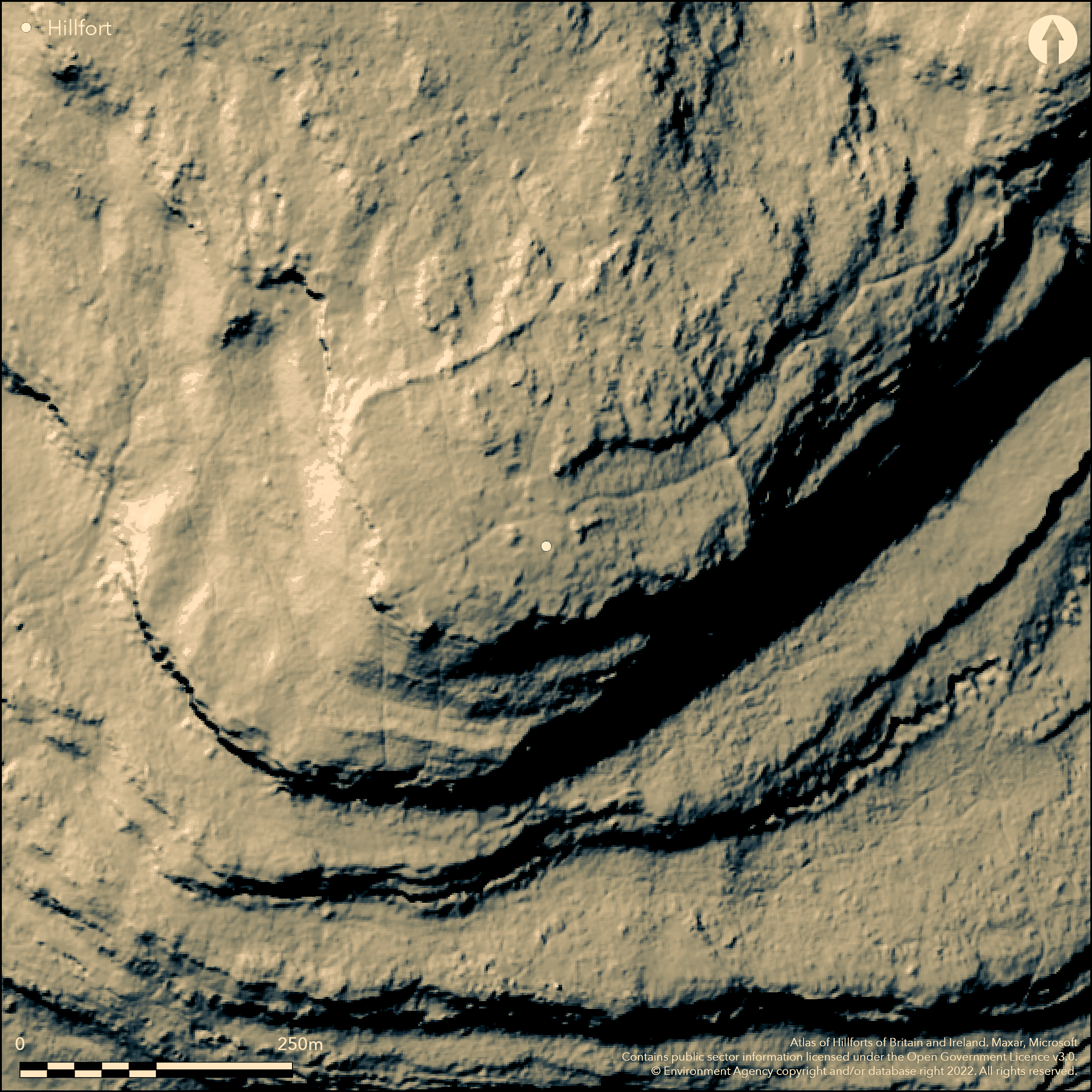
LiDAR 1m DTM Hillshade
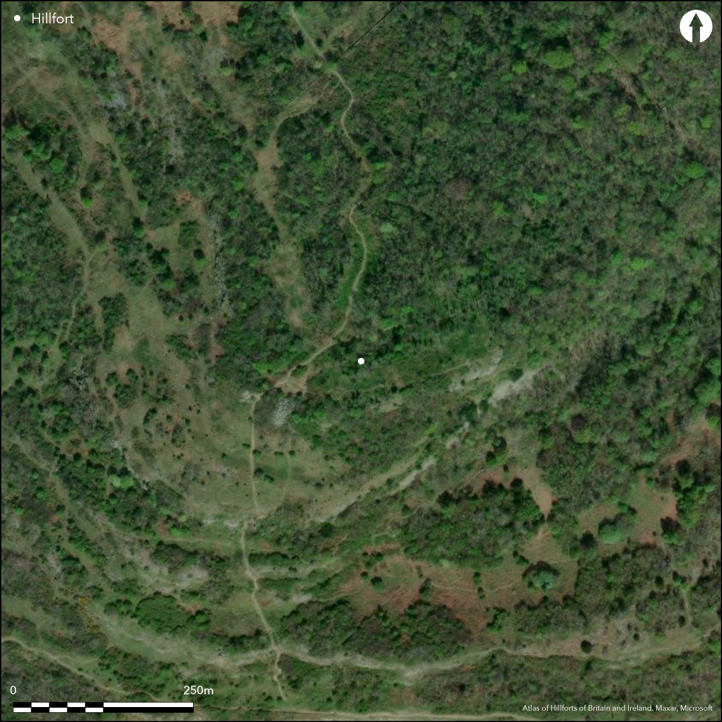
Satellite Imagery
LiDAR 1m DTM Hillshade
Satellite Imagery
Scroll left/right to view further images.
HER: Lancashire MLA513 (None)
NMR: SD 47 SE 4 (41541)
SM: 1007633
NGR: SD 4923 7281
X: 349230 Y: 472810 (OSGB36)
Overlooking Morecambe Bay to the NW of Warton and obscured by dense scrub and saplings, a promontory fort of 2.5ha on Warton Crag. The enclosed area is sub-rectangular measuring 155m by 200m. In the N and E are three concentric arcs of stone rubble spaced 50-60m apart which cut-off a natural promontory. There is no evidence for ditches. Elsewhere there are steep slopes although faint traces of a bank and ditch have been noted below the summit of the crag in the S and traces of two banks were also visible on lidar taken in 2006, located on a terrace below the eastern crags on the same alignment as the inner and middle ramparts. Ground inspection has shown the ramparts to be constructed of rough hewn stone rubble piled up to 3-7m wide and 1.3m high. The location of original entrances has not been recorded, although breaks are shown on historic mapping in the middle rampart but are inconsistent between editions. A citizen science survey reported two breaks in the inner and outer rampart and one break in the middle rampart. It is uncertain if any of these are original. Internally three sub-rectangular stone-founded huts have been recorded constructed against a rock escarpment and two further hut foundations below the inner rampart. They are undated and could be later stock pens. All the ramparts have been extensively robbed with the inner rampart surviving best. The site is recorded on 1888-1913 OS mapping but remains undated.
Citizen Science: ✓
Reliability of Data: Confirmed
Reliability of Interpretation: Confirmed
X: -309334 Y: 7198350 (EPSG: 3857)
Longitude: -2.778797580690086 Latitude: 54.14859878306004 (EPSG:4326)
Country: England
Current County or Unitary Authority: Lancashire
Historic County: Lancashire
Current Parish/Community/Council/Townland: Warton
Badly damaged and flagged in the 2009 Arnside and Silverdale AONB Statutory Management Plan as in need of positive conservation management. The site is now overgrown with scrub, bracken and trees. Remains on the Heritage at Risk Register in 2015
| Extant | ✓ |
| Cropmark | ✗ |
| Likely Destroyed | ✗ |
None
| Woodland | ✓ |
| Commercial Forestry Plantation | ✗ |
| Parkland | ✗ |
| Pasture (Grazing) | ✗ |
| Arable | ✗ |
| Scrub/Bracken | ✓ |
| Bare Outcrop | ✗ |
| Heather/Moorland | ✗ |
| Heath | ✗ |
| Built-up | ✗ |
| Coastal Grassland | ✗ |
| Other | ✗ |
A promontory fort sited at between 122-152m OD on a north-easterly sloping spur of a prominent limestone hill
| Contour Fort | ✗ |
| Partial Contour Fort | ✗ |
| Promontory Fort | ✓ |
| Hillslope Fort | ✓ |
| Level Terrain Fort | ✗ |
| Marsh Fort | ✗ |
| Multiple Enclosure Fort | ✗ |
| Hilltop | ✗ |
| Coastal Promontory | ✗ |
| Inland Promontory | ✓ |
| Valley Bottom | ✗ |
| Knoll/Hillock/Outcrop | ✗ |
| Ridge | ✗ |
| Cliff/Plateau-edge/Scarp | ✗ |
| Hillslope | ✓ |
| Lowland | ✗ |
| Spur | ✓ |
Dominant Topographic Feature: Spur of a prominent limestone hill
| North | ✗ |
| Northeast | ✓ |
| East | ✗ |
| Southeast | ✗ |
| South | ✗ |
| Southwest | ✗ |
| West | ✗ |
| Northwest | ✗ |
| Level | ✗ |
Altitude: 137.0m
N/A
The site is undated
Reliability: D - None
| Pre 1200BC | ✗ |
| 1200BC - 800BC | ✗ |
| 800BC - 400BC | ✗ |
| 400BC - AD50 | ✗ |
| AD50 - AD400 | ✗ |
| AD400 - AD 800 | ✗ |
| Post AD800 | ✗ |
| Unknown | ✓ |
| Pre Hillfort: | Hutchinson (1778) recalls finding _numerous tumuliÓ and some urns, although the location is unspecified. WCAG identified at least one possible burial mound outside the outer rampart |
| Post Hillfort: | Trig point. 'Beacon' marked on historic mapping |
Recorded on 1888-1903 mapping; General reference in Brownbill (1914), Field investigations 1967, 1999, 2009 and 2014. Lidar survey 2006. Scheduled in 1925.
| 1st Identified Written Reference (1914): | Victoria County Histories |
| Other (1925): | Scheduled |
| Other (1967): | Field investigation |
| Other (1999): | Field investigation |
| LiDAR Survey (2006): | LIDAR SD4972 Environment Agency D0058056 Mar - May 2006 |
| Other (2009): | Field investigation |
| Other (2014): | Field investigation |
| 1st Identified Map Depiction (None): | None |
Internally three sub-rectangular stone-founded huts have been recorded constructed against a rock escarpment and two further hut foundations below the inner rampart. They are undated, but possibly later stock enclosures
None
| None | ✓ |
| Spring | ✗ |
| Stream | ✗ |
| Pool | ✗ |
| Flush | ✗ |
| Well | ✗ |
| Other | ✗ |
None
| No Known Features | ✗ |
| Round Stone Structures | ✗ |
| Rectangular Stone Structures | ✓ |
| Curvilinear Platforms | ✗ |
| Other Roundhouse Evidence | ✗ |
| Pits | ✗ |
| Quarry Hollows | ✗ |
| Other | ✗ |
None
| No Known Excavation | ✓ |
| Pits | ✗ |
| Postholes | ✗ |
| Roundhouses | ✗ |
| Rectangular Structures | ✗ |
| Roads/Tracks | ✗ |
| Quarry Hollows | ✗ |
| Other | ✗ |
| Nothing Found | ✗ |
None
| No Known Geophysics | ✓ |
| Pits | ✗ |
| Roundhouses | ✗ |
| Rectangular Structures | ✗ |
| Roads/Tracks | ✗ |
| Quarry Hollows | ✗ |
| Other | ✗ |
| Nothing Found | ✗ |
None
| No Known Finds | ✓ |
| Pottery | ✗ |
| Metal | ✗ |
| Metalworking | ✗ |
| Human Bones | ✗ |
| Animal Bones | ✗ |
| Lithics | ✗ |
| Environmental | ✗ |
| Other | ✗ |
Woodland
| APs Not Checked | ✓ |
| None | ✗ |
| Roundhouses | ✗ |
| Rectangular Structures | ✗ |
| Pits | ✗ |
| Postholes | ✗ |
| Roads/Tracks | ✗ |
| Other | ✗ |
No entrances are recorded in the scheduling information. A Citizen Science survey carried out by WCAG reported two breaks in in the inner and outer rampart and one break in the middle rampart with a possible bastion or limestone outcrop on the Inner rampart at SD4919872932. A collapsed NE bastion at the presumed W entrance of outer rampart at SD 4915373030
| 5: | None |
| 2: | Uncertain if any original |
Guard Chambers: ✗
Chevaux de Frise: ✗
Sub-rectangular measuring 155m by 200m. In the N and E three concentric arcs of stone rubble, spaced 50-60m apart which cut-off a natural promontory, no evidence for ditches. Steep slopes elsewhere although faint traces of a bank and ditch have been noted below the summit of the crag in the S and traces of two banks were also visible on lidar taken in 2006, located on a terrace below the eastern crags on the same alignment as the inner and middle ramparts. The ramparts are constructed of rough hewn stone rubble piled up to 3-7m wide and 1.3m high
| Area 1: | 2.6ha. |
| Total: | 2.6ha. |
Total Footprint Area: 3.2ha.
None
| ✗ | None |
| ✗ | None |
| NE Quadrant: | 3 |
| SE Quadrant: | None |
| SW Quadrant: | None |
| NW Quadrant: | 3 |
| Total: | 3 |
| Partial Univallate | ✗ |
| Univallate | ✗ |
| Partial Bivallate | ✗ |
| Bivallate | ✗ |
| Partial Multivallate | ✓ |
| Multivallate | ✗ |
| Unknown | ✗ |
| Partial Univallate | ✗ |
| Univallate | ✗ |
| Partial Bivallate | ✗ |
| Bivallate | ✗ |
| Partial Multivallate | ✗ |
| Multivallate | ✗ |
None
| None | ✗ |
| Earthen Bank | ✗ |
| Stone Wall | ✗ |
| Rubble | ✓ |
| Wall-walk | ✗ |
| Evidence of Timber | ✗ |
| Vitrification | ✗ |
| Other Burning | ✗ |
| Palisade | ✗ |
| Counter Scarp Bank | ✗ |
| Berm | ✗ |
| Unfinished | ✗ |
| Other | ✗ |
None
| None | ✗ |
| Earthen Bank | ✗ |
| Stone Wall | ✗ |
| Murus Duplex | ✗ |
| Timber-framed | ✗ |
| Timber-laced | ✗ |
| Vitrification | ✗ |
| Other Burning | ✗ |
| Palisade | ✗ |
| Counter Scarp Bank | ✗ |
| Berm | ✗ |
| Unfinished | ✗ |
| No Known Excavation | ✓ |
| Other | ✗ |
| ✗ | None |
| ✓ | Faint traces of a bank and ditch have been noted below the summit of the crag in the S. Its relationship to the hillfort ramparts is uncertain |
Number of Ditches: 1
| ✗ | None |
Farrer, W. & Brownbill, J, The Victoria History of the County of Lancashire, (1914), 509-11
Hutchinson, W. 1788. Account of Antiquities in Lancashire (in a letter to G. Allan), (1788)
Atlas of Hillforts:
Wikidata:
This work is licensed under CC BY-SA 4.0

 and should be cited as:
Lock, Gary and Ralston, Ian. 2024. Atlas of Hillforts of Britain and Ireland. Available at: https://hillforts.arch.ox.ac.uk
Document Version 1.1