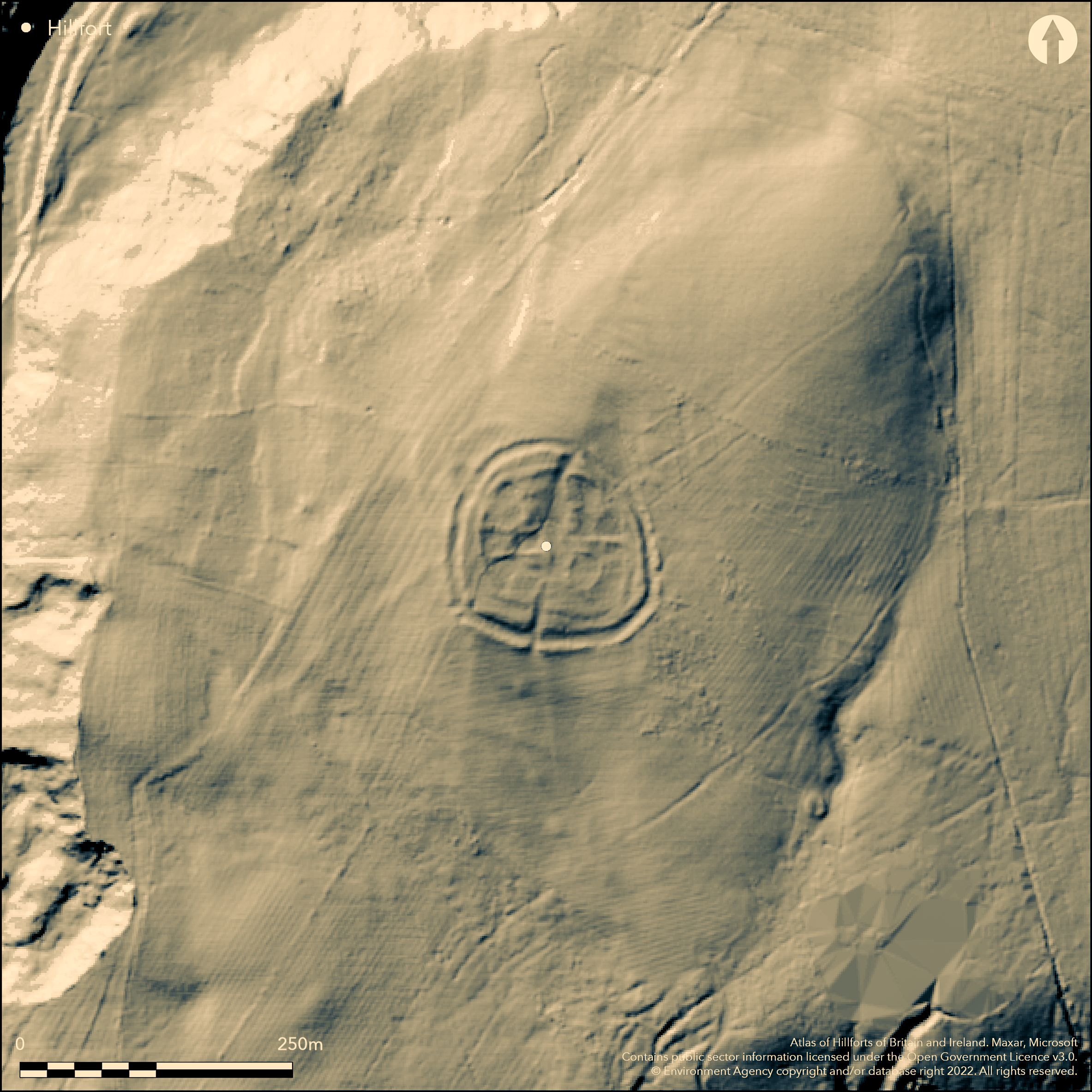
LiDAR 1m DTM Hillshade
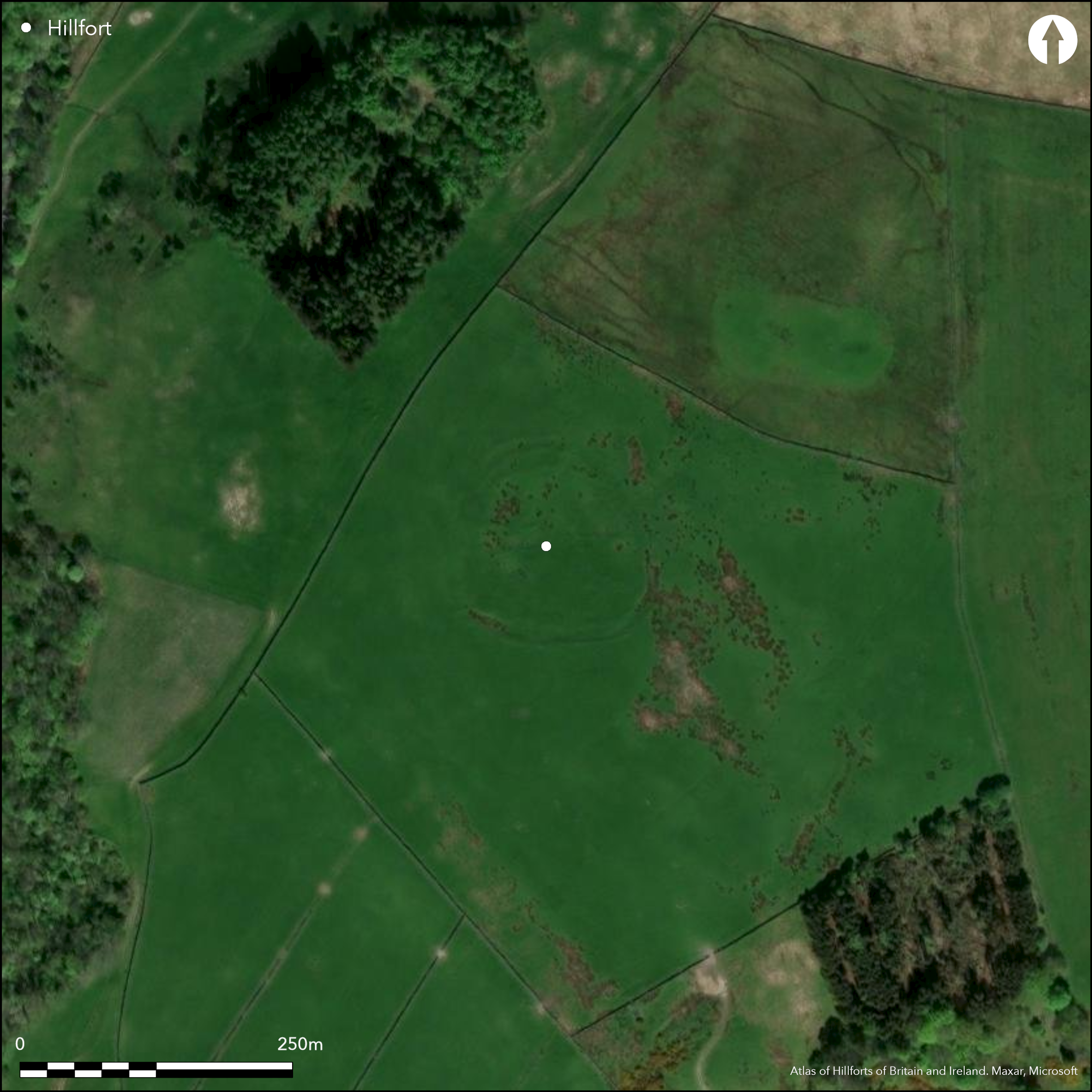
Satellite Imagery
LiDAR 1m DTM Hillshade
Satellite Imagery
Scroll left/right to view further images.
HER: Lancashire MLA672 (None)
NMR: SD 67 NE 1 (43942)
SM: 1012822
NGR: SD 65039 77928
X: 365039 Y: 477928 (OSGB36)
On Castle Hill, 400m to the N of Bank House Farm, a possible hillslope fort scheduled as a defended enclosure. It lies on a south-westerly facing spur at 210m OD, commanding extensive views along the Lune Valley to the S and W. It comprises a sub-circular enclosure 80m by 67m enclosing 0.8ha within three banks and two medial ditches. The two innermost banks survive as low earthworks up to 4m wide with the innermost ditch 6-11m wide and the outermost ditch 9m wide and 0.5m deep. The more substantial earth and stone outer bank measures 6m wide and up to 1.5m high. The innermost bank and ditch is considered by Jecock and Pullen (2013) to possibly represent an earlier phase of enclosure with what is now the middle bank,a counterscarp. Breaks in the ramparts and causeways across the ditches carry a track across the site in the NW and S and are probably original entrances. The entrance in the NW has possible hornworks, interpreted as an annex from lidar and an aerial photograph taken in 2012. Internally three circular depressions were identified as two hut circles and a pond by Collingwood (1925). The site was Investigated in 2013 as part of the NAIS Upland Pilot Project (Jecock and Pullen, 2013). Damage has occurred to the ramparts through stone robbing and through ridge-and-furrow ploughing which has clipped the base of the outer bank in the W. Recorded on 1979 1:2,500 OS mapping onwards. Undated.
Citizen Science: ✗
Reliability of Data: Confirmed
Reliability of Interpretation: Confirmed
X: -282459 Y: 7207348 (EPSG: 3857)
Longitude: -2.5373684669878647 Latitude: 54.19591732105236 (EPSG:4326)
Country: England; None
Current County or Unitary Authority: Lancashire
Historic County: Lancashire
Current Parish/Community/Council/Townland: Leck; Burrow
None
| Extant | ✓ |
| Cropmark | ✗ |
| Likely Destroyed | ✗ |
None
| Woodland | ✗ |
| Commercial Forestry Plantation | ✗ |
| Parkland | ✗ |
| Pasture (Grazing) | ✓ |
| Arable | ✗ |
| Scrub/Bracken | ✗ |
| Bare Outcrop | ✗ |
| Heather/Moorland | ✗ |
| Heath | ✗ |
| Built-up | ✗ |
| Coastal Grassland | ✗ |
| Other | ✗ |
A hillslope fort or defended enclosure lying on the south-westerly facing slope of a flat topped spur at between approximately 188-210m OD
| Contour Fort | ✗ |
| Partial Contour Fort | ✗ |
| Promontory Fort | ✗ |
| Hillslope Fort | ✓ |
| Level Terrain Fort | ✗ |
| Marsh Fort | ✗ |
| Multiple Enclosure Fort | ✗ |
| Hilltop | ✗ |
| Coastal Promontory | ✗ |
| Inland Promontory | ✗ |
| Valley Bottom | ✗ |
| Knoll/Hillock/Outcrop | ✗ |
| Ridge | ✗ |
| Cliff/Plateau-edge/Scarp | ✗ |
| Hillslope | ✓ |
| Lowland | ✗ |
| Spur | ✓ |
Dominant Topographic Feature: Flat topped spur
| North | ✗ |
| Northeast | ✗ |
| East | ✗ |
| Southeast | ✗ |
| South | ✗ |
| Southwest | ✓ |
| West | ✗ |
| Northwest | ✗ |
| Level | ✗ |
Altitude: 198.0m
The parish boundary between Leck and Burrow lie to the NW
Boundary Type: Parish/Townland
The site is undated
Reliability: D - None
| Pre 1200BC | ✗ |
| 1200BC - 800BC | ✗ |
| 800BC - 400BC | ✗ |
| 400BC - AD50 | ✗ |
| AD50 - AD400 | ✗ |
| AD400 - AD 800 | ✗ |
| Post AD800 | ✗ |
| Unknown | ✓ |
| Pre Hillfort: | None |
| Post Hillfort: | None |
Reported by Collingwood (1925). Field investigation in 1977. Recorded on 1:2,500 mapping in 1979. Lidar survey 2012. Walkover as part of the NAIS Upland Pilot Project in 2013. Scheduled
| 1st Identified Written Reference (1925): | None |
| Other (1964): | Scheduled |
| 1st Identified Map Depiction (1979): | None |
| Other (1979): | Field investigation |
| LiDAR Survey (2012): | LIDAR SD6577 DSM 12-20-MAY-2009 |
| Other (2013): | NAIS Upland Pilot Project |
Circular depressions identified as two hut circles and a pond
Possible former pond in interior
| None | ✗ |
| Spring | ✗ |
| Stream | ✗ |
| Pool | ✓ |
| Flush | ✗ |
| Well | ✗ |
| Other | ✗ |
Hollows, pond
| No Known Features | ✗ |
| Round Stone Structures | ✗ |
| Rectangular Stone Structures | ✗ |
| Curvilinear Platforms | ✗ |
| Other Roundhouse Evidence | ✓ |
| Pits | ✗ |
| Quarry Hollows | ✗ |
| Other | ✓ |
None
| No Known Excavation | ✓ |
| Pits | ✗ |
| Postholes | ✗ |
| Roundhouses | ✗ |
| Rectangular Structures | ✗ |
| Roads/Tracks | ✗ |
| Quarry Hollows | ✗ |
| Other | ✗ |
| Nothing Found | ✗ |
None
| No Known Geophysics | ✓ |
| Pits | ✗ |
| Roundhouses | ✗ |
| Rectangular Structures | ✗ |
| Roads/Tracks | ✗ |
| Quarry Hollows | ✗ |
| Other | ✗ |
| Nothing Found | ✗ |
None
| No Known Finds | ✓ |
| Pottery | ✗ |
| Metal | ✗ |
| Metalworking | ✗ |
| Human Bones | ✗ |
| Animal Bones | ✗ |
| Lithics | ✗ |
| Environmental | ✗ |
| Other | ✗ |
None
| APs Not Checked | ✓ |
| None | ✗ |
| Roundhouses | ✗ |
| Rectangular Structures | ✗ |
| Pits | ✗ |
| Postholes | ✗ |
| Roads/Tracks | ✗ |
| Other | ✗ |
Breaks in the ramparts and causeways across the ditches lie in the NW and S are probably original entrances. The entrance in the NW has possible hornworks
| 10: | Ten or more breaks estimated from satellite imagery |
| 2: | None |
Guard Chambers: ✗
Chevaux de Frise: ✗
| 1. Simple Gap (South): | Middle rampart |
| 1. Simple Gap (South): | Outer rampart |
| 2. Oblique (North west): | Inner rampart |
| 2. Oblique (North west): | Middle rampart |
| 2. Oblique (North west): | Outer rampart |
| 2. Hornwork (North west): | Outer rampart |
Sub-circular enclosure 80m by 67m occupying 0.8ha within three banks and two medial ditches. The two innermost banks survive as low earthworks up to 4m wide with the innermost ditch 6-11m wide and the outermost ditch 9m wide and 0.5m deep. The more substantial earth and stone outer bank measures 6m wide and up to 1.5m high. The inner most bank and ditch is considered by Jecock and Pullen (2013) to possibly represent an earlier phase of enclosure with what is now the middle bank, a counterscarp
| Area 1: | 0.8ha. |
| Total: | 0.8ha. |
Total Footprint Area: Noneha.
None
| ✓ | The innermost bank and ditch is considered by Jecock and Pullen (2013) to possibly represent an earlier phase of enclosure |
| ✓ | None |
| NE Quadrant: | 3 |
| SE Quadrant: | 3 |
| SW Quadrant: | 3 |
| NW Quadrant: | 3 |
| Total: | 3 |
| Partial Univallate | ✗ |
| Univallate | ✗ |
| Partial Bivallate | ✗ |
| Bivallate | ✗ |
| Partial Multivallate | ✗ |
| Multivallate | ✓ |
| Unknown | ✗ |
| Partial Univallate | ✗ |
| Univallate | ✓ |
| Partial Bivallate | ✗ |
| Bivallate | ✗ |
| Partial Multivallate | ✗ |
| Multivallate | ✗ |
None
| None | ✗ |
| Earthen Bank | ✓ |
| Stone Wall | ✗ |
| Rubble | ✓ |
| Wall-walk | ✗ |
| Evidence of Timber | ✗ |
| Vitrification | ✗ |
| Other Burning | ✗ |
| Palisade | ✗ |
| Counter Scarp Bank | ✓ |
| Berm | ✗ |
| Unfinished | ✗ |
| Other | ✗ |
None
| None | ✗ |
| Earthen Bank | ✗ |
| Stone Wall | ✗ |
| Murus Duplex | ✗ |
| Timber-framed | ✗ |
| Timber-laced | ✗ |
| Vitrification | ✗ |
| Other Burning | ✗ |
| Palisade | ✗ |
| Counter Scarp Bank | ✗ |
| Berm | ✗ |
| Unfinished | ✗ |
| No Known Excavation | ✓ |
| Other | ✗ |
| ✗ | None |
| ✓ | None |
Number of Ditches: 2
| ✓ | Possible annex created by hornworks extending from the NE entrance (Jecock and Pullen, 2013) |
Collingwood, W.G. 1925. Trans Cumb and Westm Anq and Archaeol Soc. 25 NS, 367.
Jecock, M. and Pullen, R. 2013. NAIS Upland Pilot Project 03-OCT-2013. Unpublished
Atlas of Hillforts:
Wikidata:
This work is licensed under CC BY-SA 4.0

 and should be cited as:
Lock, Gary and Ralston, Ian. 2024. Atlas of Hillforts of Britain and Ireland. Available at: https://hillforts.arch.ox.ac.uk
Document Version 1.1