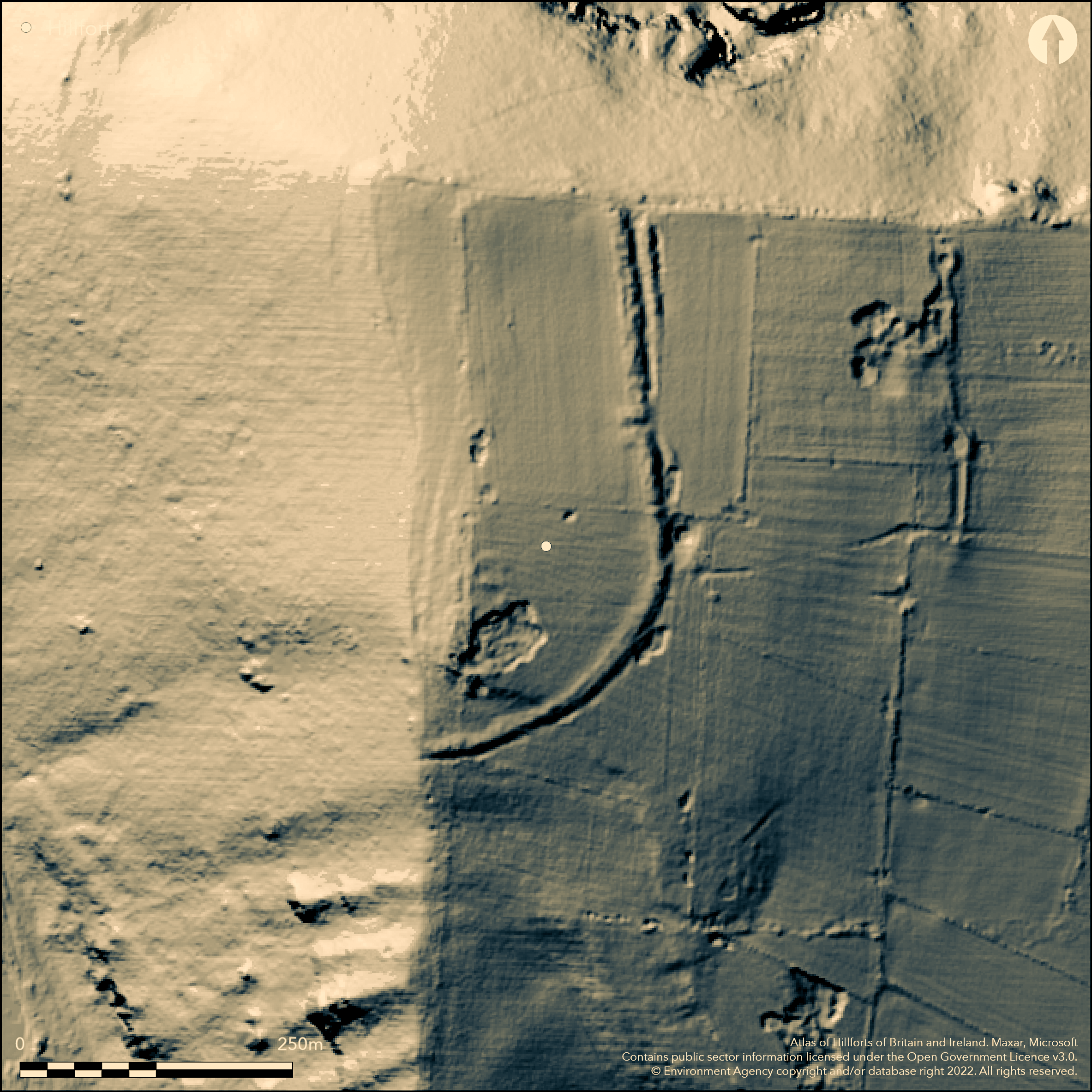
LiDAR 1m DTM Hillshade
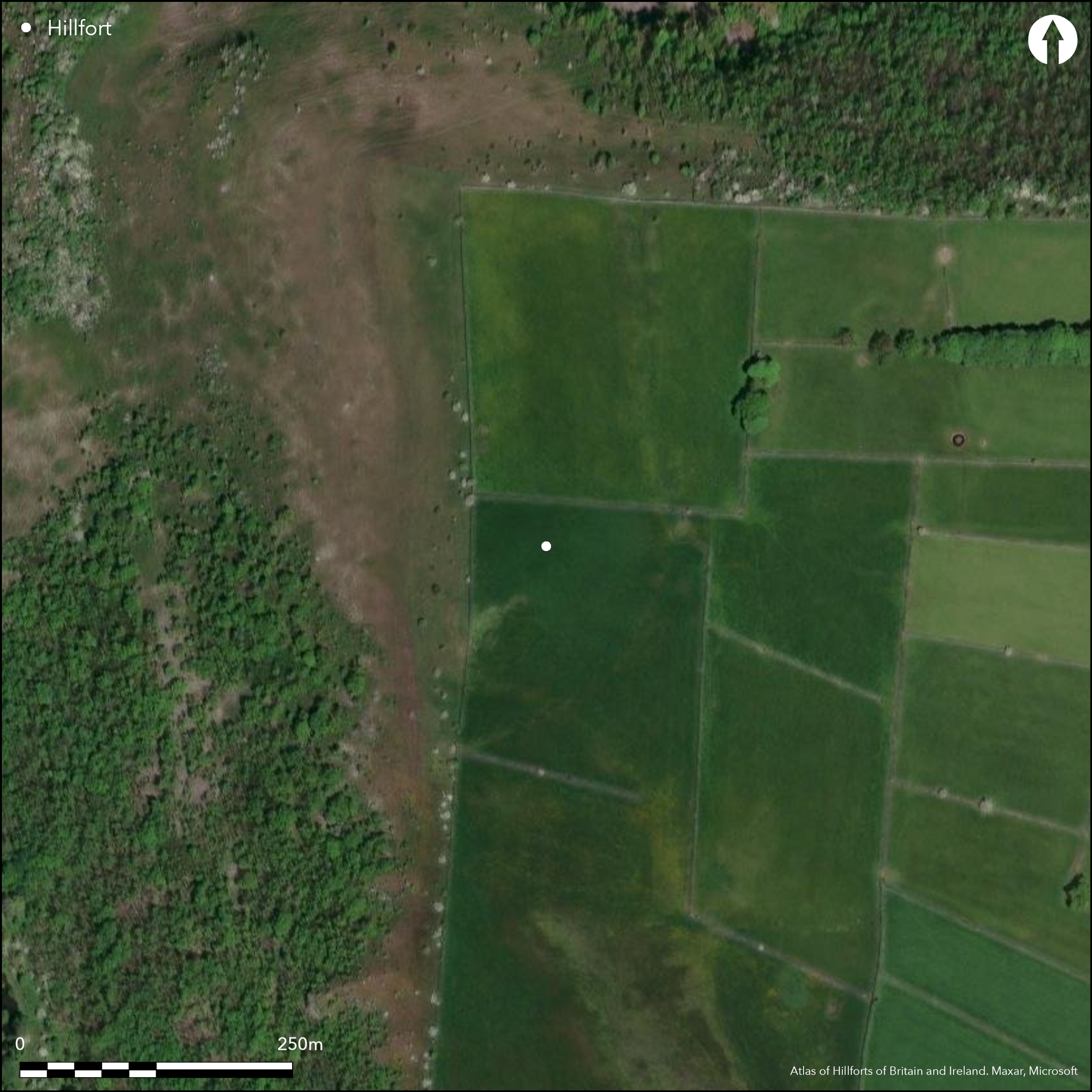
Satellite Imagery
LiDAR 1m DTM Hillshade
Satellite Imagery
Scroll left/right to view further images.
HER: Derbyshire 419 (None)
NMR: SK 17 SE 15 (309164)
SM: 1011205
NGR: SK 17479 70950
X: 417479 Y: 370950 (OSGB36)
Lying on the western edge of Longstone Moor at 332m OD, a promontory fort occupying 3.5ha of the NW corner of a steep sided promontory. It lies in a prominent position on a bend in the River Wye, commanding views of Monsal Dale in the N and Wye Dale in the W. The hillforts of Ball Cross [Atlas No. 2972], Burr Tor [Atlas No. 2976] and Mam Tor [Atlas No. 2968] are visible from the site. It has steep-sided scarps in the N and W and earthworks in the E and S and is amongst the larger of the hilltop enclosures of the Peak District. At the northernmost point above Monsal Dale the eastern defences extend southwards for 225m then curve to the SW for a further 160m terminating on the edge of Wye Dale and enclosing a corner of the promontory. Beyond this, a linear feature, originally interpreted as a palisade trench extending northwards and terminating at Monsal Dale, was shown through excavation to be a small quarry for material used in the construction of a wall, which has a maximum width of 1.2m along the scarp edge. The visible earthworks comprise a single bank with an external ditch for the northernmost 180m, and for the remainder of the circuit, a bank only. A second outer bank, probably a counterscarp, and ditch lie at the northern end of the earthworks. At the northernmost extent, the height of the bank from the base of the ditch to top is approximately 2.5-3.5m high and 5-6m wide, the ditch approximately 2m wide. The outer bank, which is discontinuous, measures approximately 1.5-2m high from the base of the ditch to the top of bank and 2m wide. The outer ditch is approximately 1.5m wide and 0.5m deep. Excavation has shown that within the larger inner bank are footings of a strong, stone-built wall. The wall had front and rear faces of dressed stones with the facing stones keyed into the body of the rampart which had a rubble core. It has been robbed for limestone for a number of purposes and is now spread across the front and rear faces and has spilt into the ditch. This is seen by Waddington (2010) as a deliberate act of destruction. The 3m wide ditch is rock cut with a vertical inner face and 2.2m deep in places. The counterscarp is composed of a dark yellowish-brown clayey silt. A trench across the northern section of ramparts produced evidence for possible gang working. The outer bank extends for approximately 30m and comprised a dump of redeposited soil and subsoil encased in a stony layer that included some slumped facing stones. A probable posthole and a post socket might indicate the bank had a breastwork of spaced timber uprights (ibid.). Beyond the bank a further section of shallow ditch was found, which appears unfinished. A well-defined entrance with in-turned banks lies centrally within these defences with two possible stone kerbs, one on either side of the entrance, suggesting an original width of. 2.5m (ibid.) Within the interior are shallow scoops, possibly hut circles. Investigations in 2009 included a full topographic survey, a geophysical survey and targeted excavation. The survey provided an accurate plan for the main ramparts including five or six, barrows within the ramparts. It also highlighted the extent of robbing, quarrying and previously unrecorded antiquarian activity at the site. The excavations provided a relative chronology and revealed evidence for human activity from the Mesolithic through to the post-medieval period. Radiocarbon dates gave a middle Iron Age date for the abandonment of the hillfort. Two radiocarbon dates from material within the primary ditch silt produced dates of the Beaker period (2350-2040 cal BC) thought to be either residual material or evidence for a much earlier enclosure on the site, part of which was incorporated into the hillfort defensive circuit. One of the trenches revealed rock-cut pits and post-sockets and produced over 200 sherds of late prehistoric pottery. Two of the sherds were radiocarbon dated to 820-550 cal BC, possibly indicating a Late Bronze Age-Early Iron Age phase of occupation. Sixteen test pits excavated along an E-W transect across the interior of the hillfort produced 1800 chipped stone artefacts, the majority from the local chert. This is thought to represent a Mesolithic extraction site for raw material where preliminary flaking took place. It was concluded that the hillfort is likely to date to the late Bronze Age, with possible house platforms indicating settlement within the ramparts. The early Bronze Age barrows predate the hillfort construction. An early Bronze Age bowl barrow near the western edge of the site, now ploughed out, was partially excavated in 1795 (Rooke 1796) who found a disarticulated skeleton with two flint arrowheads within a rock-cut grave. The skeleton was accompanied by two further inhumations in the E of the barrow as well as cremations and pottery urns elsewhere in the mound. A second excavation of a barrow in the 1920's produced over 30 inhumations (Harris 1925). Nine further inhumations were recovered during the 2009-10 excavations, many of them from the ditch. Post hillfort activity comprises three lime kilns, two of which were related to quarrying activity seen around the hillfort. Much of the southern part of the site is heavily robbed for limestone and damaged by ridge and furrow ploughing. The site is recorded on 1879 1:2,500 OS mapping.
Citizen Science: ✗
Reliability of Data: Confirmed
Reliability of Interpretation: Confirmed
X: -193650 Y: 7026638 (EPSG: 3857)
Longitude: -1.7395900225560568 Latitude: 53.235284609815174 (EPSG:4326)
Country: England
Current County or Unitary Authority: Derbyshire
Historic County: Derbyshire
Current Parish/Community/Council/Townland: Ashford in the Water
Much of the southern part of the site is heavily robbed for limestone and damaged by ridge and furrow ploughing.
| Extant | ✓ |
| Cropmark | ✗ |
| Likely Destroyed | ✗ |
Grass, pasture and scrub
| Woodland | ✗ |
| Commercial Forestry Plantation | ✗ |
| Parkland | ✗ |
| Pasture (Grazing) | ✓ |
| Arable | ✗ |
| Scrub/Bracken | ✓ |
| Bare Outcrop | ✗ |
| Heather/Moorland | ✗ |
| Heath | ✗ |
| Built-up | ✗ |
| Coastal Grassland | ✗ |
| Other | ✗ |
A promontory fort lying at 322m OD on the summit of an inland promontory
| Contour Fort | ✗ |
| Partial Contour Fort | ✗ |
| Promontory Fort | ✓ |
| Hillslope Fort | ✗ |
| Level Terrain Fort | ✗ |
| Marsh Fort | ✗ |
| Multiple Enclosure Fort | ✗ |
| Hilltop | ✓ |
| Coastal Promontory | ✗ |
| Inland Promontory | ✓ |
| Valley Bottom | ✗ |
| Knoll/Hillock/Outcrop | ✗ |
| Ridge | ✗ |
| Cliff/Plateau-edge/Scarp | ✓ |
| Hillslope | ✗ |
| Lowland | ✗ |
| Spur | ✗ |
Dominant Topographic Feature: Promontory
| North | ✗ |
| Northeast | ✗ |
| East | ✗ |
| Southeast | ✗ |
| South | ✗ |
| Southwest | ✗ |
| West | ✗ |
| Northwest | ✗ |
| Level | ✓ |
Altitude: 322.0m
N/A
Fifteen radiocarbon samples taken from seven human bones, one animal bone, three charred residues on pottery, and four samples of wood charcoal (Waddington 2010, 36-41). These provided beaker period dates for the primary ditch fills, late Bronze Age for carbonised food residues on pottery sherds. A Bayesian chronological model used to interpret the radiocarbon results estimates a construction date for the hillfort of 495_370 cal BC, with abandonment possibly two centuries later. Horn (forthcoming) suggests start: 435-390 cal. BC (68% probability), end: 355-300 cal. BC (40% probability) or 210-165 cal. BC (56% probability).
Reliability: A - High
| Pre 1200BC | ✗ |
| 1200BC - 800BC | ✗ |
| 800BC - 400BC | ✓ |
| 400BC - AD50 | ✓ |
| AD50 - AD400 | ✗ |
| AD400 - AD 800 | ✗ |
| Post AD800 | ✗ |
| Unknown | ✗ |
| Pre Hillfort: | None |
| Post Hillfort: | None |
| Artefactual: | None |
| C14: | None |
| Morphology/Earthwork/Typology: | None |
A Barrow on the western scarp edge was excavated in 1795 (Rooke 1796). Second barrow excavated in the 1920's (Harris 1926). Small evaluation trench placed across a suspected outer bank downslope from the main enclosure (Wilson & English 1998) thought to have been associated with the hillfort. Excavation was inconclusive. The site was scheduled in 1950. Ordnance Survey Field Report December 1965. Following a successful Heritage Lottery Fund bid by Longstone Local History Group, work was carried out with the support and assistance of Archaeological Research Services Ltd (ARS Ltd.). A desk-based assessment was undertaken by ARS Ltd. in 2009; analytical earthwork survey and field investigation ARS Ltd and the Longstone Local History Group in 2009; gradiometry and resistance survey by Stratascan in 2009. Excavations during 2009 by the Longstone Local History Group and ARS Ltd. The site is recorded on 1885-1900 OS mapping.
| Excavation (1796): | Excavation of a barrow by Rooke |
| Other (1950): | Scheduled |
| Other (1965): | Field investigation |
| Other (1979): | Visit by Hillfort Study Group |
| Excavation (1998): | Wilson & English |
| Other (1999): | Visited by Hillfort Study Group |
| Other (2009): | Desk based assessement |
| Geophysical Survey (2009): | Gradiometry and resistance |
| Earthwork Survey (2009): | None |
| Excavation (None): | None |
Shallow scoops, possibly hut circles are visible within the interior. Pits and ditches recorded during geophysical survey. Finds of pottery, metal working, human and animal bones.
River Wye in the N and SW
| None | ✓ |
| Spring | ✗ |
| Stream | ✗ |
| Pool | ✗ |
| Flush | ✗ |
| Well | ✗ |
| Other | ✗ |
Shallow scoops
| No Known Features | ✗ |
| Round Stone Structures | ✗ |
| Rectangular Stone Structures | ✗ |
| Curvilinear Platforms | ✗ |
| Other Roundhouse Evidence | ✗ |
| Pits | ✗ |
| Quarry Hollows | ✗ |
| Other | ✓ |
Rock cut pits and post sockets
| No Known Excavation | ✗ |
| Pits | ✓ |
| Postholes | ✓ |
| Roundhouses | ✗ |
| Rectangular Structures | ✗ |
| Roads/Tracks | ✗ |
| Quarry Hollows | ✗ |
| Other | ✓ |
| Nothing Found | ✗ |
Pits and ditches
| No Known Geophysics | ✗ |
| Pits | ✓ |
| Roundhouses | ✗ |
| Rectangular Structures | ✗ |
| Roads/Tracks | ✗ |
| Quarry Hollows | ✗ |
| Other | ✓ |
| Nothing Found | ✗ |
None
| No Known Finds | ✗ |
| Pottery | ✓ |
| Metal | ✗ |
| Metalworking | ✓ |
| Human Bones | ✓ |
| Animal Bones | ✓ |
| Lithics | ✓ |
| Environmental | ✗ |
| Other | ✗ |
None
| APs Not Checked | ✓ |
| None | ✗ |
| Roundhouses | ✗ |
| Rectangular Structures | ✗ |
| Pits | ✗ |
| Postholes | ✗ |
| Roads/Tracks | ✗ |
| Other | ✗ |
Well-defined entrance with in-turned banks lies centrally within the defences. Two possible stone kerbs, one on either side of the entrance, suggests an original width of. 2.5m (Waddington 2010)
| 1: | None |
| 2: | None |
Guard Chambers: ✗
Chevaux de Frise: ✗
| 1. In-turned (East): | None |
Naturally defended by steep-sided scarps in the N and W and by earthworks in the E and S. At the northernmost point above Monsal Dale the eastern defences extend southwards for 225m before curving to the SW for a further 160m terminating on the edge of Wye Dale and enclosing a corner of the promontory. The visible earthworks comprise a single bank with an external ditch for the northernmost 180m, continuing for the remainder of the circuit as a bank only. A second outer bank, probably a counterscarp, and ditch lie at the northern end of the earthworks. At the northernmost extent, the height of the bank from the base of the ditch to the top is approximately 2.5-3.5m high and 5-6m wide, the ditch approximately 2m wide. The outer bank, which is discontinuous, measures approximately 1.5-2m high from the base of the ditch to the top of bank and 2m wide. The outer ditch is approximately 1.5m wide and 0.5m deep. Within the larger inner bank are footings of a strong, stone-built wall with front and rear faces of dressed stones with the facing stones keyed into the body of the rampart which comprised a rubble core. The 3m wide ditch is rock cut with a vertical inner face and 2.2m deep in places. The counterscarp is composed of a dark yellowish-brown clayey silt. Evidence has been found for possible gang working. The outer bank extends for approximately 30m and comprised a dump of redeposited soil and subsoil encased in a stony layer that included some slumped facing stones. A probable posthole and a post socket might indicate the bank had a breastwork of spaced timber uprights (Waddington 2010). Beyond the bank a further section of shallow ditch was found, which appears unfinished.
| Area 1: | 3.5ha. |
| Total: | 3.5ha. |
Total Footprint Area: Noneha.
None
| ✗ | None |
| ✗ | None |
| NE Quadrant: | 2 |
| SE Quadrant: | 1 |
| SW Quadrant: | None |
| NW Quadrant: | None |
| Total: | 2 |
| Partial Univallate | ✓ |
| Univallate | ✗ |
| Partial Bivallate | ✓ |
| Bivallate | ✗ |
| Partial Multivallate | ✗ |
| Multivallate | ✗ |
| Unknown | ✗ |
| Partial Univallate | ✗ |
| Univallate | ✗ |
| Partial Bivallate | ✗ |
| Bivallate | ✗ |
| Partial Multivallate | ✗ |
| Multivallate | ✗ |
None
| None | ✗ |
| Earthen Bank | ✓ |
| Stone Wall | ✗ |
| Rubble | ✗ |
| Wall-walk | ✗ |
| Evidence of Timber | ✗ |
| Vitrification | ✗ |
| Other Burning | ✗ |
| Palisade | ✗ |
| Counter Scarp Bank | ✓ |
| Berm | ✗ |
| Unfinished | ✗ |
| Other | ✗ |
Rubble core with front and rear faces of dressed stones. A probable posthole and post socket might indicate the bank had a breastwork of spaced timber uprights (Waddington 2010).
| None | ✗ |
| Earthen Bank | ✗ |
| Stone Wall | ✓ |
| Murus Duplex | ✗ |
| Timber-framed | ✗ |
| Timber-laced | ✗ |
| Vitrification | ✗ |
| Other Burning | ✗ |
| Palisade | ✗ |
| Counter Scarp Bank | ✓ |
| Berm | ✗ |
| Unfinished | ✓ |
| No Known Excavation | ✗ |
| Other | ✓ |
| ✓ | Two sections of wall appeared to have been built up to each other. Both sections comprised limestone facing blocks and a compact rubble core, but were bonded with different materials. The section of wall in the S was composed only of limestone blocks whilst that in the N it included several blocks of sandstone. The two wall sections were only keyed in to each other at the base of the construction and the join between the two sections was on the same line as constructional differences seen in the counterscarp bank. In addition the two ditch terminals do not meet |
| ✓ | Section of a second shallow ditch which appears unfinished. |
Number of Ditches: 2
| ✗ | None |
Burn, A. and Brightman, J. 2009. An Analytical Earthwork Survey of the Hillfort at Fin Cop, Derbyshire ARS Ltd Report 2009/34 May 2009. Archaeological Research Services Ltd. https://www.archaeologicalresearchservices.com/projects/fincoppdfs/Fin%20Cop%20Earthwork%20Survey%20Report.pdf. Accessed May 2015
Brightman, J. 2009. Fin Cop Hillfort, Derbyshire. An Archaeological Desk-Based Assessment. Archaeological Research Services Ltd Report 2009/37 June 2009. https://www.archaeologicalresearchservices.com/projects/fincoppdfs/Fin%20Cop%20Desk-Based%20Assessment.pdf. Accessed May 2015
Harris, T.A. 1925. Tumulus on Fin Cop. The High Peak News 19.09.25, 6
Horn, J. Forthcoming. The dating of hillforts in Britain and Ireland. Unpublished PhD thesis, University of Edinburgh.
Rooke, H. 1796. Discoveries in A Barrow In Derbyshire, Archaeologia, 12, 327-31
Smalley, R. 2009. Geophysical Survey Report Fin Cop Hill Fort for Archaeological Research Services. May 2009. Job No. J2591. Stratascan Ltd. https://www.archaeologicalresearchservices.com/projects/fincoppdfs/Fin%20Cop%20Geophysical%20Survey%20Report.pdf. Accessed May 2015
Waddington, C. 2010. Fin Cop Excavation Archive Report for 2009. https://www.archaeologicalresearchservices.com/projects/fincoppdfs/Fin%20Cop%20Excavation%20Archive%20Report.pdf. Accessed May 2015
Waddington, C. 2011. Fin Cop Excavation Archive Report for 2011. ARS Ltd Report No. 2011/27. March 2011. https://www.archaeologicalresearchservices.com/images/Fin%20Cop%202010%20Excavation%20Archive%20Report.pdf. Accessed May 2015
Waddington, C. 2011. Massacre at Fin Cop. New evidence of an Iron Age hillfort at war. Current Archaeol, 255, 20-7.
Wilson, J. and English, E. 1998. Investigation of a ditch and bank at Fin Cop at Monsal Head, Ashford. Derbyshire. Derbyshire Archaeol J. 118: 86-93
Atlas of Hillforts:
Wikidata:
This work is licensed under CC BY-SA 4.0

 and should be cited as:
Lock, Gary and Ralston, Ian. 2024. Atlas of Hillforts of Britain and Ireland. Available at: https://hillforts.arch.ox.ac.uk
Document Version 1.1