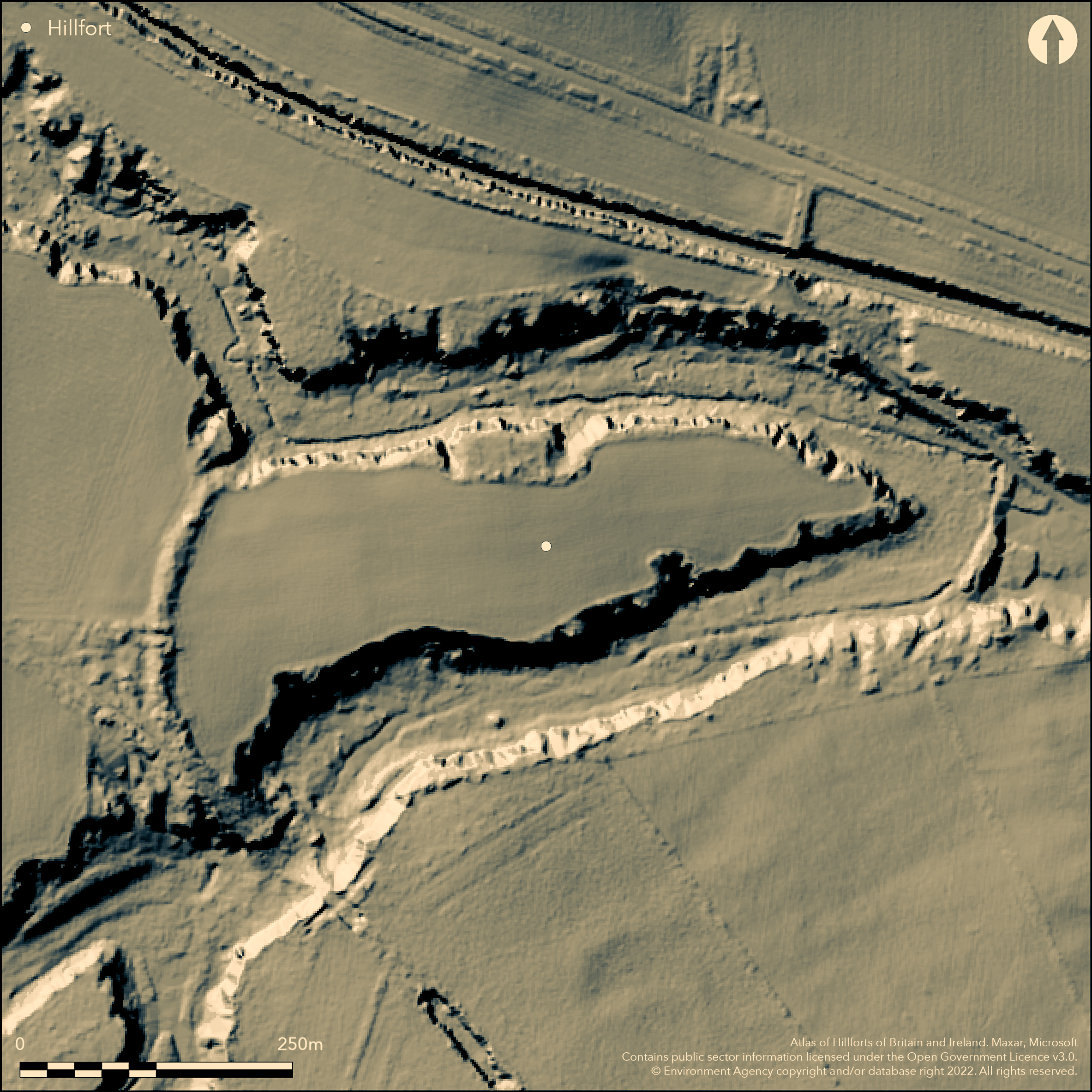
LiDAR 1m DTM Hillshade
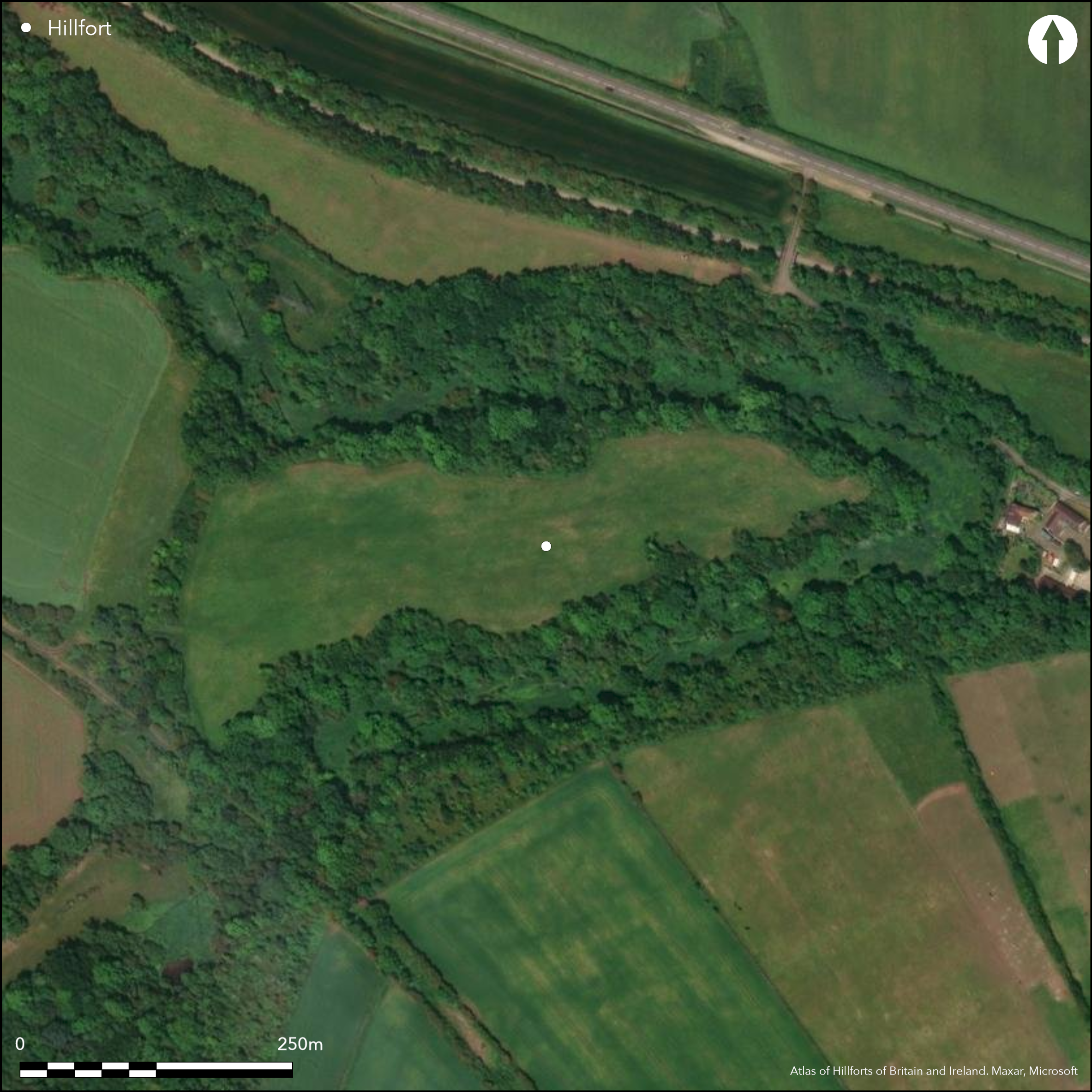
Satellite Imagery
LiDAR 1m DTM Hillshade
Satellite Imagery
Scroll left/right to view further images.
HER: Derbyshire 5215 (None)
NMR: SK 57 NW 8 (318373)
SM: 1011428
NGR: SK 51122 75178
X: 451122 Y: 375178 (OSGB36)
Lying to the NW of Elmton at 110m OD, a promontory fort of 4.8ha. The grips or gorges of Hollinhill in the N and Markland in the S meet in the E to form a triangular headland enclosed in the W by triple ramparts and two ditches and elsewhere defended by the natural ravines. The ramparts, once 183m in length, were first recorded by Cox in 1905 who noted the inner rampart was formed from large rough stones standing approximately 2.1m above the inner level in the S and 7.3m wide at the top with the external ditch approximately 2.7m deep and 4.6m wide. Damage had occurred in the S through the construction of a 19th century railway line and ploughing was annually reducing the height of the two outer ramparts. Today these ramparts and medial ditches survive as buried features recorded mainly as cropmarks. The railway line is now dismantled and the terminals of all three ramparts are visible as earthworks in the adjacent field to the S of this. On the N side, only the inner rampart survives as an upstanding feature measuring approximately 3m high, 15m wide at the base and 8m wide at the top. A 15m wide ditch is visible along the W, to the S of the entrance. The 10m wide entrance lies centrally within the ramparts, with the outer and middle ramparts joined by an additional bank N of the entrance and the inner and middle ramparts joined in the S. A further entrance lies in the NW corner. An excavation of this entrance in 1969 unearthed fragments of imported Roman pottery. A small excavation across the inner rampart showed it was of dump construction comprising a clay and gravel core with limestone slabs laid horizontally into the face of the core. Excavations within the interior (Lane 1969) recovered two sherds of Iron Age pottery and sherds of coarse 2nd or 3rd century AD. Evidence of bone and metalworking was also found but was undated. Finds of gangue, slag and burnt clay indicate some form of industrial activity has taken place but the date is unspecified. Second or third century Roman silver coins were found within the interior in 1883 (Gray 1883). The interior is now completely destroyed by modern ploughing which is cutting into the bedrock. Fieldwalking following the discovery of a mousterian handaxe in 1985 recovered further flint tools as well as sherds of Romano-British pottery and considerable amounts of post 1750 pottery, brick, slag and glass. The site is recorded on 1875-77 1:2,500 OS mapping. Scheduled.
Citizen Science: ✗
Reliability of Data: Confirmed
Reliability of Interpretation: Confirmed
X: -137468 Y: 7033306 (EPSG: 3857)
Longitude: -1.2348962577926677 Latitude: 53.27111994995618 (EPSG:4326)
Country: England; None
Current County or Unitary Authority: Derbyshire
Historic County: Derbyshire
Current Parish/Community/Council/Townland: Elmton; Whitwell
Interior has been destroyed through deep ploughing
| Extant | ✓ |
| Cropmark | ✓ |
| Likely Destroyed | ✓ |
SSSI
| Woodland | ✓ |
| Commercial Forestry Plantation | ✗ |
| Parkland | ✗ |
| Pasture (Grazing) | ✗ |
| Arable | ✓ |
| Scrub/Bracken | ✗ |
| Bare Outcrop | ✗ |
| Heather/Moorland | ✗ |
| Heath | ✗ |
| Built-up | ✗ |
| Coastal Grassland | ✗ |
| Other | ✗ |
An inland promontory fort lying on a headland at 110m OD
| Contour Fort | ✗ |
| Partial Contour Fort | ✗ |
| Promontory Fort | ✓ |
| Hillslope Fort | ✗ |
| Level Terrain Fort | ✗ |
| Marsh Fort | ✗ |
| Multiple Enclosure Fort | ✗ |
| Hilltop | ✗ |
| Coastal Promontory | ✗ |
| Inland Promontory | ✓ |
| Valley Bottom | ✗ |
| Knoll/Hillock/Outcrop | ✗ |
| Ridge | ✗ |
| Cliff/Plateau-edge/Scarp | ✗ |
| Hillslope | ✗ |
| Lowland | ✗ |
| Spur | ✓ |
Dominant Topographic Feature: Headland
| North | ✗ |
| Northeast | ✗ |
| East | ✗ |
| Southeast | ✗ |
| South | ✗ |
| Southwest | ✗ |
| West | ✗ |
| Northwest | ✗ |
| Level | ✓ |
Altitude: 110.0m
Parish boundary between Elmton and Whitwell runs along the northern perimeter of the promontory
Boundary Type: Parish/Townland
Poorly dated through pottery although scheduled as Iron Age reoccupied during the Roman period.
Reliability: B - Medium
| Pre 1200BC | ✗ |
| 1200BC - 800BC | ✗ |
| 800BC - 400BC | ✗ |
| 400BC - AD50 | ✓ |
| AD50 - AD400 | ✓ |
| AD400 - AD 800 | ✗ |
| Post AD800 | ✗ |
| Unknown | ✗ |
| Pre Hillfort: | None |
| Post Hillfort: | None |
| Artefactual: | None |
Recorded on 1875-77 OS mapping. General reference in Gray 1883. The Nottinghamshire NMP mapped some aspects of the archaeology of the area. Field investigation 1965. Small excavation in 1969. Scheduled
| 1st Identified Written Reference (1883): | None |
| Other (1935): | Scheduled |
| Other (1965): | Field investigation |
| Excavation (1969): | None |
| Other (1979): | Visit by Hillfort Study Group |
| 1st Identified Map Depiction (None): | 1:2,500 OS mapping |
No internal features are recorded. Finds of pottery, metal, human bones, lithics and coins.
Streams to the N and S
| None | ✓ |
| Spring | ✗ |
| Stream | ✗ |
| Pool | ✗ |
| Flush | ✗ |
| Well | ✗ |
| Other | ✗ |
None
| No Known Features | ✓ |
| Round Stone Structures | ✗ |
| Rectangular Stone Structures | ✗ |
| Curvilinear Platforms | ✗ |
| Other Roundhouse Evidence | ✗ |
| Pits | ✗ |
| Quarry Hollows | ✗ |
| Other | ✗ |
None
| No Known Excavation | ✗ |
| Pits | ✗ |
| Postholes | ✗ |
| Roundhouses | ✗ |
| Rectangular Structures | ✗ |
| Roads/Tracks | ✗ |
| Quarry Hollows | ✗ |
| Other | ✗ |
| Nothing Found | ✓ |
None
| No Known Geophysics | ✓ |
| Pits | ✗ |
| Roundhouses | ✗ |
| Rectangular Structures | ✗ |
| Roads/Tracks | ✗ |
| Quarry Hollows | ✗ |
| Other | ✗ |
| Nothing Found | ✗ |
Coins. Evidence for bone working
| No Known Finds | ✗ |
| Pottery | ✓ |
| Metal | ✓ |
| Metalworking | ✗ |
| Human Bones | ✓ |
| Animal Bones | ✗ |
| Lithics | ✓ |
| Environmental | ✗ |
| Other | ✓ |
Interior destroyed
| APs Not Checked | ✗ |
| None | ✓ |
| Roundhouses | ✗ |
| Rectangular Structures | ✗ |
| Pits | ✗ |
| Postholes | ✗ |
| Roads/Tracks | ✗ |
| Other | ✗ |
A 10m wide entrance lies centrally within the ramparts, with the outer and middle ramparts joined by an additional bank N of the entrance, and the inner and middle ramparts joined in the S. A further entrance lies in the NW corner.
| 6: | None |
| 2: | None |
Guard Chambers: ✗
Chevaux de Frise: ✗
| 1. Passage-way/Corridor (West): | Outer and middle ramparts N of entrance |
| 1. Simple Gap (West): | inner rampart |
| 1. Passage-way/Corridor (West): | Inner and middle ramparts S of entrance |
| 1. Simple Gap (West): | Outer rampart |
| 2. Simple Gap (North west): | None |
Triple ramparts and two ditches in the W which cut off the neck of the promontory. Elsewhere defended by natural ravines. Ramparts 183m in length were first recorded by Cox (1905) who noted the inner rampart was formed from large rough stones standing approximately 2.1m above the inner level in the S and 7.3m wide at the top with the external ditch approximately 2.7m deep and 4.6m wide. Excavation showed the Inner rampart is of dump construction comprising a clay and gravel core with limestone slabs laid horizontally into the face of the core. Today the ramparts and medial ditches survive mainly as cropmarks. On the N side, only the inner rampart survives as an upstanding feature measuring approximately 3m high, 15m wide at the base and 8m wide at the top. A 15m wide ditch is visible along the W, to the S of the entrance.
| Area 1: | 4.8ha. |
| Total: | 4.8ha. |
Total Footprint Area: Noneha.
None
| ✗ | None |
| ✗ | Although only two ditches the form of the entranceway in the W suggests the outer bank is probably not a counterscarp |
| NE Quadrant: | None |
| SE Quadrant: | None |
| SW Quadrant: | 3 |
| NW Quadrant: | 3 |
| Total: | 3 |
| Partial Univallate | ✗ |
| Univallate | ✗ |
| Partial Bivallate | ✗ |
| Bivallate | ✗ |
| Partial Multivallate | ✓ |
| Multivallate | ✗ |
| Unknown | ✗ |
| Partial Univallate | ✗ |
| Univallate | ✗ |
| Partial Bivallate | ✗ |
| Bivallate | ✗ |
| Partial Multivallate | ✗ |
| Multivallate | ✗ |
Possible counterscarp
| None | ✗ |
| Earthen Bank | ✓ |
| Stone Wall | ✗ |
| Rubble | ✗ |
| Wall-walk | ✗ |
| Evidence of Timber | ✗ |
| Vitrification | ✗ |
| Other Burning | ✗ |
| Palisade | ✗ |
| Counter Scarp Bank | ✓ |
| Berm | ✗ |
| Unfinished | ✗ |
| Other | ✗ |
Dump construction comprising a clay and gravel core with limestone slabs laid horizontally into the face of the core
| None | ✗ |
| Earthen Bank | ✓ |
| Stone Wall | ✗ |
| Murus Duplex | ✗ |
| Timber-framed | ✗ |
| Timber-laced | ✗ |
| Vitrification | ✗ |
| Other Burning | ✗ |
| Palisade | ✗ |
| Counter Scarp Bank | ✗ |
| Berm | ✗ |
| Unfinished | ✗ |
| No Known Excavation | ✗ |
| Other | ✓ |
| ✗ | None |
| ✓ | None |
Number of Ditches: 2
| ✗ | None |
Cox, J.C. 1905, Ancient Earthworks. The Victoria County History of Derbyshire. Vol 1
Gray, Reverend J. H. 1883. Bolsover Castle
Lane, H.C. 1969. Markland Grips Iron Age Promontory Fort. An interim report. Derbyshire Archaeol J. Vol. 89
Preston, F. 1954. The hill-forts of the Peak. Derbyshire Archaeol J. Vol. 74, 4-5.
Atlas of Hillforts:
Wikidata:
This work is licensed under CC BY-SA 4.0

 and should be cited as:
Lock, Gary and Ralston, Ian. 2024. Atlas of Hillforts of Britain and Ireland. Available at: https://hillforts.arch.ox.ac.uk
Document Version 1.1