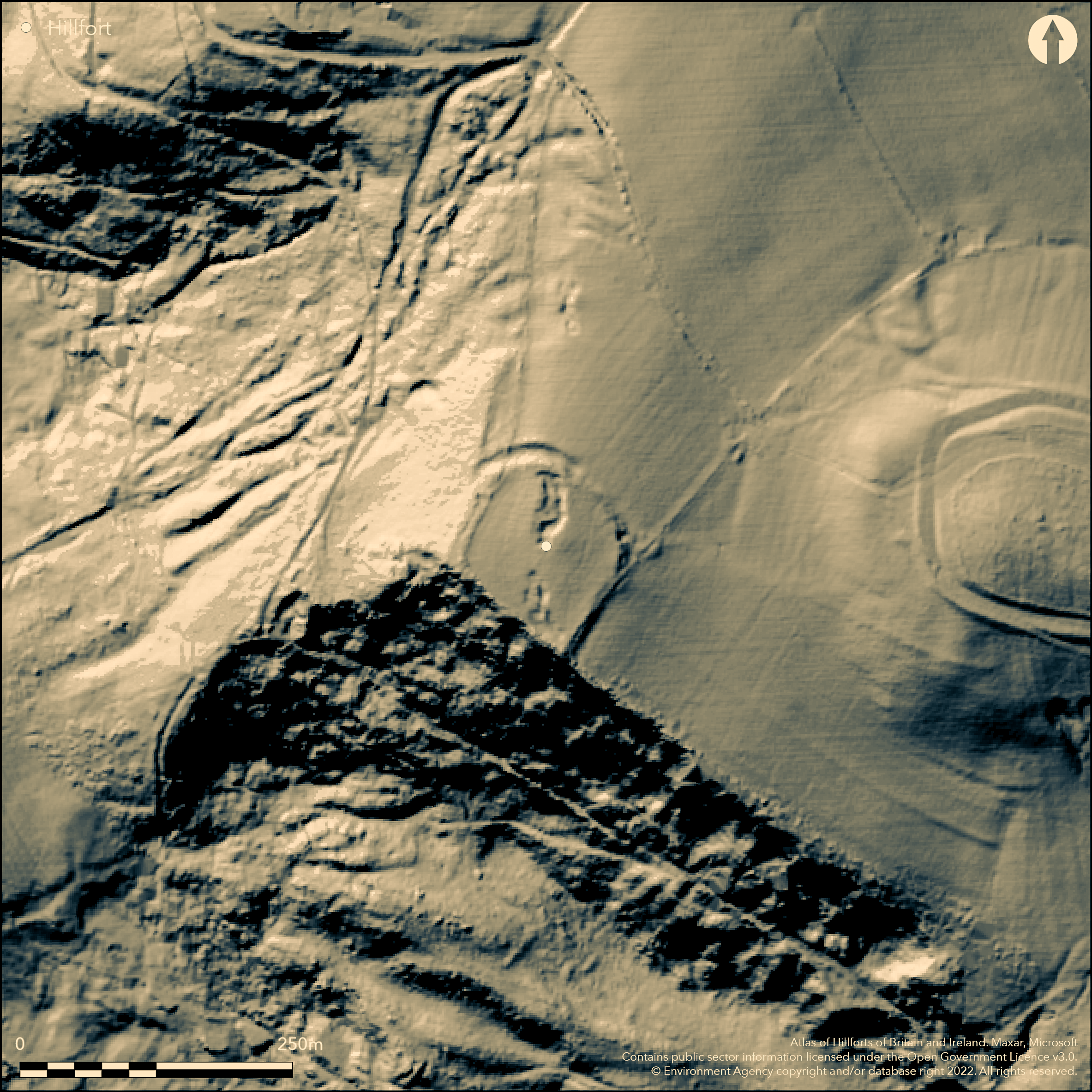
LiDAR 1m DTM Hillshade
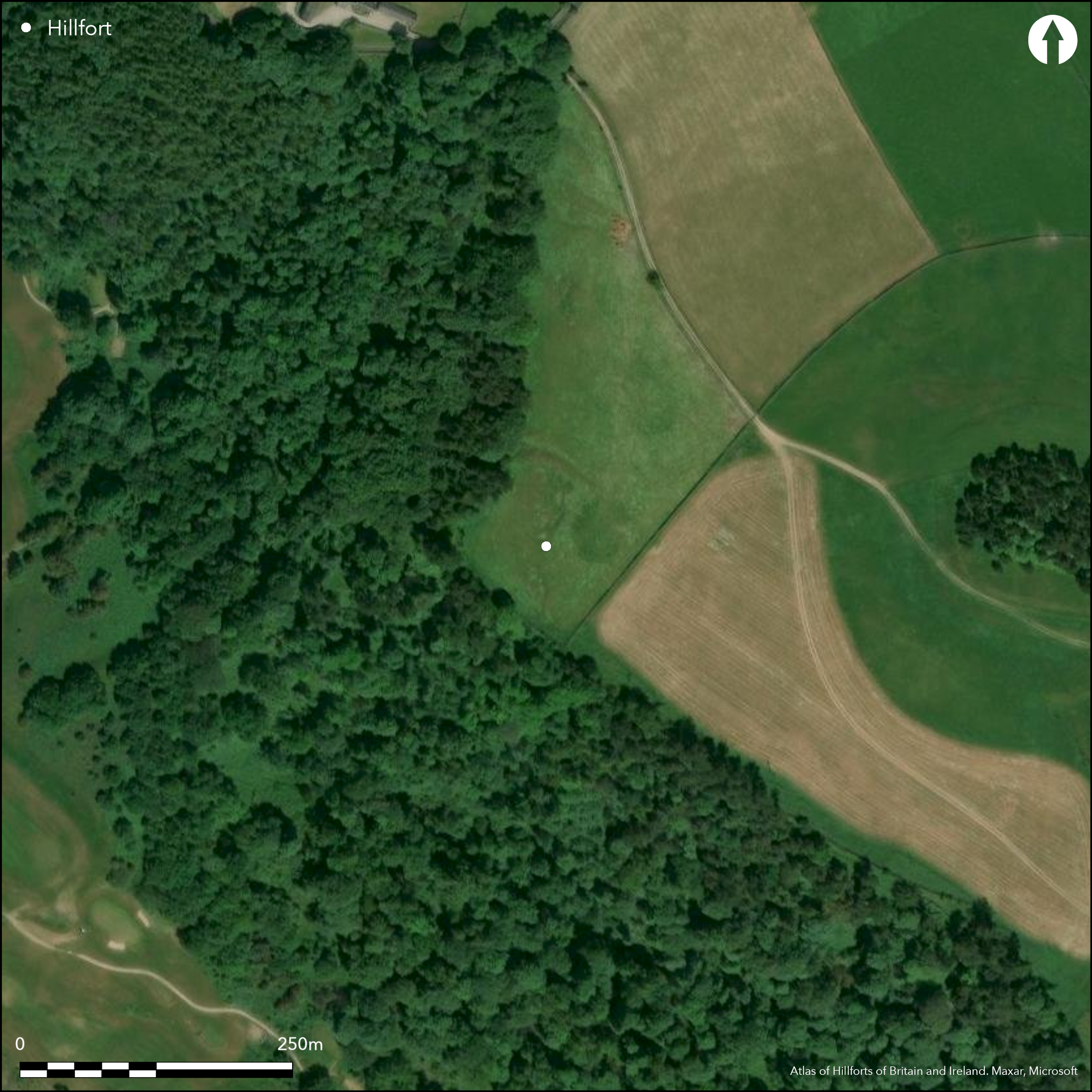
Satellite Imagery
LiDAR 1m DTM Hillshade
Satellite Imagery
Scroll left/right to view further images.
HER: Derbyshire 5141; 5142 (None)
NMR: SK 26 NW 14 (311192)
SM: 1011430
NGR: SK 2278 6912
X: 422787 Y: 369122 (OSGB36)
Lying on a small spur to the N of Calton Pastures and to the S of Ballcross Farm, a small rectangular enclosure of 0.66ha. The site has a steep precipice to the SW which is now wooded and in the E and NE a bank, in places up to 2m high. Excavations in 1952-55 (Stanley 1954) showed the hillfort had undergone strengthening, beginning with a low stone wall and finally a stone-revetted box rampart. A 20m long section of external ditch lies In the N which is 7m wide and 1.5m deep, with a slight counterscarp. Iron Age pottery and quernstones were recovered during the excavation. Three cup and ring marked stones were found stratified within the ditch, one almost a metre in size. Stanley (ibid.) suggested the stones might have been incorporated into the wall of the hillfort. In the NE quadrant the second bank was only visible in the northern third of the quadrant. The site is scheduled as a promontory fort, but would be best described as a cliff-edge fort. It was scheduled in 1961 and first recorded on OS mapping by the 1970's. The site has been likened to Evening Bank Wood, Cumbria (Atlas No. 0347) by Challis &Harding (1975).
Citizen Science: ✓
Reliability of Data: Confirmed
Reliability of Interpretation: Confirmed
X: -184812 Y: 7023546 (EPSG: 3857)
Longitude: -1.6601955199669898 Latitude: 53.2186527468232 (EPSG:4326)
Country: England; None
Current County or Unitary Authority: Derbyshire
Historic County: Derbyshire
Current Parish/Community/Council/Townland: Bakewell; Edensor
A citizen science survey in February 2014 reported that the inner bank was level with the interior of the site.
| Extant | ✓ |
| Cropmark | ✗ |
| Likely Destroyed | ✗ |
Lies within the Peak District National Park
| Woodland | ✓ |
| Commercial Forestry Plantation | ✗ |
| Parkland | ✗ |
| Pasture (Grazing) | ✓ |
| Arable | ✗ |
| Scrub/Bracken | ✗ |
| Bare Outcrop | ✗ |
| Heather/Moorland | ✗ |
| Heath | ✗ |
| Built-up | ✗ |
| Coastal Grassland | ✗ |
| Other | ✗ |
A cliff-edge fort lying at 267m OD on a small spur
| Contour Fort | ✗ |
| Partial Contour Fort | ✓ |
| Promontory Fort | ✗ |
| Hillslope Fort | ✗ |
| Level Terrain Fort | ✗ |
| Marsh Fort | ✗ |
| Multiple Enclosure Fort | ✗ |
| Hilltop | ✓ |
| Coastal Promontory | ✗ |
| Inland Promontory | ✗ |
| Valley Bottom | ✗ |
| Knoll/Hillock/Outcrop | ✗ |
| Ridge | ✗ |
| Cliff/Plateau-edge/Scarp | ✓ |
| Hillslope | ✗ |
| Lowland | ✗ |
| Spur | ✗ |
Dominant Topographic Feature: Small spur
| North | ✗ |
| Northeast | ✗ |
| East | ✗ |
| Southeast | ✗ |
| South | ✓ |
| Southwest | ✗ |
| West | ✗ |
| Northwest | ✗ |
| Level | ✗ |
Altitude: 267.0m
The parish boundary between Bakewell and Edensor follows the edge of the spur
Boundary Type: Parish/Townland
Iron Age pottery and quernstones were recovered during excavation
Reliability: B - Medium
| Pre 1200BC | ✗ |
| 1200BC - 800BC | ✗ |
| 800BC - 400BC | ✓ |
| 400BC - AD50 | ✓ |
| AD50 - AD400 | ✗ |
| AD400 - AD 800 | ✗ |
| Post AD800 | ✗ |
| Unknown | ✗ |
| Pre Hillfort: | None |
| Post Hillfort: | None |
| Artefactual: | None |
| Morphology/Earthwork/Typology: | None |
The site was excavated between 1952-55 and scheduled in 1961. Ordnance Survey field investigation in 1966. Recorded on OS mapping by 1970. Scheduled
| 1st Identified Written Reference (1954): | None |
| Other (1955): | Scheduled |
| Other (1966): | Field investigation |
| 1st Identified Map Depiction (1970): | 1:2,500 |
| Other (1979): | Visit by Hillfort Study Group |
| Other (1999): | Visited by Hillfort Study Group |
| Excavation (None): | None |
No internal features are recorded although pottery sherds and quernstones were recovered during excavation
None
| None | ✓ |
| Spring | ✗ |
| Stream | ✗ |
| Pool | ✗ |
| Flush | ✗ |
| Well | ✗ |
| Other | ✗ |
None
| No Known Features | ✓ |
| Round Stone Structures | ✗ |
| Rectangular Stone Structures | ✗ |
| Curvilinear Platforms | ✗ |
| Other Roundhouse Evidence | ✗ |
| Pits | ✗ |
| Quarry Hollows | ✗ |
| Other | ✗ |
No features are recorded
| No Known Excavation | ✗ |
| Pits | ✗ |
| Postholes | ✗ |
| Roundhouses | ✗ |
| Rectangular Structures | ✗ |
| Roads/Tracks | ✗ |
| Quarry Hollows | ✗ |
| Other | ✗ |
| Nothing Found | ✓ |
None
| No Known Geophysics | ✓ |
| Pits | ✗ |
| Roundhouses | ✗ |
| Rectangular Structures | ✗ |
| Roads/Tracks | ✗ |
| Quarry Hollows | ✗ |
| Other | ✗ |
| Nothing Found | ✗ |
Quernstone
| No Known Finds | ✗ |
| Pottery | ✓ |
| Metal | ✗ |
| Metalworking | ✗ |
| Human Bones | ✗ |
| Animal Bones | ✗ |
| Lithics | ✗ |
| Environmental | ✗ |
| Other | ✓ |
None
| APs Not Checked | ✓ |
| None | ✗ |
| Roundhouses | ✗ |
| Rectangular Structures | ✗ |
| Pits | ✗ |
| Postholes | ✗ |
| Roads/Tracks | ✗ |
| Other | ✗ |
The location of entrances is not recorded
| None: | None |
| 2: | None |
Guard Chambers: ✗
Chevaux de Frise: ✗
Naturally defended in the SW by a steep precipice and in the E and NE by a stone-revetted box rampart, in places up to 2m high. A 20m long section of external ditch lies In the N which is 0.7m wide and 15m deep, with a slight counterscarp.
| Area 1: | 0.66ha. |
| Total: | 0.66ha. |
Total Footprint Area: 0.8ha.
None
| ✓ | Strengthening of the rampart over time |
| ✗ | None |
| NE Quadrant: | 1 |
| SE Quadrant: | None |
| SW Quadrant: | None |
| NW Quadrant: | None |
| Total: | 1 |
| Partial Univallate | ✓ |
| Univallate | ✗ |
| Partial Bivallate | ✗ |
| Bivallate | ✗ |
| Partial Multivallate | ✗ |
| Multivallate | ✗ |
| Unknown | ✗ |
| Partial Univallate | ✗ |
| Univallate | ✗ |
| Partial Bivallate | ✗ |
| Bivallate | ✗ |
| Partial Multivallate | ✗ |
| Multivallate | ✗ |
None
| None | ✗ |
| Earthen Bank | ✓ |
| Stone Wall | ✗ |
| Rubble | ✗ |
| Wall-walk | ✗ |
| Evidence of Timber | ✗ |
| Vitrification | ✗ |
| Other Burning | ✗ |
| Palisade | ✗ |
| Counter Scarp Bank | ✓ |
| Berm | ✗ |
| Unfinished | ✗ |
| Other | ✗ |
Stone-revetted box rampart
| None | ✗ |
| Earthen Bank | ✗ |
| Stone Wall | ✓ |
| Murus Duplex | ✗ |
| Timber-framed | ✗ |
| Timber-laced | ✗ |
| Vitrification | ✗ |
| Other Burning | ✗ |
| Palisade | ✗ |
| Counter Scarp Bank | ✗ |
| Berm | ✗ |
| Unfinished | ✗ |
| No Known Excavation | ✗ |
| Other | ✓ |
| ✗ | None |
| ✓ | None |
Number of Ditches: 1
| ✗ | None |
Challis A.J. and Harding D.W. 1975. Later prehistory from the Trent to the Tyne; BAR British series 1 (1974) - 20(i)
Stanley, J. 1954. An Iron Age Fort at Ball Cross Farm, Bakewell. Derbyshire Archaeol J. 74. 85-99
Atlas of Hillforts:
Wikidata:
This work is licensed under CC BY-SA 4.0

 and should be cited as:
Lock, Gary and Ralston, Ian. 2024. Atlas of Hillforts of Britain and Ireland. Available at: https://hillforts.arch.ox.ac.uk
Document Version 1.1