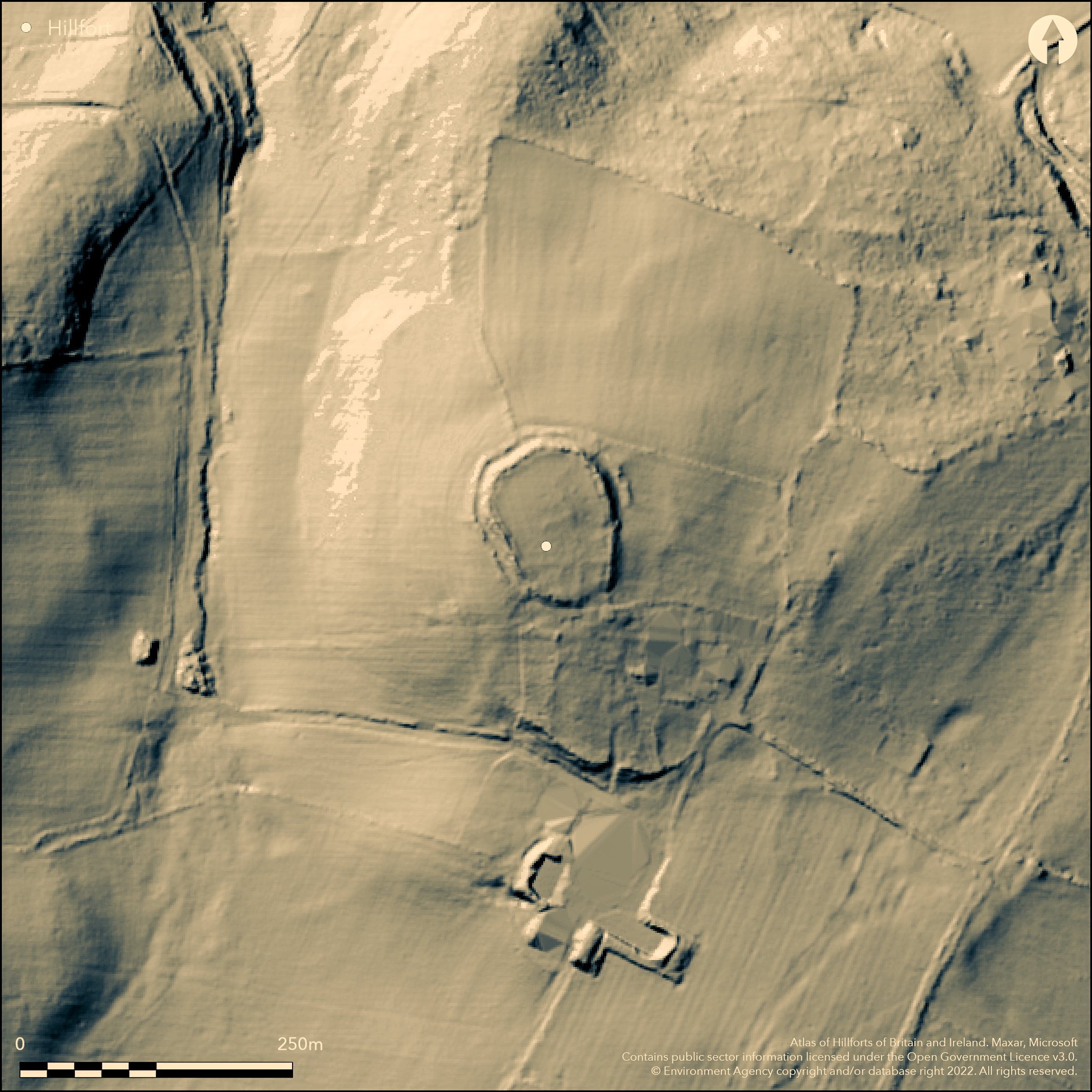
LiDAR 1m DTM Hillshade
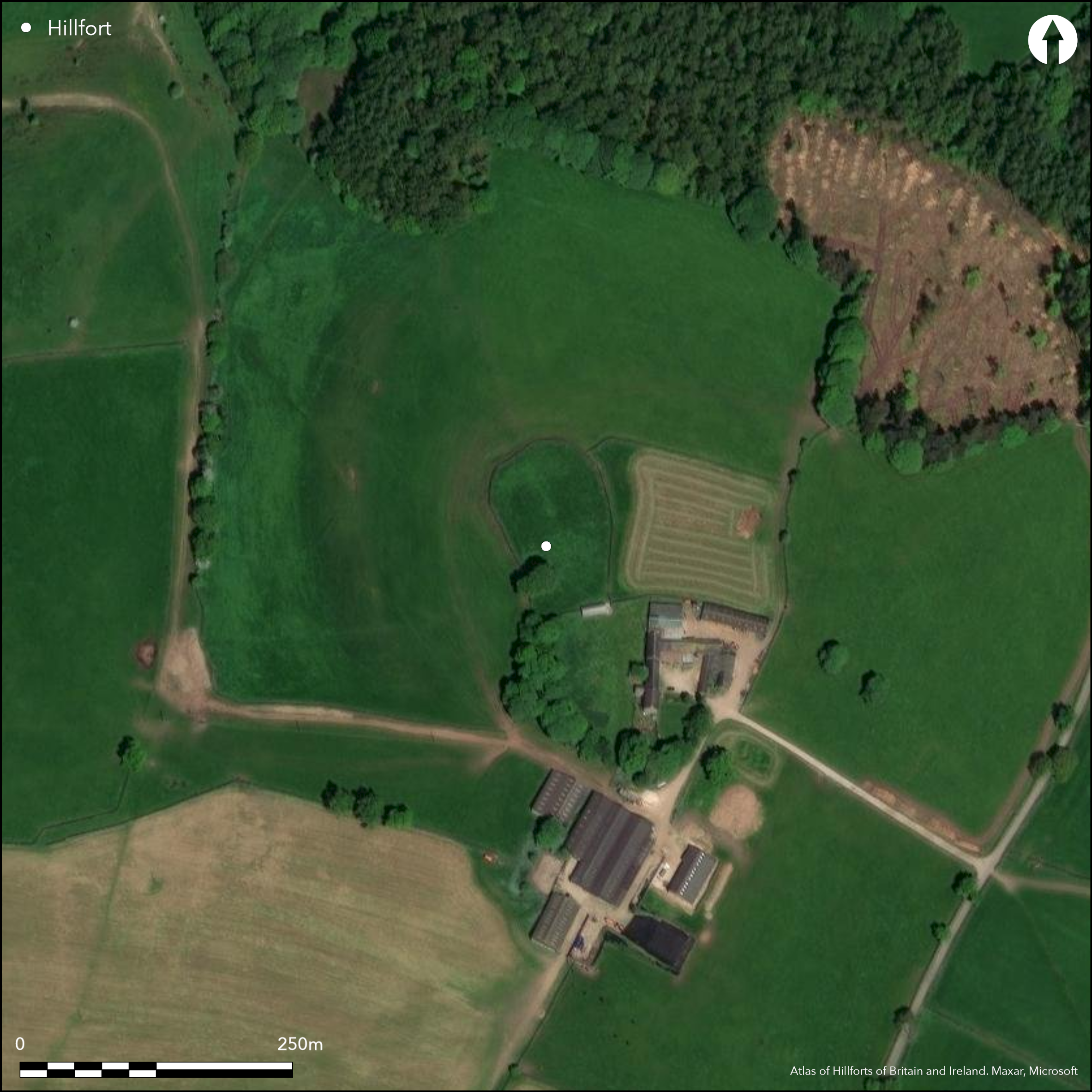
Satellite Imagery
LiDAR 1m DTM Hillshade
Satellite Imagery
Scroll left/right to view further images.
HER: Derbyshire 6717 (None)
NMR: SK 26 SW 4 (311357)
SM: 1008005
NGR: SK 22064 62827
X: 422064 Y: 362827 (OSGB36)
To the N of Harthill Moor Farm, a sub-circular enclosure. It occupies a small hill at 242m OD and comprises a bank with an external ditch and counterscarp measuring 116m by 93m enclosing 0.5ha. The rampart stands 1-2m high with an external ditch approximately 5m wide and a counterscarp up to 1m high. Both the bank and ditch are less distinct in the S where they have become ploughed out and an entrance is said to have lain in this region (Rooke 1782), although damage to the ramparts was noted at that time. Farm buildings adjacent to the S tip of the enclosure increase the problems of interpretation in the only possible area for an entrance. A field wall follows the inner rampart creating a stock enclosure. No excavation has taken place. The site is recorded on 1876-77 OS mapping. Undated. Scheduled as a defended settlement. Hodges (1980) has suggested this might be medieval in date
Citizen Science: ✓
Reliability of Data: Confirmed
Reliability of Interpretation: Unconfirmed
X: -186066 Y: 7013038 (EPSG: 3857)
Longitude: -1.6714561401069923 Latitude: 53.16209791725047 (EPSG:4326)
Country: England
Current County or Unitary Authority: Derbyshire
Historic County: Derbyshire
Current Parish/Community/Council/Townland: Harthill
Damage had occurred in the S through ploughing by 1782 and the rampart is no longer visible
| Extant | ✓ |
| Cropmark | ✗ |
| Likely Destroyed | ✓ |
Rough pasture
| Woodland | ✗ |
| Commercial Forestry Plantation | ✗ |
| Parkland | ✗ |
| Pasture (Grazing) | ✓ |
| Arable | ✗ |
| Scrub/Bracken | ✗ |
| Bare Outcrop | ✗ |
| Heather/Moorland | ✗ |
| Heath | ✗ |
| Built-up | ✗ |
| Coastal Grassland | ✗ |
| Other | ✗ |
Occupies the summit of a small hill at 242m OD
| Contour Fort | ✓ |
| Partial Contour Fort | ✗ |
| Promontory Fort | ✗ |
| Hillslope Fort | ✗ |
| Level Terrain Fort | ✗ |
| Marsh Fort | ✗ |
| Multiple Enclosure Fort | ✗ |
| Hilltop | ✓ |
| Coastal Promontory | ✗ |
| Inland Promontory | ✗ |
| Valley Bottom | ✗ |
| Knoll/Hillock/Outcrop | ✗ |
| Ridge | ✗ |
| Cliff/Plateau-edge/Scarp | ✗ |
| Hillslope | ✗ |
| Lowland | ✗ |
| Spur | ✗ |
Dominant Topographic Feature: Small hill
| North | ✗ |
| Northeast | ✗ |
| East | ✗ |
| Southeast | ✗ |
| South | ✗ |
| Southwest | ✗ |
| West | ✗ |
| Northwest | ✗ |
| Level | ✓ |
Altitude: 242.0m
N/A
The site is undated. OS maps show _Tumulus (Site of) Human Remains, Cist, Urn foundÓ on the SW rampart
Reliability: D - None
| Pre 1200BC | ✗ |
| 1200BC - 800BC | ✗ |
| 800BC - 400BC | ✗ |
| 400BC - AD50 | ✗ |
| AD50 - AD400 | ✗ |
| AD400 - AD 800 | ✗ |
| Post AD800 | ✗ |
| Unknown | ✓ |
| Pre Hillfort: | None |
| Post Hillfort: | None |
The site was reported by Rooke (1782) and on 1876-77 OS mapping. Ordnance Survey Field Report 1966. Scheduled
| 1st Identified Written Reference (1782): | None |
| Other (1949): | Scheduled |
| Other (1966): | OS Field inspection |
| Other (1979): | Visit by Hillfort Study Group |
| Other (1999): | Visited by Hillfort Study Group |
| 1st Identified Map Depiction (None): | None |
No internal features are recorded
Stream 200m downhill to the W
| None | ✓ |
| Spring | ✗ |
| Stream | ✗ |
| Pool | ✗ |
| Flush | ✗ |
| Well | ✗ |
| Other | ✗ |
None
| No Known Features | ✓ |
| Round Stone Structures | ✗ |
| Rectangular Stone Structures | ✗ |
| Curvilinear Platforms | ✗ |
| Other Roundhouse Evidence | ✗ |
| Pits | ✗ |
| Quarry Hollows | ✗ |
| Other | ✗ |
None
| No Known Excavation | ✓ |
| Pits | ✗ |
| Postholes | ✗ |
| Roundhouses | ✗ |
| Rectangular Structures | ✗ |
| Roads/Tracks | ✗ |
| Quarry Hollows | ✗ |
| Other | ✗ |
| Nothing Found | ✗ |
None
| No Known Geophysics | ✓ |
| Pits | ✗ |
| Roundhouses | ✗ |
| Rectangular Structures | ✗ |
| Roads/Tracks | ✗ |
| Quarry Hollows | ✗ |
| Other | ✗ |
| Nothing Found | ✗ |
None
| No Known Finds | ✓ |
| Pottery | ✗ |
| Metal | ✗ |
| Metalworking | ✗ |
| Human Bones | ✗ |
| Animal Bones | ✗ |
| Lithics | ✗ |
| Environmental | ✗ |
| Other | ✗ |
None
| APs Not Checked | ✗ |
| None | ✓ |
| Roundhouses | ✗ |
| Rectangular Structures | ✗ |
| Pits | ✗ |
| Postholes | ✗ |
| Roads/Tracks | ✗ |
| Other | ✗ |
An entrance is said to have lain in the S where the ramparts are now ploughed out (Rooke 1782). Farm buildings adjacent to the S tip of the enclosure increase the problems of interpretation in the only possible area for an entrance
| 1: | None |
| 2: | None |
Guard Chambers: ✗
Chevaux de Frise: ✗
| 1. Simple Gap (South): | None |
A single bank, external ditch and counterscarp measuring 116m by 93m which encloses 0.5ha. The rampart stands 1-2m high. External ditch approximately 5m wide and a counterscarp up to 1m high. Both the bank and ditch are less distinct in the S where they have become ploughed out
| Area 1: | 0.5ha. |
| Total: | 0.5ha. |
Total Footprint Area: 0.65ha.
None
| ✗ | Whole site footprint measured from satellite imagery |
| ✗ | None |
| NE Quadrant: | 1 |
| SE Quadrant: | None |
| SW Quadrant: | 1 |
| NW Quadrant: | 1 |
| Total: | 1 |
| Partial Univallate | ✓ |
| Univallate | ✗ |
| Partial Bivallate | ✗ |
| Bivallate | ✗ |
| Partial Multivallate | ✗ |
| Multivallate | ✗ |
| Unknown | ✗ |
| Partial Univallate | ✗ |
| Univallate | ✗ |
| Partial Bivallate | ✗ |
| Bivallate | ✗ |
| Partial Multivallate | ✗ |
| Multivallate | ✗ |
None
| None | ✗ |
| Earthen Bank | ✓ |
| Stone Wall | ✗ |
| Rubble | ✗ |
| Wall-walk | ✗ |
| Evidence of Timber | ✗ |
| Vitrification | ✗ |
| Other Burning | ✗ |
| Palisade | ✗ |
| Counter Scarp Bank | ✓ |
| Berm | ✗ |
| Unfinished | ✗ |
| Other | ✗ |
None
| None | ✗ |
| Earthen Bank | ✗ |
| Stone Wall | ✗ |
| Murus Duplex | ✗ |
| Timber-framed | ✗ |
| Timber-laced | ✗ |
| Vitrification | ✗ |
| Other Burning | ✗ |
| Palisade | ✗ |
| Counter Scarp Bank | ✗ |
| Berm | ✗ |
| Unfinished | ✗ |
| No Known Excavation | ✓ |
| Other | ✗ |
| ✗ | None |
| ✓ | None |
Number of Ditches: 1
| ✗ | None |
Hodges, R. 1980. Excavations at Camp Green, Hathersage (1976-7) - a Norman ringwork. Derbyshire Archaeol J. Vol. 100, 25-34
Preston, F. L. 1954. The Hill-Forts of the Peak, Derbyshire Archaeol J. Vol. 74, 1-31
Rooke, H. 1782. An account of some druidical remains on Stanton and Hustle Moor in the Peak, Derbyshire Archaeologia. Vol 6. 110-1
Atlas of Hillforts:
Wikidata:
This work is licensed under CC BY-SA 4.0

 and should be cited as:
Lock, Gary and Ralston, Ian. 2024. Atlas of Hillforts of Britain and Ireland. Available at: https://hillforts.arch.ox.ac.uk
Document Version 1.1