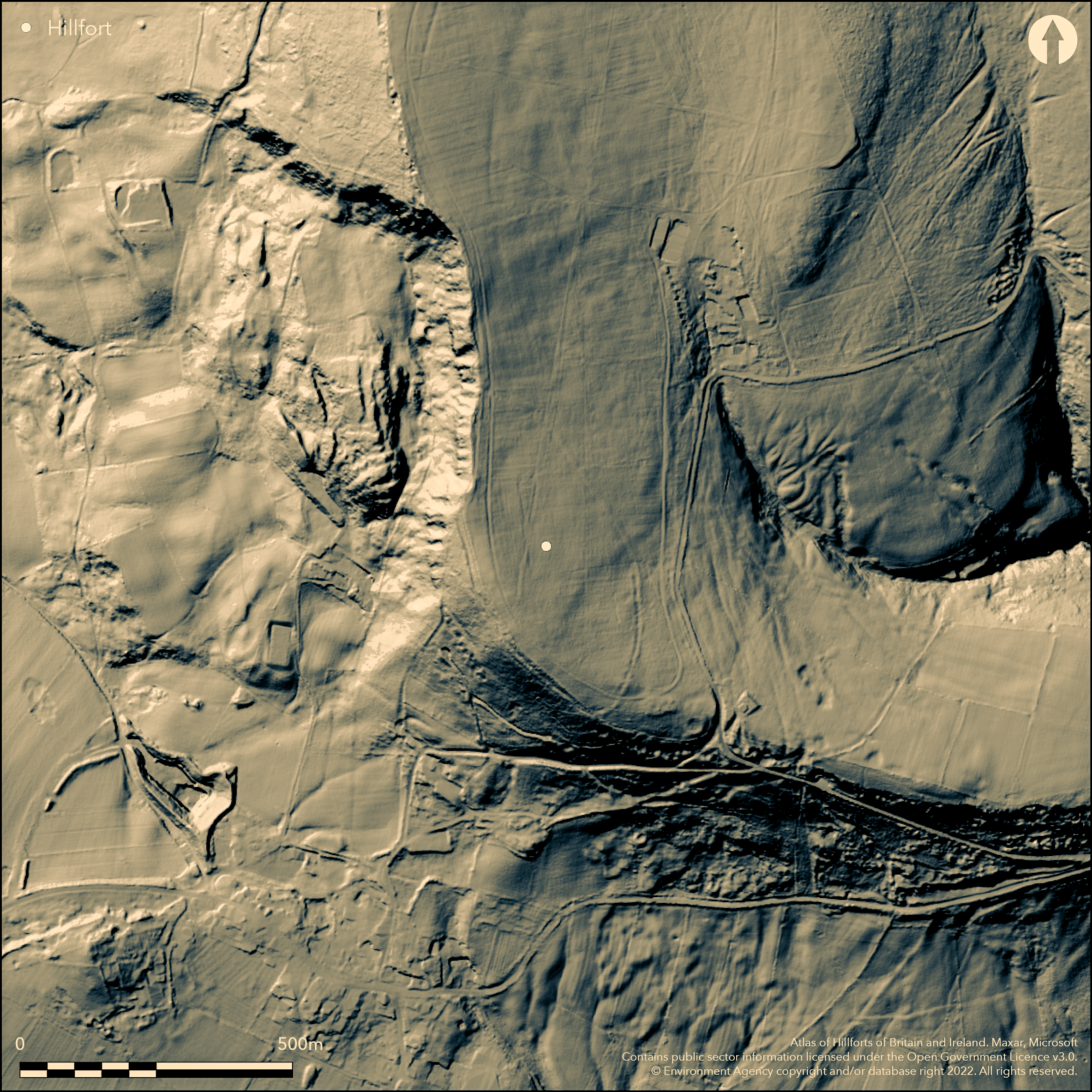
LiDAR 1m DTM Hillshade
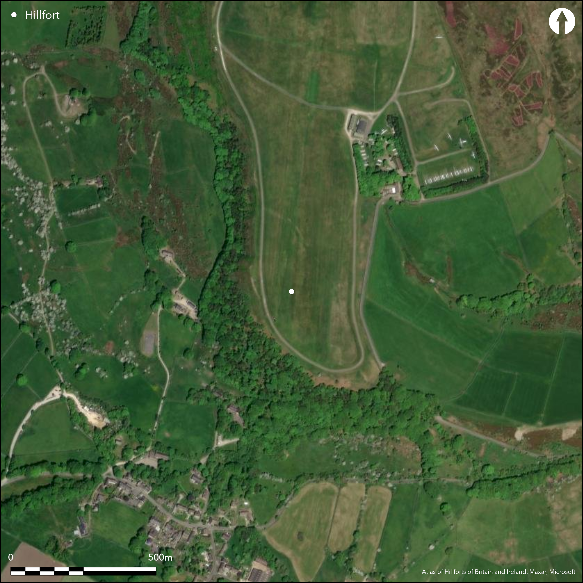
Satellite Imagery
LiDAR 1m DTM Hillshade
Satellite Imagery
Scroll left/right to view further images.
HER: Derbyshire 6303 (None)
NMR: SK 17 NE 5 (308998)
SM: 1007562
NGR: SK 1800 7832
X: 418005 Y: 378329 (OSGB36)
On the top of Burr Tor to the S of Camphill Farm, an enclosure recorded by Challis and Harding (1975) as a hillfort, but more recently scheduled as a prehistoric stock enclosure. Now destroyed. Oval in plan it measures approximately 400m N-S by 170m transversely and in 1954 was said to comprise a possible bank, a ditch and a counterscarp bank on the eastern side and a bank and berm in the W which continued as a bank and a 6m wide ditch (Preston 1954). No entrance was found. An Ordnance Survey walkover in 1966 reported no surveyable remains although a berm and ditch or possibly a track survived below the hill top. The interior had been cleared for use by the Derbyshire and Lancashire Gliding Club. In 1978 the interior was ploughed to bedrock and the surviving ditch filled with imported soils. Damage has also occurred in the S through winch cables and in the W by erosion caused by recovery vehicles. No further investigation has taken place and it is not recorded on OS mapping. Undated.
Citizen Science: ✗
Reliability of Data: Unconfirmed
Reliability of Interpretation: Irreconciled issues
X: -192727 Y: 7038981 (EPSG: 3857)
Longitude: -1.7312939057357457 Latitude: 53.30159581517077 (EPSG:4326)
Country: England
Current County or Unitary Authority: Derbyshire
Historic County: Derbyshire
Current Parish/Community/Council/Townland: Great Hucklow
None
| Extant | ✗ |
| Cropmark | ✗ |
| Likely Destroyed | ✓ |
Lies within the Peak District National Park. Rough grass used as a runway by Derbyshire and Lancashire Gliding Club
| Woodland | ✗ |
| Commercial Forestry Plantation | ✗ |
| Parkland | ✗ |
| Pasture (Grazing) | ✗ |
| Arable | ✗ |
| Scrub/Bracken | ✗ |
| Bare Outcrop | ✗ |
| Heather/Moorland | ✗ |
| Heath | ✗ |
| Built-up | ✗ |
| Coastal Grassland | ✗ |
| Other | ✓ |
A possible destroyed hillfort sited at 395m OD on level ground on the summit of a spur
| Contour Fort | ✓ |
| Partial Contour Fort | ✗ |
| Promontory Fort | ✗ |
| Hillslope Fort | ✗ |
| Level Terrain Fort | ✗ |
| Marsh Fort | ✗ |
| Multiple Enclosure Fort | ✗ |
| Hilltop | ✓ |
| Coastal Promontory | ✗ |
| Inland Promontory | ✗ |
| Valley Bottom | ✗ |
| Knoll/Hillock/Outcrop | ✗ |
| Ridge | ✗ |
| Cliff/Plateau-edge/Scarp | ✗ |
| Hillslope | ✗ |
| Lowland | ✗ |
| Spur | ✓ |
Dominant Topographic Feature: Spur
| North | ✗ |
| Northeast | ✗ |
| East | ✗ |
| Southeast | ✗ |
| South | ✗ |
| Southwest | ✗ |
| West | ✗ |
| Northwest | ✗ |
| Level | ✓ |
Altitude: 395.0m
N/A
The site is undated
Reliability: D - None
| Pre 1200BC | ✗ |
| 1200BC - 800BC | ✗ |
| 800BC - 400BC | ✗ |
| 400BC - AD50 | ✗ |
| AD50 - AD400 | ✗ |
| AD400 - AD 800 | ✗ |
| Post AD800 | ✗ |
| Unknown | ✓ |
| Pre Hillfort: | None |
| Post Hillfort: | Runway for gliding club |
General reference in Cresswell (1792). Ordnance Survey Field Report 1966. Visit by National Park Ranger in 2012. Scheduled
| 1st Identified Written Reference (1792): | None |
No internal features are known
None
| None | ✓ |
| Spring | ✗ |
| Stream | ✗ |
| Pool | ✗ |
| Flush | ✗ |
| Well | ✗ |
| Other | ✗ |
None
| No Known Features | ✓ |
| Round Stone Structures | ✗ |
| Rectangular Stone Structures | ✗ |
| Curvilinear Platforms | ✗ |
| Other Roundhouse Evidence | ✗ |
| Pits | ✗ |
| Quarry Hollows | ✗ |
| Other | ✗ |
None
| No Known Excavation | ✓ |
| Pits | ✗ |
| Postholes | ✗ |
| Roundhouses | ✗ |
| Rectangular Structures | ✗ |
| Roads/Tracks | ✗ |
| Quarry Hollows | ✗ |
| Other | ✗ |
| Nothing Found | ✗ |
None
| No Known Geophysics | ✓ |
| Pits | ✗ |
| Roundhouses | ✗ |
| Rectangular Structures | ✗ |
| Roads/Tracks | ✗ |
| Quarry Hollows | ✗ |
| Other | ✗ |
| Nothing Found | ✗ |
None
| No Known Finds | ✓ |
| Pottery | ✗ |
| Metal | ✗ |
| Metalworking | ✗ |
| Human Bones | ✗ |
| Animal Bones | ✗ |
| Lithics | ✗ |
| Environmental | ✗ |
| Other | ✗ |
None
| APs Not Checked | ✓ |
| None | ✗ |
| Roundhouses | ✗ |
| Rectangular Structures | ✗ |
| Pits | ✗ |
| Postholes | ✗ |
| Roads/Tracks | ✗ |
| Other | ✗ |
The location of entrances is unknown
| 0: | None |
| 2: | None |
Guard Chambers: ✗
Chevaux de Frise: ✗
Now destroyed. Oval in plan it measured approximately 400m N-S by 170m transversely. Said to comprise a bank, ditch and a counterscarp bank on the eastern side and a bank and berm in the W which continued as a bank and a 6m wide ditch (Preston, 1954).
| Area 1: | 5.3ha. |
| Total: | 5.3ha. |
Total Footprint Area: Noneha.
None
| ✗ | Enclosed area estimated |
| ✗ | Destroyed |
| NE Quadrant: | 1 |
| SE Quadrant: | 1 |
| SW Quadrant: | 1 |
| NW Quadrant: | 1 |
| Total: | 1 |
| Partial Univallate | ✗ |
| Univallate | ✓ |
| Partial Bivallate | ✗ |
| Bivallate | ✗ |
| Partial Multivallate | ✗ |
| Multivallate | ✗ |
| Unknown | ✗ |
| Partial Univallate | ✗ |
| Univallate | ✗ |
| Partial Bivallate | ✗ |
| Bivallate | ✗ |
| Partial Multivallate | ✗ |
| Multivallate | ✗ |
None
| None | ✓ |
| Earthen Bank | ✗ |
| Stone Wall | ✗ |
| Rubble | ✗ |
| Wall-walk | ✗ |
| Evidence of Timber | ✗ |
| Vitrification | ✗ |
| Other Burning | ✗ |
| Palisade | ✗ |
| Counter Scarp Bank | ✓ |
| Berm | ✗ |
| Unfinished | ✗ |
| Other | ✗ |
None
| None | ✗ |
| Earthen Bank | ✗ |
| Stone Wall | ✗ |
| Murus Duplex | ✗ |
| Timber-framed | ✗ |
| Timber-laced | ✗ |
| Vitrification | ✗ |
| Other Burning | ✗ |
| Palisade | ✗ |
| Counter Scarp Bank | ✗ |
| Berm | ✗ |
| Unfinished | ✗ |
| No Known Excavation | ✓ |
| Other | ✗ |
| ✗ | None |
| ✓ | Destroyed |
Number of Ditches: 1
| ✗ | None |
Challis, A. J. and Harding, W. 1975. Later Prehistory from the Trent to the Tyne. BAR Brit Ser 20. Part 2
Mr. Cresswell (of Edale), 1792, A Note. Archaeologia 10
Preston, F. L. 1954, The hill-forts of the Peak. Derbyshire Archaeol J. LXXIV
Atlas of Hillforts:
Wikidata:
This work is licensed under CC BY-SA 4.0

 and should be cited as:
Lock, Gary and Ralston, Ian. 2024. Atlas of Hillforts of Britain and Ireland. Available at: https://hillforts.arch.ox.ac.uk
Document Version 1.1