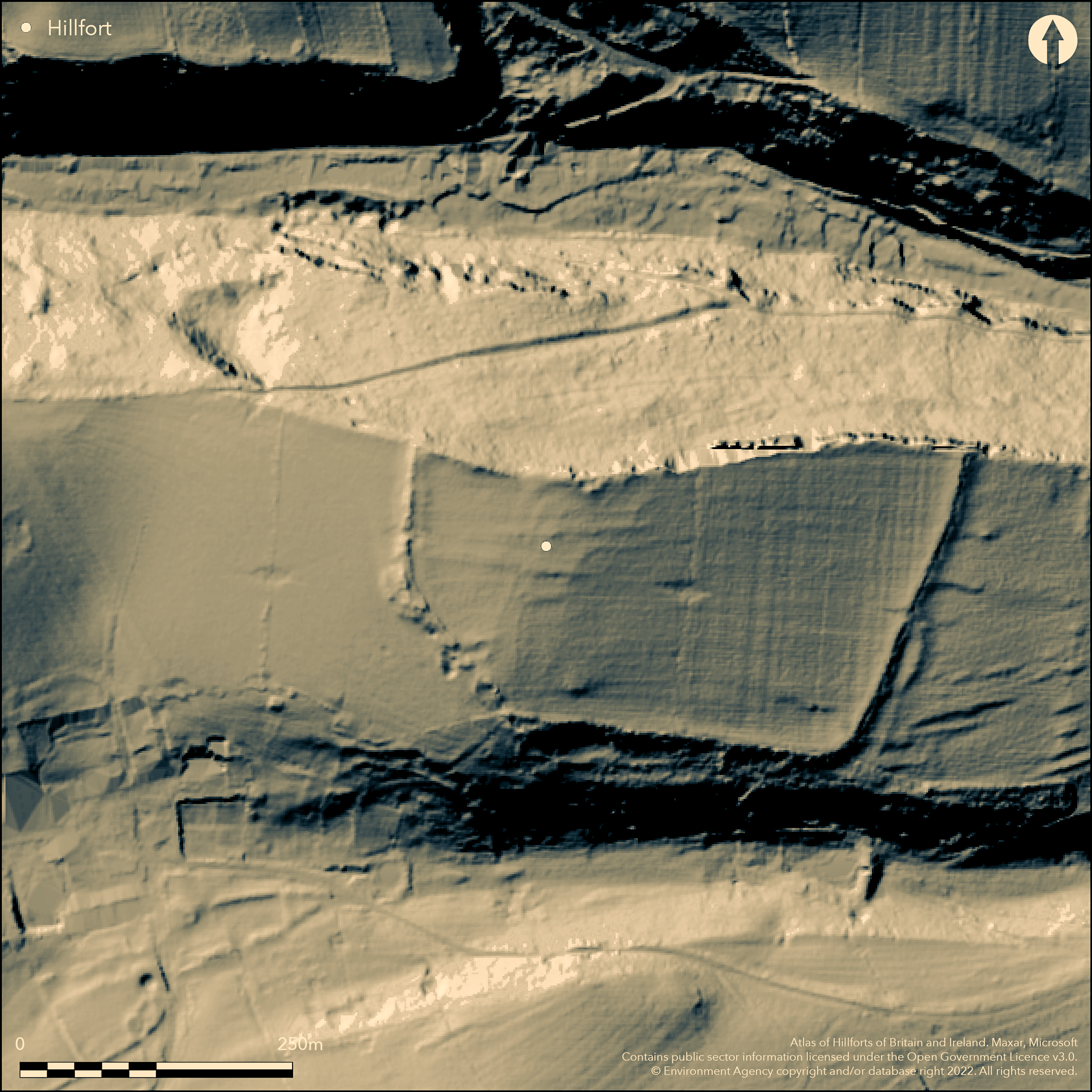
LiDAR 1m DTM Hillshade
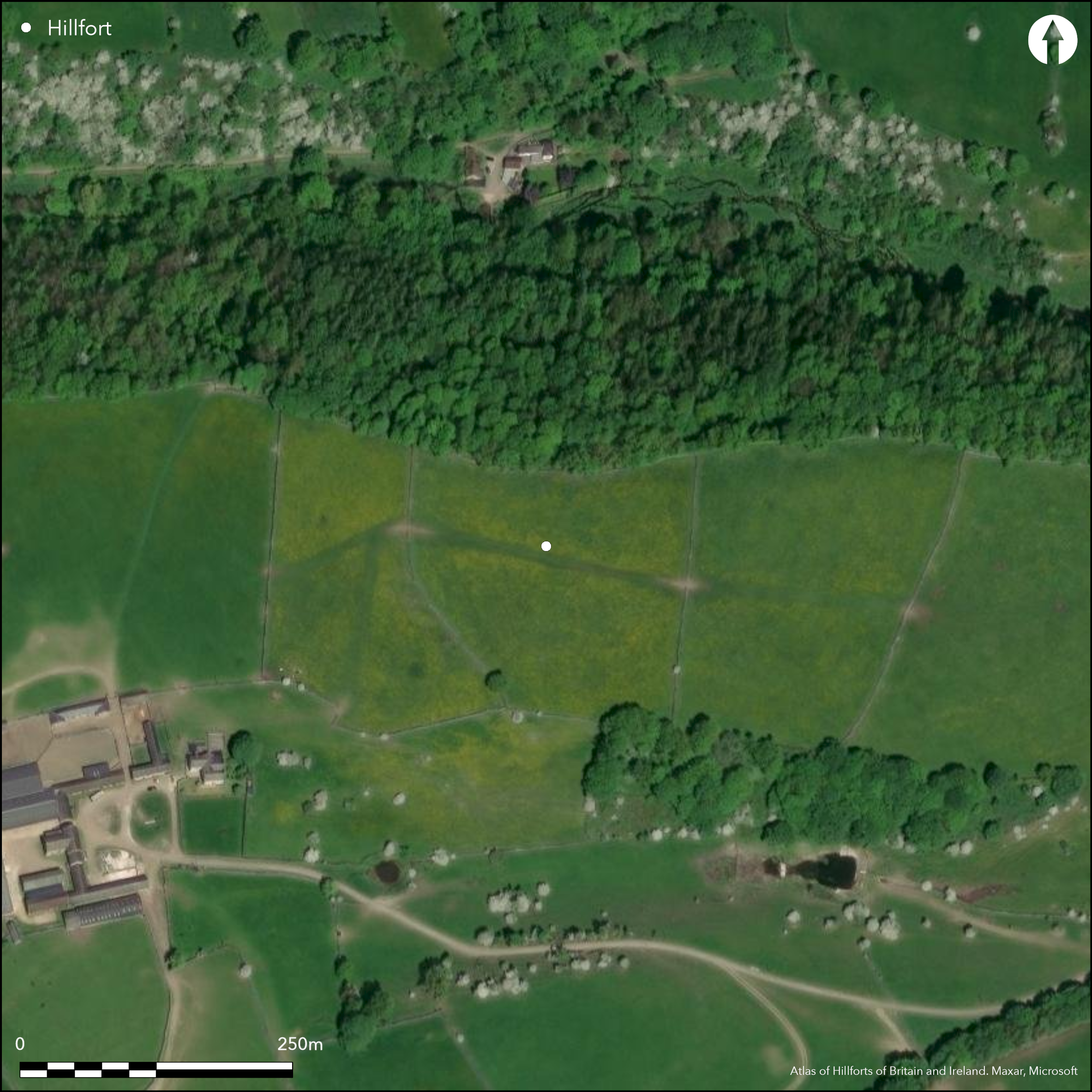
Satellite Imagery
LiDAR 1m DTM Hillshade
Satellite Imagery
Scroll left/right to view further images.
HER: Derbyshire 15735 (None)
NMR: None (None)
SM: None
NGR: SK 20298 65947
X: 420298 Y: 365947 (OSGB36)
Approximately 200m to the NE of Meadow Place Grange Farm, Conksbury, a univallate hillfort discovered in 1989 (Hart and Makepeace 1993). The site is sub-rectangular in form, enclosing 3.9 ha. It lies on the summit of a long narrow ridge at 225m OD on a bend in the River Lathkill. Precipitous slopes in the N, with steep slopes in the S. Low walls 0.8m high and 6m wide run parallel to the ridge enhancing the natural slopes but the ramparts which cut across the level ridge in the E and W comprise substantial limestone blocks with rubble infill. Any evidence for ditches is slight and presumed by the investigators (ibid.) to be due to long-term farming in the area. Damage has occurred to the rampart in the W through stone robbing for material for lime kilns but it survives up to 1.5m high and 9m wide at the base. In the E the ramparts stand 1.5m high and 10m wide at the base and are enhanced by a 5m wide quarry ditch and a counterscarp of a similar width. Within this, towards the centre, is a slightly in-curving entrance. A further possible entrance has been suggested in the SW corner although quarrying has now occurred in this area. A modern breach lies in the W. No internal features contemporary with the enclosure have been recorded. A more recent field wall runs centrally N-S through the enclosure. Medieval ridge and furrow overlies the site. It is not recorded on OS mapping and is undated.
Citizen Science: ✗
Reliability of Data: Confirmed
Reliability of Interpretation: Confirmed
X: -188984 Y: 7018260 (EPSG: 3857)
Longitude: -1.697672316440553 Latitude: 53.1902133887469 (EPSG:4326)
Country: England
Current County or Unitary Authority: Derbyshire
Historic County: Derbyshire
Current Parish/Community/Council/Townland: Youlgreave
Extensively reduced
| Extant | ✓ |
| Cropmark | ✗ |
| Likely Destroyed | ✗ |
None
| Woodland | ✗ |
| Commercial Forestry Plantation | ✗ |
| Parkland | ✗ |
| Pasture (Grazing) | ✓ |
| Arable | ✗ |
| Scrub/Bracken | ✗ |
| Bare Outcrop | ✗ |
| Heather/Moorland | ✗ |
| Heath | ✗ |
| Built-up | ✗ |
| Coastal Grassland | ✗ |
| Other | ✗ |
A probable contour fort sited on the summit of a long narrow ridge at 228m OD
| Contour Fort | ✓ |
| Partial Contour Fort | ✗ |
| Promontory Fort | ✗ |
| Hillslope Fort | ✗ |
| Level Terrain Fort | ✗ |
| Marsh Fort | ✗ |
| Multiple Enclosure Fort | ✗ |
| Hilltop | ✓ |
| Coastal Promontory | ✗ |
| Inland Promontory | ✗ |
| Valley Bottom | ✗ |
| Knoll/Hillock/Outcrop | ✗ |
| Ridge | ✓ |
| Cliff/Plateau-edge/Scarp | ✗ |
| Hillslope | ✗ |
| Lowland | ✗ |
| Spur | ✗ |
Dominant Topographic Feature: Long, narrow ridge
| North | ✓ |
| Northeast | ✗ |
| East | ✗ |
| Southeast | ✗ |
| South | ✗ |
| Southwest | ✗ |
| West | ✗ |
| Northwest | ✗ |
| Level | ✗ |
Altitude: 228.0m
N/A
The site is undated
Reliability: D - None
| Pre 1200BC | ✗ |
| 1200BC - 800BC | ✗ |
| 800BC - 400BC | ✗ |
| 400BC - AD50 | ✗ |
| AD50 - AD400 | ✗ |
| AD400 - AD 800 | ✗ |
| Post AD800 | ✗ |
| Unknown | ✓ |
| Pre Hillfort: | None |
| Post Hillfort: | None |
Etymological study of the place name by Cameron (1959: 107) suggested Conksbury 'perhaps Crane's fortification''
| 1st Identified Written Reference (1959): | None |
| Other (1999): | Visited by Hillfort Study Group |
No internal features are recorded
Spring at Greaves Hollow near possible SW entrance
| None | ✓ |
| Spring | ✗ |
| Stream | ✗ |
| Pool | ✗ |
| Flush | ✗ |
| Well | ✗ |
| Other | ✗ |
None
| No Known Features | ✓ |
| Round Stone Structures | ✗ |
| Rectangular Stone Structures | ✗ |
| Curvilinear Platforms | ✗ |
| Other Roundhouse Evidence | ✗ |
| Pits | ✗ |
| Quarry Hollows | ✗ |
| Other | ✗ |
None
| No Known Excavation | ✓ |
| Pits | ✗ |
| Postholes | ✗ |
| Roundhouses | ✗ |
| Rectangular Structures | ✗ |
| Roads/Tracks | ✗ |
| Quarry Hollows | ✗ |
| Other | ✗ |
| Nothing Found | ✗ |
None
| No Known Geophysics | ✓ |
| Pits | ✗ |
| Roundhouses | ✗ |
| Rectangular Structures | ✗ |
| Roads/Tracks | ✗ |
| Quarry Hollows | ✗ |
| Other | ✗ |
| Nothing Found | ✗ |
None
| No Known Finds | ✓ |
| Pottery | ✗ |
| Metal | ✗ |
| Metalworking | ✗ |
| Human Bones | ✗ |
| Animal Bones | ✗ |
| Lithics | ✗ |
| Environmental | ✗ |
| Other | ✗ |
None
| APs Not Checked | ✓ |
| None | ✗ |
| Roundhouses | ✗ |
| Rectangular Structures | ✗ |
| Pits | ✗ |
| Postholes | ✗ |
| Roads/Tracks | ✗ |
| Other | ✗ |
Very slightly incurving in eastern entrance towards the centre of the eastern rampart. A further possible entrance has been suggested in the SW corner although quarrying has now occurred in this area.
| 3: | Modern breach in the W |
| 2: | None |
Guard Chambers: ✗
Chevaux de Frise: ✗
| 1. Simple Gap (East): | Very slightly incurving |
| 2. Simple Gap (South west): | None |
Sub-rectangular enclosing 3.9 ha. Low walls 0.8m high and 6m wide run parallel to the ridge enhancing the natural slopes. The defences which cut across the level ridge in the E and W comprise substantial limestone blocks with rubble infill. Any evidence for ditches is slight and presumed by the investigators (Hart and Makepeace 1993) to be due to long-term farming in the area. Damage has occurred to the rampart in the W through stone robbing for material for lime kilns but it survives up to 1.5m high and 9m wide at the base. In the E the defences stand 1.5m high and 10m wide at the base and are further defended by a 5m wide quarry ditch and a counterscarp of a similar width.
| Area 1: | 3.9ha. |
| Total: | 3.9ha. |
Total Footprint Area: Noneha.
None
| ✗ | None |
| ✓ | None |
| NE Quadrant: | 1 |
| SE Quadrant: | 1 |
| SW Quadrant: | 1 |
| NW Quadrant: | 1 |
| Total: | 1 |
| Partial Univallate | ✗ |
| Univallate | ✓ |
| Partial Bivallate | ✗ |
| Bivallate | ✗ |
| Partial Multivallate | ✗ |
| Multivallate | ✗ |
| Unknown | ✗ |
| Partial Univallate | ✗ |
| Univallate | ✗ |
| Partial Bivallate | ✗ |
| Bivallate | ✗ |
| Partial Multivallate | ✗ |
| Multivallate | ✗ |
None
| None | ✗ |
| Earthen Bank | ✓ |
| Stone Wall | ✓ |
| Rubble | ✓ |
| Wall-walk | ✗ |
| Evidence of Timber | ✗ |
| Vitrification | ✗ |
| Other Burning | ✗ |
| Palisade | ✗ |
| Counter Scarp Bank | ✓ |
| Berm | ✗ |
| Unfinished | ✗ |
| Other | ✗ |
None
| None | ✗ |
| Earthen Bank | ✗ |
| Stone Wall | ✗ |
| Murus Duplex | ✗ |
| Timber-framed | ✗ |
| Timber-laced | ✗ |
| Vitrification | ✗ |
| Other Burning | ✗ |
| Palisade | ✗ |
| Counter Scarp Bank | ✗ |
| Berm | ✗ |
| Unfinished | ✗ |
| No Known Excavation | ✓ |
| Other | ✗ |
| ✗ | None |
| ✓ | None |
Number of Ditches: 1
| ✗ | None |
Cameron, K. 1959. The Place Names of Derbyshire. English Placename Society no. 27. Cambridge
Hart, C.R. and Makepeace, G. A. 1993. Crane's Fort, Conksbury, Youlgreave, Derbyshire: A Newly Discovered Hillfort. Derbyshire Archaeol J. 113. 16-20.
Atlas of Hillforts:
Wikidata:
This work is licensed under CC BY-SA 4.0

 and should be cited as:
Lock, Gary and Ralston, Ian. 2024. Atlas of Hillforts of Britain and Ireland. Available at: https://hillforts.arch.ox.ac.uk
Document Version 1.1