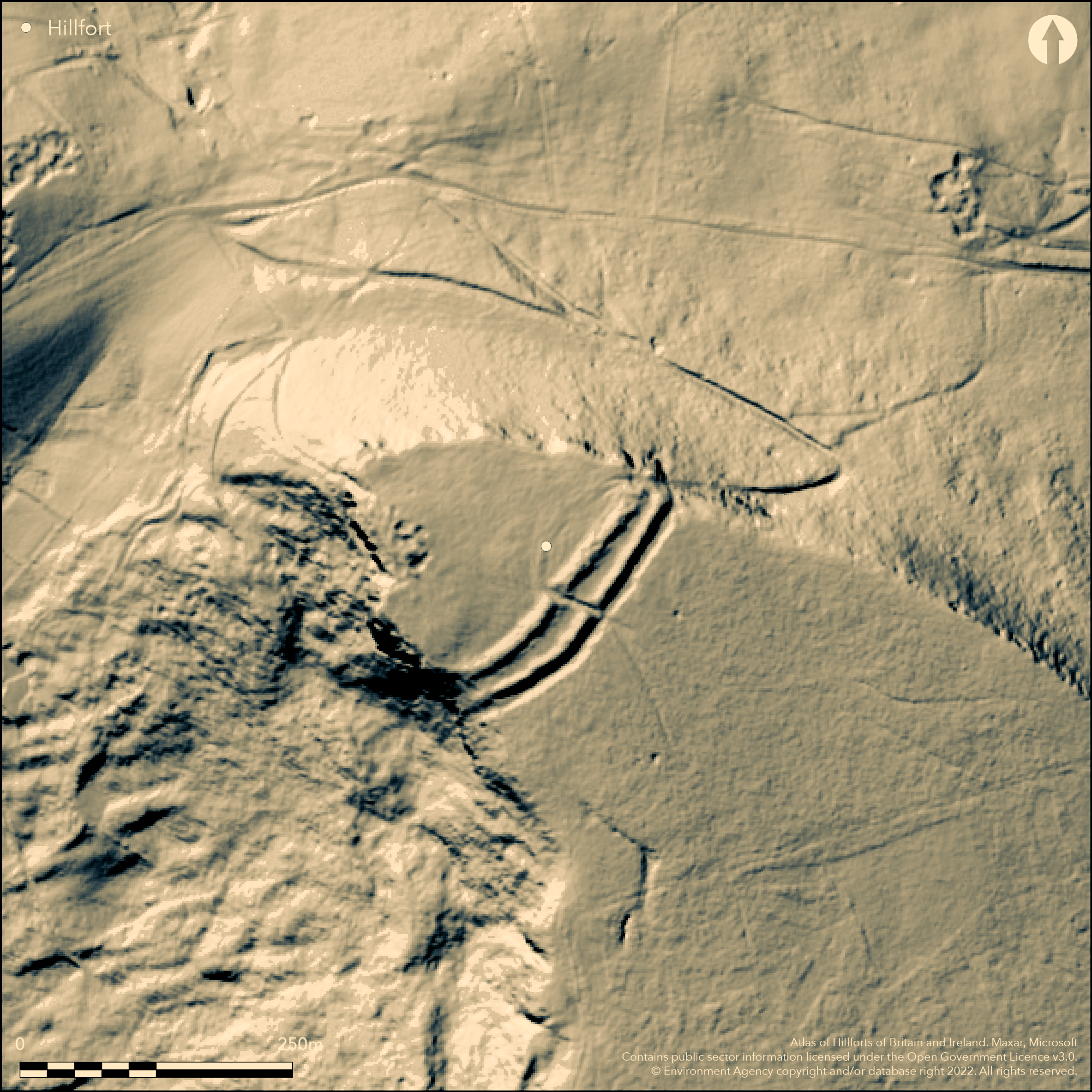
LiDAR 1m DTM Hillshade
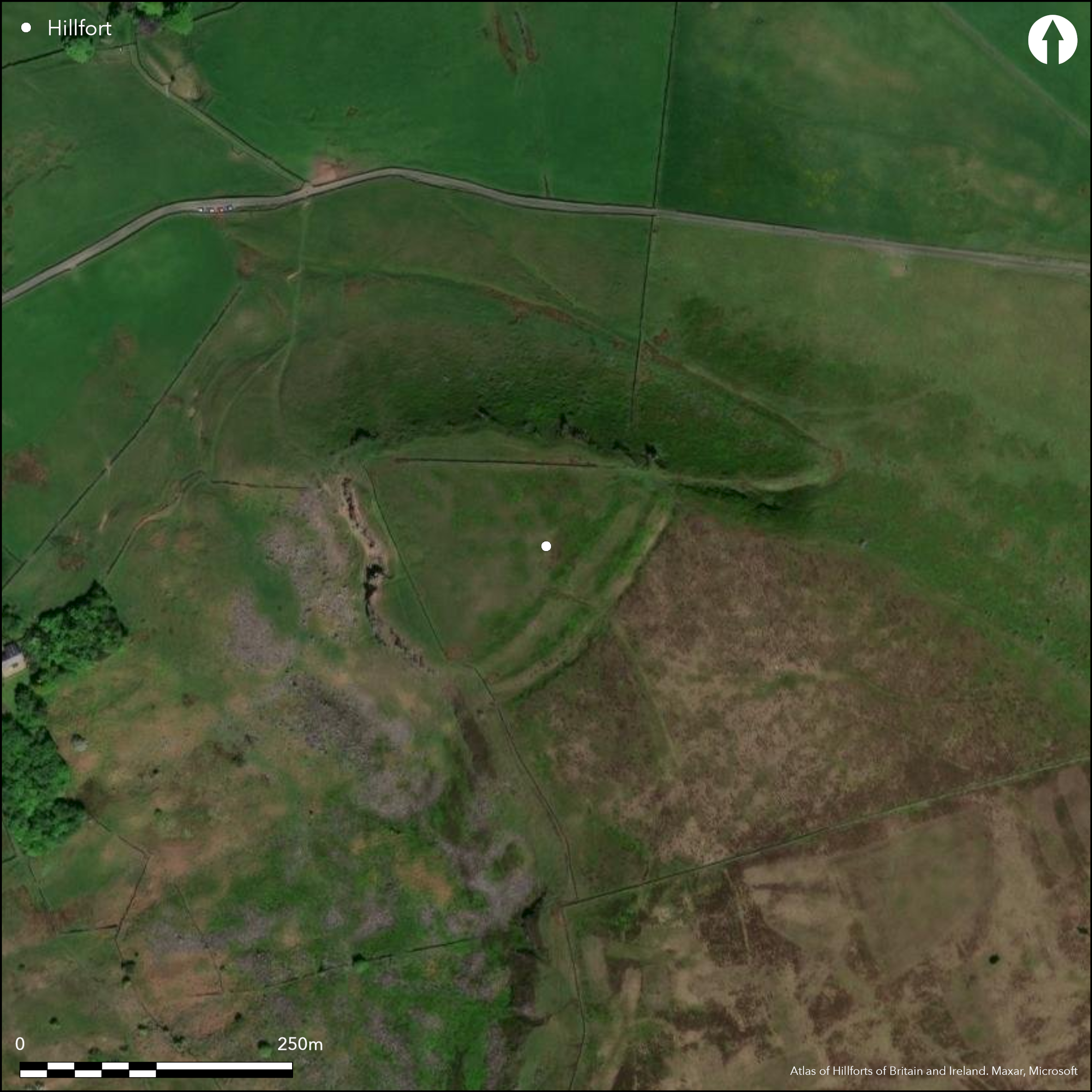
Satellite Imagery
LiDAR 1m DTM Hillshade
Satellite Imagery
Scroll left/right to view further images.
HER: Derbyshire 3510 (None)
NMR: SK 07 NE 1 (305994)
SM: 1009294
NGR: SK 05364 78439
X: 405364 Y: 378439 (OSGB36)
Lying 220m to the NE of Castle Naze Farm, a promontory fort on the western edge of Combs Moss at 443m OD. The site is naturally defended by steep gritstone cliffs in the N and W and in the S and E by double ramparts and outer ditch 60m in length, which cuts off the promontory to form a triangular enclosure of approximately 1.28ha. In the SW the earthworks extend to the cliff edge but in the NE they terminate at a secondary terraceway, which may have cut through the original entrance, although this is unconfirmed. A break near the centre of the defences is considered to be later, associated with a medieval or post medieval packhorse track. Today the ramparts appear as earthen banks 10m wide at the base and 3m at the top and stand 2-4m high. Exposed portions observed during a survey in 1957 show the inner rampart was constructed from rubble and the outer a drystone wall. This has been interpreted as evidence for two Iron Age phases of construction (Ramm 1957). Between the ramparts is a berm 10-15m wide which Ramm suggested had once been a medial ditch, now in-filled, although this area appears largely unaltered. Beyond the outer bank is a ditch 8m wide, silted up to a depth of 1m. Holloways on the lower slopes near the eastern and north-western corners are probably not related to the hillfort (G. Guilbert pers comm.). No excavation has taken place but surface finds of Romano-British pottery and a coin of Constantine I were recorded in 1893. Blanket bog lies directly to the SE of the ramparts. The site is recorded on 1879 1:2,500 OS mapping. No dating has been carried out. Scheduled.
Citizen Science: ✗
Reliability of Data: Confirmed
Reliability of Interpretation: Confirmed
X: -213842 Y: 7039217 (EPSG: 3857)
Longitude: -1.9209759555684411 Latitude: 53.302861053853114 (EPSG:4326)
Country: England
Current County or Unitary Authority: Derbyshire
Historic County: Derbyshire
Current Parish/Community/Council/Townland: Chapel-en-le-Frith
Threats to the site include erosion of its W face and hole-digging and erosion of the ramparts to the SE.
| Extant | ✓ |
| Cropmark | ✗ |
| Likely Destroyed | ✗ |
Lies within the Peak District National Park; heather and coarse grass moorland
| Woodland | ✗ |
| Commercial Forestry Plantation | ✗ |
| Parkland | ✗ |
| Pasture (Grazing) | ✗ |
| Arable | ✗ |
| Scrub/Bracken | ✗ |
| Bare Outcrop | ✗ |
| Heather/Moorland | ✓ |
| Heath | ✗ |
| Built-up | ✗ |
| Coastal Grassland | ✗ |
| Other | ✗ |
A promontory fort on the western edge of Combs Moss at 443m OD. The site is naturally defended by steep gritstone cliffs in the N and W
| Contour Fort | ✗ |
| Partial Contour Fort | ✗ |
| Promontory Fort | ✓ |
| Hillslope Fort | ✗ |
| Level Terrain Fort | ✗ |
| Marsh Fort | ✗ |
| Multiple Enclosure Fort | ✗ |
| Hilltop | ✗ |
| Coastal Promontory | ✗ |
| Inland Promontory | ✓ |
| Valley Bottom | ✗ |
| Knoll/Hillock/Outcrop | ✗ |
| Ridge | ✗ |
| Cliff/Plateau-edge/Scarp | ✗ |
| Hillslope | ✗ |
| Lowland | ✗ |
| Spur | ✗ |
Dominant Topographic Feature: Steep-sided promontory
| North | ✗ |
| Northeast | ✗ |
| East | ✗ |
| Southeast | ✗ |
| South | ✗ |
| Southwest | ✗ |
| West | ✗ |
| Northwest | ✓ |
| Level | ✗ |
Altitude: 443.0m
N/A
The site is undated
Reliability: D - None
| Pre 1200BC | ✗ |
| 1200BC - 800BC | ✗ |
| 800BC - 400BC | ✗ |
| 400BC - AD50 | ✗ |
| AD50 - AD400 | ✗ |
| AD400 - AD 800 | ✗ |
| Post AD800 | ✗ |
| Unknown | ✓ |
| Pre Hillfort: | None |
| Post Hillfort: | Triangulation pillar |
First described by Hayman Rook in 1788. Recorded on 1879 1:2,500 OS mapping. Surveyed in 1957. Field inspection in 1966. Scheduled
| 1st Identified Written Reference (1788): | None |
| 1st Identified Map Depiction (1879): | None |
| Other (1936): | Scheduled |
| Earthwork Survey (1957): | None |
| Other (1966): | Field investigation |
| Other (1979): | Visit by Hillfort Study Group |
| Other (1999): | Visit by Hillfort Study Group |
No internal features are recorded. Stray finds of Romano-British pottery and a coin of Constantine I
None
| None | ✓ |
| Spring | ✗ |
| Stream | ✗ |
| Pool | ✗ |
| Flush | ✗ |
| Well | ✗ |
| Other | ✗ |
None
| No Known Features | ✓ |
| Round Stone Structures | ✗ |
| Rectangular Stone Structures | ✗ |
| Curvilinear Platforms | ✗ |
| Other Roundhouse Evidence | ✗ |
| Pits | ✗ |
| Quarry Hollows | ✗ |
| Other | ✗ |
None
| No Known Excavation | ✓ |
| Pits | ✗ |
| Postholes | ✗ |
| Roundhouses | ✗ |
| Rectangular Structures | ✗ |
| Roads/Tracks | ✗ |
| Quarry Hollows | ✗ |
| Other | ✗ |
| Nothing Found | ✗ |
None
| No Known Geophysics | ✓ |
| Pits | ✗ |
| Roundhouses | ✗ |
| Rectangular Structures | ✗ |
| Roads/Tracks | ✗ |
| Quarry Hollows | ✗ |
| Other | ✗ |
| Nothing Found | ✗ |
Pottery and a coin
| No Known Finds | ✗ |
| Pottery | ✓ |
| Metal | ✗ |
| Metalworking | ✗ |
| Human Bones | ✗ |
| Animal Bones | ✗ |
| Lithics | ✗ |
| Environmental | ✗ |
| Other | ✓ |
None
| APs Not Checked | ✗ |
| None | ✓ |
| Roundhouses | ✗ |
| Rectangular Structures | ✗ |
| Pits | ✗ |
| Postholes | ✗ |
| Roads/Tracks | ✗ |
| Other | ✗ |
In the SW the earthworks extend to the cliff edge but in the NE they terminate at a secondary terraceway, which may or may not have cut through the original entrance. A break near the centre of the ramparts is considered to be later, associated with a medieval or post medieval packhorse track.
| 2: | Break near the centre of the ramparts thought to be associated with a later packhorse track |
| 2: | Uncertain |
Guard Chambers: ✗
Chevaux de Frise: ✗
| 1. Other Forms (North east): | Area of secondary terracing |
Defended by steep gritstone cliffs in the N and W and in the S and E by double ramparts and outer ditch 60m in length, which cut of the promontory to form a triangular enclosure of approximately 1.28ha. In the SW the earthworks extend to the cliff edge but in the NE they terminate at a secondary terraceway, which may or may not have cut through the original entrance. Today the ramparts appear as earthen banks 10m wide at the base and 3m at the top and standing 2-4m high, but exposed portions observed during a survey in 1957 show the inner rampart was constructed from rubble and the outer a drystone wall. This has been interpreted as evidence for two Iron Age phases of construction (Ramm 1957). Between the ramparts is a berm 10-15m wide which Ramm suggested had once been a medial ditch, now in-filled, although this area appears largely unaltered. Beyond the outer bank is a ditch 8m wide, silted up to a depth of 1m. Holloways on the lower slopes near the eastern and north-western corners are probably not related to the hillfort (G. Guilbert pers comm.)
| Area 1: | 1.28ha. |
| Total: | 1.28ha. |
Total Footprint Area: 1.9ha.
None
| ✓ | Measured from satellite imagery |
| ✗ | Two different methods of construction for the inner and outer rampart possibly represents two phases. Assumed here to have originally had a univallate phase. |
| NE Quadrant: | None |
| SE Quadrant: | 2 |
| SW Quadrant: | None |
| NW Quadrant: | None |
| Total: | 2 |
| Partial Univallate | ✗ |
| Univallate | ✗ |
| Partial Bivallate | ✓ |
| Bivallate | ✗ |
| Partial Multivallate | ✗ |
| Multivallate | ✗ |
| Unknown | ✗ |
| Partial Univallate | ✗ |
| Univallate | ✓ |
| Partial Bivallate | ✗ |
| Bivallate | ✗ |
| Partial Multivallate | ✗ |
| Multivallate | ✗ |
None
| None | ✗ |
| Earthen Bank | ✓ |
| Stone Wall | ✓ |
| Rubble | ✓ |
| Wall-walk | ✗ |
| Evidence of Timber | ✗ |
| Vitrification | ✗ |
| Other Burning | ✗ |
| Palisade | ✗ |
| Counter Scarp Bank | ✗ |
| Berm | ✗ |
| Unfinished | ✗ |
| Other | ✗ |
None
| None | ✗ |
| Earthen Bank | ✗ |
| Stone Wall | ✗ |
| Murus Duplex | ✗ |
| Timber-framed | ✗ |
| Timber-laced | ✗ |
| Vitrification | ✗ |
| Other Burning | ✗ |
| Palisade | ✗ |
| Counter Scarp Bank | ✗ |
| Berm | ✗ |
| Unfinished | ✗ |
| No Known Excavation | ✓ |
| Other | ✗ |
| ✗ | None |
| ✓ | External ditch with a further possible ditch on the lower slopes near the eastern corner, and an inner ditch which continues around the NW. Ramm's interpretation of the berm being an infilled ditch would give a fourth ditch |
Number of Ditches: 3
| ✗ | None |
Preston, F. L. 1954. The Hill-Forts of the Peak. Derbyshire Archaeol J. 74, 9
Ramm, H.G. 1957. A Survey of the Combs Moss Hillfort. Derbyshire Archaeol J. 77, 49-53
Rooke, H. 1789. Account of a Roman Building and Camp lately discovered in Buxton in the County of Derbyshire. Archaeologia
Atlas of Hillforts:
Wikidata:
This work is licensed under CC BY-SA 4.0

 and should be cited as:
Lock, Gary and Ralston, Ian. 2024. Atlas of Hillforts of Britain and Ireland. Available at: https://hillforts.arch.ox.ac.uk
Document Version 1.1