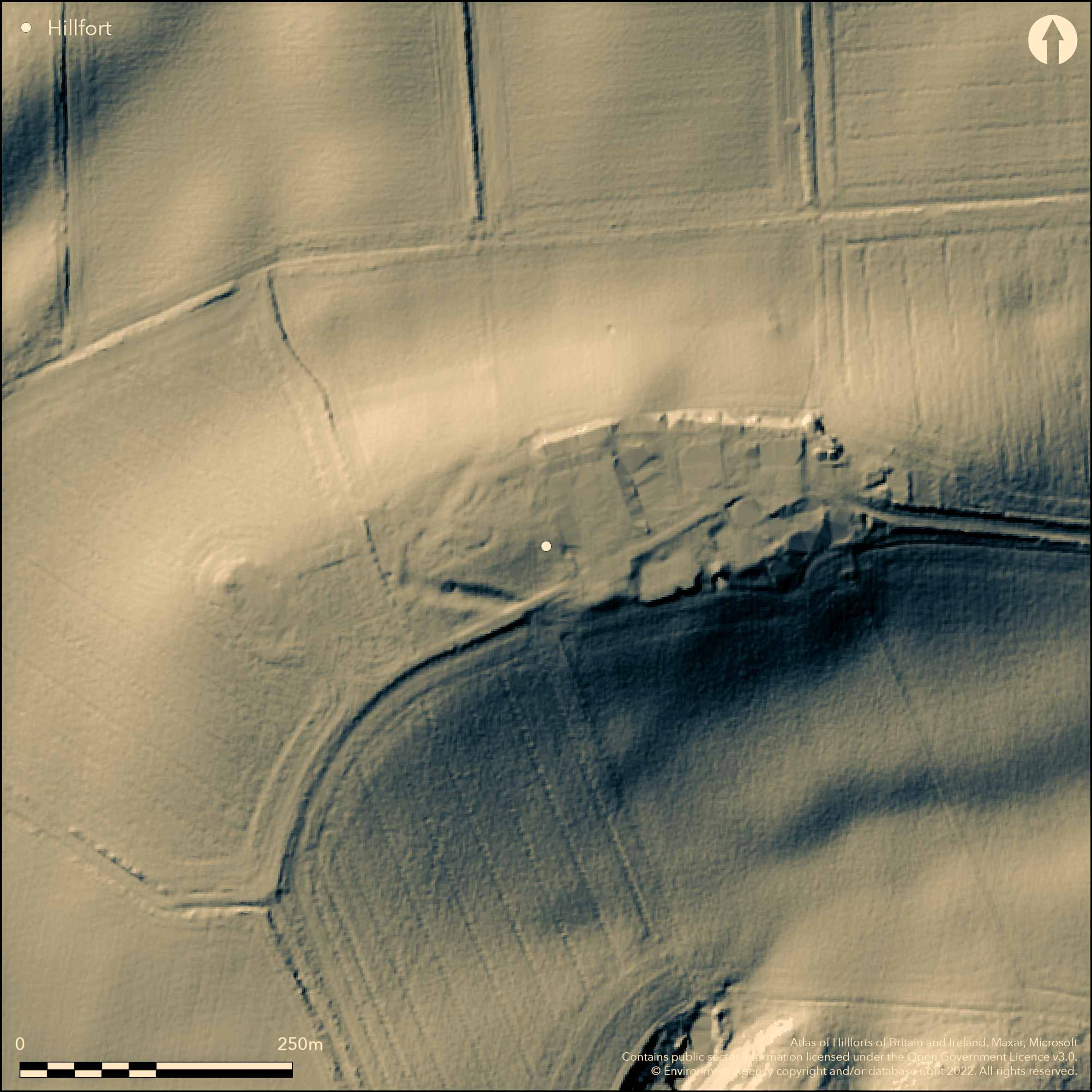
LiDAR 1m DTM Hillshade
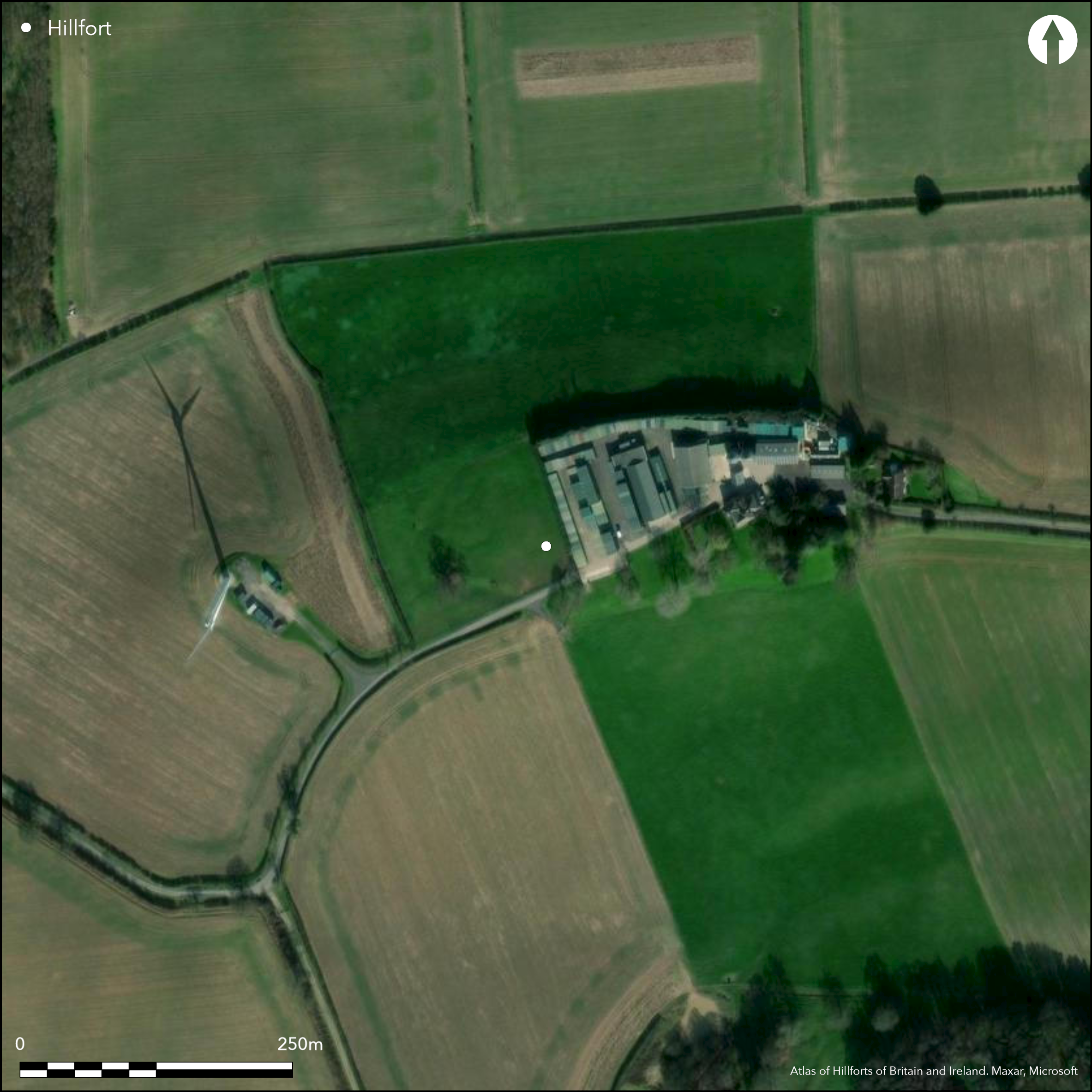
Satellite Imagery
LiDAR 1m DTM Hillshade
Satellite Imagery
Scroll left/right to view further images.
HER: Nottinghamshire 2757 (None)
NMR: SK 65 NW 2 (320231)
SM: 1003483
NGR: SK 6314 5512
X: 463141 Y: 355120 (OSGB36)
To the W of Combs Farm, the remains of a univallate hillfort of 1.4ha originally recorded as a promontory fort (Stevenson 1906). It lies in a commanding position at 96m OD with good visibility in all directions. It survives as curving earthwork banks which extend for 120m to the SW of the hillfort. A ditch has been identified at the western extent and a scarped bank in the S. Linear depressions seen on aerial photographs in a field to the W could be the remains of outer ditches. The site was surveyed by Hayman Rooke in 1785, at which time a curving ditch of approximately 37m to the N was already partly ploughed out. This can no longer be identified and is not recorded on OS mapping. A section through the ditch in 1961-2 identified two separate charcoal layers (Simmons 1963). A deliberately cut slot 0.6m wide was also discovered which has been interpreted as a cleaning slot. A 23cm high revetment stone was discovered at the lowest point of the bank. A flint scraper and knife were recovered but could not be dated. The site has suffered damage from ploughing and other activities including being a depository for silage and farm refuse and a barn has been constructed in the NE corner of the site. Finds reported by Rooke comprising a defaced brass coin, Roman brick and tile, several 'Roman' weapons and two small 'copper' battle axes discovered 0.6m deep in a bed of ashes have not been located and their classification as Roman is unverified. The cropmarks of two possible conjoined enclosures to the W of the site were noted on aerial photographs taken in 2001 which were possibly precursors to the hillfort. Recorded on 1885-1900 OS mapping. The site is undated.
Citizen Science: ✗
Reliability of Data: Confirmed
Reliability of Interpretation: Confirmed
X: -117849 Y: 6999579 (EPSG: 3857)
Longitude: -1.058652038921487 Latitude: 53.089549103868215 (EPSG:4326)
Country: England
Current County or Unitary Authority: Nottinghamshire
Historic County: Nottinghamshire
Current Parish/Community/Council/Townland: Farnsfield
Destroyed in places, but surviving as cropmarks in the W and earthworks in the SW. A road cuts through the defences in the S
| Extant | ✓ |
| Cropmark | ✓ |
| Likely Destroyed | ✓ |
None
| Woodland | ✗ |
| Commercial Forestry Plantation | ✗ |
| Parkland | ✗ |
| Pasture (Grazing) | ✗ |
| Arable | ✓ |
| Scrub/Bracken | ✗ |
| Bare Outcrop | ✗ |
| Heather/Moorland | ✗ |
| Heath | ✗ |
| Built-up | ✓ |
| Coastal Grassland | ✗ |
| Other | ✗ |
A univallate contour fort lying at 96m OD on an inland promontory.
| Contour Fort | ✓ |
| Partial Contour Fort | ✗ |
| Promontory Fort | ✗ |
| Hillslope Fort | ✗ |
| Level Terrain Fort | ✗ |
| Marsh Fort | ✗ |
| Multiple Enclosure Fort | ✗ |
| Hilltop | ✗ |
| Coastal Promontory | ✗ |
| Inland Promontory | ✓ |
| Valley Bottom | ✗ |
| Knoll/Hillock/Outcrop | ✗ |
| Ridge | ✗ |
| Cliff/Plateau-edge/Scarp | ✗ |
| Hillslope | ✗ |
| Lowland | ✗ |
| Spur | ✓ |
Dominant Topographic Feature: Inland promontory
| North | ✗ |
| Northeast | ✗ |
| East | ✗ |
| Southeast | ✗ |
| South | ✗ |
| Southwest | ✗ |
| West | ✗ |
| Northwest | ✗ |
| Level | ✓ |
Altitude: 96.0m
N/A
The site is undated
Reliability: D - None
| Pre 1200BC | ✗ |
| 1200BC - 800BC | ✗ |
| 800BC - 400BC | ✗ |
| 400BC - AD50 | ✗ |
| AD50 - AD400 | ✗ |
| AD400 - AD 800 | ✗ |
| Post AD800 | ✗ |
| Unknown | ✓ |
| Pre Hillfort: | Conjoined enclosures said to pre-date the hillfort |
| Post Hillfort: | Pottery and brick, possible Roman finds would suggest some later activity on the site. Trig point |
| Artefactual: | Finds said to be Roman recovered in the 18th century, but unverified |
Surveyed by Rooke in 1785. Recorded on 1883-5 1:2,500 OS mapping; Excavated in 1961-2 by Mansfield Archaeological Society. Field investigation in 1974. Scheduled
| 1st Identified Written Reference (1785): | None |
| Other (1955): | Scheduled |
| Other (1974): | Field investigation |
| 1st Identified Map Depiction (None): | None |
| Excavation (None): | None |
No internal features are known. Pottery, metal and lithics recovered.
None
| None | ✓ |
| Spring | ✗ |
| Stream | ✗ |
| Pool | ✗ |
| Flush | ✗ |
| Well | ✗ |
| Other | ✗ |
None
| No Known Features | ✓ |
| Round Stone Structures | ✗ |
| Rectangular Stone Structures | ✗ |
| Curvilinear Platforms | ✗ |
| Other Roundhouse Evidence | ✗ |
| Pits | ✗ |
| Quarry Hollows | ✗ |
| Other | ✗ |
Ramparts only excavated
| No Known Excavation | ✓ |
| Pits | ✗ |
| Postholes | ✗ |
| Roundhouses | ✗ |
| Rectangular Structures | ✗ |
| Roads/Tracks | ✗ |
| Quarry Hollows | ✗ |
| Other | ✗ |
| Nothing Found | ✗ |
None
| No Known Geophysics | ✓ |
| Pits | ✗ |
| Roundhouses | ✗ |
| Rectangular Structures | ✗ |
| Roads/Tracks | ✗ |
| Quarry Hollows | ✗ |
| Other | ✗ |
| Nothing Found | ✗ |
None
| No Known Finds | ✗ |
| Pottery | ✓ |
| Metal | ✓ |
| Metalworking | ✗ |
| Human Bones | ✗ |
| Animal Bones | ✗ |
| Lithics | ✓ |
| Environmental | ✗ |
| Other | ✗ |
None
| APs Not Checked | ✗ |
| None | ✓ |
| Roundhouses | ✗ |
| Rectangular Structures | ✗ |
| Pits | ✗ |
| Postholes | ✗ |
| Roads/Tracks | ✗ |
| Other | ✗ |
The location of entrances is unknown
| None: | Unknown |
| 2: | Unknown |
Guard Chambers: ✗
Chevaux de Frise: ✗
Survives as curving earthwork banks which extend for 120m to the SW of the hillfort. A ditch has been identified at the western extent and a scarped bank in the S. Linear depressions seen on aerial photographs in a field to the W could be the remains of outer ditches. A curving ditch of approximately 37m was identified to the N (Rooke 1785). This can no longer be identified.
| Area 1: | 1.4ha. |
| Total: | 1.4ha. |
Total Footprint Area: Noneha.
None
| ✗ | The area is defined by the extent of the promontory |
| ✗ | None |
| NE Quadrant: | None |
| SE Quadrant: | None |
| SW Quadrant: | 1 |
| NW Quadrant: | None |
| Total: | 1 |
| Partial Univallate | ✓ |
| Univallate | ✗ |
| Partial Bivallate | ✗ |
| Bivallate | ✗ |
| Partial Multivallate | ✗ |
| Multivallate | ✗ |
| Unknown | ✗ |
| Partial Univallate | ✗ |
| Univallate | ✗ |
| Partial Bivallate | ✗ |
| Bivallate | ✗ |
| Partial Multivallate | ✗ |
| Multivallate | ✗ |
Scarped bank in S
| None | ✗ |
| Earthen Bank | ✓ |
| Stone Wall | ✗ |
| Rubble | ✗ |
| Wall-walk | ✗ |
| Evidence of Timber | ✗ |
| Vitrification | ✗ |
| Other Burning | ✗ |
| Palisade | ✗ |
| Counter Scarp Bank | ✗ |
| Berm | ✗ |
| Unfinished | ✗ |
| Other | ✗ |
None
| None | ✗ |
| Earthen Bank | ✓ |
| Stone Wall | ✗ |
| Murus Duplex | ✗ |
| Timber-framed | ✗ |
| Timber-laced | ✗ |
| Vitrification | ✗ |
| Other Burning | ✗ |
| Palisade | ✗ |
| Counter Scarp Bank | ✗ |
| Berm | ✗ |
| Unfinished | ✗ |
| No Known Excavation | ✗ |
| Other | ✗ |
| ✗ | None |
| ✓ | Described by Rooke (1785) but can no longer be seen |
Number of Ditches: 1
| ✗ | None |
Rooke H. 1789. Letter. Archaeologia. 9, 200
Simmons, B.B. 1963. Iron Age Hill Forts in Nottinghamshire. Trans Thoroton Soc Nottinghamshire. LXVII 9-13, 15.
Stevenson, W. 1906. Victoria County History, Nottinghamshire, Vol 1, 290-1.
Atlas of Hillforts:
Wikidata:
This work is licensed under CC BY-SA 4.0

 and should be cited as:
Lock, Gary and Ralston, Ian. 2024. Atlas of Hillforts of Britain and Ireland. Available at: https://hillforts.arch.ox.ac.uk
Document Version 1.1