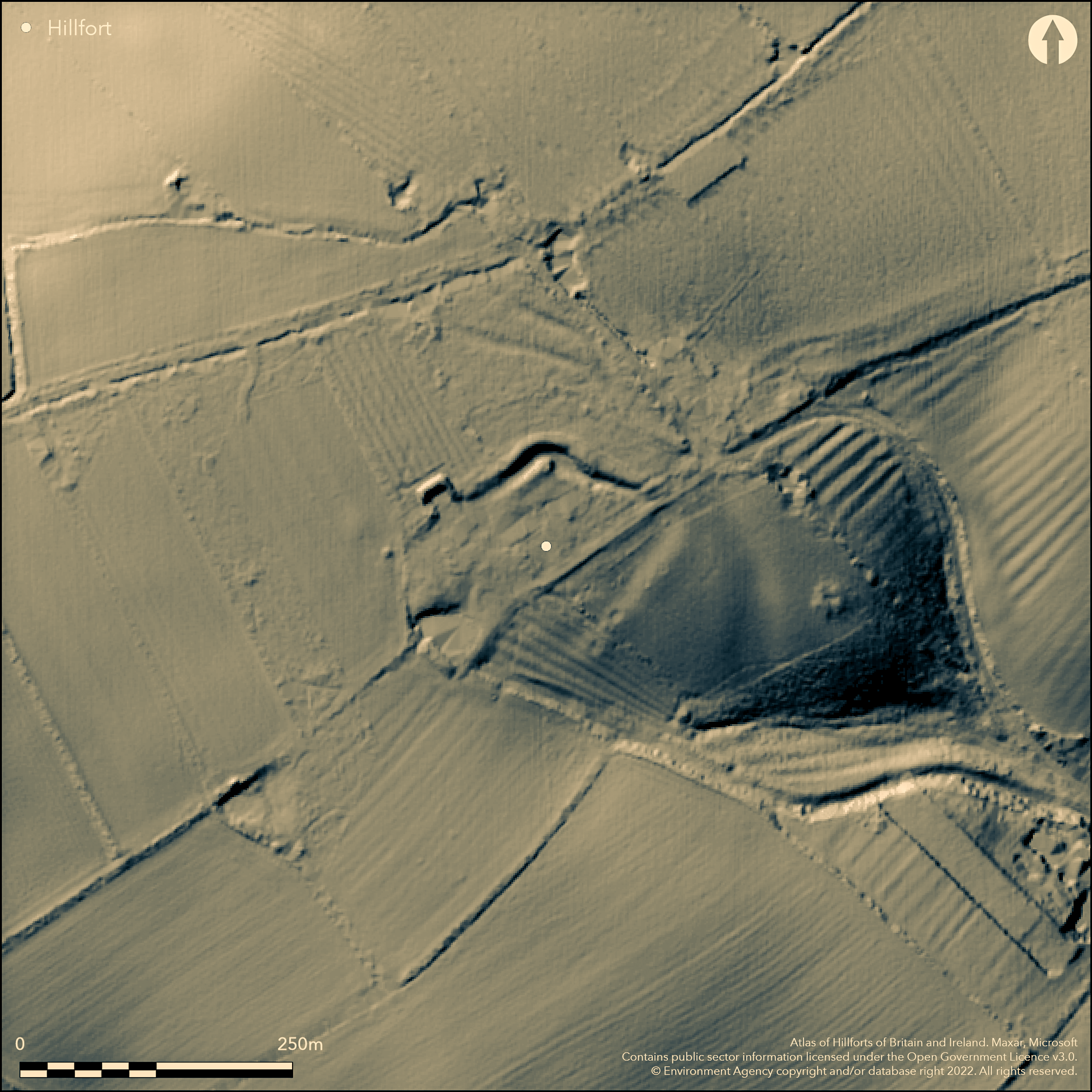
LiDAR 1m DTM Hillshade
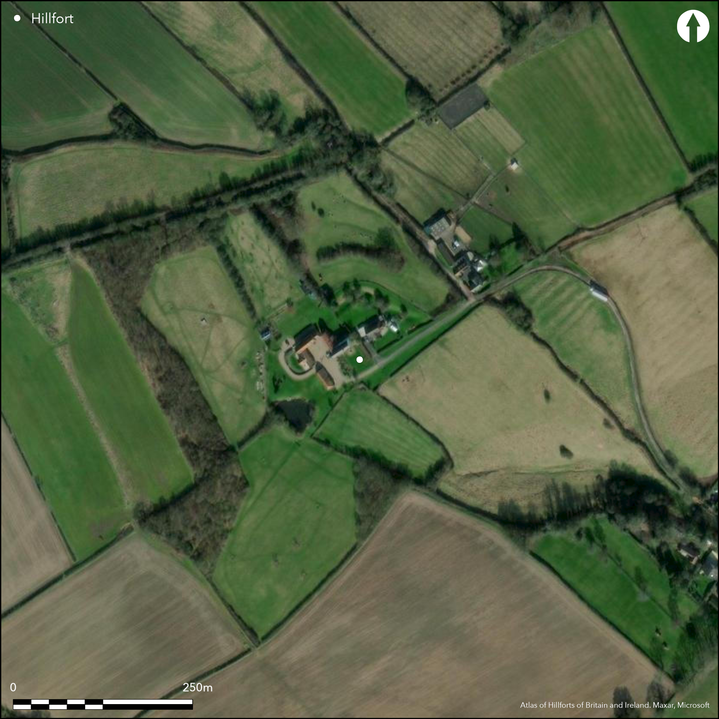
Satellite Imagery
LiDAR 1m DTM Hillshade
Satellite Imagery
Scroll left/right to view further images.
HER: Nottinghamshire 1788 (None)
NMR: SK 64 SW 1 (320143)
SM: None
NGR: SK 6338 4458
X: 463395 Y: 344583 (OSGB36)
A possible univallate hillfort lying on a ridge at 86m OD between Lodge Farm and Stockhill Farm. The ridge carries a track which is also the parish boundary between Burton Joyce and Lambley which Simmons (1963) suggested was contemporary with the hillfort. Historically the site was recorded as a homestead moat but interpreted as a 'doubtful' univallate hillfort by Hogg (1975) and as a hillfort by Challis and Harding (1975). Former ditches survive as shallow depressions covering 1.2ha around buildings at Lodge Farm. Trial excavations across the ditch by Peveral Archaeological Group (Mein 1950; Mein and Revill 1951) showed it was steep-sided and V-shaped, approximately 4.6m wide and 2.7m deep, with a slotted channel 0.9m deep and 0.9m wide. A layer of greenstone had been used as a revetment and the infill of the ditch suggested a shallow rampart had once existed. A small mound in the angle where the enclosure turns in the NE is the only surviving evidence for a former bank. Coarse calcite-gritted pottery, possibly Iron Age and a single fragment of Roman Samian ware was recovered from the fills of the ditch. A single piece of medieval pottery was found on the surface. Although considered to have been destroyed through ridge and furrow ploughing (Mein 1950: 26), traces of a slight ditch were observed on Environment Agency lidar in the SE (Keyworth 2012, 74-5). The old field name for the site is 'Borough Wong.' The earthworks are recorded as 'Moat' on First Edition OS mapping and 'Earthwork' on more recent maps. If Iron Age, it is one of five hilltop enclosures within a distance of eight miles.
Citizen Science: ✗
Reliability of Data: Unconfirmed
Reliability of Interpretation: Unconfirmed
X: -117657 Y: 6982038 (EPSG: 3857)
Longitude: -1.0569291771060605 Latitude: 52.994811807755376 (EPSG:4326)
Country: England; None
Current County or Unitary Authority: Nottinghamshire
Historic County: Nottinghamshire
Current Parish/Community/Council/Townland: Burton Joyce; Lambley
None
| Extant | ✓ |
| Cropmark | ✗ |
| Likely Destroyed | ✓ |
Farm buildings lie within the enclosed area. Pasture in the SE and SW
| Woodland | ✗ |
| Commercial Forestry Plantation | ✗ |
| Parkland | ✗ |
| Pasture (Grazing) | ✓ |
| Arable | ✗ |
| Scrub/Bracken | ✗ |
| Bare Outcrop | ✗ |
| Heather/Moorland | ✗ |
| Heath | ✗ |
| Built-up | ✓ |
| Coastal Grassland | ✗ |
| Other | ✗ |
A possible univallate hillfort lying at 86m OD on gently rising ground
| Contour Fort | ✓ |
| Partial Contour Fort | ✗ |
| Promontory Fort | ✗ |
| Hillslope Fort | ✗ |
| Level Terrain Fort | ✗ |
| Marsh Fort | ✗ |
| Multiple Enclosure Fort | ✗ |
| Hilltop | ✓ |
| Coastal Promontory | ✗ |
| Inland Promontory | ✗ |
| Valley Bottom | ✗ |
| Knoll/Hillock/Outcrop | ✗ |
| Ridge | ✓ |
| Cliff/Plateau-edge/Scarp | ✗ |
| Hillslope | ✗ |
| Lowland | ✗ |
| Spur | ✗ |
Dominant Topographic Feature: Gently rising ground
| North | ✗ |
| Northeast | ✗ |
| East | ✗ |
| Southeast | ✗ |
| South | ✗ |
| Southwest | ✗ |
| West | ✗ |
| Northwest | ✗ |
| Level | ✓ |
Altitude: 86.0m
LIes partially in Burton Joyce and partially within Lambley
Boundary Type: Parish/Townland
The site is undated but possible Iron Age pottery was recovered from ditch fills
Reliability: D - None
| Pre 1200BC | ✗ |
| 1200BC - 800BC | ✗ |
| 800BC - 400BC | ✗ |
| 400BC - AD50 | ✗ |
| AD50 - AD400 | ✗ |
| AD400 - AD 800 | ✗ |
| Post AD800 | ✗ |
| Unknown | ✓ |
| Pre Hillfort: | None |
| Post Hillfort: | None |
| Artefactual: | Possible Iron Age pottery and Samien ware |
Recorded on 1883-1885 1:10,560 OS mapping and in VCH (Stevenson 1906). Excavation in 1950-51
| 1st Identified Written Reference (1906): | None |
| 1st Identified Map Depiction (None): | None |
| Excavation (None): | None |
No internal features are recorded and farm buildings now lie within the interior. Pottery.
None
| None | ✓ |
| Spring | ✗ |
| Stream | ✗ |
| Pool | ✗ |
| Flush | ✗ |
| Well | ✗ |
| Other | ✗ |
None
| No Known Features | ✓ |
| Round Stone Structures | ✗ |
| Rectangular Stone Structures | ✗ |
| Curvilinear Platforms | ✗ |
| Other Roundhouse Evidence | ✗ |
| Pits | ✗ |
| Quarry Hollows | ✗ |
| Other | ✗ |
Interior was not excavated
| No Known Excavation | ✓ |
| Pits | ✗ |
| Postholes | ✗ |
| Roundhouses | ✗ |
| Rectangular Structures | ✗ |
| Roads/Tracks | ✗ |
| Quarry Hollows | ✗ |
| Other | ✗ |
| Nothing Found | ✗ |
None
| No Known Geophysics | ✓ |
| Pits | ✗ |
| Roundhouses | ✗ |
| Rectangular Structures | ✗ |
| Roads/Tracks | ✗ |
| Quarry Hollows | ✗ |
| Other | ✗ |
| Nothing Found | ✗ |
Possible Iron Age pottery recovered from ditch fills
| No Known Finds | ✗ |
| Pottery | ✓ |
| Metal | ✗ |
| Metalworking | ✗ |
| Human Bones | ✗ |
| Animal Bones | ✗ |
| Lithics | ✗ |
| Environmental | ✗ |
| Other | ✗ |
None
| APs Not Checked | ✓ |
| None | ✗ |
| Roundhouses | ✗ |
| Rectangular Structures | ✗ |
| Pits | ✗ |
| Postholes | ✗ |
| Roads/Tracks | ✗ |
| Other | ✗ |
The location of an entrance is not recorded
| 0: | None |
| 2: | None |
Guard Chambers: ✗
Chevaux de Frise: ✗
Former ditches survive as shallow depressions covering 1.2ha around buildings at Lodge Farm. Trial excavations across the ditch by Peveral Archaeological Group (Mein 1950; Mein and Revill 1951) showed it was steep-sided and V-shaped, approximately 4.6m wide and 2.7m deep, with a slotted channel 0.9m deep and 0.9m wide. A layer of greenstone had been used as a revetment and the infill of the ditch suggested a shallow rampart had once existed. A small mound in the angle where the enclosure turns in the N is the only surviving evidence for a former bank.
| Area 1: | Noneha. |
| Total: | Noneha. |
Total Footprint Area: 1.2ha.
None
| ✗ | None |
| ✗ | Ditch only with slight bank in the NE |
| NE Quadrant: | 1 |
| SE Quadrant: | None |
| SW Quadrant: | None |
| NW Quadrant: | None |
| Total: | 1 |
| Partial Univallate | ✓ |
| Univallate | ✗ |
| Partial Bivallate | ✗ |
| Bivallate | ✗ |
| Partial Multivallate | ✗ |
| Multivallate | ✗ |
| Unknown | ✗ |
| Partial Univallate | ✗ |
| Univallate | ✗ |
| Partial Bivallate | ✗ |
| Bivallate | ✗ |
| Partial Multivallate | ✗ |
| Multivallate | ✗ |
None
| None | ✗ |
| Earthen Bank | ✓ |
| Stone Wall | ✗ |
| Rubble | ✗ |
| Wall-walk | ✗ |
| Evidence of Timber | ✗ |
| Vitrification | ✗ |
| Other Burning | ✗ |
| Palisade | ✗ |
| Counter Scarp Bank | ✗ |
| Berm | ✗ |
| Unfinished | ✗ |
| Other | ✗ |
Ditch excavated
| None | ✓ |
| Earthen Bank | ✗ |
| Stone Wall | ✗ |
| Murus Duplex | ✗ |
| Timber-framed | ✗ |
| Timber-laced | ✗ |
| Vitrification | ✗ |
| Other Burning | ✗ |
| Palisade | ✗ |
| Counter Scarp Bank | ✗ |
| Berm | ✗ |
| Unfinished | ✗ |
| No Known Excavation | ✗ |
| Other | ✗ |
| ✗ | None |
| ✓ | None |
Number of Ditches: 1
| ✗ | None |
Challis, A.J. and Harding, D.W., 1975. Later prehistory from the Trent to the Tyne. BAR British Series 1 (1974) 20 (ii) 47
Hogg, A.H.A.1975. British Hill-Forts. An Index. British Archaeological Reports, British Series 62. 156
Keyworth, T. 2012. An Archaeological Synthesis and Landscape Investigation of Iron Age and Romano-British Central Nottinghamshire. MA dissertation, University of Leicester. https://www.academia.edu/7064496/MA-Dissertation-An-Archaeological-Synthesis-and-Landscape-Investigation-of-Iron-Age-and-Romano-British-Central-Nottinghamshire. Accessed Jun 2015
Mein, A. G.1950. Excavations at Burton Lodge Farm, Burton Joyce, Notts: Preliminary Report. Peverel Archaeological Group Annual Report: 25-28.
Mein, A.G. and Revill, S. 1951. The Progress of the Excavation at Burton Lodge, Peverel Archaeological Group Annual Report, 45-49.
Simmons, B.B. 1963. Iron Age hill forts in Nottinghamshire. Trans Thoroton Soc Nottinghamshire, 67, 18-20
Stevenson, W. 1906. Victoria County History Nottinghamshire Vol 1 (1906), 309
Atlas of Hillforts:
Wikidata:
This work is licensed under CC BY-SA 4.0

 and should be cited as:
Lock, Gary and Ralston, Ian. 2024. Atlas of Hillforts of Britain and Ireland. Available at: https://hillforts.arch.ox.ac.uk
Document Version 1.1