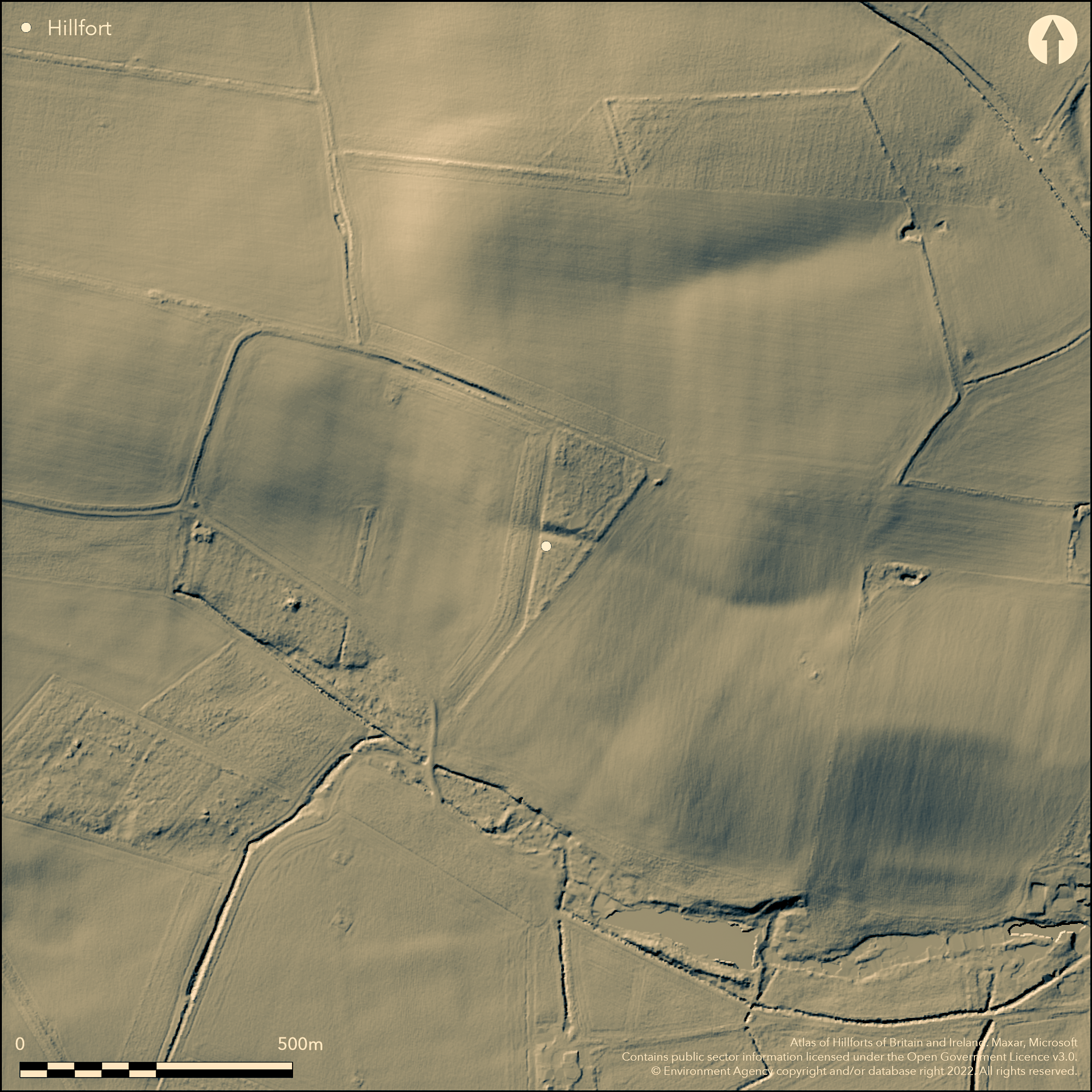
LiDAR 1m DTM Hillshade
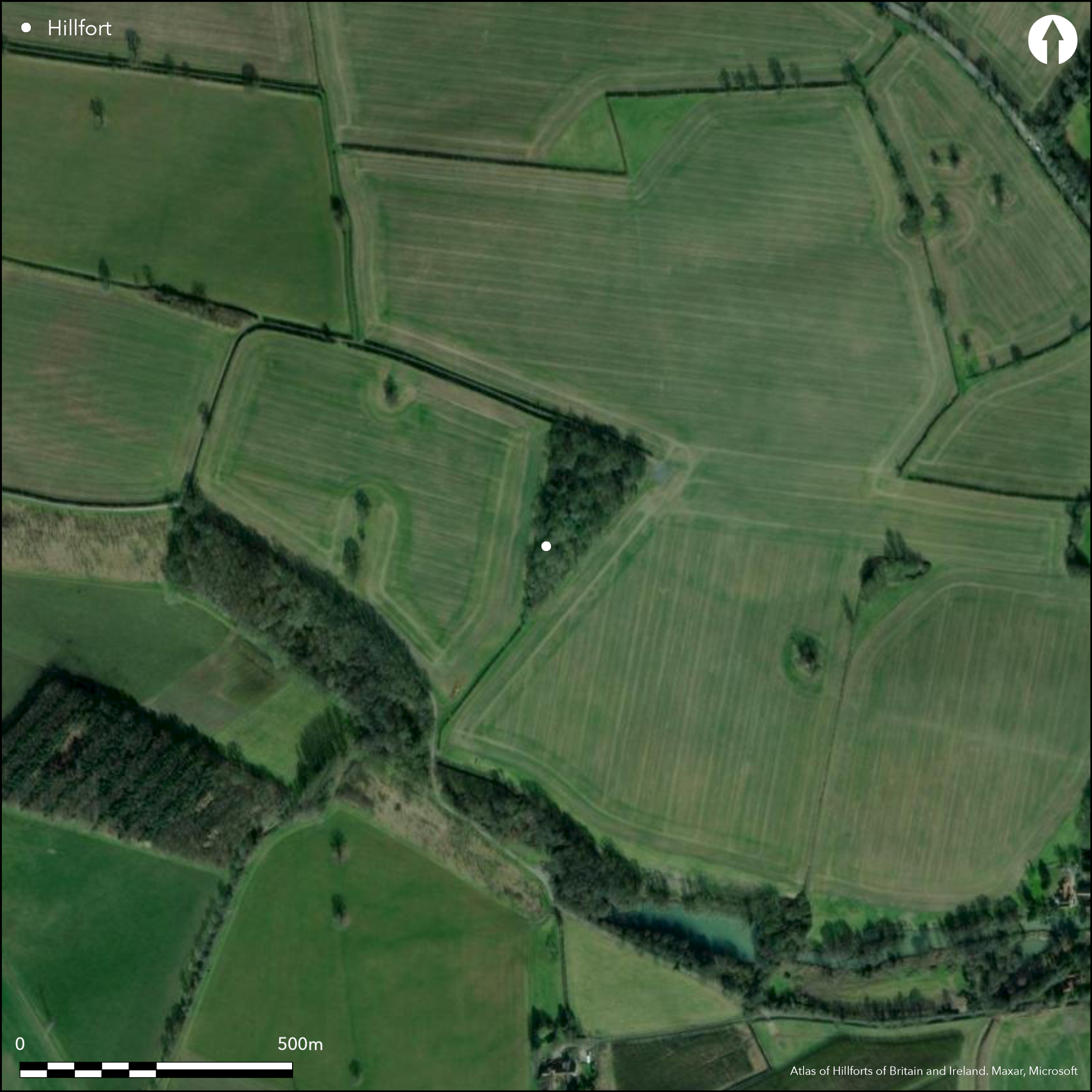
Satellite Imagery
LiDAR 1m DTM Hillshade
Satellite Imagery
Scroll left/right to view further images.
HER: Nottinghamshire 2763 (None)
NMR: SK 65 NE 2 (320188)
SM: None
NGR: SK 6680 5790
X: 466900 Y: 357700 (OSGB36)
The site of an alleged hillfort lying approximately 750m to the NW of Kirklington on Camp Hill at 67m OD. The site is said to have comprised a bank and ditch which covered 16ha, encircling the crown of the hill, but ploughed out in part by 1788 (Rooke 1788) and completely before 1818 (Stevenson 1906). Simmons (1963) reported ditches surviving in a small wood to the S and traces in the field to the W of the wood. The larger, inner ditch is 9.2m wide and 1.5-1.8m deep and the outer ditch 3.6m wide and 0.3m deep. A Roman pig of lead was found nearby in 1848 and a large number of pottery sherds, including Samian, a 1st/2nd century bronze brooch and five Iron Age sherds were found in 1960 (Simmons 1963). The course of a possible Roman road cuts through what would be the western side of the earthwork. The site is recorded on 1885-1900 OS mapping as 'site of Encampment' at that time the location was shown as Hill Close. A possible section of curving ditch can be seen on 2000 Google Earth satellite imagery.
Citizen Science: ✗
Reliability of Data: Unconfirmed
Reliability of Interpretation: Unconfirmed
X: -111542 Y: 7003794 (EPSG: 3857)
Longitude: -1.0019958913317388 Latitude: 53.11228061081904 (EPSG:4326)
Country: England
Current County or Unitary Authority: Nottinghamshire
Historic County: Nottinghamshire
Current Parish/Community/Council/Townland: Farnsfield
Possible section of ditch visible on aerial photographs
| Extant | ✗ |
| Cropmark | ✓ |
| Likely Destroyed | ✓ |
None
| Woodland | ✗ |
| Commercial Forestry Plantation | ✗ |
| Parkland | ✗ |
| Pasture (Grazing) | ✗ |
| Arable | ✓ |
| Scrub/Bracken | ✗ |
| Bare Outcrop | ✗ |
| Heather/Moorland | ✗ |
| Heath | ✗ |
| Built-up | ✗ |
| Coastal Grassland | ✗ |
| Other | ✗ |
A possible former contour fort lying at 67m OD on the summit of a low-lying hill
| Contour Fort | ✓ |
| Partial Contour Fort | ✗ |
| Promontory Fort | ✗ |
| Hillslope Fort | ✗ |
| Level Terrain Fort | ✗ |
| Marsh Fort | ✗ |
| Multiple Enclosure Fort | ✗ |
| Hilltop | ✓ |
| Coastal Promontory | ✗ |
| Inland Promontory | ✗ |
| Valley Bottom | ✗ |
| Knoll/Hillock/Outcrop | ✗ |
| Ridge | ✗ |
| Cliff/Plateau-edge/Scarp | ✗ |
| Hillslope | ✗ |
| Lowland | ✓ |
| Spur | ✗ |
Dominant Topographic Feature: Hilltop
| North | ✗ |
| Northeast | ✗ |
| East | ✗ |
| Southeast | ✗ |
| South | ✗ |
| Southwest | ✗ |
| West | ✗ |
| Northwest | ✗ |
| Level | ✓ |
Altitude: 67.0m
N/A
The site is undated however a Roman road cuts through the enclosure in the W. Pottery sherds, including Samian, a 1st/2nd century bronze brooch and five Iron Age sherds have been found
Reliability: D - None
| Pre 1200BC | ✗ |
| 1200BC - 800BC | ✗ |
| 800BC - 400BC | ✗ |
| 400BC - AD50 | ✗ |
| AD50 - AD400 | ✗ |
| AD400 - AD 800 | ✗ |
| Post AD800 | ✗ |
| Unknown | ✓ |
| Pre Hillfort: | None |
| Post Hillfort: | Possibly some Roman activity |
Recorded on 1885-1900 OS mapping. General reference in Rooke (1788), Field investigation 1975
| 1st Identified Written Reference (1788): | None |
| Other (1975): | Field investigation |
| 1st Identified Map Depiction (None): | None |
No features are recorded
None
| None | ✓ |
| Spring | ✗ |
| Stream | ✗ |
| Pool | ✗ |
| Flush | ✗ |
| Well | ✗ |
| Other | ✗ |
None
| No Known Features | ✓ |
| Round Stone Structures | ✗ |
| Rectangular Stone Structures | ✗ |
| Curvilinear Platforms | ✗ |
| Other Roundhouse Evidence | ✗ |
| Pits | ✗ |
| Quarry Hollows | ✗ |
| Other | ✗ |
None
| No Known Excavation | ✓ |
| Pits | ✗ |
| Postholes | ✗ |
| Roundhouses | ✗ |
| Rectangular Structures | ✗ |
| Roads/Tracks | ✗ |
| Quarry Hollows | ✗ |
| Other | ✗ |
| Nothing Found | ✗ |
None
| No Known Geophysics | ✓ |
| Pits | ✗ |
| Roundhouses | ✗ |
| Rectangular Structures | ✗ |
| Roads/Tracks | ✗ |
| Quarry Hollows | ✗ |
| Other | ✗ |
| Nothing Found | ✗ |
None
| No Known Finds | ✓ |
| Pottery | ✗ |
| Metal | ✗ |
| Metalworking | ✗ |
| Human Bones | ✗ |
| Animal Bones | ✗ |
| Lithics | ✗ |
| Environmental | ✗ |
| Other | ✗ |
None
| APs Not Checked | ✗ |
| None | ✓ |
| Roundhouses | ✗ |
| Rectangular Structures | ✗ |
| Pits | ✗ |
| Postholes | ✗ |
| Roads/Tracks | ✗ |
| Other | ✗ |
The location of entrances is not recorded
| None: | None |
| 2: | None |
Guard Chambers: ✗
Chevaux de Frise: ✗
Said to have comprised a bank and ditch which covered 16ha, encircling the crown of the hill, but ploughed out in part by 1788 (Rooke 1788) and completely before 1818 (Stevenson 1906)
| Area 1: | 16.0ha. |
| Total: | 16.0ha. |
Total Footprint Area: Noneha.
None
| ✗ | None |
| ✓ | None |
| NE Quadrant: | 1 |
| SE Quadrant: | 1 |
| SW Quadrant: | 1 |
| NW Quadrant: | 1 |
| Total: | 1 |
| Partial Univallate | ✗ |
| Univallate | ✓ |
| Partial Bivallate | ✗ |
| Bivallate | ✗ |
| Partial Multivallate | ✗ |
| Multivallate | ✗ |
| Unknown | ✗ |
| Partial Univallate | ✗ |
| Univallate | ✗ |
| Partial Bivallate | ✗ |
| Bivallate | ✗ |
| Partial Multivallate | ✗ |
| Multivallate | ✗ |
None
| None | ✓ |
| Earthen Bank | ✗ |
| Stone Wall | ✗ |
| Rubble | ✗ |
| Wall-walk | ✗ |
| Evidence of Timber | ✗ |
| Vitrification | ✗ |
| Other Burning | ✗ |
| Palisade | ✗ |
| Counter Scarp Bank | ✗ |
| Berm | ✗ |
| Unfinished | ✗ |
| Other | ✗ |
None
| None | ✗ |
| Earthen Bank | ✗ |
| Stone Wall | ✗ |
| Murus Duplex | ✗ |
| Timber-framed | ✗ |
| Timber-laced | ✗ |
| Vitrification | ✗ |
| Other Burning | ✗ |
| Palisade | ✗ |
| Counter Scarp Bank | ✗ |
| Berm | ✗ |
| Unfinished | ✗ |
| No Known Excavation | ✓ |
| Other | ✗ |
| ✗ | None |
| ✓ | None |
Number of Ditches: 1
| ✗ | None |
Rooke, H. 1788. Letter. Archaeologia
Stevenson, W. 1906. Victoria County History, Nottinghamshire Vol. I (1906), 295
Simmons, B.B. 1963. Iron Age Hill Forts in Nottinghamshire. Trans Thoroton Soc Nottinghamshire. LXVII 13-15
Atlas of Hillforts:
Wikidata:
This work is licensed under CC BY-SA 4.0

 and should be cited as:
Lock, Gary and Ralston, Ian. 2024. Atlas of Hillforts of Britain and Ireland. Available at: https://hillforts.arch.ox.ac.uk
Document Version 1.1