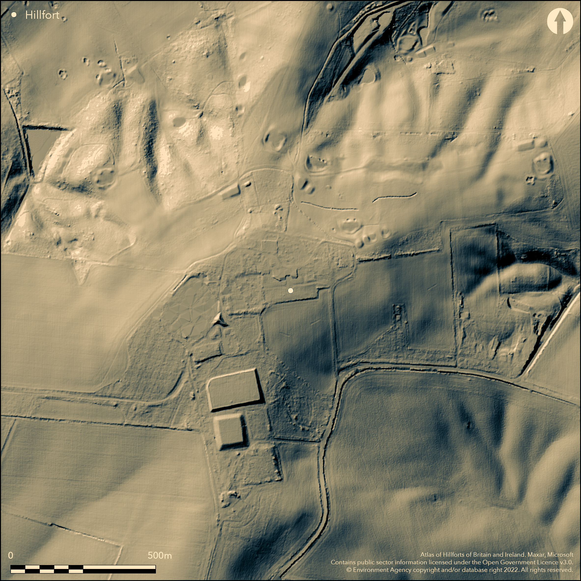
LiDAR 1m DTM Hillshade
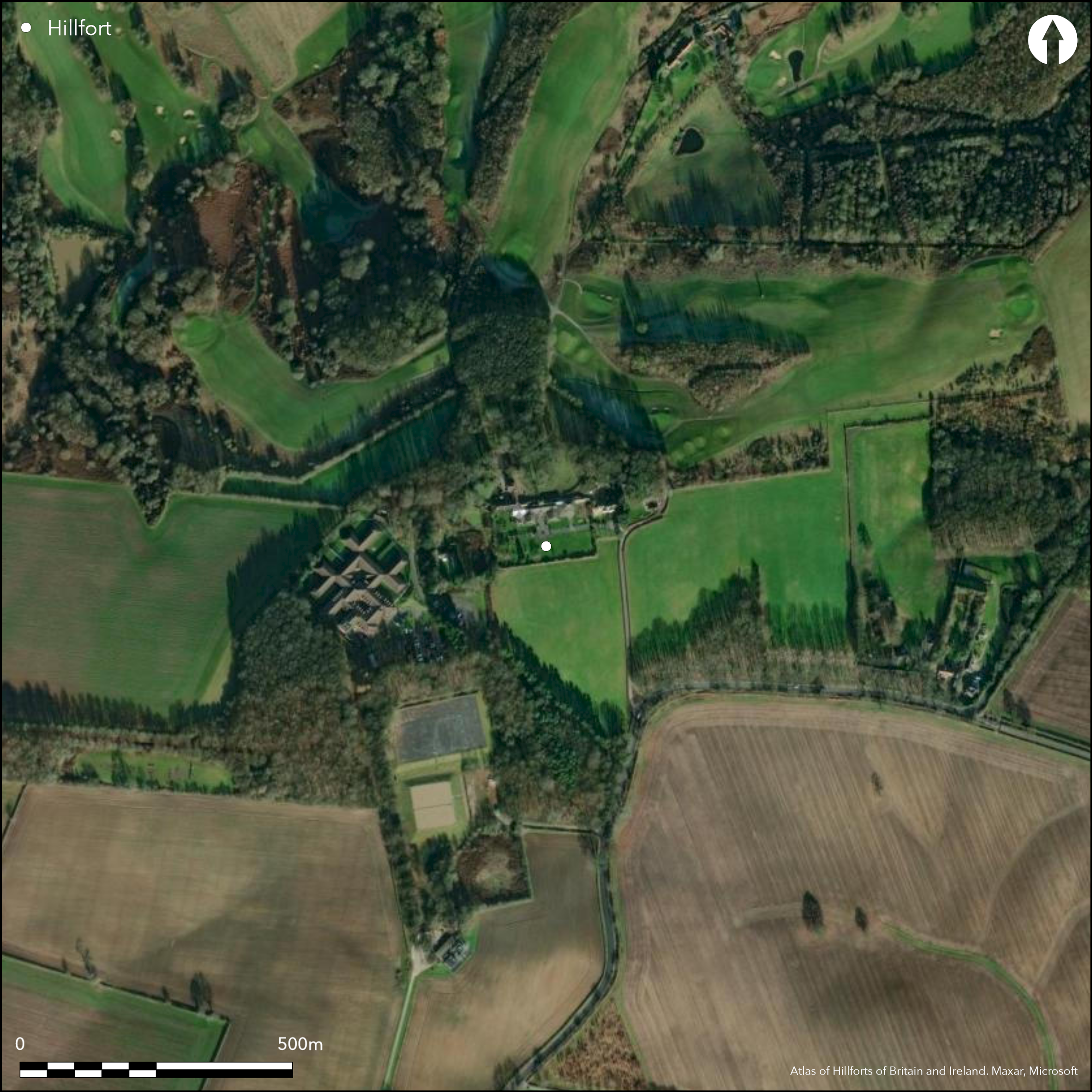
Satellite Imagery
LiDAR 1m DTM Hillshade
Satellite Imagery
Scroll left/right to view further images.
HER: Nottinghamshire 2051 (None)
NMR: SK 54 NE 4 (317855)
SM: 1006397
NGR: SK 59692 48572
X: 459692 Y: 348572 (OSGB36)
Lying approximately 1km to the SW of Calverton on Ramsdale Hill, a possible late Iron Age defended enclosure or hillfort described by Hayman Rooke as a Roman Camp in 1792, now mostly destroyed by buildings. Rectangular in plan enclosing 8.5ha, it was said to be extant in the early 18th century but is no longer visible. The site was investigated by Sherwood Archaeological Society between 1973-1991 (Turner and Turner 1997) who concluded the fort was built on an Iron Age defended enclosure possibly with the line of an Iron Age ditch used in the construction of the Roman Fort. Several ditches were excavated based on photographic evidence and Rooke's plan from which the basic form of the enclosure could be made out. Evidence for Iron Age and Roman activity was found. In the SE and NW the ditches were found to lie 219.4m apart. An excavation of the ditch in the NW showed it to be 1.2-1.5m wide and 1.0-1.2m deep. Charcoal had spilt into the ditch from a hearth on its lip and 1st century pottery was recovered. Within the ditch a 3m wide entrance was recorded 50m from the W corner and 21m beyond this a gateway 7m wide with post-settings on either side. The ditch in the SW was 1.2m wide and 1.5m deep. A cleaning-slot was found at its base. Three ditches were identified from aerial photographs on the SE side with the two outer ditches closing to form a W profile 2.2m wide and 1m deep. The inner ditch, which lies 26m beyond these was 2.0m wide and 1.4m deep with a rounded base. All produced early Roman pottery. A saddle quern was recovered from the bottom of a shallow stone-lined ditch in the N. Excavation of a possible hut circle ditch produced Iron Age sherds and a socketed sickle. A metal detecting survey on adjoining land in the NE, now a golf course, produced a half/quarter silver stater, a bronze axe, five brooches and a coin of M. Aurelius. The finds are held at Nottingham University Museum. Analysis of the pottery showed it comprised two late Bronze Age/early Iron Age sherds, 296 Iron Age sherds, the majority late Iron Age, collected from ploughsoil during fieldwalking and from ditch fills, and 77 Roman sherds. The quantity of Iron Age pottery, unusual for Nottinghamshire, makes it more likely that this was primarily a late Iron Age defended site (Elsdon, in Turner and Turner 1997). The location is shown on 1836 OS mapping as Hollinwood HIll, 'site of encampment', on 1885-1900 mapping as 'Cockpit Hill and by 1937-61 as Ramsdale Hill although the monument is no longer shown. It is scheduled as Cockpit Hill, Ramsdale Park.
Citizen Science: ✗
Reliability of Data: Confirmed
Reliability of Interpretation: Unconfirmed
X: -123716 Y: 6988751 (EPSG: 3857)
Longitude: -1.111356796715374 Latitude: 53.03109066485015 (EPSG:4326)
Country: England; None
Current County or Unitary Authority: Nottinghamshire
Historic County: Nottinghamshire
Current Parish/Community/Council/Townland: Arnold; Calverton
None
| Extant | ✗ |
| Cropmark | ✗ |
| Likely Destroyed | ✓ |
None
| Woodland | ✓ |
| Commercial Forestry Plantation | ✗ |
| Parkland | ✓ |
| Pasture (Grazing) | ✗ |
| Arable | ✗ |
| Scrub/Bracken | ✗ |
| Bare Outcrop | ✗ |
| Heather/Moorland | ✗ |
| Heath | ✗ |
| Built-up | ✗ |
| Coastal Grassland | ✗ |
| Other | ✗ |
A contour fort lying at 160m OD on relatively level ground on Ramsdale Hill
| Contour Fort | ✓ |
| Partial Contour Fort | ✗ |
| Promontory Fort | ✗ |
| Hillslope Fort | ✗ |
| Level Terrain Fort | ✗ |
| Marsh Fort | ✗ |
| Multiple Enclosure Fort | ✗ |
| Hilltop | ✓ |
| Coastal Promontory | ✗ |
| Inland Promontory | ✗ |
| Valley Bottom | ✗ |
| Knoll/Hillock/Outcrop | ✗ |
| Ridge | ✗ |
| Cliff/Plateau-edge/Scarp | ✗ |
| Hillslope | ✗ |
| Lowland | ✗ |
| Spur | ✗ |
Dominant Topographic Feature: Ramsdale Hill
| North | ✗ |
| Northeast | ✗ |
| East | ✗ |
| Southeast | ✗ |
| South | ✗ |
| Southwest | ✗ |
| West | ✗ |
| Northwest | ✗ |
| Level | ✓ |
Altitude: 160.0m
Parish Boundary with Calverton to the E
Boundary Type: Parish/Townland
Pottery from the early Iron Age to Roman period recovered during fieldwalking. Flints recovered during fieldwalking show activity from the Palaeolithic to the Bronze Age.
Reliability: D - None
| Pre 1200BC | ✗ |
| 1200BC - 800BC | ✗ |
| 800BC - 400BC | ✗ |
| 400BC - AD50 | ✗ |
| AD50 - AD400 | ✗ |
| AD400 - AD 800 | ✗ |
| Post AD800 | ✗ |
| Unknown | ✓ |
| Pre Hillfort: | Flints recovered during fieldwalking show activity from the Palaeolithic to the Bronze Age. Iron Age pottery also recovered |
| Post Hillfort: | Roman pottery recovered during fieldwalking. Developed in the 20th century as a small estate with house, formal gardens and outbuildings |
First noted by Hayman Rooke (1792); recorded on 1885-1900 OS mapping. Investigated by Sherwood Archaeological Society 1974-91. Scheduled
| 1st Identified Written Reference (1792): | None |
| 1st Identified Map Depiction (None): | None |
| Excavation (None): | None |
| Other (None): | Scheduled |
Curving channels thought to be hut sites. Pottery
The excavators reported a spring line within the investigated area and waterloggoing
| None | ✗ |
| Spring | ✓ |
| Stream | ✗ |
| Pool | ✗ |
| Flush | ✗ |
| Well | ✓ |
| Other | ✗ |
None
| No Known Features | ✓ |
| Round Stone Structures | ✗ |
| Rectangular Stone Structures | ✗ |
| Curvilinear Platforms | ✗ |
| Other Roundhouse Evidence | ✗ |
| Pits | ✗ |
| Quarry Hollows | ✗ |
| Other | ✗ |
None
| No Known Excavation | ✗ |
| Pits | ✗ |
| Postholes | ✗ |
| Roundhouses | ✓ |
| Rectangular Structures | ✗ |
| Roads/Tracks | ✗ |
| Quarry Hollows | ✗ |
| Other | ✗ |
| Nothing Found | ✗ |
None
| No Known Geophysics | ✓ |
| Pits | ✗ |
| Roundhouses | ✗ |
| Rectangular Structures | ✗ |
| Roads/Tracks | ✗ |
| Quarry Hollows | ✗ |
| Other | ✗ |
| Nothing Found | ✗ |
None
| No Known Finds | ✗ |
| Pottery | ✓ |
| Metal | ✗ |
| Metalworking | ✗ |
| Human Bones | ✗ |
| Animal Bones | ✗ |
| Lithics | ✗ |
| Environmental | ✗ |
| Other | ✗ |
None
| APs Not Checked | ✓ |
| None | ✗ |
| Roundhouses | ✗ |
| Rectangular Structures | ✗ |
| Pits | ✗ |
| Postholes | ✗ |
| Roads/Tracks | ✗ |
| Other | ✗ |
Both entrances lie in the NW with a narrow gap 3m wide, 50m from the W corner beyond which 25m further N a 7m wide gateway with post setting on each side. The 1.3m deep ditch curves outwards and a feature described as 'titulum-like' 3.5m long, 1m wide and 0.67m deep lay 5.5m outside from entrance.
| 2: | Identified through excavation |
| 2: | None |
Guard Chambers: ✗
Chevaux de Frise: ✗
| 1. Out-turned (North west): | With possible titulum, suggesting this a Roman feature |
| 2. Simple Gap (North west): | None |
The enclosing works are described at rectangular enclosing 8.5ha although they are believed to be Roman which overlie an earlier Iron Age enclosure. In the SE and NW the ditches were found to lie 219.4m apart. An excavation of the ditch in the NW showed it to be 1.2-1.5m wide and 1.0-1.2m deep. The ditch in the SW was 1.2m wide and 1.5m deep. A cleaning-slot was found at it's base. Three ditches were identified from aerial photographs on the SE side with the two outer ditches closing to form a W profile 2.2m wide and 1m deep. The inner ditch which lies 26m beyond these was 2.0m wide and 1.4m deep with a rounded base.
| Area 1: | 8.5ha. |
| Total: | 8.5ha. |
Total Footprint Area: Noneha.
None
| ✗ | None |
| ✗ | Only the ditches are described |
| NE Quadrant: | None |
| SE Quadrant: | None |
| SW Quadrant: | None |
| NW Quadrant: | None |
| Total: | None |
| Partial Univallate | ✗ |
| Univallate | ✗ |
| Partial Bivallate | ✗ |
| Bivallate | ✗ |
| Partial Multivallate | ✗ |
| Multivallate | ✗ |
| Unknown | ✓ |
| Partial Univallate | ✗ |
| Univallate | ✗ |
| Partial Bivallate | ✗ |
| Bivallate | ✗ |
| Partial Multivallate | ✗ |
| Multivallate | ✗ |
None
| None | ✓ |
| Earthen Bank | ✗ |
| Stone Wall | ✗ |
| Rubble | ✗ |
| Wall-walk | ✗ |
| Evidence of Timber | ✗ |
| Vitrification | ✗ |
| Other Burning | ✗ |
| Palisade | ✗ |
| Counter Scarp Bank | ✗ |
| Berm | ✗ |
| Unfinished | ✗ |
| Other | ✗ |
Ditches only excavated
| None | ✗ |
| Earthen Bank | ✗ |
| Stone Wall | ✗ |
| Murus Duplex | ✗ |
| Timber-framed | ✗ |
| Timber-laced | ✗ |
| Vitrification | ✗ |
| Other Burning | ✗ |
| Palisade | ✗ |
| Counter Scarp Bank | ✗ |
| Berm | ✗ |
| Unfinished | ✗ |
| No Known Excavation | ✗ |
| Other | ✓ |
| ✗ | None |
| ✓ | None |
Number of Ditches: 3
| ✗ | None |
Rooke, H. 1792. Letter. Archaeologia 10 1792 378-80 plan
Turner, J. and Turner, C. 1997. Dorket Head Nottinghamshire. Sherwood Archaeological Society. Unpublished
Atlas of Hillforts:
Wikidata:
This work is licensed under CC BY-SA 4.0

 and should be cited as:
Lock, Gary and Ralston, Ian. 2024. Atlas of Hillforts of Britain and Ireland. Available at: https://hillforts.arch.ox.ac.uk
Document Version 1.1