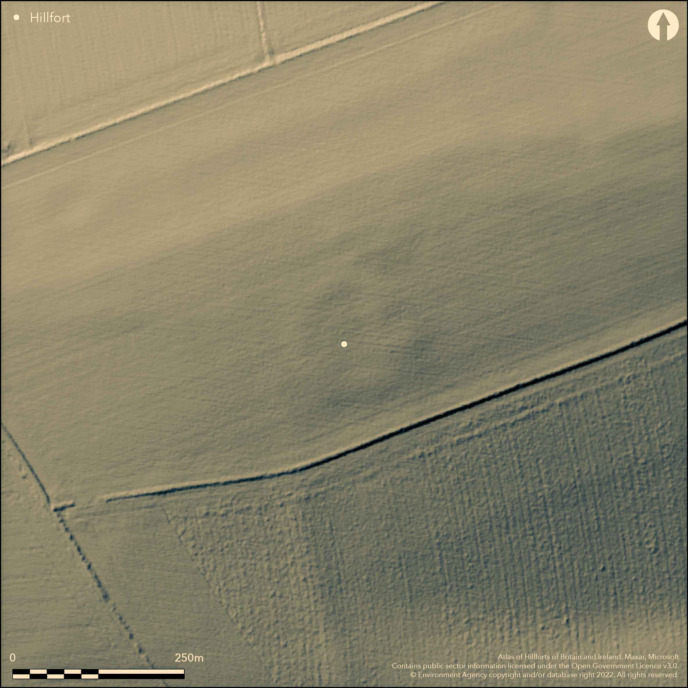
LiDAR 1m DTM Hillshade
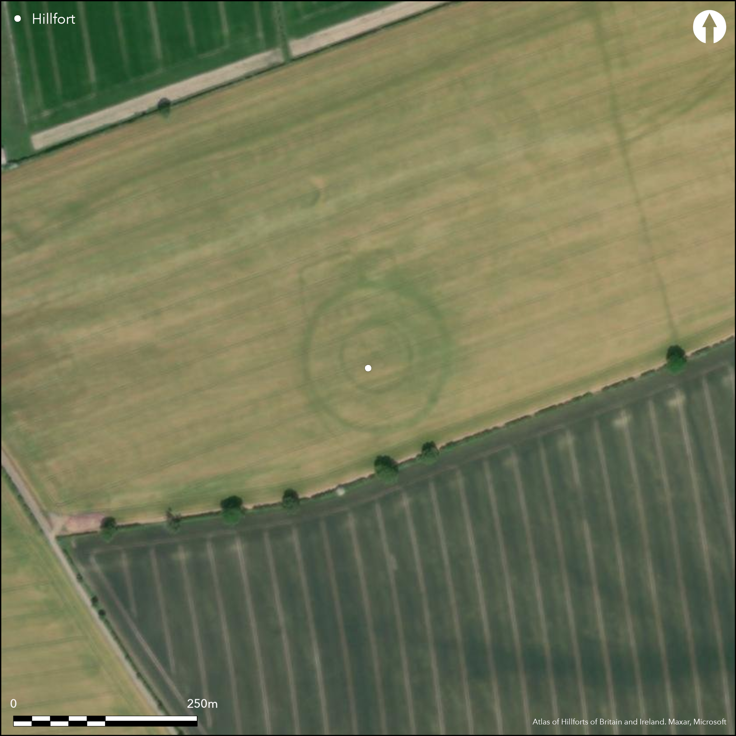
Satellite Imagery
LiDAR 1m DTM Hillshade
Satellite Imagery
Scroll left/right to view further images.
HER: Humber Archaeology Partnership 3939 (None)
NMR: TA 07 SW 10 (79885)
SM: None
NGR: TA 0300 7070
X: 503028 Y: 470724 (OSGB36)
Approximately 420m to the NW of Octon Manor, the cropmarks of a multi-period site on Paddock Hill, possibly a hillfort in a later phase. Circular in plan and assumed to be a henge, it was excavated between 1973-87 (Manby 1988) when a complex sequence of use was determined. Neolithic and Mesolithic flint implements were recovered along with sherds from Neolithic Peterborough Ware vessels. In the late Neolithic, a Class 2 henge, 60m in diameter was constructed with opposing entrances in the NW and SE. The henge was recut in the later Bronze Age and a central post circle 17m in diameter constructed which contained an urned cremation within a central pit. At a later date a circular enclosure, possibly a hillfort, 115m in diameter, enclosing 1.39ha, with a timber revetment retained at the back by a double row of posts was constructed with an external ditch, which encircled the earlier features. The entrances retained the same alignment as the henge. A ring ditch, possibly for a timber building, 25m in diameter within and concentric to the henge, is considered to be contemporary with the proposed hillfort. Romano-British pottery and brooches from the ditch fill and a circular hut attest to some later activity. From 700 AD onwards the enclosure was remodelled with the rampart fronted by a palisade and the SE entrance brought back into use. A large inhumation cemetery of 130 burials and a possible chapel and other buildings were discovered within the interior. In the 13th century, a post mill was constructed on the crest of the western rampart bank and a metalled road laid down through the SE entrance. Charred and mineralised plant macrofossils recovered during excavations showed that crop cultivation was taking place in the Bronze Age and Anglo Saxon periods (Carruthers 1993). Occupation debris indicates early 8th to late 9th century AD occupation. The site is not recorded on OS mapping but has been transcribed from aerial photographs (Stoertz, 1997: Fig. 42)
Citizen Science: ✗
Reliability of Data: Confirmed
Reliability of Interpretation: Confirmed
X: -47319 Y: 7193308 (EPSG: 3857)
Longitude: -0.42507555202415204 Latitude: 54.122065969928265 (EPSG:4326)
Country: England
Current County or Unitary Authority: East Riding of Yorkshire
Historic County: Yorkshire
Current Parish/Community/Council/Townland: Thwing
None
| Extant | ✗ |
| Cropmark | ✓ |
| Likely Destroyed | ✗ |
None
| Woodland | ✗ |
| Commercial Forestry Plantation | ✗ |
| Parkland | ✗ |
| Pasture (Grazing) | ✗ |
| Arable | ✓ |
| Scrub/Bracken | ✗ |
| Bare Outcrop | ✗ |
| Heather/Moorland | ✗ |
| Heath | ✗ |
| Built-up | ✗ |
| Coastal Grassland | ✗ |
| Other | ✗ |
A possible hillslope fort lying at 115m OD on ground sloping to the NE
| Contour Fort | ✗ |
| Partial Contour Fort | ✗ |
| Promontory Fort | ✗ |
| Hillslope Fort | ✓ |
| Level Terrain Fort | ✗ |
| Marsh Fort | ✗ |
| Multiple Enclosure Fort | ✗ |
| Hilltop | ✗ |
| Coastal Promontory | ✗ |
| Inland Promontory | ✗ |
| Valley Bottom | ✗ |
| Knoll/Hillock/Outcrop | ✗ |
| Ridge | ✗ |
| Cliff/Plateau-edge/Scarp | ✗ |
| Hillslope | ✓ |
| Lowland | ✓ |
| Spur | ✗ |
Dominant Topographic Feature: Hillslope
| North | ✗ |
| Northeast | ✓ |
| East | ✗ |
| Southeast | ✗ |
| South | ✗ |
| Southwest | ✗ |
| West | ✗ |
| Northwest | ✗ |
| Level | ✗ |
Altitude: 115.0m
N/A
A multiperiod site with evidence of activity from the Neolithic to the 13th century AD. The main constructional phases occurred in the Neolithic as a henge monument, enclosed in the later Bronze Age by a larger enclosure, interpreted as a possible hillfort. Reused in the Anglo Saxon period.
Reliability: B - Medium
| Pre 1200BC | ✗ |
| 1200BC - 800BC | ✓ |
| 800BC - 400BC | ✓ |
| 400BC - AD50 | ✗ |
| AD50 - AD400 | ✗ |
| AD400 - AD 800 | ✗ |
| Post AD800 | ✗ |
| Unknown | ✗ |
| Pre Hillfort: | None |
| Post Hillfort: | None |
| Artefactual: | Mesolithic fints including microliths, cores and flakes. Earlier Neolithic flint arrowheads, scrapers and stone axes, plus some sherds of Peterborough Ware. Grooved Ware and Beaker sherds associated with the henge. Earlier Bronze Age flint implements and food vessel sherds. Artefacts and other finds of mid-to-late Bronze Age, including evidence for metalworking activity. |
Excavated between 1973-87 (Manby 1988)
| Excavation (None): | None |
A ring ditch, possibly a timber buidling, 25m in diameter within and concentric to the henge is considered to be contemporary with the possible hillfort. Large assemblage of multi-period artefacts.
None
| None | ✓ |
| Spring | ✗ |
| Stream | ✗ |
| Pool | ✗ |
| Flush | ✗ |
| Well | ✗ |
| Other | ✗ |
None
| No Known Features | ✗ |
| Round Stone Structures | ✗ |
| Rectangular Stone Structures | ✗ |
| Curvilinear Platforms | ✗ |
| Other Roundhouse Evidence | ✓ |
| Pits | ✗ |
| Quarry Hollows | ✗ |
| Other | ✗ |
Inhumation cemetery
| No Known Excavation | ✗ |
| Pits | ✗ |
| Postholes | ✗ |
| Roundhouses | ✓ |
| Rectangular Structures | ✓ |
| Roads/Tracks | ✗ |
| Quarry Hollows | ✗ |
| Other | ✓ |
| Nothing Found | ✗ |
None
| No Known Geophysics | ✓ |
| Pits | ✗ |
| Roundhouses | ✗ |
| Rectangular Structures | ✗ |
| Roads/Tracks | ✗ |
| Quarry Hollows | ✗ |
| Other | ✗ |
| Nothing Found | ✗ |
None
| No Known Finds | ✗ |
| Pottery | ✓ |
| Metal | ✓ |
| Metalworking | ✓ |
| Human Bones | ✓ |
| Animal Bones | ✗ |
| Lithics | ✓ |
| Environmental | ✓ |
| Other | ✗ |
Ring ditch
| APs Not Checked | ✗ |
| None | ✗ |
| Roundhouses | ✗ |
| Rectangular Structures | ✗ |
| Pits | ✗ |
| Postholes | ✗ |
| Roads/Tracks | ✗ |
| Other | ✓ |
Entrances in the NW and SE, simple gaps.
| 2: | None |
| 2: | None |
Guard Chambers: ✗
Chevaux de Frise: ✗
| 1. Simple Gap (North west): | None |
| 2. Simple Gap (South east): | None |
Circular enclosure 115m in diameter with a timber revetment retained at the back by a double row of posts and an outer ditch. From 700 AD onwards the enclosure was remodelled with the rampart fronted by a palisade.
| Area 1: | 1.39ha. |
| Total: | 1.39ha. |
Total Footprint Area: Noneha.
None
| ✗ | None |
| ✓ | Ploughed out, but ditch appears continuous |
| NE Quadrant: | 1 |
| SE Quadrant: | 1 |
| SW Quadrant: | 1 |
| NW Quadrant: | 1 |
| Total: | 1 |
| Partial Univallate | ✗ |
| Univallate | ✓ |
| Partial Bivallate | ✗ |
| Bivallate | ✗ |
| Partial Multivallate | ✗ |
| Multivallate | ✗ |
| Unknown | ✗ |
| Partial Univallate | ✗ |
| Univallate | ✗ |
| Partial Bivallate | ✗ |
| Bivallate | ✗ |
| Partial Multivallate | ✗ |
| Multivallate | ✗ |
Ploughed out
| None | ✓ |
| Earthen Bank | ✗ |
| Stone Wall | ✗ |
| Rubble | ✗ |
| Wall-walk | ✗ |
| Evidence of Timber | ✗ |
| Vitrification | ✗ |
| Other Burning | ✗ |
| Palisade | ✗ |
| Counter Scarp Bank | ✗ |
| Berm | ✗ |
| Unfinished | ✗ |
| Other | ✗ |
None
| None | ✗ |
| Earthen Bank | ✗ |
| Stone Wall | ✗ |
| Murus Duplex | ✗ |
| Timber-framed | ✓ |
| Timber-laced | ✗ |
| Vitrification | ✗ |
| Other Burning | ✗ |
| Palisade | ✓ |
| Counter Scarp Bank | ✗ |
| Berm | ✗ |
| Unfinished | ✗ |
| No Known Excavation | ✗ |
| Other | ✗ |
| ✗ | None |
| ✓ | None |
Number of Ditches: 1
| ✗ | None |
Carruthers, W. 1993. Charred and mineralised macrofossils from Paddock Hill, Octon, Thwing, Yorkshire. Ancient Monuments Laboratory Report 14/93
Manby, T.G. 1988. Excavation and Field Archaeology in Eastern Yorkshire: The Thwing Project 1973-1987. CBA Forum,16-18
Stoertz C. 1997. Ancient Landscapes of the Yorkshire Wolds: Aerial Photographic Transcription and Analysis. Royal Commission on Historical Monuments
Atlas of Hillforts:
Wikidata:
This work is licensed under CC BY-SA 4.0

 and should be cited as:
Lock, Gary and Ralston, Ian. 2024. Atlas of Hillforts of Britain and Ireland. Available at: https://hillforts.arch.ox.ac.uk
Document Version 1.1