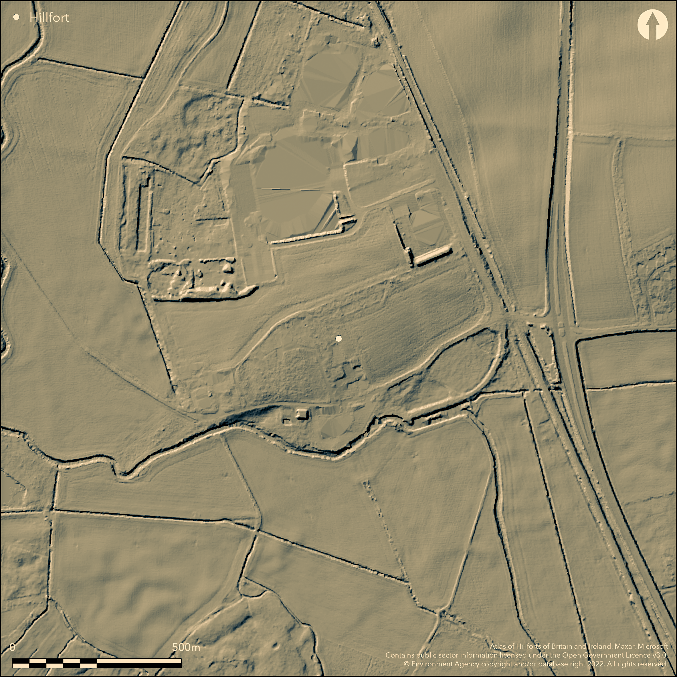
LiDAR 1m DTM Hillshade
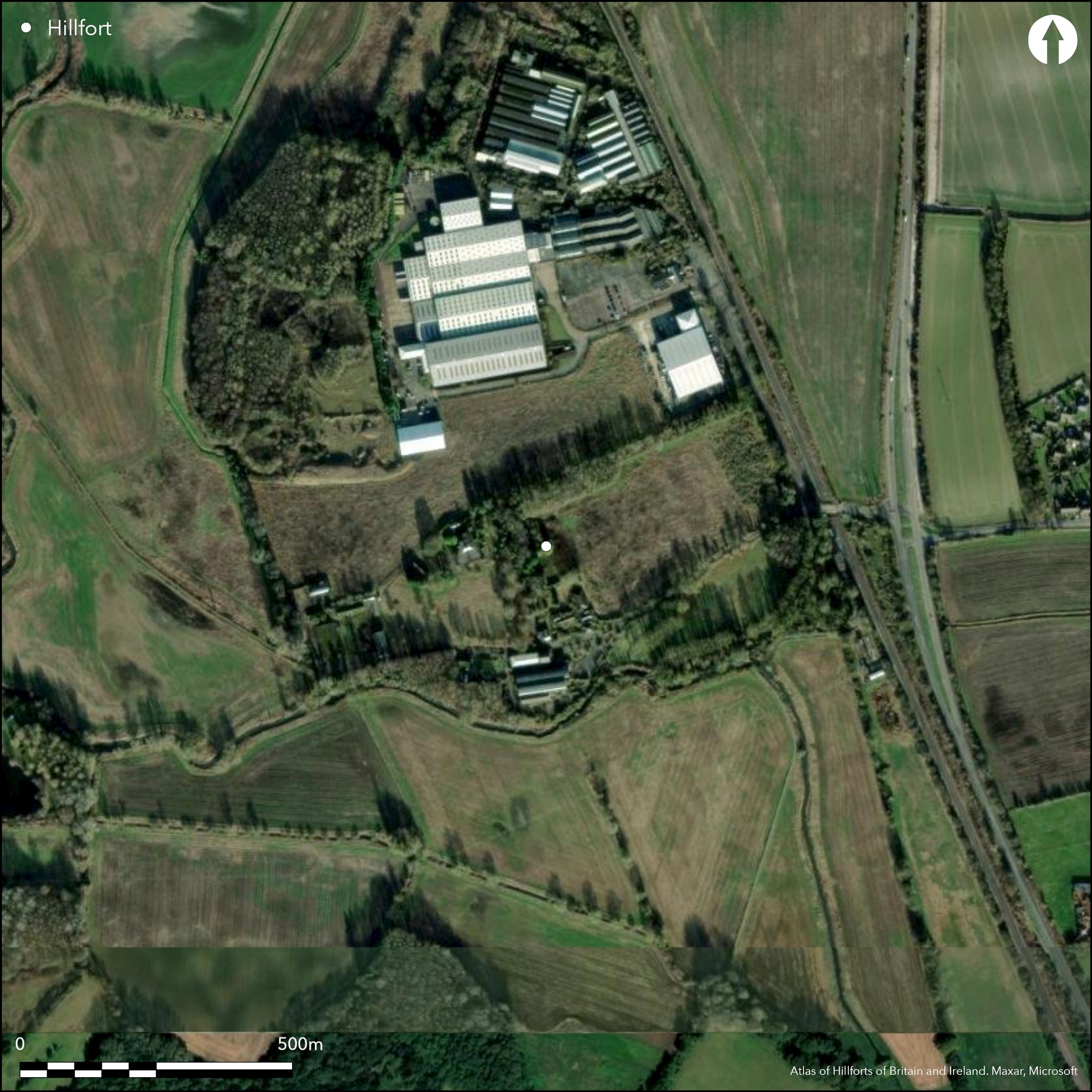
Satellite Imagery
LiDAR 1m DTM Hillshade
Satellite Imagery
Scroll left/right to view further images.
HER: Cambridgeshire 9742 (None)
NMR: TL 4 4 NE 76 (1030517)
SM: 1009396
NGR: TL 4718 4947
X: 547183 Y: 249487 (OSGB36)
Situated to the W of Sawston, first recognised from aerial photographs in 1980. A large multivallate hillfort situated on a low chalk promontory surrounded to the N, S and W by the floodplain of the River Cam. Standing about 2m-3m above the surrounding alluvium, sufficient to allow the hillfort to dominate the local landscape, and in particular the course of the river which flows close to the S edge of the site. Roughly oval in plan, 430m E-W, and 300m N-S, enclosing 8ha. Although badly damaged by a agriculture, a paperworks, reservoirs, roads and other buildings roughly three quarters of the perimeter still survives as a slight earthwork. On the NW a wide low bank is visible, although the rest of the N perimeter is now reduced to a single outward facing scarp of up to 0.9m high. On the NE side the earthwork boundary cuts through a coppice, and here the rampart is best preserved, surviving to a height of 1.1m and up to 6.4m wide, inner ditch shown to be large and V-shaped by excavation. A slight parallel counterscarp 5.9m away might be the remains of the outer ditch. On the E the ramparts are spread to form a single bank, 52m across and up to 1.4m high, although air photographs show that the works here were at least bivallate in form. There is evidence of an entrance in the centre of the E side, a 30m gap, although the surviving earthworks have been severely distorted by ploughing. On the SE side the rampart is cut by an access road, but survives 11.1m wide and up to 1.1m high, although the earthworks in this area are poorly preserved. On the S side the enclosure boundary has been obliterated by later development and alterations to the course of the Cam. Two scarps mark the perimeter on the western side. Geophysical surveys in 1992 and 2000 along the NE and NW sides of the enclosure showed two parallel ditches, 5m wide and 30m apart, together with a possible timber built box rampart and palisade ditch, a possible elaborate entrance at the NW. Interior anomalies were also identified, comprising a series of linear features, a possible ring ditch and a several pits. Limited test pitting (Mortimer 2001) has shown Mesolithic/early Neolithic and Bronze Age contexts beneath the bank material as well as Early/Middle Iron Age settlement activity in the centre of the hillfort area with occupation continuing into the late Iron Age and Roman periods, and possibly into the early Saxon period. Subsequent small-scale excavation (JSAC 2003) suggests the site started as a univallate enclosure and was later developed into multivallate form and confirmed domestic occupation from the early to late Iron Age..
Citizen Science: ✓
Reliability of Data: Confirmed
Reliability of Interpretation: Confirmed
X: 16539 Y: 6822589 (EPSG: 3857)
Longitude: 0.1485694695703826 Latitude: 52.124062591203966 (EPSG:4326)
Country: England
Current County or Unitary Authority: Cambridgeshire
Historic County: Essex
Current Parish/Community/Council/Townland: Sawston
On Heritage at Risk Register (2015).
| Extant | ✓ |
| Cropmark | ✗ |
| Likely Destroyed | ✓ |
None
| Woodland | ✓ |
| Commercial Forestry Plantation | ✗ |
| Parkland | ✗ |
| Pasture (Grazing) | ✓ |
| Arable | ✗ |
| Scrub/Bracken | ✗ |
| Bare Outcrop | ✗ |
| Heather/Moorland | ✗ |
| Heath | ✗ |
| Built-up | ✓ |
| Coastal Grassland | ✗ |
| Other | ✗ |
A partial contour fort on a low chalk promontory surrounded to the N, S and W by the floodplain of the River Cam. Standing about 2m-3m above the surrounding alluvium, sufficient to allow the hillfort to dominate the local landscape, and in particular the course of the river
| Contour Fort | ✗ |
| Partial Contour Fort | ✓ |
| Promontory Fort | ✗ |
| Hillslope Fort | ✗ |
| Level Terrain Fort | ✗ |
| Marsh Fort | ✗ |
| Multiple Enclosure Fort | ✗ |
| Hilltop | ✗ |
| Coastal Promontory | ✗ |
| Inland Promontory | ✓ |
| Valley Bottom | ✗ |
| Knoll/Hillock/Outcrop | ✗ |
| Ridge | ✗ |
| Cliff/Plateau-edge/Scarp | ✗ |
| Hillslope | ✗ |
| Lowland | ✗ |
| Spur | ✗ |
Dominant Topographic Feature: A raised promontory surrounded by the River Cam
| North | ✗ |
| Northeast | ✗ |
| East | ✗ |
| Southeast | ✗ |
| South | ✗ |
| Southwest | ✗ |
| West | ✗ |
| Northwest | ✗ |
| Level | ✓ |
Altitude: 20.0m
N/A
Early to Late Iron Age pottery. Mesolithic/early Neolithic material, possible ring ditch in interior. Roman and possibly Saxon material.
Reliability: C - Low
| Pre 1200BC | ✗ |
| 1200BC - 800BC | ✗ |
| 800BC - 400BC | ✓ |
| 400BC - AD50 | ✓ |
| AD50 - AD400 | ✗ |
| AD400 - AD 800 | ✗ |
| Post AD800 | ✗ |
| Unknown | ✗ |
| Pre Hillfort: | None |
| Post Hillfort: | None |
| Artefactual: | None |
Discovered by aerial photograph in 1980. RCHME earthwork survey 1993 ref. no. 832793 (Tayler et al 1994), geophysical survey 1993 and 2000 (GSB 2000), watching brief (Mortimer 2001), excavation 2001.
| Geophysical Survey (1992): | None |
| Earthwork Survey (1993): | None |
| Geophysical Survey (2000): | None |
| Excavation (2001): | None |
Pits and linear features shown by geophysics, limited excavation has produced pottery and animal bone, lithics and other material.
River Cam very close.
| None | ✓ |
| Spring | ✗ |
| Stream | ✗ |
| Pool | ✗ |
| Flush | ✗ |
| Well | ✗ |
| Other | ✗ |
None
| No Known Features | ✓ |
| Round Stone Structures | ✗ |
| Rectangular Stone Structures | ✗ |
| Curvilinear Platforms | ✗ |
| Other Roundhouse Evidence | ✗ |
| Pits | ✗ |
| Quarry Hollows | ✗ |
| Other | ✗ |
None
| No Known Excavation | ✗ |
| Pits | ✓ |
| Postholes | ✗ |
| Roundhouses | ✗ |
| Rectangular Structures | ✗ |
| Roads/Tracks | ✗ |
| Quarry Hollows | ✗ |
| Other | ✗ |
| Nothing Found | ✗ |
linear features
| No Known Geophysics | ✗ |
| Pits | ✓ |
| Roundhouses | ✗ |
| Rectangular Structures | ✗ |
| Roads/Tracks | ✗ |
| Quarry Hollows | ✗ |
| Other | ✓ |
| Nothing Found | ✗ |
None
| No Known Finds | ✗ |
| Pottery | ✓ |
| Metal | ✗ |
| Metalworking | ✗ |
| Human Bones | ✓ |
| Animal Bones | ✓ |
| Lithics | ✓ |
| Environmental | ✓ |
| Other | ✗ |
NO APPARENT FEATURES
| APs Not Checked | ✓ |
| None | ✗ |
| Roundhouses | ✗ |
| Rectangular Structures | ✗ |
| Pits | ✗ |
| Postholes | ✗ |
| Roads/Tracks | ✗ |
| Other | ✗ |
Many breaks through the ramparts. Possible simple entrance 30m gap to E. Possible elaborate entrance to NW suggested by geophysics.
| None: | None |
| 2: | None |
Guard Chambers: ✗
Chevaux de Frise: ✗
| 1. Simple Gap (East): | None |
| 2. Other Forms (North west): | None |
Roughly three quarters of the perimeter still survives as a slight earthwork. On the NW a wide low bank is visible, although the rest of the N perimeter is now reduced to a single outward facing scarp of up to 0.9m high. On the NE side the earthwork boundary cuts through a coppice, and here the rampart is best preserved, surviving to a height of 1.1m and up to 6.4m wide, inner ditch shown to be large and V-shaped by excavation. . A slight parallel counterscarp 5.9m away might be the remains of the outer ditch. On the E the ramparts are spread to form a single bank, 52m across and up to 1.4m high, although air photographs show that the works here were at least bivallate in form. Geophysical surveys in 1992 and 2000 along the NE and NW sides of the enclosure showed two parallel ditches, 5m wide and 30m apart, together with a possible timber built box rampart and palisade ditch.
| Area 1: | 8.0ha. |
| Total: | 8.0ha. |
Total Footprint Area: Noneha.
None
| ✗ | None |
| ✗ | None |
| NE Quadrant: | 2 |
| SE Quadrant: | None |
| SW Quadrant: | None |
| NW Quadrant: | 1 |
| Total: | 2 |
| Partial Univallate | ✓ |
| Univallate | ✗ |
| Partial Bivallate | ✓ |
| Bivallate | ✗ |
| Partial Multivallate | ✗ |
| Multivallate | ✗ |
| Unknown | ✗ |
| Partial Univallate | ✗ |
| Univallate | ✗ |
| Partial Bivallate | ✗ |
| Bivallate | ✗ |
| Partial Multivallate | ✗ |
| Multivallate | ✗ |
None
| None | ✗ |
| Earthen Bank | ✓ |
| Stone Wall | ✗ |
| Rubble | ✗ |
| Wall-walk | ✗ |
| Evidence of Timber | ✗ |
| Vitrification | ✗ |
| Other Burning | ✗ |
| Palisade | ✗ |
| Counter Scarp Bank | ✗ |
| Berm | ✗ |
| Unfinished | ✗ |
| Other | ✗ |
Timber box rampart and palisade suggested by geophysics
| None | ✗ |
| Earthen Bank | ✓ |
| Stone Wall | ✗ |
| Murus Duplex | ✗ |
| Timber-framed | ✗ |
| Timber-laced | ✗ |
| Vitrification | ✗ |
| Other Burning | ✗ |
| Palisade | ✗ |
| Counter Scarp Bank | ✗ |
| Berm | ✗ |
| Unfinished | ✗ |
| No Known Excavation | ✗ |
| Other | ✓ |
| ✗ | None |
| ✓ | None |
Number of Ditches: 2
| ✗ | None |
GSB Prospection. 2000. Geophysical survey at Borough Hill, Sawston. Geophysical Surveys of Bradford Report 2000/108, unpublished.
John Samuels Archaeological Consultants. 2003. An Archaeological Evaluation Excavation at Borough Hill, Sawston, Cambridgeshire. JSAC Reference 685/03/09, unpublished.
Mortimer, R.. 2001. The Hillfort at Borough Hill, Sawston, Cambridgeshire: An Archaeological Watching Brief. Assessment Report. Cambridge Archaeological Unit Report 450, unpublished.
Taylor, C.C., Topping, P., and Oswald, A.. 1994. A Prehistoric Enclosure at Sawston, Cambridgeshire. A Survey by the Royal Commission on the Historical Monuments of England. Proc Cambridge Antiq Soc, 82: 5-9.
Atlas of Hillforts:
Wikidata:
This work is licensed under CC BY-SA 4.0

 and should be cited as:
Lock, Gary and Ralston, Ian. 2024. Atlas of Hillforts of Britain and Ireland. Available at: https://hillforts.arch.ox.ac.uk
Document Version 1.1