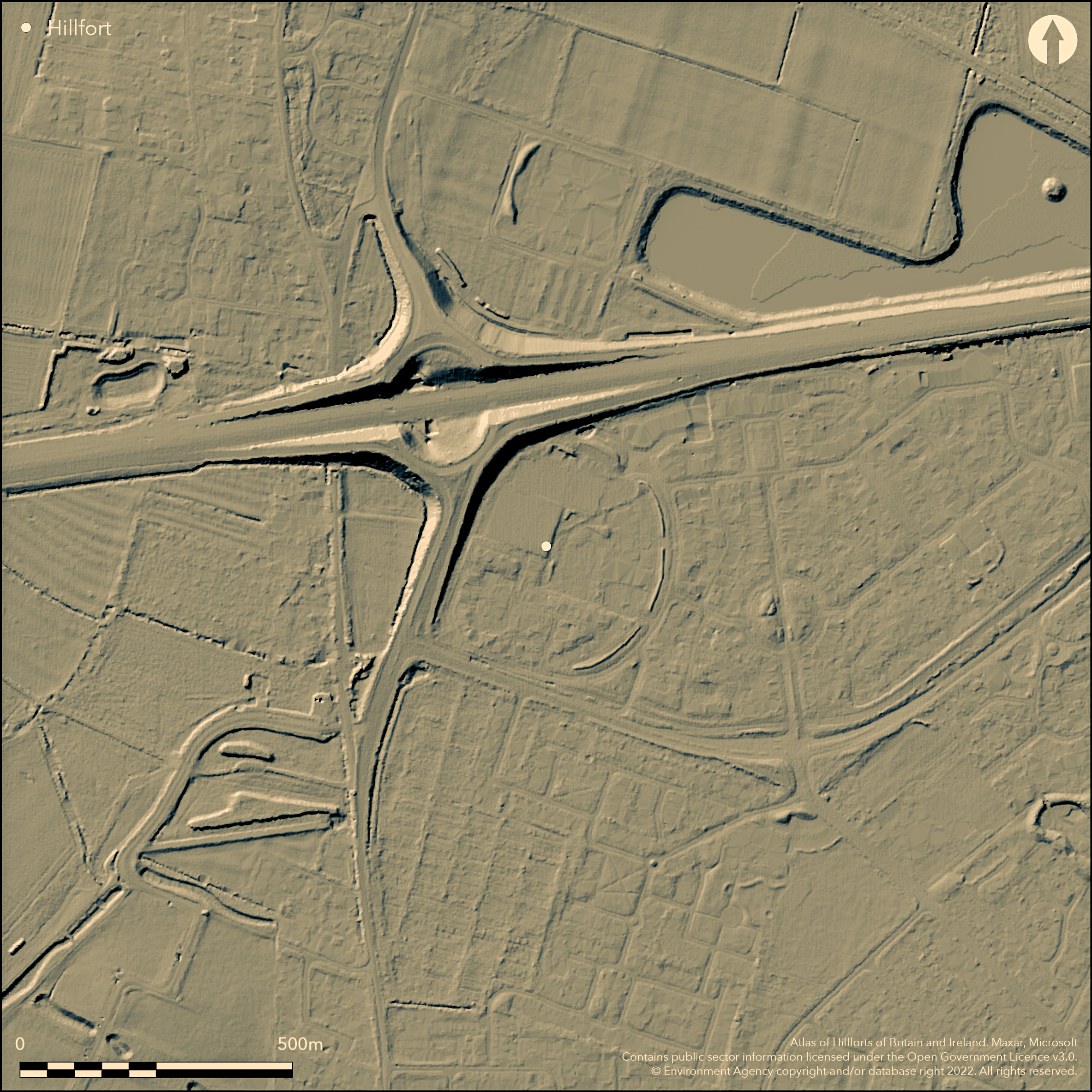
LiDAR 1m DTM Hillshade
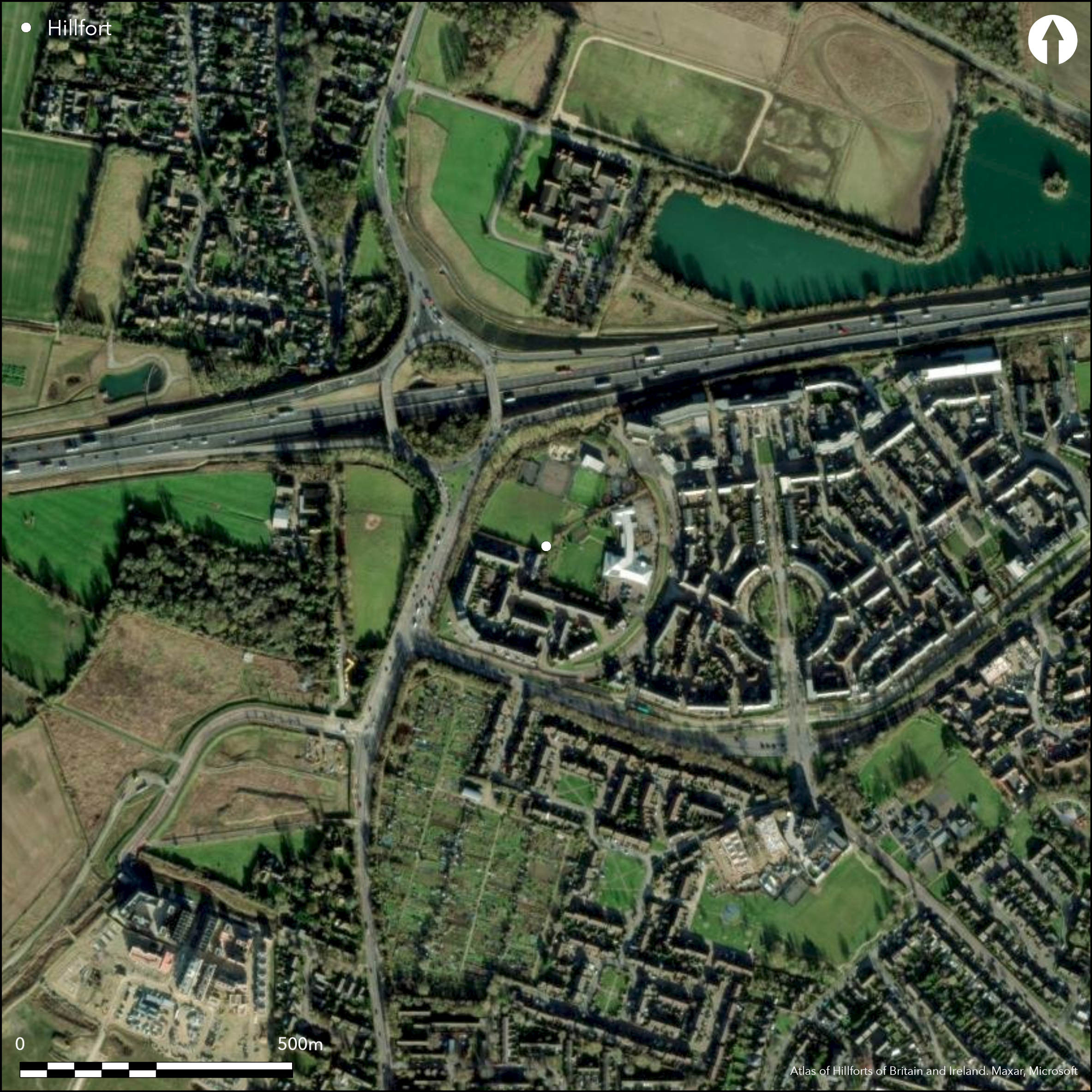
Satellite Imagery
LiDAR 1m DTM Hillshade
Satellite Imagery
Scroll left/right to view further images.
HER: Cambridgeshire 8479 (None)
NMR: TL 4 6 SW 4 (372005)
SM: None
NGR: TL 4449 6160
X: 544493 Y: 261608 (OSGB36)
Located on the N outskirts of Cambridge, situated upon nearly level ground but now virtually destroyed by modern roads to the N and W and buildings over much of the interior. It was originally near-circular in plan, estimated 5.6ha, of which only part of the E side remains consisting of a much ploughed-down rampart 15.0m. wide, up to 0.7m. in height, with no surface evidence of a ditch. On 1st Ed OS map (1885). Small-scale excavations of E entrance in 1970 (unpublished) confirmed by further excavation in 2003/4 (Evans and Knight 2002; 2005) which revealed the ditch terminals, the bank and the remains of a timber gate with 'tower-like' structure. It revealed the quasi-segmented character of the ditch construction, which seems to have been dug as a series of interconnecting elongated hollows, in places 7m wide and 1.25m deep and U-shaped. This perhaps suggests that ditch was relatively unimportant as a boundary, rather its main purpose was to provide quarry upcast for its interior bank, which was the predominant enclosure-defining feature. The excavation also revealed evidence for the simple structure of the bank, which for the most part was only supported by a turf-stack revetment. No evidence for internal occupation shown by test-pitting. A quantity of leather and prepared skin was recovered from the waterlogged ditch fill, C14 dated with human bone to the 4th - 2nd centuries BC. Roman and medieval material from surface finds.
Citizen Science: ✓
Reliability of Data: Confirmed
Reliability of Interpretation: Confirmed
X: 12742 Y: 6842487 (EPSG: 3857)
Longitude: 0.11446419768181719 Latitude: 52.23367279027274 (EPSG:4326)
Country: England
Current County or Unitary Authority: Cambridgeshire
Historic County: Cambridgeshire
Current Parish/Community/Council/Townland: Orchard Park, Cambridge City
None
| Extant | ✓ |
| Cropmark | ✗ |
| Likely Destroyed | ✓ |
None
| Woodland | ✗ |
| Commercial Forestry Plantation | ✗ |
| Parkland | ✗ |
| Pasture (Grazing) | ✓ |
| Arable | ✗ |
| Scrub/Bracken | ✗ |
| Bare Outcrop | ✗ |
| Heather/Moorland | ✗ |
| Heath | ✗ |
| Built-up | ✓ |
| Coastal Grassland | ✗ |
| Other | ✗ |
A partial contour fort on level land, much destroyed.
| Contour Fort | ✗ |
| Partial Contour Fort | ✓ |
| Promontory Fort | ✗ |
| Hillslope Fort | ✗ |
| Level Terrain Fort | ✗ |
| Marsh Fort | ✗ |
| Multiple Enclosure Fort | ✗ |
| Hilltop | ✗ |
| Coastal Promontory | ✗ |
| Inland Promontory | ✗ |
| Valley Bottom | ✗ |
| Knoll/Hillock/Outcrop | ✗ |
| Ridge | ✗ |
| Cliff/Plateau-edge/Scarp | ✗ |
| Hillslope | ✗ |
| Lowland | ✓ |
| Spur | ✗ |
Dominant Topographic Feature: None
| North | ✗ |
| Northeast | ✗ |
| East | ✗ |
| Southeast | ✗ |
| South | ✗ |
| Southwest | ✗ |
| West | ✗ |
| Northwest | ✗ |
| Level | ✓ |
Altitude: 10.0m
N/A
Two C14 dates from waterlogged leather 4th-2nd centuries BC, some Iron Age artefacts. Roman and medieval material from surface finds. Early Bronze Age activity.
Reliability: B - Medium
| Pre 1200BC | ✗ |
| 1200BC - 800BC | ✗ |
| 800BC - 400BC | ✗ |
| 400BC - AD50 | ✓ |
| AD50 - AD400 | ✗ |
| AD400 - AD 800 | ✗ |
| Post AD800 | ✗ |
| Unknown | ✗ |
| Pre Hillfort: | None |
| Post Hillfort: | None |
| Artefactual: | None |
| C14: | None |
In Aubrey's Monumenta Britannica (1665-1693). On 1st edition OS map (1885). Excavations in 1904-06 (McKenny and Hughes), 1970 (Alexander and Trump) and 2003/4 Evans and Knight 2002; 2005), RCHME earthwork survey, ref. no. 1051178 (Oswald 1995).
| Excavation (1970): | None |
| Earthwork Survey (1995): | None |
| 1st Identified Written Reference (None): | None |
| 1st Identified Map Depiction (None): | None |
| Excavation (None): | None |
| Excavation (None): | None |
No evidence for internal features. Pottery, rotary quern, animal bones and Roman material including a coin.
None
| None | ✓ |
| Spring | ✗ |
| Stream | ✗ |
| Pool | ✗ |
| Flush | ✗ |
| Well | ✗ |
| Other | ✗ |
None
| No Known Features | ✓ |
| Round Stone Structures | ✗ |
| Rectangular Stone Structures | ✗ |
| Curvilinear Platforms | ✗ |
| Other Roundhouse Evidence | ✗ |
| Pits | ✗ |
| Quarry Hollows | ✗ |
| Other | ✗ |
None
| No Known Excavation | ✗ |
| Pits | ✗ |
| Postholes | ✗ |
| Roundhouses | ✗ |
| Rectangular Structures | ✗ |
| Roads/Tracks | ✗ |
| Quarry Hollows | ✗ |
| Other | ✗ |
| Nothing Found | ✓ |
None
| No Known Geophysics | ✓ |
| Pits | ✗ |
| Roundhouses | ✗ |
| Rectangular Structures | ✗ |
| Roads/Tracks | ✗ |
| Quarry Hollows | ✗ |
| Other | ✗ |
| Nothing Found | ✗ |
Rotary quern.
| No Known Finds | ✗ |
| Pottery | ✓ |
| Metal | ✗ |
| Metalworking | ✗ |
| Human Bones | ✓ |
| Animal Bones | ✓ |
| Lithics | ✗ |
| Environmental | ✓ |
| Other | ✓ |
NO APPARENT FEATURES
| APs Not Checked | ✓ |
| None | ✗ |
| Roundhouses | ✗ |
| Rectangular Structures | ✗ |
| Pits | ✗ |
| Postholes | ✗ |
| Roads/Tracks | ✗ |
| Other | ✗ |
Excavation of E entrance showed 'tower-like' structure, much of rampart circuit destroyed
| None: | None |
| 2: | None |
Guard Chambers: ✗
Chevaux de Frise: ✗
| 1. Simple Gap (East): | None |
| 1. Simple Gap (East): | None |
Originally near-circular in plan, estimated 5.6ha, of which only part of the E side remains consisting of a much ploughed-down rampart 15.0m. wide, up to 0.7m. in height, with no surface evidence of a ditch. Excavation revealed the ditch terminals and the bank - the quasi-segmented character of the ditch's construction, which seems to have been dug as a series of interconnecting elongated hollows, in places 7m wide and 1.25m deep and U-shaped.
| Area 1: | 5.6ha. |
| Total: | 5.6ha. |
Total Footprint Area: Noneha.
None
| ✗ | None |
| ✗ | None |
| NE Quadrant: | 1 |
| SE Quadrant: | 1 |
| SW Quadrant: | None |
| NW Quadrant: | None |
| Total: | 1 |
| Partial Univallate | ✓ |
| Univallate | ✗ |
| Partial Bivallate | ✗ |
| Bivallate | ✗ |
| Partial Multivallate | ✗ |
| Multivallate | ✗ |
| Unknown | ✗ |
| Partial Univallate | ✗ |
| Univallate | ✗ |
| Partial Bivallate | ✗ |
| Bivallate | ✗ |
| Partial Multivallate | ✗ |
| Multivallate | ✗ |
None
| None | ✗ |
| Earthen Bank | ✓ |
| Stone Wall | ✗ |
| Rubble | ✗ |
| Wall-walk | ✗ |
| Evidence of Timber | ✗ |
| Vitrification | ✗ |
| Other Burning | ✗ |
| Palisade | ✗ |
| Counter Scarp Bank | ✗ |
| Berm | ✗ |
| Unfinished | ✗ |
| Other | ✗ |
Turf stack
| None | ✗ |
| Earthen Bank | ✓ |
| Stone Wall | ✗ |
| Murus Duplex | ✗ |
| Timber-framed | ✗ |
| Timber-laced | ✗ |
| Vitrification | ✗ |
| Other Burning | ✗ |
| Palisade | ✗ |
| Counter Scarp Bank | ✗ |
| Berm | ✗ |
| Unfinished | ✗ |
| No Known Excavation | ✗ |
| Other | ✓ |
| ✗ | None |
| ✓ | None |
Number of Ditches: 1
| ✗ | None |
Evans, C., and Knight., M. 2002, A Great Circle: Investigations at Arbury Camp, Cambridge. Proc Cambridge Antiq Soc, 91, 23-53.
Evans, C. and Knight, M.. 2005. Excavations at Arbury Camp, Cambridge: The Eastern Entrance. Cambridge Archaeological Unit Report 657
Oswald, A.. 1995. Arbury Camp, City of Cambridge. An Earthwork Survey by the RCHME. Unpublished RCHME Report
Salzman, L.F (ed). 1948. The Victoria County History of Cambridgeshire and the Isle of Ely. Volume 2.
Atlas of Hillforts:
Wikidata:
This work is licensed under CC BY-SA 4.0

 and should be cited as:
Lock, Gary and Ralston, Ian. 2024. Atlas of Hillforts of Britain and Ireland. Available at: https://hillforts.arch.ox.ac.uk
Document Version 1.1