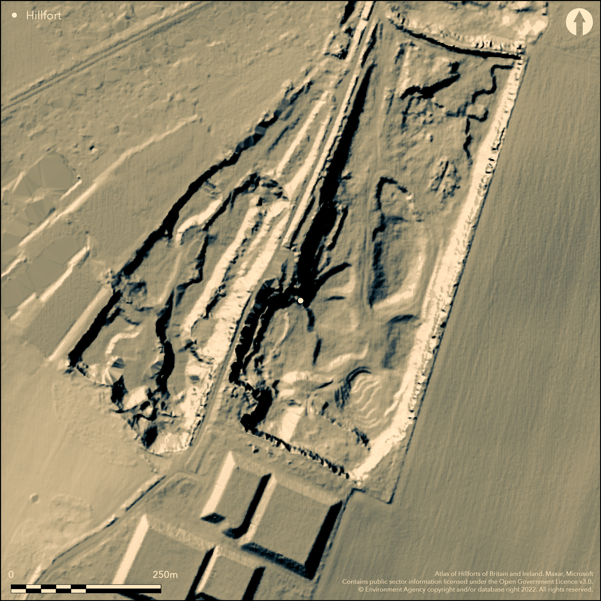
LiDAR 1m DTM Hillshade
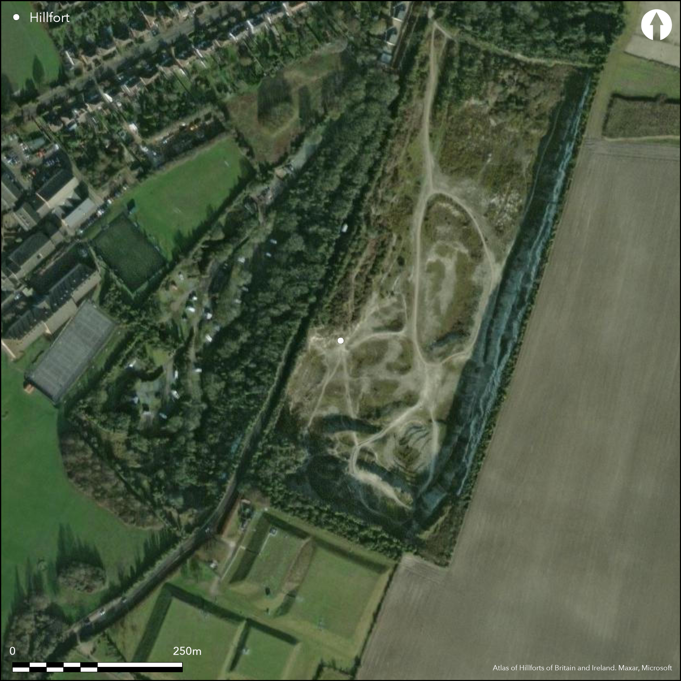
Satellite Imagery
LiDAR 1m DTM Hillshade
Satellite Imagery
Scroll left/right to view further images.
HER: Cambridgeshire 4963 (None)
NMR: TL 4 5 NE 16 (371231)
SM: None
NGR: TL 48397 55577
X: 548384 Y: 255708 (OSGB36)
Situated in the SE area of Cambridge on a hilltop above Cherry Hinton, the site is now mostly destroyed by quarrying which started in the late 19th century. Originally a circular univallate enclosure with a possible counterscarp, approximately 165m in diameter, estimated to enclose 2.1ha. A series of small scale excavations since 1893 culminated with those in 2009 (Pickstone and Mortimer 2012) when a single large slot through the surviving ditch, V-shaped, 3m deep and 6m wide, was supplemented by test pits and auger surveys. The rampart was of earth and rubble. Relatively large and well stratified finds and environmental assemblages were found from the ditch; including several human skeletons, which, allied with C14 dating, have enabled dating of the ditch infill sequence. It is now clear that the monument was constructed at the end of the 5th century BC or the beginning of the 4th century BC only to be destroyed before completion or shortly thereafter. The site was then abandoned until reoccupation in the middle of the 1st century BC which continued until c. 50 AD when the final infilling of the upper part of the ditch occurred with the establishment of a Romano-British settlement with kilns and sub-rectangular huts. Earlier excavations had shown an out-turned entrance in the SE. Beaker-type pottery shows earlier use.
Citizen Science: ✓
Reliability of Data: Confirmed
Reliability of Interpretation: Confirmed
X: 18792 Y: 6832671 (EPSG: 3857)
Longitude: 0.16881514967488465 Latitude: 52.179632509273716 (EPSG:4326)
Country: England
Current County or Unitary Authority: Cambridgeshire
Historic County: Cambridgeshire
Current Parish/Community/Council/Townland: Cherry Hinton, Cambridge City
Destroyed by quarrying
| Extant | ✗ |
| Cropmark | ✗ |
| Likely Destroyed | ✓ |
None
| Woodland | ✗ |
| Commercial Forestry Plantation | ✗ |
| Parkland | ✗ |
| Pasture (Grazing) | ✗ |
| Arable | ✗ |
| Scrub/Bracken | ✗ |
| Bare Outcrop | ✗ |
| Heather/Moorland | ✗ |
| Heath | ✗ |
| Built-up | ✗ |
| Coastal Grassland | ✗ |
| Other | ✓ |
A partial contour fort on a low hill top, now destroyed.
| Contour Fort | ✗ |
| Partial Contour Fort | ✓ |
| Promontory Fort | ✗ |
| Hillslope Fort | ✗ |
| Level Terrain Fort | ✗ |
| Marsh Fort | ✗ |
| Multiple Enclosure Fort | ✗ |
| Hilltop | ✓ |
| Coastal Promontory | ✗ |
| Inland Promontory | ✗ |
| Valley Bottom | ✗ |
| Knoll/Hillock/Outcrop | ✗ |
| Ridge | ✗ |
| Cliff/Plateau-edge/Scarp | ✗ |
| Hillslope | ✗ |
| Lowland | ✗ |
| Spur | ✗ |
Dominant Topographic Feature: on a low hill top
| North | ✗ |
| Northeast | ✗ |
| East | ✗ |
| Southeast | ✗ |
| South | ✗ |
| Southwest | ✗ |
| West | ✗ |
| Northwest | ✗ |
| Level | ✓ |
Altitude: 38.0m
N/A
Sixteen C14 dates and pottery show 5th-4th century BC construction then abandonment, re-occupation in the mid 1st century BC. Horn (Forthcoming) suggests the hillfort start 495-385 BC, ends 405-380 BC, span = 1-30 years. Romano-British use. Earlier use suggested by Beaker-type pottery.
Reliability: A - High
| Pre 1200BC | ✗ |
| 1200BC - 800BC | ✗ |
| 800BC - 400BC | ✓ |
| 400BC - AD50 | ✓ |
| AD50 - AD400 | ✗ |
| AD400 - AD 800 | ✗ |
| Post AD800 | ✗ |
| Unknown | ✗ |
| Pre Hillfort: | None |
| Post Hillfort: | None |
| Artefactual: | None |
| C14: | None |
A series of small scale excavations since 1893 culminated with those in 2009 (Pickstone and Mortimer 2012). First described in 1895 (Hughes et al).
| Excavation (1893): | None |
| 1st Identified Written Reference (1895): | None |
| Excavation (1902): | None |
| Excavation (1912): | None |
| Excavation (1939): | None |
| Excavation (2009): | None |
| Excavation (None): | None |
| Excavation (None): | None |
| Excavation (None): | None |
Kilns and sub-rectangular huts of later Romano-British re-occupation. Pottery, human skeletons and environmental from Iron Age.
None
| None | ✓ |
| Spring | ✗ |
| Stream | ✗ |
| Pool | ✗ |
| Flush | ✗ |
| Well | ✗ |
| Other | ✗ |
None
| No Known Features | ✓ |
| Round Stone Structures | ✗ |
| Rectangular Stone Structures | ✗ |
| Curvilinear Platforms | ✗ |
| Other Roundhouse Evidence | ✗ |
| Pits | ✗ |
| Quarry Hollows | ✗ |
| Other | ✗ |
None
| No Known Excavation | ✗ |
| Pits | ✗ |
| Postholes | ✗ |
| Roundhouses | ✗ |
| Rectangular Structures | ✓ |
| Roads/Tracks | ✗ |
| Quarry Hollows | ✗ |
| Other | ✓ |
| Nothing Found | ✗ |
None
| No Known Geophysics | ✓ |
| Pits | ✗ |
| Roundhouses | ✗ |
| Rectangular Structures | ✗ |
| Roads/Tracks | ✗ |
| Quarry Hollows | ✗ |
| Other | ✗ |
| Nothing Found | ✗ |
None
| No Known Finds | ✓ |
| Pottery | ✗ |
| Metal | ✓ |
| Metalworking | ✗ |
| Human Bones | ✓ |
| Animal Bones | ✓ |
| Lithics | ✓ |
| Environmental | ✓ |
| Other | ✗ |
NO APPARENT FEATURES
| APs Not Checked | ✓ |
| None | ✗ |
| Roundhouses | ✗ |
| Rectangular Structures | ✗ |
| Pits | ✗ |
| Postholes | ✗ |
| Roads/Tracks | ✗ |
| Other | ✗ |
Early excavations had shown an out-turned entrance in the SE
| None: | None |
| 2: | None |
Guard Chambers: ✗
Chevaux de Frise: ✗
| 1. Out-turned (South east): | None |
Site now destroyed by quarrying but originally univallate with external ditch, possible counterscarp. Excavation of a single large slot through the surviving ditch, V-shaped, 3m deep and 6m wide. The rampart was of earth and rubble.
| Area 1: | 2.1ha. |
| Total: | 2.1ha. |
Total Footprint Area: Noneha.
None
| ✗ | None |
| ✗ | Destroyed but originally univallate |
| NE Quadrant: | None |
| SE Quadrant: | None |
| SW Quadrant: | None |
| NW Quadrant: | None |
| Total: | None |
| Partial Univallate | ✗ |
| Univallate | ✗ |
| Partial Bivallate | ✗ |
| Bivallate | ✗ |
| Partial Multivallate | ✗ |
| Multivallate | ✗ |
| Unknown | ✓ |
| Partial Univallate | ✗ |
| Univallate | ✗ |
| Partial Bivallate | ✗ |
| Bivallate | ✗ |
| Partial Multivallate | ✗ |
| Multivallate | ✗ |
None
| None | ✗ |
| Earthen Bank | ✓ |
| Stone Wall | ✗ |
| Rubble | ✗ |
| Wall-walk | ✗ |
| Evidence of Timber | ✗ |
| Vitrification | ✗ |
| Other Burning | ✗ |
| Palisade | ✗ |
| Counter Scarp Bank | ✓ |
| Berm | ✗ |
| Unfinished | ✗ |
| Other | ✗ |
None
| None | ✗ |
| Earthen Bank | ✓ |
| Stone Wall | ✗ |
| Murus Duplex | ✗ |
| Timber-framed | ✗ |
| Timber-laced | ✗ |
| Vitrification | ✗ |
| Other Burning | ✗ |
| Palisade | ✗ |
| Counter Scarp Bank | ✗ |
| Berm | ✗ |
| Unfinished | ✗ |
| No Known Excavation | ✗ |
| Other | ✗ |
| ✗ | None |
| ✓ | None |
Number of Ditches: 1
| ✗ | None |
Horn, J. Forthcoming. The dating of hillforts in Britain and Ireland. Unpublished PhD thesis, University of Edinburgh.
Hughes, T.M., Macalister, R..A.S. and Duckworth, W.H.L. 1895. On a newly discovered dyke at Cherry Hinton. Proc Cambridge Antiq Soc, 8, 317-30.
Pickstone, A. and Mortimer, R.. 2012. War Ditches, Cherry Hinton: Revisiting an Iron Age Hillfort. Proc Cambridge Antiq Soc, 101, 31-59.
Atlas of Hillforts:
Wikidata:
This work is licensed under CC BY-SA 4.0

 and should be cited as:
Lock, Gary and Ralston, Ian. 2024. Atlas of Hillforts of Britain and Ireland. Available at: https://hillforts.arch.ox.ac.uk
Document Version 1.1