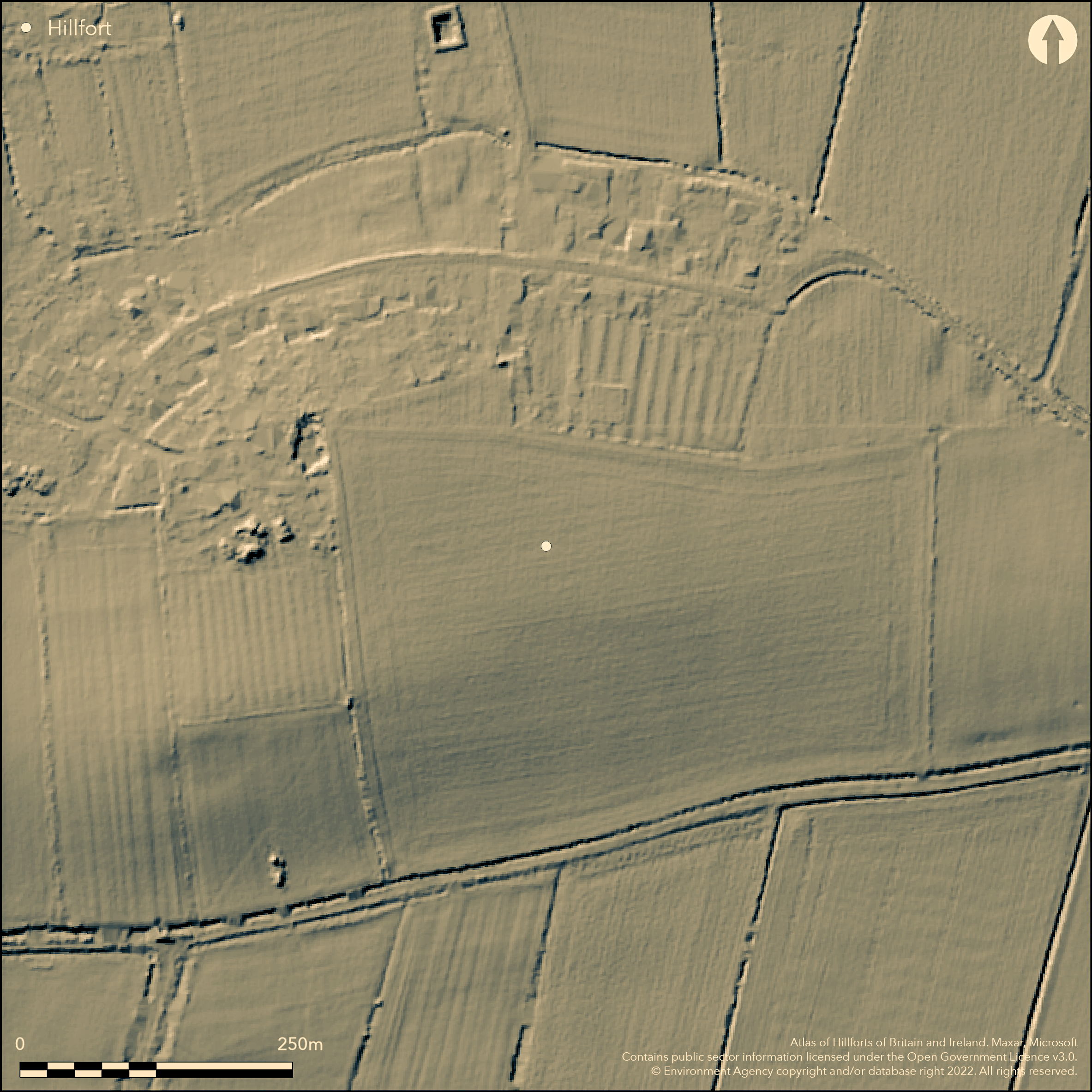
LiDAR 1m DTM Hillshade
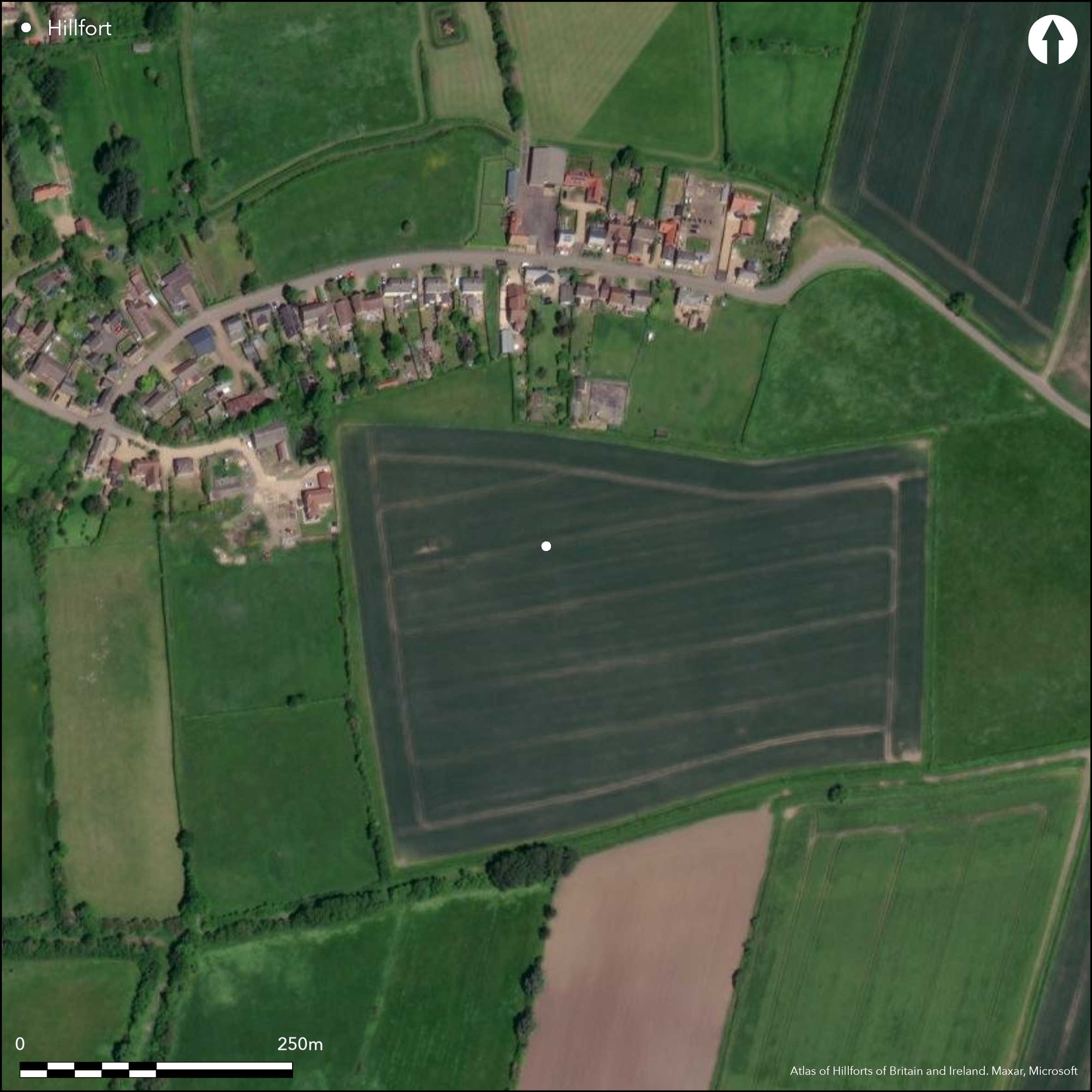
Satellite Imagery
LiDAR 1m DTM Hillshade
Satellite Imagery
Scroll left/right to view further images.
HER: Cambridgeshire 9497 (None)
NMR: TL 4 8 SE 19 (1147640)
SM: None
NGR: TL 4721 8197
X: 547273 Y: 281977 (OSGB36)
Situated N of Witcham, on a prominent spur dominating a former marsh embayment on the N side of the Isle of Ely. One of a series of cropmark enclosures discovered in 1984. Totally excavated in 1991-2 (Evans 2003). A complex enclosure which is part of a much wider ditched landscape shown on aerial photographs and by geophysics. Substantial pre-enclosure Late Bronze Age occupation, mainly lithics, with a burnt mound and embanked land boundaries (Evans 2002). The suggested sequence is an inner ditch which is relatively slight (perhaps an enclosed farmstead), replaced by a more massive and larger ditch and bank enclosure of c. 0.6ha with later additions to the NW, the landward side, of two extra banks and ditches, banks estimated to be c. 5m wide. There is a simple entrance to the NE, a complex sequence of ditches suggest another to the SW with a causeway and another to the W which was finally blocked. In the interior six roundhouse structures were excavated, of various sizes with two smaller ones possibly ancilliary buildings, also pits. Evidence for cereal processing and worked bone and clay. Radiocarbon dates and pottery date the site to construction in the Middle Iron Age and use into the early Roman period, a range of 520 cal BC to cal 80 AD.
Citizen Science: ✗
Reliability of Data: Confirmed
Reliability of Interpretation: Confirmed
X: 18263 Y: 6875683 (EPSG: 3857)
Longitude: 0.16405638015281487 Latitude: 52.41593170524616 (EPSG:4326)
Country: England
Current County or Unitary Authority: Cambridgeshire
Historic County: Cambridgeshire
Current Parish/Community/Council/Townland: Coveney
None
| Extant | ✗ |
| Cropmark | ✓ |
| Likely Destroyed | ✗ |
None
| Woodland | ✗ |
| Commercial Forestry Plantation | ✗ |
| Parkland | ✗ |
| Pasture (Grazing) | ✗ |
| Arable | ✓ |
| Scrub/Bracken | ✗ |
| Bare Outcrop | ✗ |
| Heather/Moorland | ✗ |
| Heath | ✗ |
| Built-up | ✗ |
| Coastal Grassland | ✗ |
| Other | ✗ |
low-lying partial contour fort on a spur dominating Coveney embayment
| Contour Fort | ✗ |
| Partial Contour Fort | ✓ |
| Promontory Fort | ✗ |
| Hillslope Fort | ✗ |
| Level Terrain Fort | ✗ |
| Marsh Fort | ✓ |
| Multiple Enclosure Fort | ✗ |
| Hilltop | ✗ |
| Coastal Promontory | ✗ |
| Inland Promontory | ✗ |
| Valley Bottom | ✗ |
| Knoll/Hillock/Outcrop | ✗ |
| Ridge | ✗ |
| Cliff/Plateau-edge/Scarp | ✗ |
| Hillslope | ✗ |
| Lowland | ✗ |
| Spur | ✓ |
Dominant Topographic Feature: Spur dominating Coveney embayment
| North | ✗ |
| Northeast | ✗ |
| East | ✗ |
| Southeast | ✗ |
| South | ✗ |
| Southwest | ✗ |
| West | ✗ |
| Northwest | ✗ |
| Level | ✓ |
Altitude: 10.0m
N/A
Nine C14 dates plus pottery from excavation. Late Bronze Age activity, Roman re-use.
Reliability: A - High
| Pre 1200BC | ✗ |
| 1200BC - 800BC | ✗ |
| 800BC - 400BC | ✓ |
| 400BC - AD50 | ✓ |
| AD50 - AD400 | ✗ |
| AD400 - AD 800 | ✗ |
| Post AD800 | ✗ |
| Unknown | ✗ |
| Pre Hillfort: | None |
| Post Hillfort: | None |
| Artefactual: | None |
| C14: | None |
Discovered by aerial photography in 1984, total excavation in 1991-92, geophysics of the sider area in 1993.
| Geophysical Survey (1993): | None |
| Excavation (None): | None |
Six roundhouses excavated plus pits, wide range of artefacts, cereal processing.
In the Fens
| None | ✓ |
| Spring | ✗ |
| Stream | ✗ |
| Pool | ✗ |
| Flush | ✗ |
| Well | ✗ |
| Other | ✗ |
None
| No Known Features | ✓ |
| Round Stone Structures | ✗ |
| Rectangular Stone Structures | ✗ |
| Curvilinear Platforms | ✗ |
| Other Roundhouse Evidence | ✗ |
| Pits | ✗ |
| Quarry Hollows | ✗ |
| Other | ✗ |
None
| No Known Excavation | ✗ |
| Pits | ✓ |
| Postholes | ✓ |
| Roundhouses | ✓ |
| Rectangular Structures | ✗ |
| Roads/Tracks | ✗ |
| Quarry Hollows | ✗ |
| Other | ✗ |
| Nothing Found | ✗ |
None
| No Known Geophysics | ✗ |
| Pits | ✗ |
| Roundhouses | ✓ |
| Rectangular Structures | ✗ |
| Roads/Tracks | ✗ |
| Quarry Hollows | ✗ |
| Other | ✗ |
| Nothing Found | ✗ |
None
| No Known Finds | ✗ |
| Pottery | ✓ |
| Metal | ✓ |
| Metalworking | ✗ |
| Human Bones | ✗ |
| Animal Bones | ✓ |
| Lithics | ✓ |
| Environmental | ✓ |
| Other | ✗ |
None
| APs Not Checked | ✗ |
| None | ✗ |
| Roundhouses | ✓ |
| Rectangular Structures | ✗ |
| Pits | ✗ |
| Postholes | ✗ |
| Roads/Tracks | ✗ |
| Other | ✗ |
There is a simple entrance to the NE, a complex sequence of ditches suggest another to the SW with a causeway and another to the W which was finally blocked.
| 3: | None |
| 2: | None |
Guard Chambers: ✗
Chevaux de Frise: ✗
| 1. Simple Gap (North east): | None |
| 2. Blocked (West): | None |
| 2. Simple Gap (West): | None |
| 3. Other Forms (South west): | None |
The suggested sequence is an inner ditch which is relatively slight (perhaps an enclosed farmstead), replaced by a more massive and larger ditch and bank enclosure of c. 0.6ha with later additions to the NW, the landward side, of two extra banks and ditches, banks estimated to be c. 5m wide.
| Area 1: | 0.6ha. |
| Total: | 0.6ha. |
Total Footprint Area: Noneha.
None
| ✗ | None |
| ✓ | None |
| NE Quadrant: | 1 |
| SE Quadrant: | 1 |
| SW Quadrant: | 1 |
| NW Quadrant: | 3 |
| Total: | 3 |
| Partial Univallate | ✓ |
| Univallate | ✗ |
| Partial Bivallate | ✗ |
| Bivallate | ✗ |
| Partial Multivallate | ✓ |
| Multivallate | ✗ |
| Unknown | ✗ |
| Partial Univallate | ✗ |
| Univallate | ✗ |
| Partial Bivallate | ✗ |
| Bivallate | ✗ |
| Partial Multivallate | ✗ |
| Multivallate | ✗ |
None
| None | ✓ |
| Earthen Bank | ✗ |
| Stone Wall | ✗ |
| Rubble | ✗ |
| Wall-walk | ✗ |
| Evidence of Timber | ✗ |
| Vitrification | ✗ |
| Other Burning | ✗ |
| Palisade | ✗ |
| Counter Scarp Bank | ✗ |
| Berm | ✗ |
| Unfinished | ✗ |
| Other | ✗ |
None
| None | ✓ |
| Earthen Bank | ✗ |
| Stone Wall | ✗ |
| Murus Duplex | ✗ |
| Timber-framed | ✗ |
| Timber-laced | ✗ |
| Vitrification | ✗ |
| Other Burning | ✗ |
| Palisade | ✗ |
| Counter Scarp Bank | ✗ |
| Berm | ✗ |
| Unfinished | ✗ |
| No Known Excavation | ✗ |
| Other | ✗ |
| ✗ | None |
| ✓ | None |
Number of Ditches: 3
| ✗ | None |
Evans, C. 2002. Metalwork and 'cold claylands'; pre-Iron Age occupation on the Isle of Ely, in Lane, T. and Coles, J. (eds), Through wet and dry. Essays in honour of David Hall. Lincolnshire Archaeological and Heritage Reports 5, WARP Occasional Paper 17, 33-53.
Evans, C. 2003. Power and Island Communities. Excavations at the Wardy Hill Ringwork, Coveney, Ely. East Anglian Archaeology Report 103.
Atlas of Hillforts:
Wikidata:
This work is licensed under CC BY-SA 4.0

 and should be cited as:
Lock, Gary and Ralston, Ian. 2024. Atlas of Hillforts of Britain and Ireland. Available at: https://hillforts.arch.ox.ac.uk
Document Version 1.1