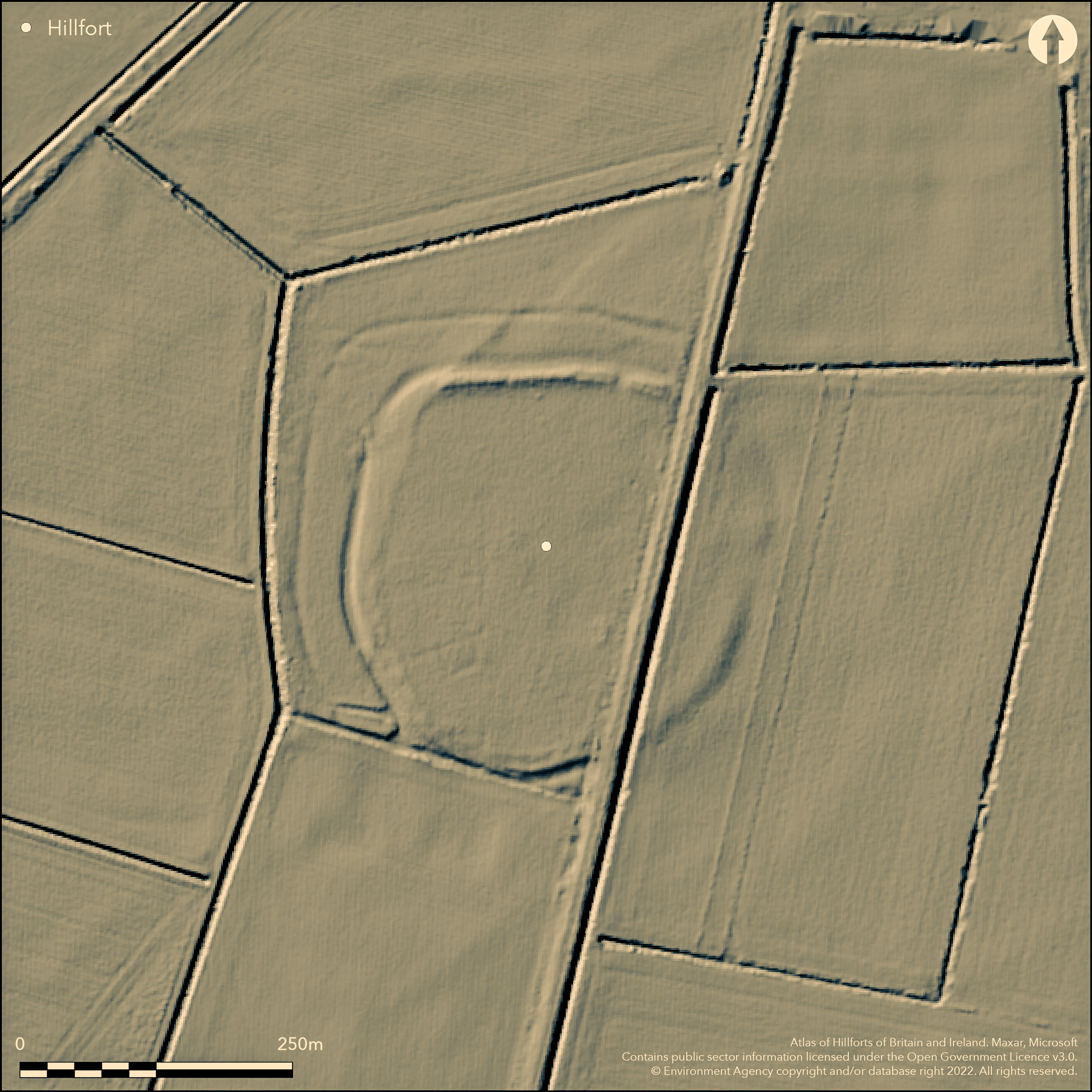
LiDAR 1m DTM Hillshade
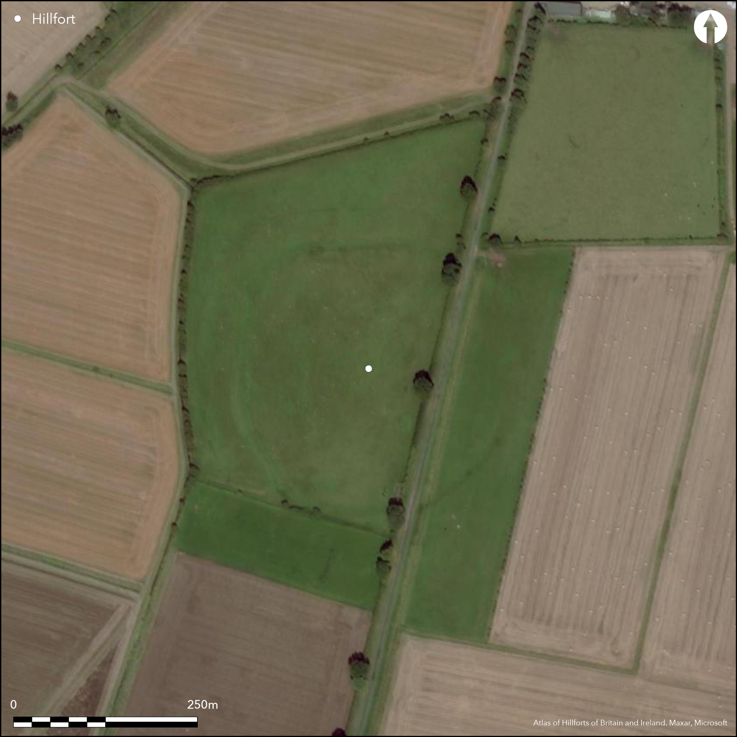
Satellite Imagery
LiDAR 1m DTM Hillshade
Satellite Imagery
Scroll left/right to view further images.
HER: Peterborough City 51313 (None)
NMR: TF 1 0 NE 17 (350093)
SM: 1006811
NGR: TF 1908 0729
X: 519078 Y: 307293 (OSGB36)
Situated NE of Peakirk, a low lying bivallate near circular enclosure of 300m diameter and 3.8ha, cut N-S by a modern road, on a penisnsular projecting into the Fen. Earthworks much denuded by ploughing to the E of the road. The main inner bank is 7.5m wide at the base and 1.5m high, has a berm 1.5m wide separating it from the ditch which is 2.3m deep and 10.5 m wide across the top. The ditch of the outer rampart survives as an earthwork heavily abraded by ploughing, for a total of 400m along the N and W sides of the enclosure. The ditch is 1.3m deep and 3.5m wide across the top. Possible contemporary features are represented by four closely-spaced ditches set 2m apart and running parallel to the W edge of the enclosure. A slightly in-turned entrance on the E side, through both banks, is probably original. Later features comprise a relatively broad and abraded bank between the inner and outer rampart, which appears to represent re-deposited soil removed from the bank. A series of ditched rectangular depression to the SW of the enclosure are likely to be post medieval quarries with associated drainage ditches, possibly contemporary with the construction of the road in the 19th century. Limited augering and excavation (French 1988; French and Pryor 1993) demonstrated the survival of a well preserved buried soil and a major phase of occupation, sealed by alluvial deposits of probably Roman date. In 1991 the Ancient Monuments Laboratory carried out satellite photography and resistivity survey. In 1992-3, limited excavation was carried out along the sides of Redcow Drain, and sections through both ramparts were exposed showing possible timber revetting (Malim and McKenna 1993). Organic material and Middle Iron Age pottery (3rd - 2nd century BC) were recovered from the water-logged primary fills of the main ditch. During a survey in 1993 a total of 13 sherds of probable Middle Iron Age pottery were found (Oswald 1994). Scheduled as Roman or medieval but shown to have been constructed in the Middle Iron Age, then abandoned with cultivation across the interior, flooded in Roman times. Described as 'one of the best preserved Iron Age sites in the country' due to it water-logging and potential for evidence.
Citizen Science: ✓
Reliability of Data: Confirmed
Reliability of Interpretation: Confirmed
X: -26852 Y: 6918569 (EPSG: 3857)
Longitude: -0.24121746163809027 Latitude: 52.650276836065544 (EPSG:4326)
Country: England; None
Current County or Unitary Authority: Peterborough
Historic County: Cambridgeshire
Current Parish/Community/Council/Townland: Newborough; Borough Fen
None
| Extant | ✓ |
| Cropmark | ✗ |
| Likely Destroyed | ✗ |
None
| Woodland | ✗ |
| Commercial Forestry Plantation | ✗ |
| Parkland | ✗ |
| Pasture (Grazing) | ✓ |
| Arable | ✗ |
| Scrub/Bracken | ✗ |
| Bare Outcrop | ✗ |
| Heather/Moorland | ✗ |
| Heath | ✗ |
| Built-up | ✗ |
| Coastal Grassland | ✗ |
| Other | ✗ |
In the Fens, very low lying and flat
| Contour Fort | ✗ |
| Partial Contour Fort | ✗ |
| Promontory Fort | ✗ |
| Hillslope Fort | ✗ |
| Level Terrain Fort | ✓ |
| Marsh Fort | ✓ |
| Multiple Enclosure Fort | ✗ |
| Hilltop | ✗ |
| Coastal Promontory | ✗ |
| Inland Promontory | ✗ |
| Valley Bottom | ✗ |
| Knoll/Hillock/Outcrop | ✗ |
| Ridge | ✗ |
| Cliff/Plateau-edge/Scarp | ✗ |
| Hillslope | ✗ |
| Lowland | ✓ |
| Spur | ✗ |
Dominant Topographic Feature: None
| North | ✗ |
| Northeast | ✗ |
| East | ✗ |
| Southeast | ✗ |
| South | ✗ |
| Southwest | ✗ |
| West | ✗ |
| Northwest | ✗ |
| Level | ✓ |
Altitude: 4.0m
Boundary Type: Parish/Townland
3rd-2nd century BC pottery from excavation. Roman re-use. 17th/18th century drainage and road cut through.
Reliability: B - Medium
| Pre 1200BC | ✗ |
| 1200BC - 800BC | ✗ |
| 800BC - 400BC | ✗ |
| 400BC - AD50 | ✓ |
| AD50 - AD400 | ✗ |
| AD400 - AD 800 | ✗ |
| Post AD800 | ✗ |
| Unknown | ✗ |
| Pre Hillfort: | None |
| Post Hillfort: | None |
| Artefactual: | None |
In 1991 the Ancient Monuments Laboratory carried out satellite photography and resistivity survey. In 1982-83 and 1992-3, augering and limited excavation, 1993 earthwork survey
| Geophysical Survey (1991): | None |
| Earthwork Survey (1993): | None |
| Other (None): | augering |
| Excavation (None): | None |
No internal features, middle Iron Age pottery and animal bones
In Fens
| None | ✓ |
| Spring | ✗ |
| Stream | ✗ |
| Pool | ✗ |
| Flush | ✗ |
| Well | ✗ |
| Other | ✗ |
None
| No Known Features | ✓ |
| Round Stone Structures | ✗ |
| Rectangular Stone Structures | ✗ |
| Curvilinear Platforms | ✗ |
| Other Roundhouse Evidence | ✗ |
| Pits | ✗ |
| Quarry Hollows | ✗ |
| Other | ✗ |
None
| No Known Excavation | ✓ |
| Pits | ✗ |
| Postholes | ✗ |
| Roundhouses | ✗ |
| Rectangular Structures | ✗ |
| Roads/Tracks | ✗ |
| Quarry Hollows | ✗ |
| Other | ✗ |
| Nothing Found | ✗ |
None
| No Known Geophysics | ✗ |
| Pits | ✗ |
| Roundhouses | ✗ |
| Rectangular Structures | ✗ |
| Roads/Tracks | ✗ |
| Quarry Hollows | ✗ |
| Other | ✗ |
| Nothing Found | ✓ |
None
| No Known Finds | ✗ |
| Pottery | ✓ |
| Metal | ✗ |
| Metalworking | ✗ |
| Human Bones | ✗ |
| Animal Bones | ✓ |
| Lithics | ✗ |
| Environmental | ✗ |
| Other | ✗ |
NO APPARENT FEATURES
| APs Not Checked | ✓ |
| None | ✗ |
| Roundhouses | ✗ |
| Rectangular Structures | ✗ |
| Pits | ✗ |
| Postholes | ✗ |
| Roads/Tracks | ✗ |
| Other | ✗ |
A slightly in-turned entrance on the E side, through both banks, is probably original. Several other breaks, modern.
| 4: | None |
| 2: | None |
Guard Chambers: ✗
Chevaux de Frise: ✗
| 1. In-turned (East): | None |
The main inner bank is 7.5m wide at the base and 1.5m high, has a berm 1.5m wide separating it from the ditch which is 2.3m deep and 10.5 m wide across the top. The ditch of the outer rampart survives as an earthwork heavily abraded by ploughing, for a total of 400m along the N and W sides of the enclosure. The ditch is 1.3m deep and 3.5m wide across the top.
| Area 1: | 3.8ha. |
| Total: | 3.8ha. |
Total Footprint Area: Noneha.
None
| ✗ | None |
| ✓ | None |
| NE Quadrant: | 2 |
| SE Quadrant: | 2 |
| SW Quadrant: | 2 |
| NW Quadrant: | 2 |
| Total: | 2 |
| Partial Univallate | ✗ |
| Univallate | ✗ |
| Partial Bivallate | ✗ |
| Bivallate | ✓ |
| Partial Multivallate | ✗ |
| Multivallate | ✗ |
| Unknown | ✗ |
| Partial Univallate | ✗ |
| Univallate | ✗ |
| Partial Bivallate | ✗ |
| Bivallate | ✗ |
| Partial Multivallate | ✗ |
| Multivallate | ✗ |
None
| None | ✗ |
| Earthen Bank | ✓ |
| Stone Wall | ✗ |
| Rubble | ✗ |
| Wall-walk | ✗ |
| Evidence of Timber | ✗ |
| Vitrification | ✗ |
| Other Burning | ✗ |
| Palisade | ✗ |
| Counter Scarp Bank | ✗ |
| Berm | ✓ |
| Unfinished | ✗ |
| Other | ✗ |
None
| None | ✗ |
| Earthen Bank | ✓ |
| Stone Wall | ✗ |
| Murus Duplex | ✗ |
| Timber-framed | ✓ |
| Timber-laced | ✗ |
| Vitrification | ✗ |
| Other Burning | ✗ |
| Palisade | ✗ |
| Counter Scarp Bank | ✗ |
| Berm | ✗ |
| Unfinished | ✗ |
| No Known Excavation | ✗ |
| Other | ✗ |
| ✗ | None |
| ✓ | None |
Number of Ditches: 2
| ✗ | None |
French, C. 1988. The South-West Fen Dyke Survey Project. Antiquity, 62, 343-8.
French, C. and Pryor, F. 1993. The South-West Fen-dyke survey project 1982-1986. East Anglian Archaeolgy, 59.
Hall, D. 1987. The Fenland Project No. 2. Fenland landscape and settlement between Peterborough and March. East Anglian Archaeology 35, 26-28.
Malim, T. and McKenna, R. 1993. Borough Fen Ring-work: Iron Age Fort, Newborough, Cambridgeshire. Fenland Research, 8, 53-62.
Malim, T. 2005. Stonea and the Roman Fens. Tempus.
Oswald, A., 1994, The Iron Age enclosure at Borough Fen, Cambridgeshire: a survey by the RCHME, The Conduit 29, 45-6
Atlas of Hillforts:
Wikidata:
This work is licensed under CC BY-SA 4.0

 and should be cited as:
Lock, Gary and Ralston, Ian. 2024. Atlas of Hillforts of Britain and Ireland. Available at: https://hillforts.arch.ox.ac.uk
Document Version 1.1