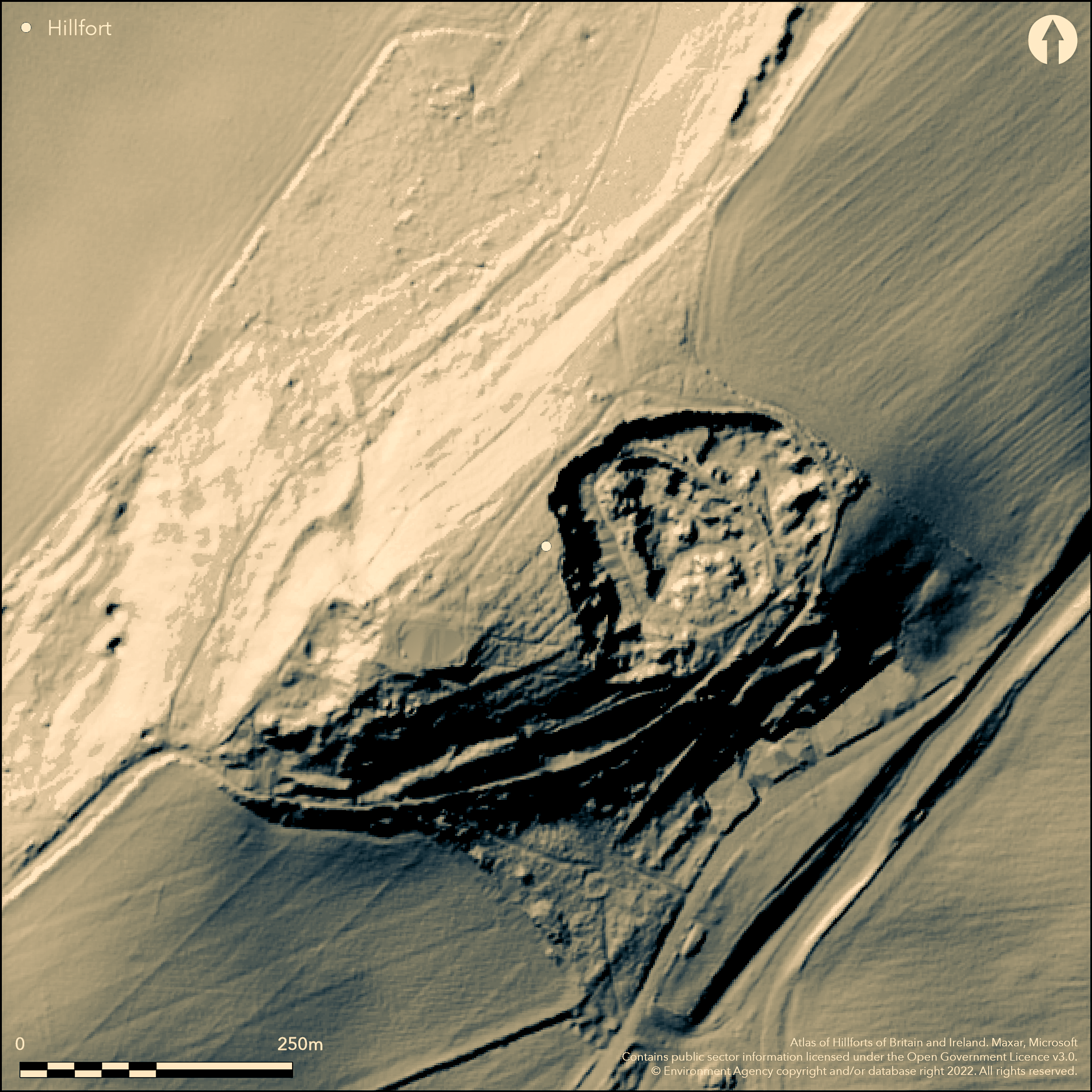
LiDAR 1m DTM Hillshade
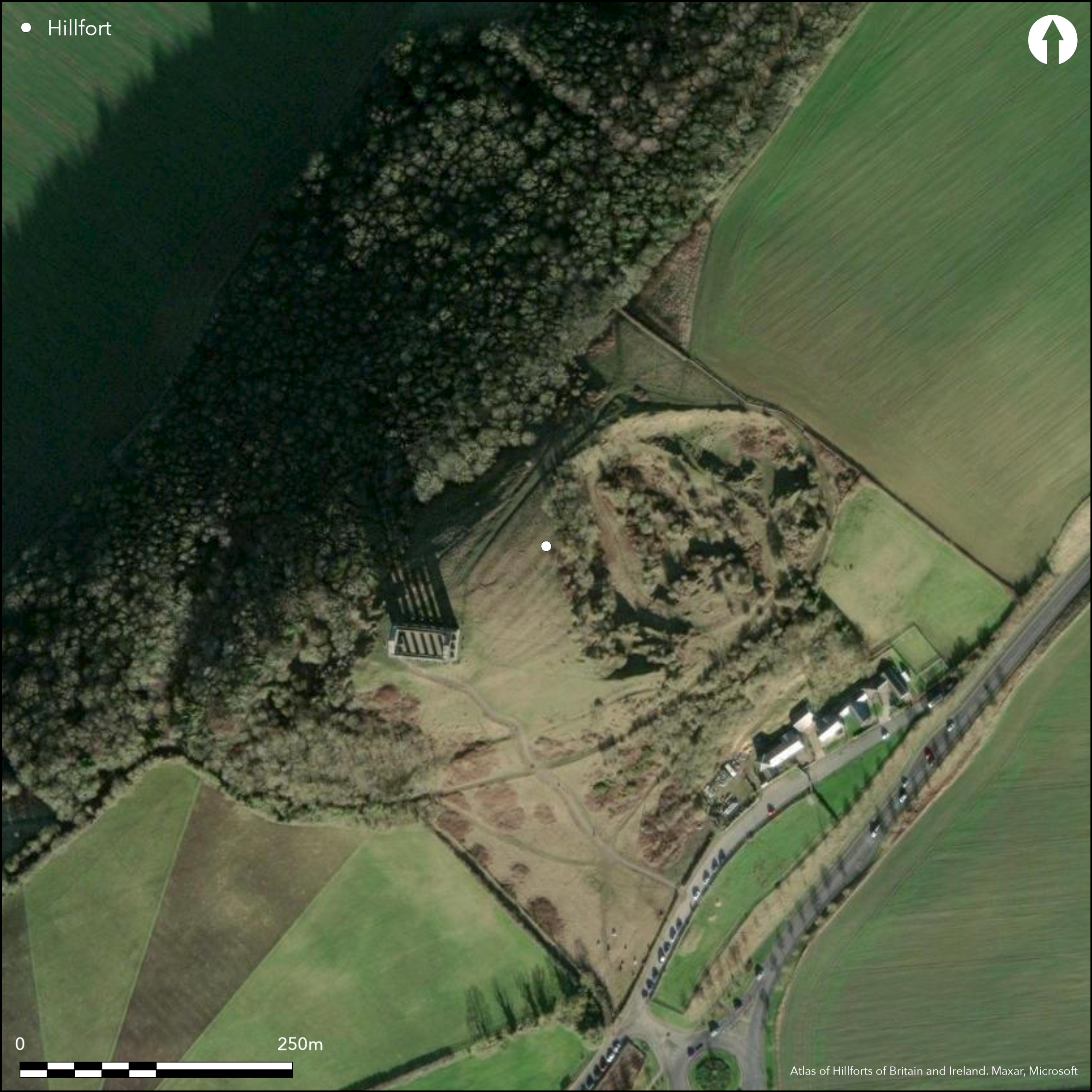
Satellite Imagery
LiDAR 1m DTM Hillshade
Satellite Imagery
Scroll left/right to view further images.
HER: Tyne and Wear 16664 (None)
NMR: None (None)
SM: None
NGR: NZ 3345 5442
X: 433458 Y: 554427 (OSGB36)
Overlooking the River Tyne at 121m OD, a possible Iron Age multivallate contour fort on a knoll on Penshaw Hill. Penshaw Hill is visibly prominent within the landscape and from its summit it commands views to the S and W of the East Durham plateau and dales and has a direct line of site with Maiden Castle (Atlas No. 0115) 13km to the SW. To the E it would have once had views along the coast and to the N to the mouth of the Tyne. Its attribution as a hillfort is uncertain as although it has substantial ramparts or terracing. There is no antiquarian record of the site, although Armstrong's map of 1768 shows the hill with concentric rings (Archaeo-Environment 2010). It is also one of the sites proposed for the origin of the legend of the Lambton Worm, a dragon which slept coiled around the hill, the coils possibly relating to the earthwork. The earthworks now comprise three banks in the S and SE where the land drops away steeply, with further traces in the NW. There is no evidence for earthworks in the W where there is a steep drop down the scarp, although it is uncertain if the steepness is related to quarrying activities. Approximate enclosed area is 2.0ha. Quarrying has destroyed much of the NE side. The banks midway down the hill are the best preserved with a berm, bank and a ditch surviving. The outer ramparts have been considerably altered by a trackway. The site is better known for the Penshaw Monument built in 1844 and dedicated to John George Lambton, the first Earl of Durham. It is not recorded as a prehistoric site by English Heritage or shown as such on OS mapping. A desktop and topographic survey was carried out by Archaeo-Environment in 2010 when a case was made for this being a possible Iron Age hillfort, but no further investigation has taken place. Undated.
Citizen Science: ✓
Reliability of Data: Confirmed
Reliability of Interpretation: Unconfirmed
X: -164753 Y: 7339289 (EPSG: 3857)
Longitude: -1.4799983626043847 Latitude: 54.883501389000116 (EPSG:4326)
Country: England; None
Current County or Unitary Authority: Sunderland
Historic County: County Durham
Current Parish/Community/Council/Townland: Sunderland
Owned by the National Trust, destroyed in parts through quarrying
| Extant | ✓ |
| Cropmark | ✗ |
| Likely Destroyed | ✓ |
Recreational grassland, used by visitors to Penshaw Monument
| Woodland | ✗ |
| Commercial Forestry Plantation | ✗ |
| Parkland | ✗ |
| Pasture (Grazing) | ✗ |
| Arable | ✗ |
| Scrub/Bracken | ✗ |
| Bare Outcrop | ✗ |
| Heather/Moorland | ✗ |
| Heath | ✗ |
| Built-up | ✗ |
| Coastal Grassland | ✗ |
| Other | ✓ |
A possible contour fort lying on a knoll on Penshaw Hill at 121m OD
| Contour Fort | ✓ |
| Partial Contour Fort | ✗ |
| Promontory Fort | ✗ |
| Hillslope Fort | ✗ |
| Level Terrain Fort | ✗ |
| Marsh Fort | ✗ |
| Multiple Enclosure Fort | ✗ |
| Hilltop | ✓ |
| Coastal Promontory | ✗ |
| Inland Promontory | ✗ |
| Valley Bottom | ✗ |
| Knoll/Hillock/Outcrop | ✗ |
| Ridge | ✗ |
| Cliff/Plateau-edge/Scarp | ✗ |
| Hillslope | ✗ |
| Lowland | ✗ |
| Spur | ✗ |
Dominant Topographic Feature: Knoll on Penshaw Hill
| North | ✗ |
| Northeast | ✗ |
| East | ✗ |
| Southeast | ✗ |
| South | ✗ |
| Southwest | ✗ |
| West | ✗ |
| Northwest | ✗ |
| Level | ✓ |
Altitude: 121.0m
A parish boundary running to the E and N of the site is recorded on historic OS, but appears to be no longer extant
Boundary Type: Parish/Townland
The site is undated
Reliability: D - None
| Pre 1200BC | ✗ |
| 1200BC - 800BC | ✗ |
| 800BC - 400BC | ✗ |
| 400BC - AD50 | ✗ |
| AD50 - AD400 | ✗ |
| AD400 - AD 800 | ✗ |
| Post AD800 | ✗ |
| Unknown | ✓ |
| Pre Hillfort: | None |
| Post Hillfort: | Penshaw Monument built in 1844, dedicated to John George Lambton, the first Earl of Durham. 18th century magnesium limestone quarry. Triangulation pillar |
Unrecorded as a hillfort or 'camp' on OS mapping, concentric rings are shown around the hill on Armstrong's map of 1768. Desktop and topographic survey carried out in 2010
| 1st Identified Map Depiction (1768): | None |
| Earthwork Survey (2010): | None |
No internal features are recorded
River Tyne to the NW
| None | ✓ |
| Spring | ✗ |
| Stream | ✗ |
| Pool | ✗ |
| Flush | ✗ |
| Well | ✗ |
| Other | ✗ |
None
| No Known Features | ✓ |
| Round Stone Structures | ✗ |
| Rectangular Stone Structures | ✗ |
| Curvilinear Platforms | ✗ |
| Other Roundhouse Evidence | ✗ |
| Pits | ✗ |
| Quarry Hollows | ✗ |
| Other | ✗ |
None
| No Known Excavation | ✓ |
| Pits | ✗ |
| Postholes | ✗ |
| Roundhouses | ✗ |
| Rectangular Structures | ✗ |
| Roads/Tracks | ✗ |
| Quarry Hollows | ✗ |
| Other | ✗ |
| Nothing Found | ✗ |
None
| No Known Geophysics | ✓ |
| Pits | ✗ |
| Roundhouses | ✗ |
| Rectangular Structures | ✗ |
| Roads/Tracks | ✗ |
| Quarry Hollows | ✗ |
| Other | ✗ |
| Nothing Found | ✗ |
None
| No Known Finds | ✓ |
| Pottery | ✗ |
| Metal | ✗ |
| Metalworking | ✗ |
| Human Bones | ✗ |
| Animal Bones | ✗ |
| Lithics | ✗ |
| Environmental | ✗ |
| Other | ✗ |
None
| APs Not Checked | ✓ |
| None | ✗ |
| Roundhouses | ✗ |
| Rectangular Structures | ✗ |
| Pits | ✗ |
| Postholes | ✗ |
| Roads/Tracks | ✗ |
| Other | ✗ |
No entrances are recorded
| None: | None |
| 2: | None |
Guard Chambers: ✗
Chevaux de Frise: ✗
Three banks in the S and SE where the land drops away steeply, with further traces in the NW. There is no evidence for earthworks in the W where there is a steep drop down the scarp. Quarrying has destroyed much of the NE side. The banks midway down the hill are the best preserved with a berm, bank and a ditch surviving.
| Area 1: | 2.0ha. |
| Total: | 2.0ha. |
Total Footprint Area: Noneha.
None
| ✗ | None |
| ✗ | No evidence for earthworks in the W where there is a steep drop down the scarp. Quarrying has destroyed much of the NE side |
| NE Quadrant: | None |
| SE Quadrant: | 3 |
| SW Quadrant: | 3 |
| NW Quadrant: | 3 |
| Total: | 3 |
| Partial Univallate | ✗ |
| Univallate | ✗ |
| Partial Bivallate | ✗ |
| Bivallate | ✗ |
| Partial Multivallate | ✓ |
| Multivallate | ✗ |
| Unknown | ✗ |
| Partial Univallate | ✗ |
| Univallate | ✗ |
| Partial Bivallate | ✗ |
| Bivallate | ✗ |
| Partial Multivallate | ✗ |
| Multivallate | ✗ |
None
| None | ✗ |
| Earthen Bank | ✓ |
| Stone Wall | ✗ |
| Rubble | ✗ |
| Wall-walk | ✗ |
| Evidence of Timber | ✗ |
| Vitrification | ✗ |
| Other Burning | ✗ |
| Palisade | ✗ |
| Counter Scarp Bank | ✗ |
| Berm | ✓ |
| Unfinished | ✗ |
| Other | ✗ |
None
| None | ✗ |
| Earthen Bank | ✗ |
| Stone Wall | ✗ |
| Murus Duplex | ✗ |
| Timber-framed | ✗ |
| Timber-laced | ✗ |
| Vitrification | ✗ |
| Other Burning | ✗ |
| Palisade | ✗ |
| Counter Scarp Bank | ✗ |
| Berm | ✗ |
| Unfinished | ✗ |
| No Known Excavation | ✓ |
| Other | ✗ |
| ✗ | None |
| ✓ | None |
Number of Ditches: 1
| ✗ | None |
Archaeo-Environment Ltd 2010. Historic Environment Survey for National Trust Properties, Tyne and Wear. Penshaw Monument. Report No: 0074/1-10. www.aenvironment.co.uk/downloads/Penshaw%20Management%20Plan.pdf. Accessed Jun 2015
Atlas of Hillforts:
Wikidata:
This work is licensed under CC BY-SA 4.0

 and should be cited as:
Lock, Gary and Ralston, Ian. 2024. Atlas of Hillforts of Britain and Ireland. Available at: https://hillforts.arch.ox.ac.uk
Document Version 1.1