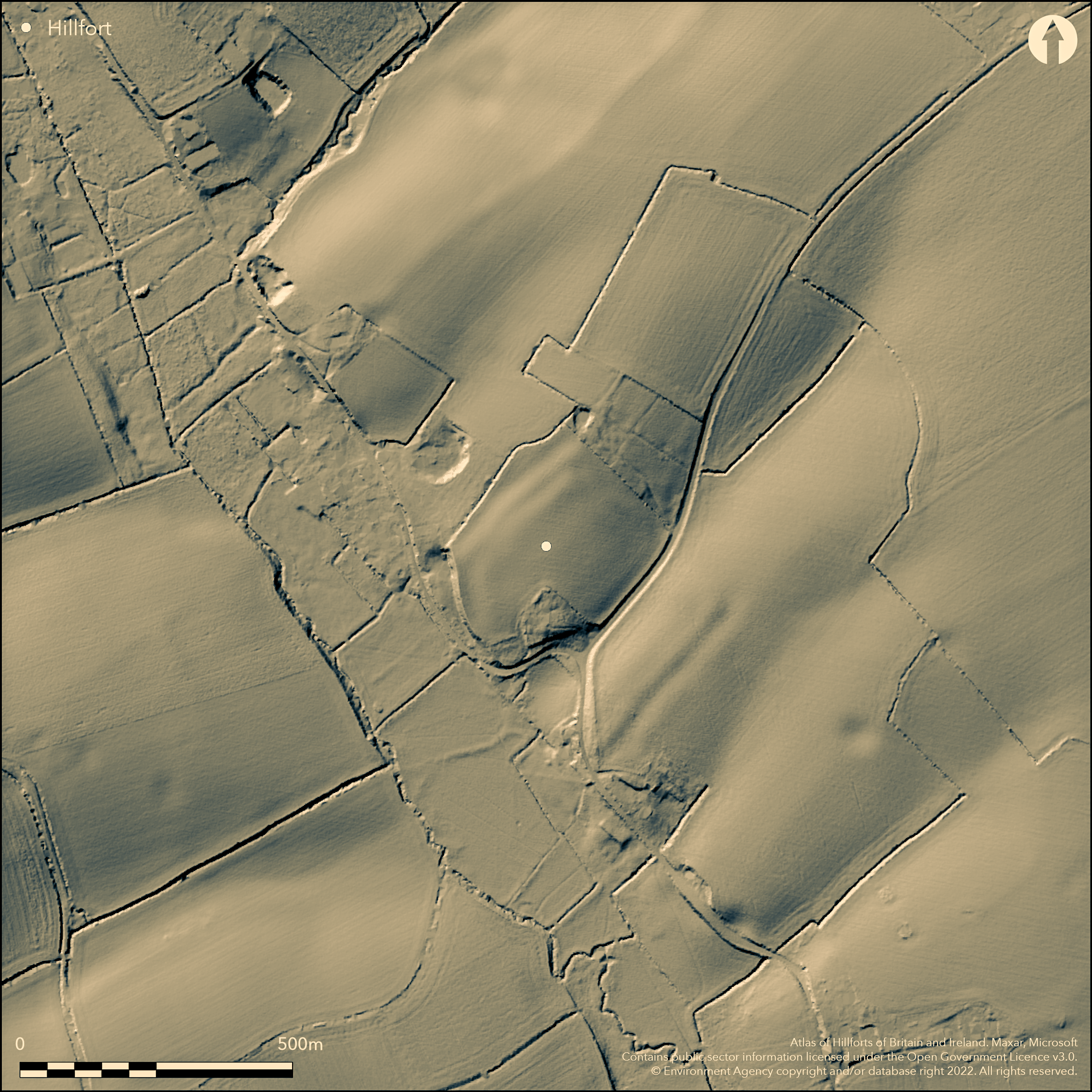
LiDAR 1m DTM Hillshade
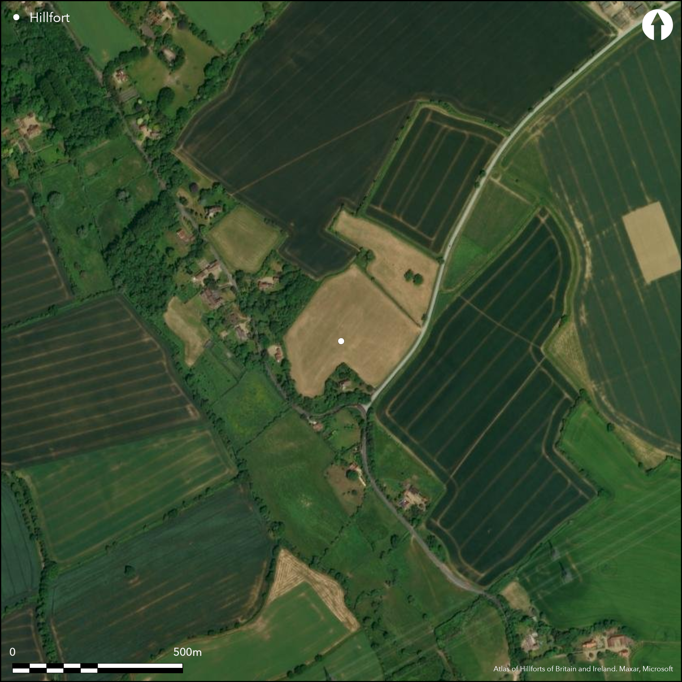
Satellite Imagery
LiDAR 1m DTM Hillshade
Satellite Imagery
Scroll left/right to view further images.
HER: Suffolk BUG002 (None)
NMR: TM 2 5 SW 1 (390212)
SM: 1006035
NGR: TM 224 523
X: 622350 Y: 252360 (OSGB36)
Situated NE of Burgh on a hillslope overlooking the floodplain of the River Deben. Large quadrilaterial enclosure covering 7 ha bisected by Drabs Lane and partially occupied by Burgh church. Originally comprised of double banks and ditches enclosing an area c 200.0m NW-SE by c 120.0m transversely, but ploughing has reduced the ramparts to flint scatters and the ditches to slight depressions 0.8 m maximum depth. On the SW flood-plain side the fort is defined by a flinty scarp visible for about 65.0m. Soil marks adjacent to Drabs Lane at NE suggest an entrance. There is no trace of the circular earthwork shown by VCH in the N corner of the fort (now suggested to be a medieval windmill mound).The site has been excavated on three occasions (1900-1, 1947-57, and 1975), all published in Martin (1988). The enclosure was constructed in the 1st century BC with a possible unenclosed settlement preceeding it. The first phase ditch was c. 3m deep and 5m wide containing late Iron Age and early Roman pottery, also evidence for a tumbled rampart. A "destruction horizon" belonging to the early 1st century AD was followed by a marked increase in the presence of wheel-made Belgic style pottery and imported wares. An inner enclosure of c 1ha was constructed in the NW corner, probably prior to the Roman conquest, though it may be very early Roman in date. Part of it was levelled c. AD 60. Pits with pottery and human remains. Occupation of the site continued well into the 4th century. A hypocaust and tessellated floors suggest the existence of a villa. The church was built within the earthwork during the late Saxon period. During the 19th century, the earthwork was erroneously identified with the place called Combretovium in the Antonine Itinerary, and was long thought to be a Roman fort or camp. Finds of Mesolithic, Neolithic and Bronze Age date were also recovered during the various excavations. Shown on OS 1:25,000 map (1928) as 'Roman building, site of' with length of earthwork.
Citizen Science: ✗
Reliability of Data: Confirmed
Reliability of Interpretation: Confirmed
X: 138801 Y: 6822715 (EPSG: 3857)
Longitude: 1.2468735376966704 Latitude: 52.12475632803952 (EPSG:4326)
Country: England; None
Current County or Unitary Authority: Suffolk
Historic County: Suffolk
Current Parish/Community/Council/Townland: Burgh; Clopton
None
| Extant | ✓ |
| Cropmark | ✓ |
| Likely Destroyed | ✗ |
None
| Woodland | ✓ |
| Commercial Forestry Plantation | ✗ |
| Parkland | ✗ |
| Pasture (Grazing) | ✗ |
| Arable | ✓ |
| Scrub/Bracken | ✗ |
| Bare Outcrop | ✗ |
| Heather/Moorland | ✗ |
| Heath | ✗ |
| Built-up | ✓ |
| Coastal Grassland | ✗ |
| Other | ✗ |
Hillslope fort overlooking a valley
| Contour Fort | ✗ |
| Partial Contour Fort | ✗ |
| Promontory Fort | ✗ |
| Hillslope Fort | ✓ |
| Level Terrain Fort | ✗ |
| Marsh Fort | ✗ |
| Multiple Enclosure Fort | ✗ |
| Hilltop | ✗ |
| Coastal Promontory | ✗ |
| Inland Promontory | ✗ |
| Valley Bottom | ✗ |
| Knoll/Hillock/Outcrop | ✗ |
| Ridge | ✗ |
| Cliff/Plateau-edge/Scarp | ✗ |
| Hillslope | ✓ |
| Lowland | ✗ |
| Spur | ✗ |
Dominant Topographic Feature: overlooking a valley
| North | ✗ |
| Northeast | ✗ |
| East | ✗ |
| Southeast | ✗ |
| South | ✗ |
| Southwest | ✓ |
| West | ✗ |
| Northwest | ✗ |
| Level | ✗ |
Altitude: 38.0m
Parish boundary runs along the N edge of the site
Boundary Type: Parish/Townland
Dated to 1st century BC through Roman period by excavated pottery. Finds of Mesolithic, Neolithic and Bronze Age date. Saxon church.
Reliability: B - Medium
| Pre 1200BC | ✗ |
| 1200BC - 800BC | ✗ |
| 800BC - 400BC | ✗ |
| 400BC - AD50 | ✓ |
| AD50 - AD400 | ✗ |
| AD400 - AD 800 | ✗ |
| Post AD800 | ✗ |
| Unknown | ✗ |
| Pre Hillfort: | None |
| Post Hillfort: | None |
| Artefactual: | None |
First mentioned in 1819 (Cromwell)Shown on OS 1:25,000 map (1928) as 'Roman building, site of' with length of earthwork. In Raven's History of Suffolk (1895). Excavations in 1900-1 (V.B. Redstone), 1947-57 (J.D.W. Treherne), and 1975 (E. Martin).
| 1st Identified Written Reference (1819): | None |
| 1st Identified Written Reference (1895): | None |
| 1st Identified Map Depiction (1928): | None |
| Excavation (1975): | None |
| Excavation (None): | None |
| Excavation (None): | None |
Pits and postholes from excavation, pottery, metal and coins.
None
| None | ✓ |
| Spring | ✗ |
| Stream | ✗ |
| Pool | ✗ |
| Flush | ✗ |
| Well | ✗ |
| Other | ✗ |
None
| No Known Features | ✓ |
| Round Stone Structures | ✗ |
| Rectangular Stone Structures | ✗ |
| Curvilinear Platforms | ✗ |
| Other Roundhouse Evidence | ✗ |
| Pits | ✗ |
| Quarry Hollows | ✗ |
| Other | ✗ |
None
| No Known Excavation | ✗ |
| Pits | ✓ |
| Postholes | ✓ |
| Roundhouses | ✗ |
| Rectangular Structures | ✗ |
| Roads/Tracks | ✗ |
| Quarry Hollows | ✗ |
| Other | ✗ |
| Nothing Found | ✗ |
None
| No Known Geophysics | ✓ |
| Pits | ✗ |
| Roundhouses | ✗ |
| Rectangular Structures | ✗ |
| Roads/Tracks | ✗ |
| Quarry Hollows | ✗ |
| Other | ✗ |
| Nothing Found | ✗ |
None
| No Known Finds | ✗ |
| Pottery | ✓ |
| Metal | ✓ |
| Metalworking | ✓ |
| Human Bones | ✓ |
| Animal Bones | ✓ |
| Lithics | ✗ |
| Environmental | ✓ |
| Other | ✓ |
NO APPARENT FEATURES
| APs Not Checked | ✓ |
| None | ✗ |
| Roundhouses | ✗ |
| Rectangular Structures | ✗ |
| Pits | ✗ |
| Postholes | ✗ |
| Roads/Tracks | ✗ |
| Other | ✗ |
Soil marks adjacent to Drabs Lane at NE suggest an entrance.
| None: | None |
| 2: | None |
Guard Chambers: ✗
Chevaux de Frise: ✗
| 1. Simple Gap (North east): | None |
Originally double bank and ditches, now much reduced by ploughing but surviving in places as flinty scarps. Ditches excavated.
| Area 1: | 7.0ha. |
| Total: | 7.0ha. |
Total Footprint Area: Noneha.
None
| ✗ | None |
| ✓ | None |
| NE Quadrant: | 2 |
| SE Quadrant: | 2 |
| SW Quadrant: | 2 |
| NW Quadrant: | 2 |
| Total: | 2 |
| Partial Univallate | ✗ |
| Univallate | ✗ |
| Partial Bivallate | ✗ |
| Bivallate | ✓ |
| Partial Multivallate | ✗ |
| Multivallate | ✗ |
| Unknown | ✗ |
| Partial Univallate | ✗ |
| Univallate | ✗ |
| Partial Bivallate | ✗ |
| Bivallate | ✗ |
| Partial Multivallate | ✗ |
| Multivallate | ✗ |
None
| None | ✗ |
| Earthen Bank | ✓ |
| Stone Wall | ✗ |
| Rubble | ✗ |
| Wall-walk | ✗ |
| Evidence of Timber | ✗ |
| Vitrification | ✗ |
| Other Burning | ✗ |
| Palisade | ✗ |
| Counter Scarp Bank | ✗ |
| Berm | ✗ |
| Unfinished | ✗ |
| Other | ✗ |
None
| None | ✗ |
| Earthen Bank | ✓ |
| Stone Wall | ✗ |
| Murus Duplex | ✗ |
| Timber-framed | ✗ |
| Timber-laced | ✗ |
| Vitrification | ✗ |
| Other Burning | ✗ |
| Palisade | ✗ |
| Counter Scarp Bank | ✗ |
| Berm | ✗ |
| Unfinished | ✗ |
| No Known Excavation | ✗ |
| Other | ✗ |
| ✗ | None |
| ✓ | None |
Number of Ditches: 2
| ✗ | None |
Martin, E. 1988. Burgh: the Iron Age and Roman enclosure. East Anglian Archaeology, 40.
Page, W. (ed). 1911. The Victoria history of the county of Suffolk, Volume 1, 586-7, 591.
Atlas of Hillforts:
Wikidata:
This work is licensed under CC BY-SA 4.0

 and should be cited as:
Lock, Gary and Ralston, Ian. 2024. Atlas of Hillforts of Britain and Ireland. Available at: https://hillforts.arch.ox.ac.uk
Document Version 1.1