LiDAR 1m DTM Hillshade
Satellite Imagery
LiDAR 1m DTM Hillshade
Satellite Imagery
Scroll left/right to view further images.
HER: Warwickshire 755 (None)
NMR: SP 34 NE 4 (335146)
SM: 1003724
NGR: SP 39017 48208
X: 439017 Y: 248208 (OSGB36)
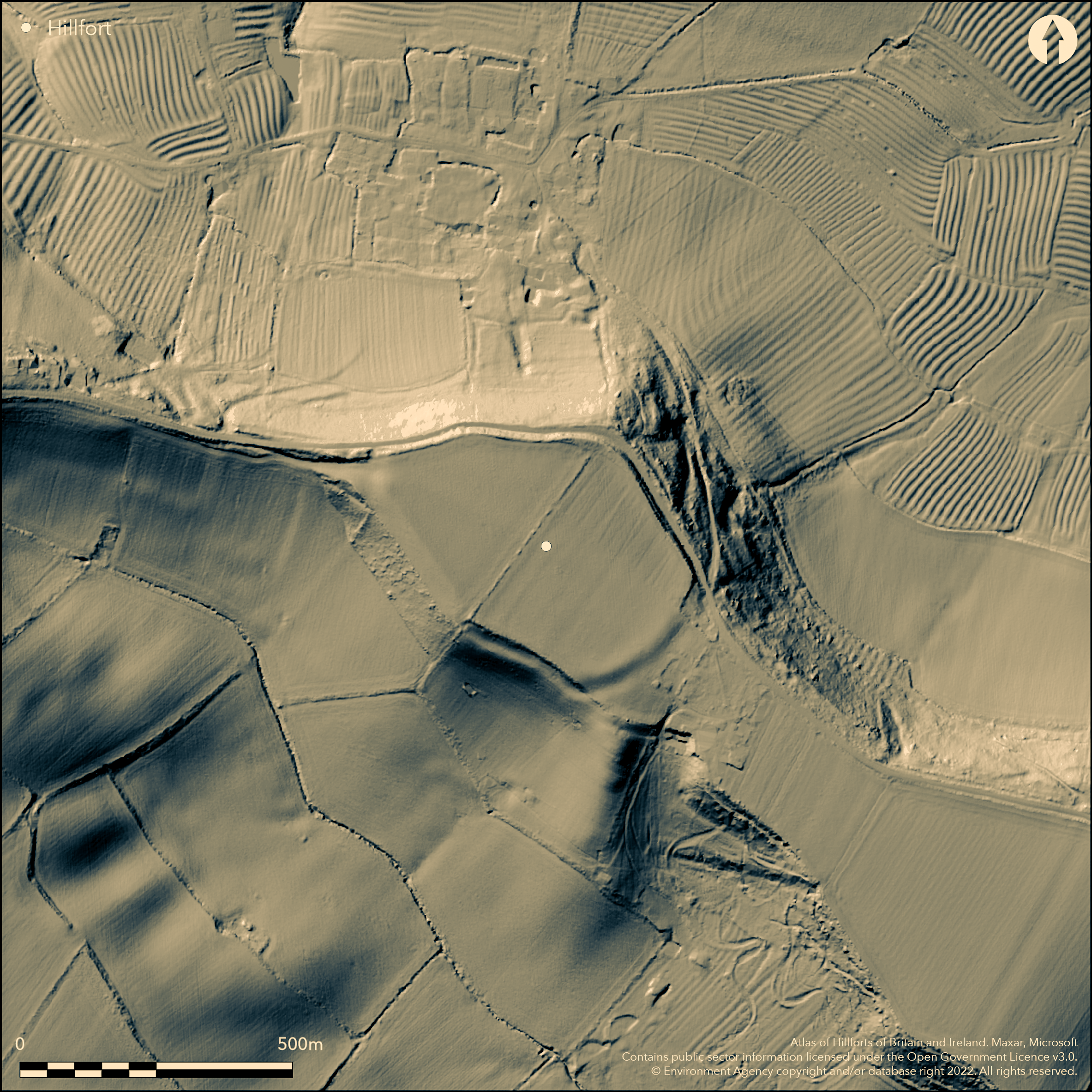
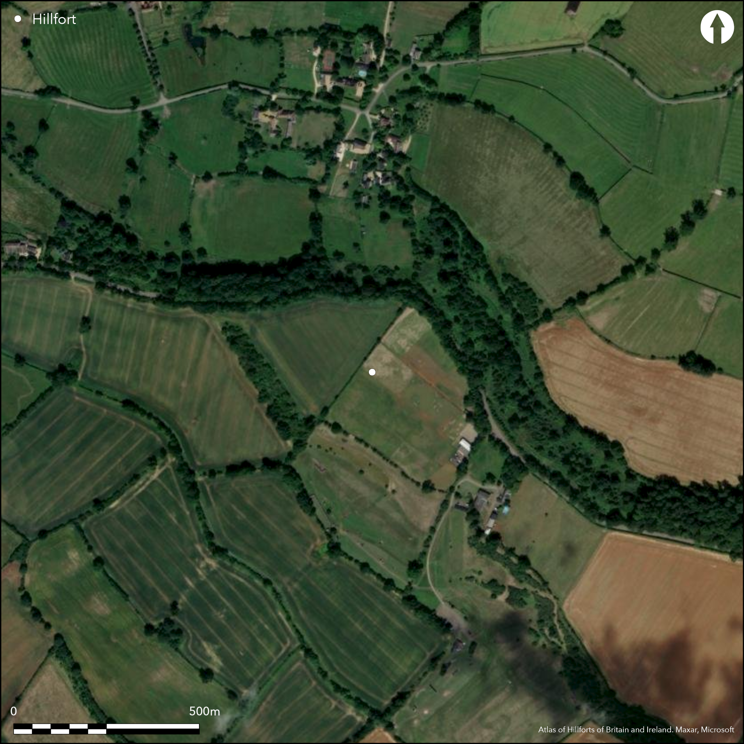
A large univallate hillfort lying directly to the S of Arlescote at 210m OD on a narrow, jutting promontory of the Edge Hills scarp. It is sub-oval in form with maximum dimensions of 360m by 243m enclosing 6.9ha with the ground sloping away steeply in all directions. A plan drawn in 1882 shows two ramparts and a medial ditch, the outer rampart is now interpreted as a counterscarp bank. It was extant on aerial photographs in 1947 but almost plough-levelled by 2007, although in places the ramparts survive in varying states of preservation and as scarps up to 2m high within the modern field boundaries. The ditch, now in-filled and in the N, underlies the modern road. A probable entrance, approached by a holloway, lies in the W with out-turned terminals. A series of parallel crescent-shaped banks in the region of entrance once interpreted as an annex (Thomas 1974), are now thought to be an elaboration of the entrance. This description is contradicted by McArthur (1987-8) who describes a single inturned entrance in the NW. Seventy fragments of Iron Age pot and other finds were recovered during a survey (French 1981). A small excavation by Birmingham University Field Archaeology Unit across the northern defences in 1983 (McArthur 1987-8) showed the rampart was of dump construction on a stone platform with a rear kerb of large stones. The front face was destroyed by a large quarry pit and no evidence could be found for the ditch in that area. Large pits were discovered, one underlying the rampart and a second, which cut the rampart, showing at least one earlier phase and subsequent remodelling. A currency bar was recovered from one of the pits along with bone, pottery and slag. The finds assemblage and radiocarbon dates suggest a date of construction for the rampart within the central two centuries of the first millennium BC. A resistance survey of part of the interior indicated that considerable evidence for occupation survived within the interior McArthur (1987-8). The interior is now divided into two arable fields. A watching brief ahead of a water main work in 1997 and 1998 by Warwickshire Museum Field Services produced no further finds (Coutts, 1997; WMFS 1998). A beehive quern was found in the 1960's and field walking by Edgehill Group in 1999 recovered an assemblage of predominantly early Iron Age pottery together with flint from several different time periods (Wager 2002). The site is recorded on 1885-1900 OS mapping. Scheduled
Citizen Science: ✗
Reliability of Data: Confirmed
Reliability of Interpretation: Confirmed
X: -159346 Y: 6823805 (EPSG: 3857)
Longitude: -1.4314269807065112 Latitude: 52.13076836304426 (EPSG:4326)
Country: England; None
Current County or Unitary Authority: Warwickshire
Historic County: Warwickshire
Current Parish/Community/Council/Townland: Ratley and Upton; Warmington
On Heritage at Risk Register (2015).
| Extant | ✓ |
| Cropmark | ✗ |
| Likely Destroyed | ✓ |
None
| Woodland | ✗ |
| Commercial Forestry Plantation | ✗ |
| Parkland | ✗ |
| Pasture (Grazing) | ✗ |
| Arable | ✓ |
| Scrub/Bracken | ✗ |
| Bare Outcrop | ✗ |
| Heather/Moorland | ✗ |
| Heath | ✗ |
| Built-up | ✗ |
| Coastal Grassland | ✗ |
| Other | ✗ |
A contour fort lying on level ground at 210m OD on a narrow, jutting promontory of the Edge Hills.
| Contour Fort | ✓ |
| Partial Contour Fort | ✗ |
| Promontory Fort | ✗ |
| Hillslope Fort | ✗ |
| Level Terrain Fort | ✗ |
| Marsh Fort | ✗ |
| Multiple Enclosure Fort | ✗ |
| Hilltop | ✓ |
| Coastal Promontory | ✗ |
| Inland Promontory | ✓ |
| Valley Bottom | ✗ |
| Knoll/Hillock/Outcrop | ✗ |
| Ridge | ✗ |
| Cliff/Plateau-edge/Scarp | ✗ |
| Hillslope | ✗ |
| Lowland | ✗ |
| Spur | ✗ |
Dominant Topographic Feature: Promontory
| North | ✗ |
| Northeast | ✗ |
| East | ✗ |
| Southeast | ✗ |
| South | ✗ |
| Southwest | ✗ |
| West | ✗ |
| Northwest | ✗ |
| Level | ✓ |
Altitude: 210.0m
Boundary between Ratley and Upton and Warmington, with the ramparts on the northern side reused as a parish boundary
Boundary Type: Parish/Townland
A sample of pre-rampart date charcoal gave a date of 2410+/- 90 BP uncalibrated (HAR - 5887) calibrated to 600-400BC (68% confidence) or 800-280BC (95% confidence)
Reliability: B - Medium
| Pre 1200BC | ✗ |
| 1200BC - 800BC | ✗ |
| 800BC - 400BC | ✓ |
| 400BC - AD50 | ✓ |
| AD50 - AD400 | ✗ |
| AD400 - AD 800 | ✗ |
| Post AD800 | ✗ |
| Unknown | ✗ |
| Pre Hillfort: | None |
| Post Hillfort: | None |
| Artefactual: | Iron Age pottery |
| C14: | None |
| Morphology/Earthwork/Typology: | None |
Mentioned in Camden's Britannia, 1695. Plan drawn by E. Pretty in 1822 (held by Warwickshire HER), recorded on 1886 1:2,500 OS mapping. Field investigation 1968; resistance survey and small excavation in 1983 (McArthur 1987-8), Watching brief in 1997 and 1998. Fieldwalking 1999. Transcribed from aerial photographs as part of the South East Warwickshire and Cotswolds HLS Target Areas National Mapping Programme. Scheduled
| 1st Identified Written Reference (1695): | Camden's Britannia |
| Earthwork Survey (1822): | E. Pretty |
| 1st Identified Map Depiction (1886): | 1:2,500 |
| Other (1968): | Field investigation |
| Excavation (1983): | None |
| Geophysical Survey (1983): | Resistance survey |
| Other (1992): | Fieldwalking |
| Other (None): | Watching brief |
| Other (None): | Scheduled |
Resistance survey suggests there is considerable surviving evidence for activity within the interior. Excavation concentrated on the rampart but showed internal pits. A currency bar was recovered from one of the pits along with bone, pottery and slag.
A number of springs in the region are shown on OS mapping
| None | ✓ |
| Spring | ✗ |
| Stream | ✗ |
| Pool | ✗ |
| Flush | ✗ |
| Well | ✗ |
| Other | ✗ |
None
| No Known Features | ✓ |
| Round Stone Structures | ✗ |
| Rectangular Stone Structures | ✗ |
| Curvilinear Platforms | ✗ |
| Other Roundhouse Evidence | ✗ |
| Pits | ✗ |
| Quarry Hollows | ✗ |
| Other | ✗ |
None
| No Known Excavation | ✗ |
| Pits | ✓ |
| Postholes | ✗ |
| Roundhouses | ✗ |
| Rectangular Structures | ✗ |
| Roads/Tracks | ✗ |
| Quarry Hollows | ✗ |
| Other | ✗ |
| Nothing Found | ✗ |
Considerable undefined activity recorded
| No Known Geophysics | ✗ |
| Pits | ✗ |
| Roundhouses | ✗ |
| Rectangular Structures | ✗ |
| Roads/Tracks | ✗ |
| Quarry Hollows | ✗ |
| Other | ✓ |
| Nothing Found | ✗ |
Currency bar, slag
| No Known Finds | ✗ |
| Pottery | ✓ |
| Metal | ✓ |
| Metalworking | ✓ |
| Human Bones | ✗ |
| Animal Bones | ✓ |
| Lithics | ✓ |
| Environmental | ✗ |
| Other | ✗ |
None
| APs Not Checked | ✓ |
| None | ✗ |
| Roundhouses | ✗ |
| Rectangular Structures | ✗ |
| Pits | ✗ |
| Postholes | ✗ |
| Roads/Tracks | ✗ |
| Other | ✗ |
A probable entrance, approached by a holloway, lies in the W with out-turned terminals. A series of parallel crescent-shaped banks in the region of entrance once interpreted as an annex, are now thought to be an elaboration of the entrance.
| 1: | None |
| 2: | None |
Guard Chambers: ✗
Chevaux de Frise: ✗
| 1. Out-turned (West): | None |
| 1. Hollow Way (West): | None |
Sub-oval in form with maximum dimensions of 360m by 243m enclosing 6.9ha. Two banks, the outer of which is a counterscarp, with a medial ditch. The ramparts survive in varying states of preservation and as scarps up to 2m high within the modern field boundaries. The ditch is now in-filled and in the N underlies the modern road.
| Area 1: | 6.5ha. |
| Total: | 6.5ha. |
Total Footprint Area: Noneha.
None
| ✓ | A large pit discovered underlying the rampart and a second, which cut the rampart, shows at least one earlier phase and subsequent remodelling |
| ✓ | None |
| NE Quadrant: | 1 |
| SE Quadrant: | 1 |
| SW Quadrant: | 1 |
| NW Quadrant: | 1 |
| Total: | 1 |
| Partial Univallate | ✗ |
| Univallate | ✓ |
| Partial Bivallate | ✗ |
| Bivallate | ✗ |
| Partial Multivallate | ✗ |
| Multivallate | ✗ |
| Unknown | ✗ |
| Partial Univallate | ✗ |
| Univallate | ✗ |
| Partial Bivallate | ✗ |
| Bivallate | ✗ |
| Partial Multivallate | ✗ |
| Multivallate | ✗ |
None
| None | ✗ |
| Earthen Bank | ✓ |
| Stone Wall | ✗ |
| Rubble | ✗ |
| Wall-walk | ✗ |
| Evidence of Timber | ✗ |
| Vitrification | ✗ |
| Other Burning | ✗ |
| Palisade | ✗ |
| Counter Scarp Bank | ✓ |
| Berm | ✗ |
| Unfinished | ✗ |
| Other | ✗ |
None
| None | ✗ |
| Earthen Bank | ✓ |
| Stone Wall | ✓ |
| Murus Duplex | ✗ |
| Timber-framed | ✗ |
| Timber-laced | ✗ |
| Vitrification | ✗ |
| Other Burning | ✗ |
| Palisade | ✗ |
| Counter Scarp Bank | ✓ |
| Berm | ✗ |
| Unfinished | ✗ |
| No Known Excavation | ✗ |
| Other | ✗ |
| ✗ | None |
| ✓ | None |
Number of Ditches: 1
| ✓ | Possible annex at SE shown on aerial photographs (Thomas 1974) |
Camden's Britannia, 1695 a facsimile of the 1695 edition published by Edmund Gibson 1969. London Times Newspapers. 499
Coutts, C. 1997. Archaeological Observation at Nadbury Camp, Ratley and Upton, Warwickshire. Warwickshire Museum Field Services. Unpublished
French, A .H. 1981. Nadbury. Unpublished
McArthur, C 1987-8. Excavations at Nadbury Camp, Warwickshire SP 390482. Trans Birmingham & Warwickshire Archaeol Soc. 96, 1-16.
Thomas, N. 1974. An archaeological gazetteer for Warwickshire: Neolithic to Iron Age. Trans Birm Warwicks Archaeol Soc, 86, 16-48.
Wager, S.J. 2002. Nadbury Camp, Warwickshire: Report on Field Survey in 1999. Unpublished
Warwickshire Museum Field Services 1998. Archaeological Observation at Nadbury Camp 1998, Ratley and Upton, Warwickshire. Unpublished
Atlas of Hillforts:
Wikidata:
This work is licensed under CC BY-SA 4.0![]()
![]()
![]() and should be cited as:
and should be cited as:
Lock, Gary and Ralston, Ian. 2024. Atlas of Hillforts of Britain and Ireland. Available at: https://hillforts.arch.ox.ac.uk
Document Version 1.1