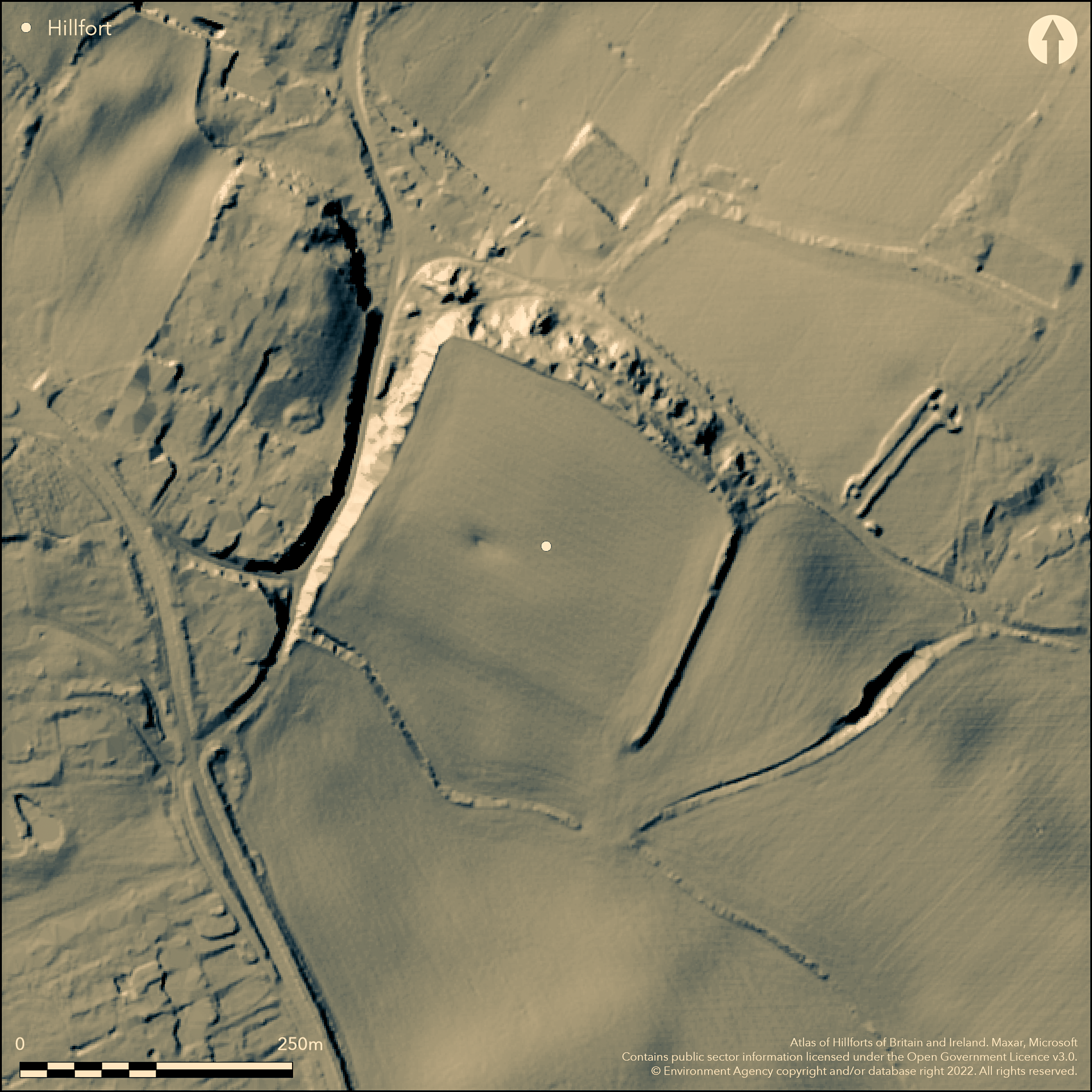
LiDAR 1m DTM Hillshade
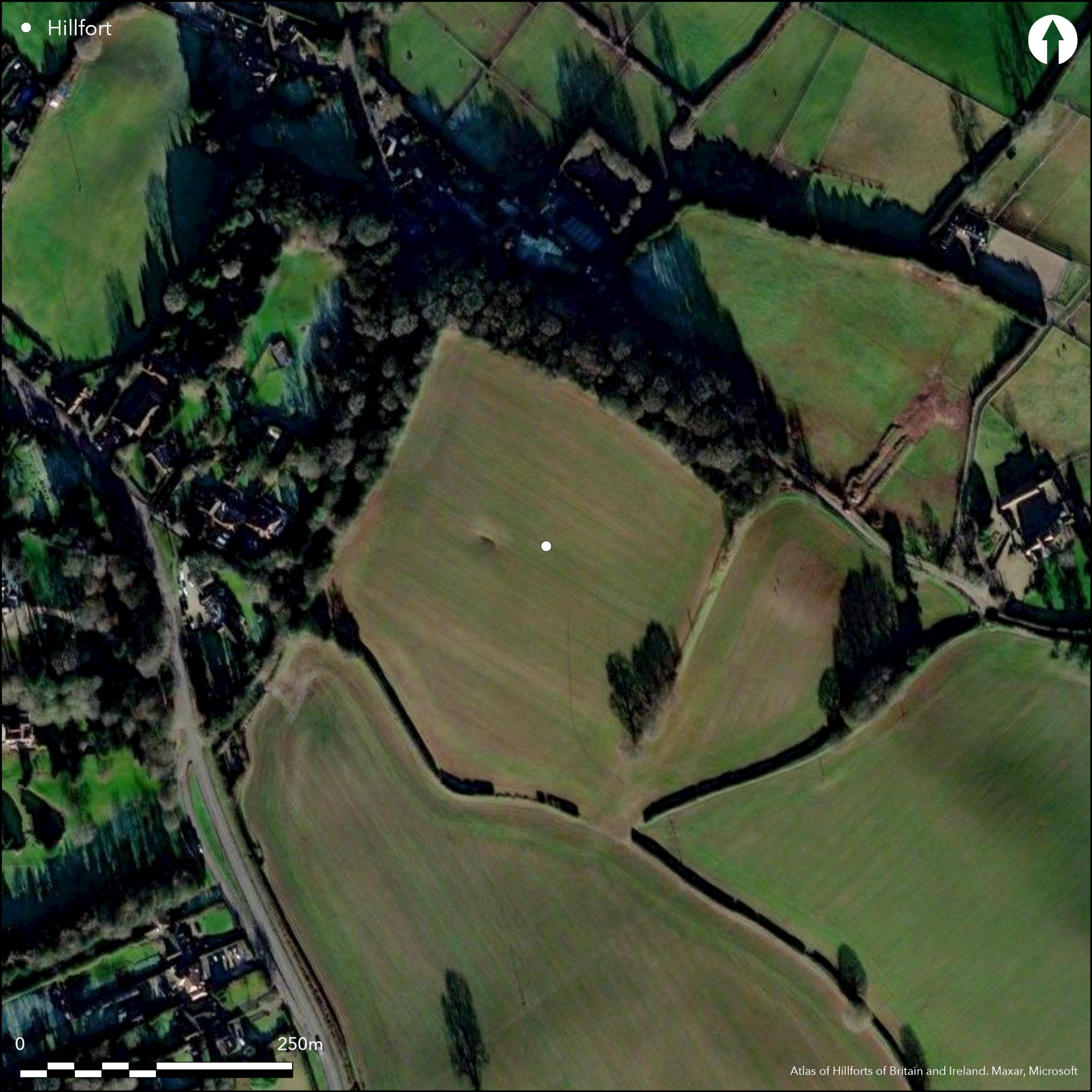
Satellite Imagery
LiDAR 1m DTM Hillshade
Satellite Imagery
Scroll left/right to view further images.
HER: Warwickshire 369 (None)
NMR: SP 38 NW 9 (335977)
SM: 1007718
NGR: SP 30447 85094
X: 430447 Y: 285094 (OSGB36)
To the E of the village of Corley, a univallate hillfort lying at 166m OD on the summit of Burrow Hill, bordered by Rock Lane in the W and Burrow Hill Lane in the N. The site is sub-square measuring 210m NW-SE by 190m transversely, enclosing approximately 3.0ha. Excavations in 1923 and 1926 (Chatwin 1930) determined that the earthworks, although poorly preserved, were constructed from coursed masonry forming a drystone wall, reinforced length-wise and cross-wise with timbering and faced with earth, described as similar to the murus Gallicus construction of Continental Iron Age forts. The site is best preserved along the SE edge with the rampart measuring up to 1.8m high and 9.8m wide at the base. Elsewhere intermittent traces of a rampart and ditch are visible with traces of a counterscarp bank along the northern edge. At the NE edge the rampart survives 10m wide and the ditch 6m wide. Quarrying has destroyed the ramparts at the northern corner of the site and sections of the NE counterscarp bank. Little surface evidence survives in the NW where the ground surface falls away steeply. The ramparts in the SW are thought to have been levelled and spread by ploughing and survive only as a slight break in slope. The ditch in the SW has been infilled. A possible coursewayed entrance 8.2m wide was discovered in the NW during excavation. Collapsed stone walls unearthed during the 1923 excavations have been interpreted as possible hut circles. Large quantities of flint flakes and fragments of Iron Age and Romano-British pottery were also recovered. In addition to the destruction through quarrying, the site is under arable and is being destroyed through ploughing. Recorded as 'Entrenchment' on 1888 1:2,500 OS mapping. Scheduled
Citizen Science: ✗
Reliability of Data: Confirmed
Reliability of Interpretation: Confirmed
X: -172912 Y: 6884263 (EPSG: 3857)
Longitude: -1.553298057400456 Latitude: 52.46291626302123 (EPSG:4326)
Country: England
Current County or Unitary Authority: Warwickshire
Historic County: Warwickshire
Current Parish/Community/Council/Townland: Corley
Damage is occurring through ploughing and quarrying
| Extant | ✓ |
| Cropmark | ✗ |
| Likely Destroyed | ✗ |
None
| Woodland | ✗ |
| Commercial Forestry Plantation | ✗ |
| Parkland | ✗ |
| Pasture (Grazing) | ✗ |
| Arable | ✓ |
| Scrub/Bracken | ✗ |
| Bare Outcrop | ✗ |
| Heather/Moorland | ✗ |
| Heath | ✗ |
| Built-up | ✗ |
| Coastal Grassland | ✗ |
| Other | ✗ |
A partial contour fort lying on the level summit of Burrow Hill at 166m OD. The earthworks follow the 160m contour in the NE
| Contour Fort | ✗ |
| Partial Contour Fort | ✓ |
| Promontory Fort | ✗ |
| Hillslope Fort | ✗ |
| Level Terrain Fort | ✗ |
| Marsh Fort | ✗ |
| Multiple Enclosure Fort | ✗ |
| Hilltop | ✓ |
| Coastal Promontory | ✗ |
| Inland Promontory | ✗ |
| Valley Bottom | ✗ |
| Knoll/Hillock/Outcrop | ✗ |
| Ridge | ✗ |
| Cliff/Plateau-edge/Scarp | ✗ |
| Hillslope | ✗ |
| Lowland | ✗ |
| Spur | ✗ |
Dominant Topographic Feature: Summit of Burrow Hill
| North | ✗ |
| Northeast | ✗ |
| East | ✗ |
| Southeast | ✗ |
| South | ✗ |
| Southwest | ✗ |
| West | ✗ |
| Northwest | ✗ |
| Level | ✓ |
Altitude: 166.0m
N/A
Iron Age and Romano-British pottery recovered
Reliability: B - Medium
| Pre 1200BC | ✗ |
| 1200BC - 800BC | ✗ |
| 800BC - 400BC | ✓ |
| 400BC - AD50 | ✓ |
| AD50 - AD400 | ✗ |
| AD400 - AD 800 | ✗ |
| Post AD800 | ✗ |
| Unknown | ✗ |
| Pre Hillfort: | None |
| Post Hillfort: | None |
| Artefactual: | Iron Age pottery |
Recorded on 1888 1:2,500 OS mapping; 1904 VCH Warwickshire. Excavated in 1923 and 1926. Field investigation in 1968. Scheduled
| 1st Identified Map Depiction (1888): | None |
| 1st Identified Written Reference (1904): | None |
| Other (1923): | Scheduled |
| Other (1924): | Scheduled |
| Other (1968): | Field investigation |
| Excavation (None): | None |
Collapsed stone walls unearthed during the 1923 excavations have been interpreted as possible hut circles. Large quantities of flint flakes and fragments of Iron Age and Romano-British pottery also recovered.
None
| None | ✓ |
| Spring | ✗ |
| Stream | ✗ |
| Pool | ✗ |
| Flush | ✗ |
| Well | ✗ |
| Other | ✗ |
None
| No Known Features | ✓ |
| Round Stone Structures | ✗ |
| Rectangular Stone Structures | ✗ |
| Curvilinear Platforms | ✗ |
| Other Roundhouse Evidence | ✗ |
| Pits | ✗ |
| Quarry Hollows | ✗ |
| Other | ✗ |
None
| No Known Excavation | ✗ |
| Pits | ✗ |
| Postholes | ✗ |
| Roundhouses | ✓ |
| Rectangular Structures | ✗ |
| Roads/Tracks | ✗ |
| Quarry Hollows | ✗ |
| Other | ✗ |
| Nothing Found | ✗ |
None
| No Known Geophysics | ✓ |
| Pits | ✗ |
| Roundhouses | ✗ |
| Rectangular Structures | ✗ |
| Roads/Tracks | ✗ |
| Quarry Hollows | ✗ |
| Other | ✗ |
| Nothing Found | ✗ |
None
| No Known Finds | ✗ |
| Pottery | ✓ |
| Metal | ✗ |
| Metalworking | ✗ |
| Human Bones | ✗ |
| Animal Bones | ✗ |
| Lithics | ✓ |
| Environmental | ✗ |
| Other | ✗ |
None
| APs Not Checked | ✓ |
| None | ✗ |
| Roundhouses | ✗ |
| Rectangular Structures | ✗ |
| Pits | ✗ |
| Postholes | ✗ |
| Roads/Tracks | ✗ |
| Other | ✗ |
A simple causewayed entrance 8.2m wide lies in the NW
| 1: | None |
| 2: | None |
Guard Chambers: ✗
Chevaux de Frise: ✗
| 1. Other Forms (North west): | Causeway |
Sub-square in form measuring 210m NW-SE by 190m transversely, enclosing approximately 3.0ha. The earthworks, although poorly preserved, were constructed from coursed masonry forming a drystone wall, reinforced length-wise and cross-wise with timbering and faced with earth, described as similar to the murus Gallicus construction of Continental Iron Age forts. Intermittent traces of an outer ditch and counterscarp bank. Where measured the bank is approximately 1.8m high and 9.8m wide at the base and the ditch, now infilled, 6m wide.
| Area 1: | 3.0ha. |
| Total: | 3.0ha. |
Total Footprint Area: Noneha.
None
| ✗ | None |
| ✗ | None |
| NE Quadrant: | 1 |
| SE Quadrant: | 1 |
| SW Quadrant: | 1 |
| NW Quadrant: | 1 |
| Total: | 1 |
| Partial Univallate | ✗ |
| Univallate | ✓ |
| Partial Bivallate | ✗ |
| Bivallate | ✗ |
| Partial Multivallate | ✗ |
| Multivallate | ✗ |
| Unknown | ✗ |
| Partial Univallate | ✗ |
| Univallate | ✗ |
| Partial Bivallate | ✗ |
| Bivallate | ✗ |
| Partial Multivallate | ✗ |
| Multivallate | ✗ |
None
| None | ✗ |
| Earthen Bank | ✓ |
| Stone Wall | ✗ |
| Rubble | ✗ |
| Wall-walk | ✗ |
| Evidence of Timber | ✗ |
| Vitrification | ✗ |
| Other Burning | ✗ |
| Palisade | ✗ |
| Counter Scarp Bank | ✓ |
| Berm | ✗ |
| Unfinished | ✗ |
| Other | ✗ |
Described as similar to the murus Gallicus construction of Continental Iron Age forts
| None | ✗ |
| Earthen Bank | ✓ |
| Stone Wall | ✓ |
| Murus Duplex | ✗ |
| Timber-framed | ✓ |
| Timber-laced | ✓ |
| Vitrification | ✗ |
| Other Burning | ✗ |
| Palisade | ✗ |
| Counter Scarp Bank | ✗ |
| Berm | ✗ |
| Unfinished | ✗ |
| No Known Excavation | ✗ |
| Other | ✗ |
| ✗ | None |
| ✓ | None |
Number of Ditches: 1
| ✗ | None |
Chatwin, P. B. 1930. Excavations On Corley Camp, Near Coventry. Trans Proc Birmingham Archaeol Soc, 52. 282-7
Cotton, M.A. 1955. British camps with timber-laced ramparts. Archaeol. J. 111, 46-53, 85.
Doubleday, H. A. and Page, W. (eds) 1904. Victoria County History, Warwickshire, Vol 1, 370-1
Thomas, N. 1974. An archaeological gazetteer for Warwickshire: Neolithic to Iron Age. Trans Birm Warwicks Archaeol Soc, 86, 16-48.
Atlas of Hillforts:
Wikidata:
This work is licensed under CC BY-SA 4.0

 and should be cited as:
Lock, Gary and Ralston, Ian. 2024. Atlas of Hillforts of Britain and Ireland. Available at: https://hillforts.arch.ox.ac.uk
Document Version 1.1