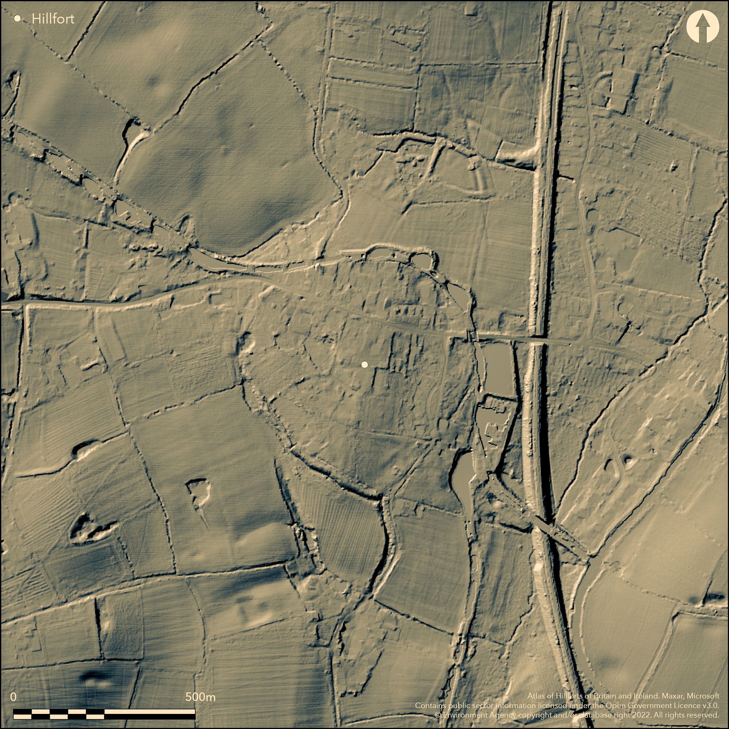
LiDAR 1m DTM Hillshade
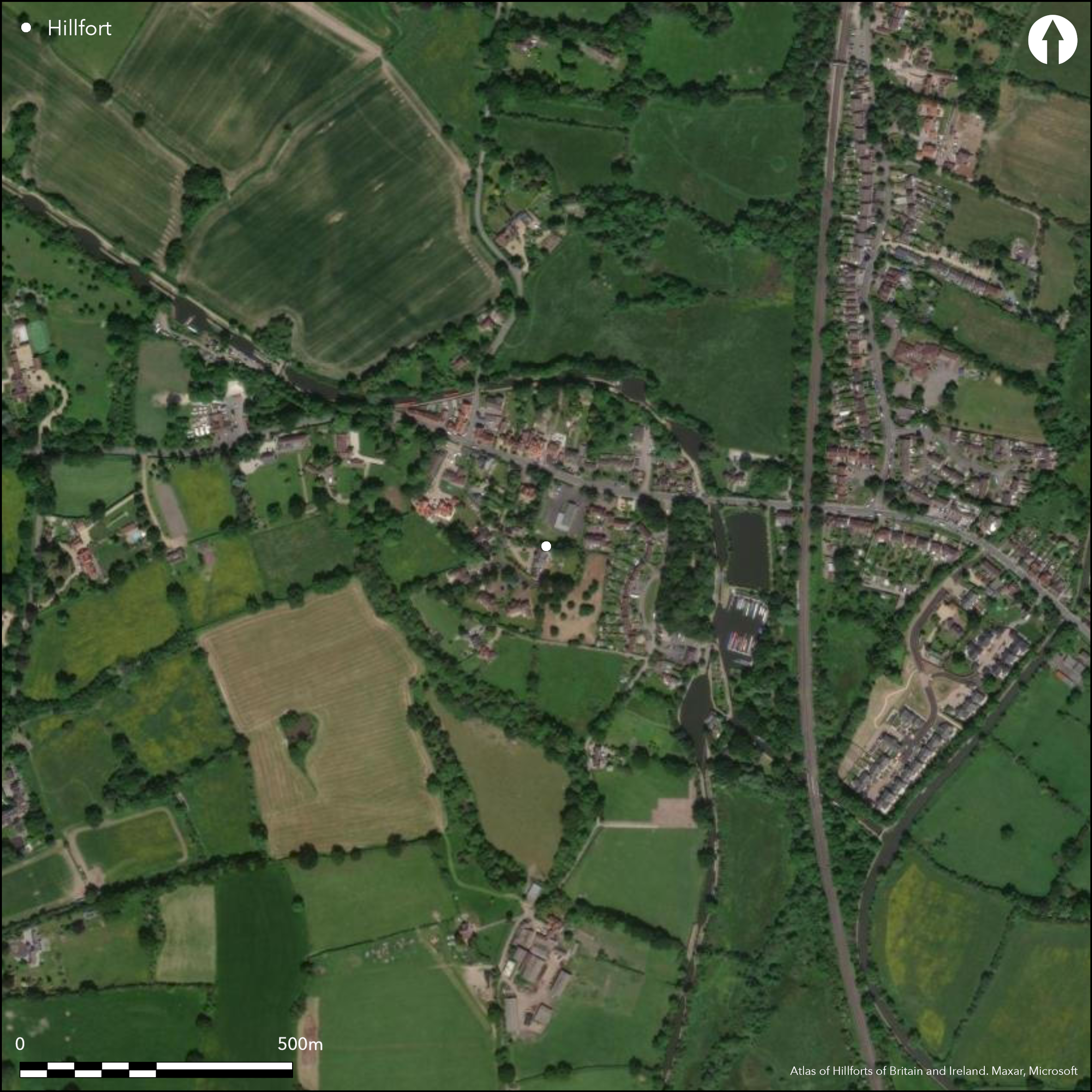
Satellite Imagery
LiDAR 1m DTM Hillshade
Satellite Imagery
Scroll left/right to view further images.
HER: Warwickshire 1694; 13179 (None)
NMR: SP 17 SE 10 (331481)
SM: None
NGR: SP 18453 71033
X: 418453 Y: 271033 (OSGB36)
Lying 300m to the N of Broom Hall Bridge the remains of a possible univallate enclosure in the region of 10.8ha now mostly destroyed. It is sited at 118m OD on the slope of a slight hollow overlooked by higher ground on the W, N and E. It survives as a 300m length of rampart and ditch running NW-SE which a plan of 1860 shows once extended 200m further N. Its course in this area passes through gardens and is barely traceable. In the S a 300m length of rampart along the E and N alignments forms an irregular oval. In the E a slight ridge seen as a scarp slope 0.9m high running through a plantation is possibly the remains of the defences. Today, deciduous woodland and modern housing and associated infrastructure lies within the interior and it is crossed by roads and the Stratford on Avon canal. A great deal of damage has also occurred to the site through historic gravel extraction and the construction of the Stratford on Avon canal which obliterated much of the camp, with a lock constructed across its NE corner and a small reservoir built partly within and outside its ramparts. A watching brief in 2000 (Palmer 2000) produced nothing of significance and monitoring for drainage groundworks (Williams 2001) recorded only a single sherd of unstratified late prehistoric pottery. Evaluation at Mill Lane/Old Warwick Road failed to record any securely dated features associated with the hillfort although a series of possible pits and postholes of unknown date were recorded and gullies which were suggested as possible wheel ruts associated with Old Warwick Road (Kipling 2012). Warwickshire Museums service noted that it was not possible to be certain if it was a valley fort and may be part of the Hobditch linear system (Cracknell and Hingley 1995). The site has been likened to Wappenbury Camp (Atlas No. 3146). Recorded on 1885-1900 OS mapping.
Citizen Science: ✗
Reliability of Data: Confirmed
Reliability of Interpretation: Unconfirmed
X: -192650 Y: 6861298 (EPSG: 3857)
Longitude: -1.7306027940584305 Latitude: 52.33704042816 (EPSG:4326)
Country: England; None
Current County or Unitary Authority: Warwickshire
Historic County: Warwickshire
Current Parish/Community/Council/Townland: Lapworth; Rowington
Destroyed in places
| Extant | ✓ |
| Cropmark | ✗ |
| Likely Destroyed | ✓ |
Marsh shown within the interior on 1888-1913 OS mapping
| Woodland | ✓ |
| Commercial Forestry Plantation | ✓ |
| Parkland | ✓ |
| Pasture (Grazing) | ✗ |
| Arable | ✗ |
| Scrub/Bracken | ✗ |
| Bare Outcrop | ✗ |
| Heather/Moorland | ✗ |
| Heath | ✗ |
| Built-up | ✓ |
| Coastal Grassland | ✗ |
| Other | ✓ |
A possible valley fort sited on an easterly slope lying at between 120-110m OD
| Contour Fort | ✗ |
| Partial Contour Fort | ✗ |
| Promontory Fort | ✗ |
| Hillslope Fort | ✓ |
| Level Terrain Fort | ✗ |
| Marsh Fort | ✗ |
| Multiple Enclosure Fort | ✗ |
| Hilltop | ✗ |
| Coastal Promontory | ✗ |
| Inland Promontory | ✗ |
| Valley Bottom | ✓ |
| Knoll/Hillock/Outcrop | ✗ |
| Ridge | ✗ |
| Cliff/Plateau-edge/Scarp | ✗ |
| Hillslope | ✓ |
| Lowland | ✗ |
| Spur | ✗ |
Dominant Topographic Feature: Hillslope
| North | ✗ |
| Northeast | ✗ |
| East | ✓ |
| Southeast | ✗ |
| South | ✗ |
| Southwest | ✗ |
| West | ✗ |
| Northwest | ✗ |
| Level | ✗ |
Altitude: 118.0m
Parish boundary between Lapworth and Rowington lies to the E
Boundary Type: Parish/Townland
The site is undated. In use during the English Civil War. A cannon ball and remnants of a pistol have been recovered (Thomas 1730).
Reliability: D - None
| Pre 1200BC | ✗ |
| 1200BC - 800BC | ✗ |
| 800BC - 400BC | ✗ |
| 400BC - AD50 | ✗ |
| AD50 - AD400 | ✗ |
| AD400 - AD 800 | ✗ |
| Post AD800 | ✗ |
| Unknown | ✓ |
| Pre Hillfort: | None |
| Post Hillfort: | None |
Recorded on 1885-1900 OS mapping. General reference in Hobley (1894). Field investigations in 1968 and 1976. 2000, archaeological salvage recording during housing development revealed no evidence for the hillfort or finds of archaeological significance. 2001, monitoring for drainage groundworks. Nothing of significance other than a single sherd of unstratified late prehistoric pottery. 2012, evaluation at Mill Lane/Old Warwick Road failed to record any securely dated features associated with the hillfort although a series of possible pits, postholes of unknown date were recorded, and gullies which were suggested as possible wheel ruts associated with Old Warwick Road.
| 1st Identified Written Reference (1894): | None |
| Other (1968): | Field investigation |
| Other (1976): | Field investigation |
| Other (2000): | Watching brief (Palmer 2000) |
| Other (2000): | Field investigation |
| Other (2001): | Watching brief (Williams 2001) |
| Other (2012): | Watching brief (Kipling 2012) |
| 1st Identified Map Depiction (None): | None |
No internal features are recorded and the site is now built up, especially in the NE. Single unstratified later prehistoric pottery sherd recovered
Ponds and streams shown on historic mapping but it is unknown if any of these were contemporary with hillfort, however the presence of marshland suggests water would have been available
| None | ✓ |
| Spring | ✗ |
| Stream | ✗ |
| Pool | ✗ |
| Flush | ✗ |
| Well | ✗ |
| Other | ✗ |
None
| No Known Features | ✓ |
| Round Stone Structures | ✗ |
| Rectangular Stone Structures | ✗ |
| Curvilinear Platforms | ✗ |
| Other Roundhouse Evidence | ✗ |
| Pits | ✗ |
| Quarry Hollows | ✗ |
| Other | ✗ |
None
| No Known Excavation | ✓ |
| Pits | ✗ |
| Postholes | ✗ |
| Roundhouses | ✗ |
| Rectangular Structures | ✗ |
| Roads/Tracks | ✗ |
| Quarry Hollows | ✗ |
| Other | ✗ |
| Nothing Found | ✗ |
None
| No Known Geophysics | ✓ |
| Pits | ✗ |
| Roundhouses | ✗ |
| Rectangular Structures | ✗ |
| Roads/Tracks | ✗ |
| Quarry Hollows | ✗ |
| Other | ✗ |
| Nothing Found | ✗ |
One sherd
| No Known Finds | ✗ |
| Pottery | ✓ |
| Metal | ✗ |
| Metalworking | ✗ |
| Human Bones | ✗ |
| Animal Bones | ✗ |
| Lithics | ✗ |
| Environmental | ✗ |
| Other | ✗ |
None
| APs Not Checked | ✓ |
| None | ✗ |
| Roundhouses | ✗ |
| Rectangular Structures | ✗ |
| Pits | ✗ |
| Postholes | ✗ |
| Roads/Tracks | ✗ |
| Other | ✗ |
The location of entrances is unknown
| None: | None |
| 2: | None |
Guard Chambers: ✗
Chevaux de Frise: ✗
Possible univallate enclosure in the region of 10.8ha now mostly destroyed. It survives as a 300m length of rampart and ditch running NW-SE which a plan of 1860 shows once extended 200m further N. Its course in this area passes through gardens and is barely traceable. In the S a 300m length of rampart along the E and N alignments forms an irregular oval. In the E a slight ridge seen as a scarp slope 0.9m high running through a plantation is possibly the remains of the defences.
| Area 1: | 10.8ha. |
| Total: | 10.8ha. |
Total Footprint Area: Noneha.
None
| ✗ | None |
| ✗ | Now destroyed and intermittent, lost or absent in the NW |
| NE Quadrant: | None |
| SE Quadrant: | 1 |
| SW Quadrant: | None |
| NW Quadrant: | 1 |
| Total: | 1 |
| Partial Univallate | ✓ |
| Univallate | ✗ |
| Partial Bivallate | ✗ |
| Bivallate | ✗ |
| Partial Multivallate | ✗ |
| Multivallate | ✗ |
| Unknown | ✗ |
| Partial Univallate | ✗ |
| Univallate | ✗ |
| Partial Bivallate | ✗ |
| Bivallate | ✗ |
| Partial Multivallate | ✗ |
| Multivallate | ✗ |
None
| None | ✗ |
| Earthen Bank | ✓ |
| Stone Wall | ✗ |
| Rubble | ✗ |
| Wall-walk | ✗ |
| Evidence of Timber | ✗ |
| Vitrification | ✗ |
| Other Burning | ✗ |
| Palisade | ✗ |
| Counter Scarp Bank | ✗ |
| Berm | ✗ |
| Unfinished | ✗ |
| Other | ✗ |
None
| None | ✗ |
| Earthen Bank | ✗ |
| Stone Wall | ✗ |
| Murus Duplex | ✗ |
| Timber-framed | ✗ |
| Timber-laced | ✗ |
| Vitrification | ✗ |
| Other Burning | ✗ |
| Palisade | ✗ |
| Counter Scarp Bank | ✗ |
| Berm | ✗ |
| Unfinished | ✗ |
| No Known Excavation | ✓ |
| Other | ✗ |
| ✗ | None |
| ✓ | None |
Number of Ditches: 1
| ✗ | None |
Cracknell, S. and Hingley, R. 1995. Hobditch linear earthworks: survey and excavation 1987. Trans Birm Warwicks Archaeol Soc 99, 47-56.
Doubleday, H. A. and Page, W. (eds) 1904. Victoria County History, Warwickshire, Vol 1. 384-6.
Hannett, J. 1894. The Forest of Arden: Its towns, villages and hamlets. Birmingham Charles Lowe.
Hingley, R. 1988. Lapworth, possible Iron Age valley fort at Harborough Banks. West Midlands Archaeol, 31, 37-9.
Kipling, R. 2012. An Archaeological Evaluation At Mill Lane/Old Warwick Road, Lapworth, Warwickshire
Palmer, S.C. 2000. Archaeological Observation Adjacent to Bridge Cottage, Old Warwick Road, Lapworth, Warwickshire (Report 0015) Post-determination/Research. Warwickshire Museum Field Services
Thomas, N. 1974. An archaeological gazetteer for Warwickshire: Neolithic to Iron Age. Trans Birm Warwicks Archaeol Soc, 86, 16-48.
Williams, J. 2001. Harborough Banks, Lapworth, Warwickshire: archaeological watching brief/Report No 01015. Cotswold Archaeological Trust [archaeological evaluation reports]. Unpublished
Atlas of Hillforts:
Wikidata:
This work is licensed under CC BY-SA 4.0

 and should be cited as:
Lock, Gary and Ralston, Ian. 2024. Atlas of Hillforts of Britain and Ireland. Available at: https://hillforts.arch.ox.ac.uk
Document Version 1.1