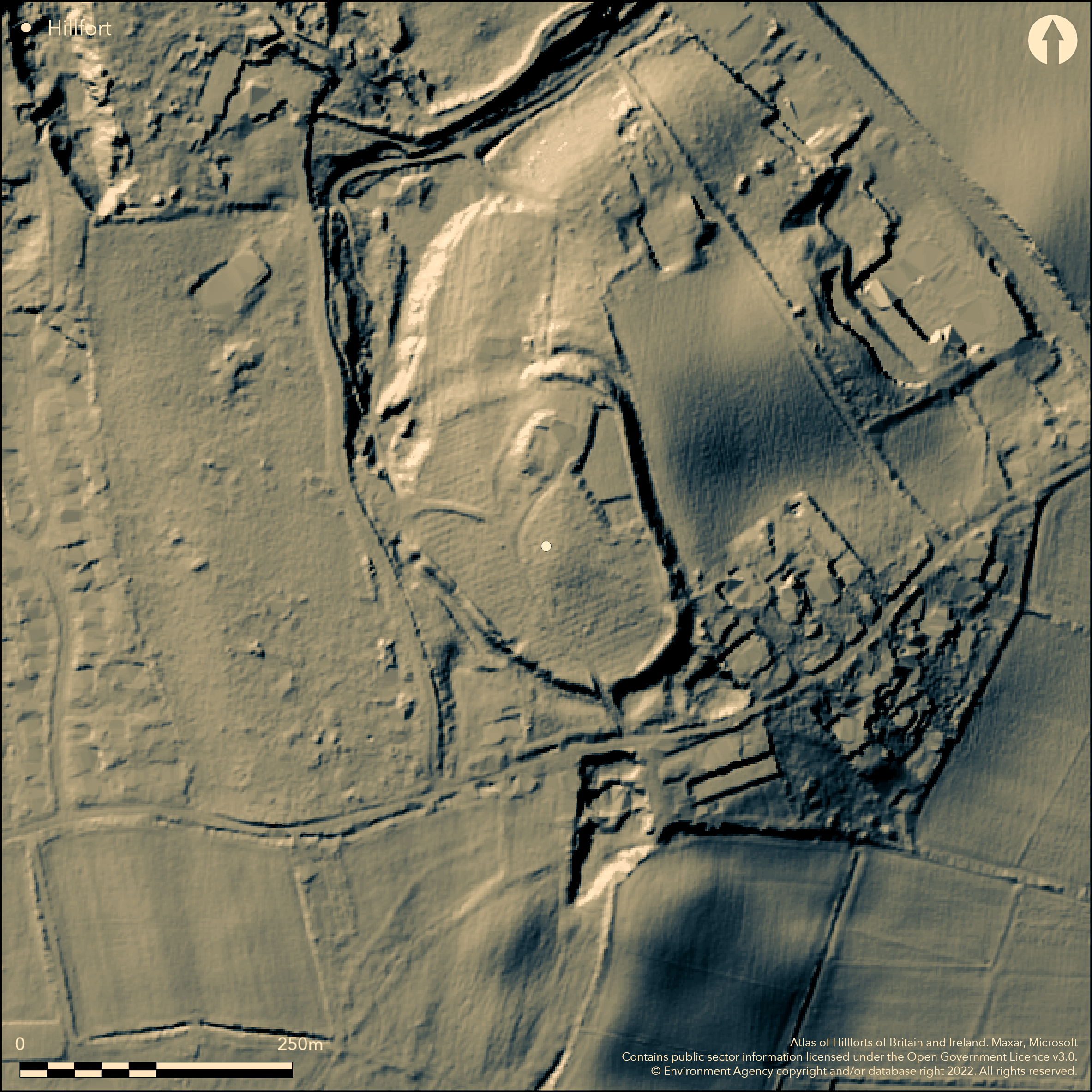
LiDAR 1m DTM Hillshade
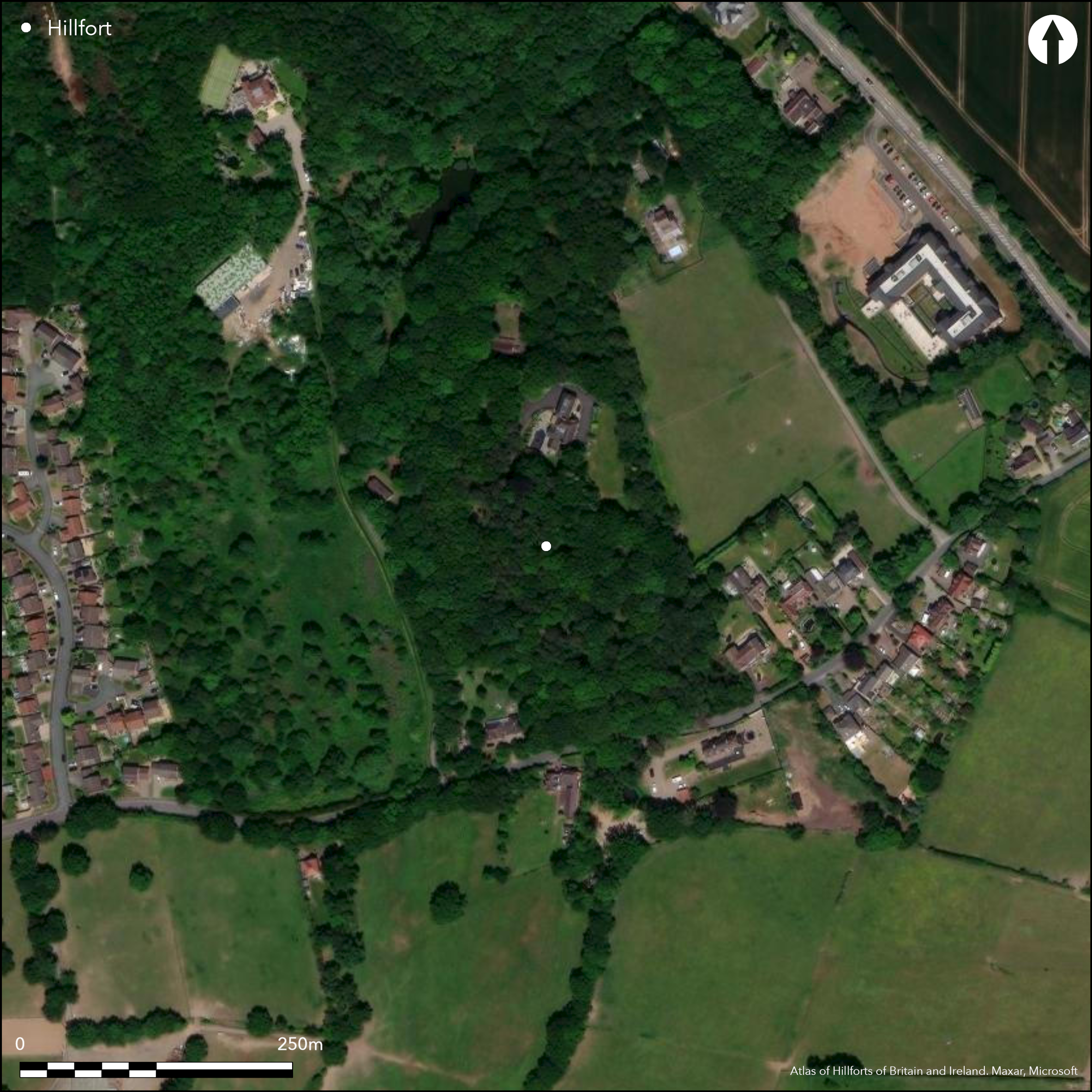
Satellite Imagery
LiDAR 1m DTM Hillshade
Satellite Imagery
Scroll left/right to view further images.
HER: Wolverhampton and Walsall 2661 (None)
NMR: SK 00 SE 1 (304477)
SM: 1017244
NGR: SK 06199 03269
X: 406199 Y: 303269 (OSGB36)
Lying to the NW of Castle HIll Road, within the woodland of Castlebank Plantation, a slight univallate hillfort of 1.5ha. It lies at 189m OD on the SE end of a north sloping ridge where the land falls away in all directions, particularly in the E. The enclosure is oval in form measuring 170m N-S by 140 transversely with a bank constructed of earth and river cobbles, standing between 1-2m high and 8m wide where best preserved, and an external ditch 1-2m wide and 4m deep. A counterscarp lies externally to the ditch. Traces of a further ditch have been recorded on the NE and SE sides which suggest a further bank once existed. An in-turned entrance, approached by a track, lies in the SE. This was closed when Castle Fort House was constructed within the interior. The 17th century scholar Robert Plot noted the existence of an entrance in the NW which has since been destroyed by quarrying (Plot 1686). He also made reference to a second ditch. A further breach in the W is probably not original. In addition to the house and further buildings, narrow ridge and furrow ploughing has been recorded across the interior and overlying the rampart in the W. Ploughing has also damaged the ramparts in the N, sharpened the inner scarp face in the E, and quarrying has greatly damaged the ramparts in the NW and SE. Watching briefs and small scale excavations within the interior, carried out by Birmingham University Field Archaeology Unit ahead of building work failed to find anything of archaeological interest, however, the discovery of flint arrowheads, Roman pottery, and coins of Otho, Domitian and Nero were noted by Willmore(1887). Recorded on 1885-1900 OS mapping. Undated.
Citizen Science: ✗
Reliability of Data: Confirmed
Reliability of Interpretation: Confirmed
X: -212605 Y: 6914321 (EPSG: 3857)
Longitude: -1.909862590863075 Latitude: 52.6271194241337 (EPSG:4326)
Country: England
Current County or Unitary Authority: Walsall
Historic County: Staffordshire
Current Parish/Community/Council/Townland: Walsall
Damaged has occurred through ploughing and quarrying
| Extant | ✓ |
| Cropmark | ✗ |
| Likely Destroyed | ✗ |
None
| Woodland | ✗ |
| Commercial Forestry Plantation | ✓ |
| Parkland | ✗ |
| Pasture (Grazing) | ✗ |
| Arable | ✗ |
| Scrub/Bracken | ✗ |
| Bare Outcrop | ✗ |
| Heather/Moorland | ✗ |
| Heath | ✗ |
| Built-up | ✗ |
| Coastal Grassland | ✗ |
| Other | ✗ |
A hillslope fort lying at 189m OD on the SE end of a N sloping ridge where the land falls away in all directions, particularly in the E.
| Contour Fort | ✗ |
| Partial Contour Fort | ✗ |
| Promontory Fort | ✗ |
| Hillslope Fort | ✓ |
| Level Terrain Fort | ✗ |
| Marsh Fort | ✗ |
| Multiple Enclosure Fort | ✗ |
| Hilltop | ✗ |
| Coastal Promontory | ✗ |
| Inland Promontory | ✗ |
| Valley Bottom | ✗ |
| Knoll/Hillock/Outcrop | ✗ |
| Ridge | ✓ |
| Cliff/Plateau-edge/Scarp | ✗ |
| Hillslope | ✓ |
| Lowland | ✗ |
| Spur | ✗ |
Dominant Topographic Feature: Ridge
| North | ✗ |
| Northeast | ✗ |
| East | ✓ |
| Southeast | ✗ |
| South | ✗ |
| Southwest | ✗ |
| West | ✗ |
| Northwest | ✗ |
| Level | ✗ |
Altitude: 189.0m
N/A
Reliability: D - None
| Pre 1200BC | ✗ |
| 1200BC - 800BC | ✗ |
| 800BC - 400BC | ✗ |
| 400BC - AD50 | ✗ |
| AD50 - AD400 | ✗ |
| AD400 - AD 800 | ✗ |
| Post AD800 | ✗ |
| Unknown | ✓ |
| Pre Hillfort: | None |
| Post Hillfort: | Finds of Roman pottery and coins. Half-timbered house, modern house, barns, swimming pool and garages lie within the interior |
Recorded in Plot (1686) and on 1885-1900 OS mapping. Scheduled 1958; Field investigations in 1958, 1974 and 1976. 1987 RCHME measured survey, ref. no. 909530, as part of the Staffordshire Hillforts Project; 1991 Watching Brief and excavations ahead of development; 1996, 1998 and 2001 watching brief. Recorded on Environment Agency lidar in 2014
| 1st Identified Written Reference (1686): | None |
| Other (1958): | Scheduled |
| Other (1958): | Field investigation |
| Other (1974): | Field investigation |
| Other (1976): | Field investigation |
| Earthwork Survey (1987): | Staffordshire Hillforts Project |
| Excavation (1991): | None |
| 1st Identified Map Depiction (None): | None |
| Other (None): | Watching Brief |
No contemporary features are recorded. The interior is now occupied by a house and several buildings. Flint arrowheads, Roman pottery, and coins of Otho, Domitian and Nero were noted by Willmore (1887).
None
| None | ✓ |
| Spring | ✗ |
| Stream | ✗ |
| Pool | ✗ |
| Flush | ✗ |
| Well | ✗ |
| Other | ✗ |
None
| No Known Features | ✓ |
| Round Stone Structures | ✗ |
| Rectangular Stone Structures | ✗ |
| Curvilinear Platforms | ✗ |
| Other Roundhouse Evidence | ✗ |
| Pits | ✗ |
| Quarry Hollows | ✗ |
| Other | ✗ |
None
| No Known Excavation | ✗ |
| Pits | ✗ |
| Postholes | ✗ |
| Roundhouses | ✗ |
| Rectangular Structures | ✗ |
| Roads/Tracks | ✗ |
| Quarry Hollows | ✗ |
| Other | ✗ |
| Nothing Found | ✓ |
None
| No Known Geophysics | ✓ |
| Pits | ✗ |
| Roundhouses | ✗ |
| Rectangular Structures | ✗ |
| Roads/Tracks | ✗ |
| Quarry Hollows | ✗ |
| Other | ✗ |
| Nothing Found | ✗ |
Coins
| No Known Finds | ✗ |
| Pottery | ✓ |
| Metal | ✗ |
| Metalworking | ✗ |
| Human Bones | ✗ |
| Animal Bones | ✗ |
| Lithics | ✓ |
| Environmental | ✗ |
| Other | ✓ |
Woodland
| APs Not Checked | ✓ |
| None | ✗ |
| Roundhouses | ✗ |
| Rectangular Structures | ✗ |
| Pits | ✗ |
| Postholes | ✗ |
| Roads/Tracks | ✗ |
| Other | ✗ |
In-turned entrance approached by a track in the SE. This was closed when Castle Fort House was constructed within the interior. The 17th century scholar Robert Plot noted the existence of an entrance in the NW which has since been destroyed by quarrying (Plot 1686). A further breach in the W is probably not original.
| 3: | None |
| 2: | None |
Guard Chambers: ✗
Chevaux de Frise: ✗
| 1. In-turned (South east): | None |
| 2. Simple Gap (North west): | None |
Oval in form measuring 170m N-S by 140 transversely with a bank constructed of earth and river cobbles, standing between 1-2m high and 8m wide where best preserved, and an external ditch 1-2m wide and 4m deep. A counterscarp lies externally to the ditch. Traces of a further ditch have been recorded on the NE and SE sides which suggest a further bank once existed.
| Area 1: | 1.5ha. |
| Total: | 1.5ha. |
Total Footprint Area: Noneha.
None
| ✗ | None |
| ✓ | Now destroyed in places. Traces of a further ditch recorded on the NE and SE sides suggests a further bank once existed |
| NE Quadrant: | 2 |
| SE Quadrant: | 2 |
| SW Quadrant: | 1 |
| NW Quadrant: | 1 |
| Total: | 2 |
| Partial Univallate | ✓ |
| Univallate | ✗ |
| Partial Bivallate | ✓ |
| Bivallate | ✗ |
| Partial Multivallate | ✗ |
| Multivallate | ✗ |
| Unknown | ✗ |
| Partial Univallate | ✗ |
| Univallate | ✗ |
| Partial Bivallate | ✗ |
| Bivallate | ✗ |
| Partial Multivallate | ✗ |
| Multivallate | ✗ |
Earth and river cobbles
| None | ✗ |
| Earthen Bank | ✓ |
| Stone Wall | ✗ |
| Rubble | ✗ |
| Wall-walk | ✗ |
| Evidence of Timber | ✗ |
| Vitrification | ✗ |
| Other Burning | ✗ |
| Palisade | ✗ |
| Counter Scarp Bank | ✓ |
| Berm | ✗ |
| Unfinished | ✗ |
| Other | ✓ |
Interior only investigated
| None | ✗ |
| Earthen Bank | ✗ |
| Stone Wall | ✗ |
| Murus Duplex | ✗ |
| Timber-framed | ✗ |
| Timber-laced | ✗ |
| Vitrification | ✗ |
| Other Burning | ✗ |
| Palisade | ✗ |
| Counter Scarp Bank | ✗ |
| Berm | ✗ |
| Unfinished | ✗ |
| No Known Excavation | ✓ |
| Other | ✗ |
| ✗ | None |
| ✓ | None |
Number of Ditches: 2
| ✗ | None |
Cocroft, W., Jecock, M and Johnston, D. 1988, Staffordshire Hillforts Project. RCHME. Unpublished
Hughes, E. 1991. An Archaeological Evaluation at Castle Old Fort, Stonnall, Walsall, 1991. Birmingham University Field Archaeology Unit. Unpublished
Hughes, E. 1991. An Excavation & Watching Brief at Castle Old Fort, Stonnall, Walsall, 1991, (report no. 175). Birmingham University Field Archaeology Unit. Unpublished
Hughes, E. 1991. An Excavation & Watching Brief at Castle Old Fort, Stonnall, Walsall, 1991, (report no. 150). Birmingham University Field Archaeology Unit. Unpublished
Linnane, S. J. 1998. Castle Old Fort, Stonnall, Walsall: an archaeological watching brief, June 1998. Birmingham University Field Archaeology Unit, Unpublished
Macey, E. 2001. Castle Old Fort, Stonnall. Birmingham University Field Archaeology Unit
Moscrop D. 1996. Castle Old Fort, Stonnall, Walsall. An archaeological watching brief, March 1996. Birmingham University Field Archaeology Unit. Unpublished
Plot, R. 1686. Natural History of Staffordshire.
Willmore, F. W. 1887. A history of Walsall and its neighbourhood. 11.
Atlas of Hillforts:
Wikidata:
This work is licensed under CC BY-SA 4.0

 and should be cited as:
Lock, Gary and Ralston, Ian. 2024. Atlas of Hillforts of Britain and Ireland. Available at: https://hillforts.arch.ox.ac.uk
Document Version 1.1