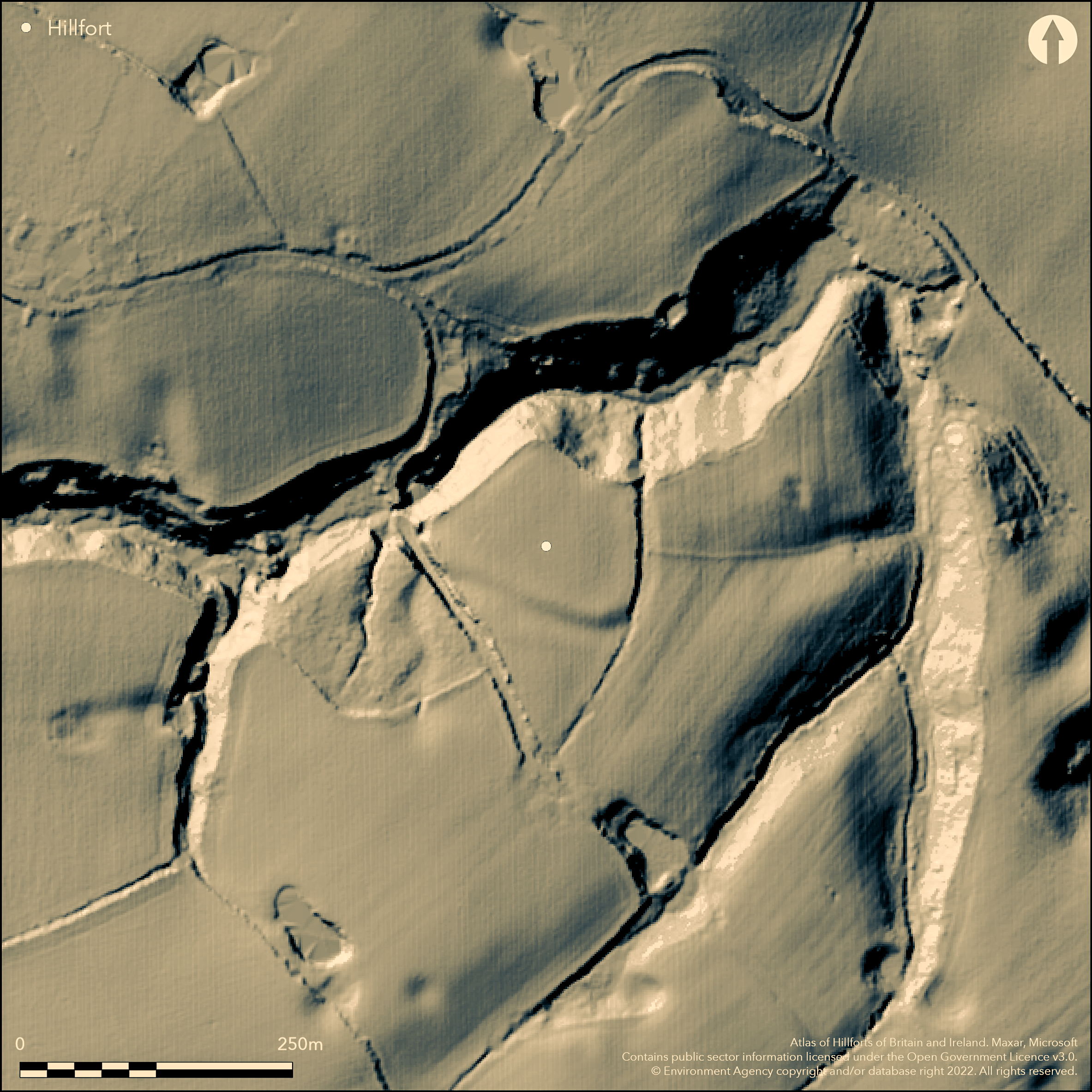
LiDAR 1m DTM Hillshade
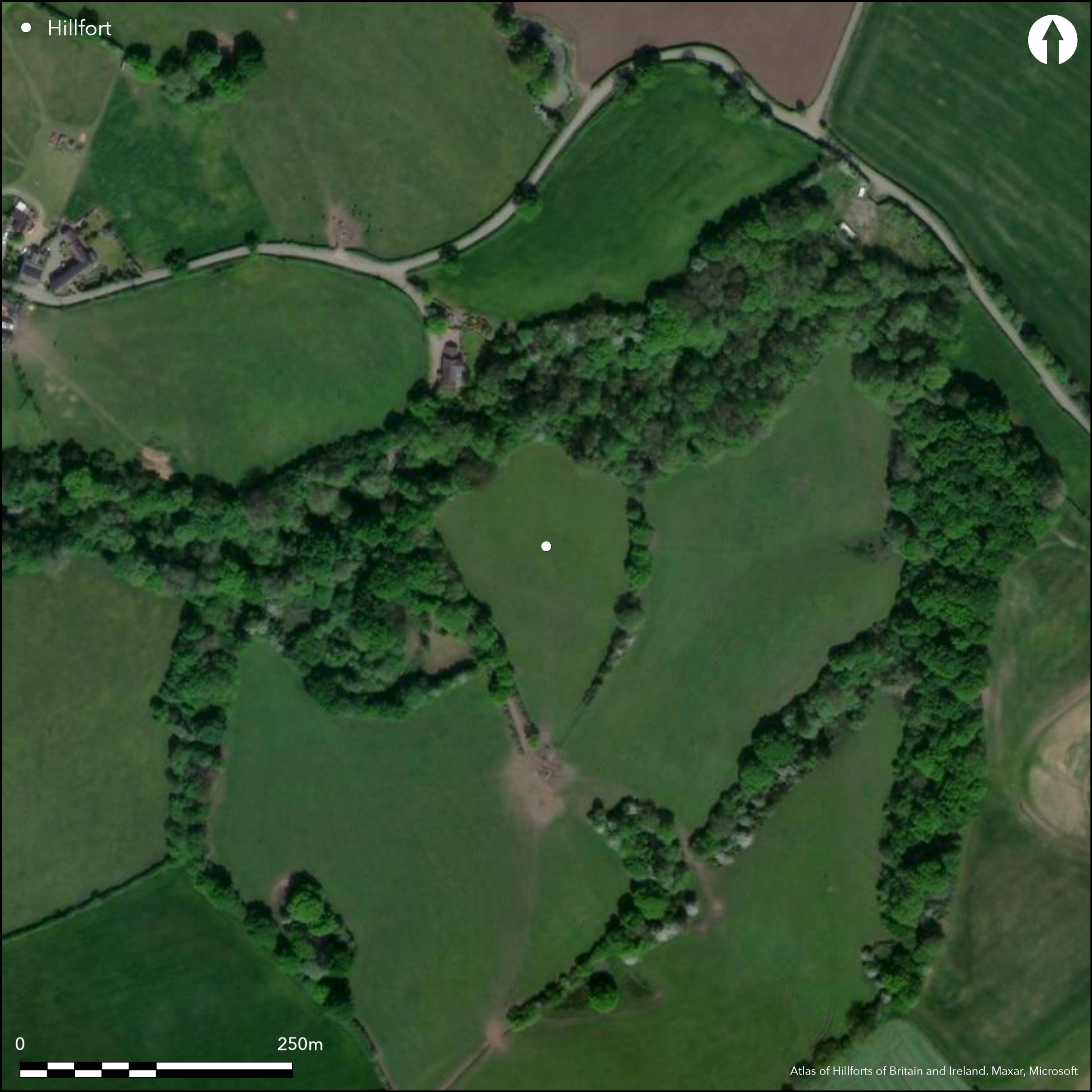
Satellite Imagery
LiDAR 1m DTM Hillshade
Satellite Imagery
Scroll left/right to view further images.
HER: Cheshire MCH8235 (971/1)
NMR: SJ 57 NW 6 (71532)
SM: 1013296
NGR: SJ53947679
X: 353943 Y: 376794 (OSGB36)
Small, univallate, inland promontory fort located on low-lying NNE-facing spur of the Triassic sandstone mid-Cheshire Ridge, overlooking the floodplain of the River Weaver, 750m to E, and within the south Mersey Basin. The Beechbrook, a tributary of the Weaver, forms the N limit of fort as a steep 15m high craggy scarp. Views across Mersey Estuary. Higher ground to E. Much ploughed-down curving bank (probably of earth) and ditch cut off the promontory SE-SW running for c. 100m and ill-defined spread to 25m; best preserved E section c. 30 long, c. 20m wide but only c. 0.5m high. Possible counterscarp bank. Enclosing 0.61ha. Possible inturned entrance on SE. To W of site hollow way runs down to brook and this could indicate entrance on NW. Geophysical survey 2011 by Engineering Archaeological Services showed occupation anomalies. Suggested by Garner (2012, 42) as possibly having origins in late Bronze Age. Brine springs in locality. Interior improved pasture, but arable recorded. To N protected ancient woodland. On 1st Ed. OS map (1874-79).
Citizen Science: ✗
Reliability of Data: Confirmed
Reliability of Interpretation: Confirmed
X: -299709 Y: 7036093 (EPSG: 3857)
Longitude: -2.6923284922006516 Latitude: 53.28609108874989 (EPSG:4326)
Country: England
Current County or Unitary Authority: Cheshire West and Chester
Historic County: Cheshire
Current Parish/Community/Council/Townland: Kingsley
Badly ploughed and disturbed by later field boundaries, but traces of bank and ditch still visible in field. N defence a SSSI.
| Extant | ✓ |
| Cropmark | ✗ |
| Likely Destroyed | ✗ |
Interior improved pasture, but arable recorded. To N protected ancient woodland. Wooded surrounds to N and W.
| Woodland | ✓ |
| Commercial Forestry Plantation | ✗ |
| Parkland | ✗ |
| Pasture (Grazing) | ✓ |
| Arable | ✓ |
| Scrub/Bracken | ✗ |
| Bare Outcrop | ✗ |
| Heather/Moorland | ✗ |
| Heath | ✗ |
| Built-up | ✗ |
| Coastal Grassland | ✗ |
| Other | ✗ |
Small, univallate, inland promontory fort located on low-lying NNE-facing spur of the Triassic sandstone mid-Cheshire Ridge, overlooking the floodplain of the River Weaver, 750m to E, and within the south Mersey Basin. The Beechbrook, a tributary of the Weaver, forms the N defence of fort as a steep 15m high craggy scarp.
| Contour Fort | ✗ |
| Partial Contour Fort | ✗ |
| Promontory Fort | ✓ |
| Hillslope Fort | ✗ |
| Level Terrain Fort | ✗ |
| Marsh Fort | ✗ |
| Multiple Enclosure Fort | ✗ |
| Hilltop | ✗ |
| Coastal Promontory | ✗ |
| Inland Promontory | ✓ |
| Valley Bottom | ✗ |
| Knoll/Hillock/Outcrop | ✗ |
| Ridge | ✗ |
| Cliff/Plateau-edge/Scarp | ✗ |
| Hillslope | ✗ |
| Lowland | ✗ |
| Spur | ✓ |
Dominant Topographic Feature: Sandstone spur.
| North | ✓ |
| Northeast | ✗ |
| East | ✗ |
| Southeast | ✗ |
| South | ✗ |
| Southwest | ✗ |
| West | ✗ |
| Northwest | ✗ |
| Level | ✗ |
Altitude: 45.0m
N/A
Suggested by Garner (2012, 42) as possibly having origins in late Bronze Age.
Reliability: C - Low
| Pre 1200BC | ✗ |
| 1200BC - 800BC | ✗ |
| 800BC - 400BC | ✓ |
| 400BC - AD50 | ✓ |
| AD50 - AD400 | ✗ |
| AD400 - AD 800 | ✗ |
| Post AD800 | ✗ |
| Unknown | ✗ |
| Pre Hillfort: | None |
| Post Hillfort: | None |
| Morphology/Earthwork/Typology: | None |
First recorded on 1843 OS map. On 1st Ed. OS 1:2500 map (18874-79). Field evaluation by Ferguson et al 1977. LiDAR survey covering mid-Cheshire Ridge for Habitats and Hilforts Landscape Partnership Scheme (Bradley not part of scheme). Investigation and desk survey, A.H.C. Bray 2011. Geophysical survey I.P Brooks, Engineering Archaeological Services with A.H.C. Bray, University of Leicester.
| 1st Identified Map Depiction (1843): | OS map. |
| Other (1977): | Field evaluation Ferguson et al. |
| LiDAR Survey (2010): | LiDAR survey covering mid-Cheshire Ridge for Habitats and Hilforts Landscape Partnership Scheme. |
| Geophysical Survey (2011): | I.P Brooks, Engineering Archaeological Services with A.H.C. Bray, University of Leicester. |
| Other (2011): | Investigation and desk survey, A.H.C. Bray, University of Leicester. |
| Other (None): | OS 1:2500 map. |
Possible occupation anomalies. Possible hearth or fire pit. Possible stock enclosure, all by geophysics.
None
| None | ✓ |
| Spring | ✗ |
| Stream | ✗ |
| Pool | ✗ |
| Flush | ✗ |
| Well | ✗ |
| Other | ✗ |
None
| No Known Features | ✓ |
| Round Stone Structures | ✗ |
| Rectangular Stone Structures | ✗ |
| Curvilinear Platforms | ✗ |
| Other Roundhouse Evidence | ✗ |
| Pits | ✗ |
| Quarry Hollows | ✗ |
| Other | ✗ |
None
| No Known Excavation | ✓ |
| Pits | ✗ |
| Postholes | ✗ |
| Roundhouses | ✗ |
| Rectangular Structures | ✗ |
| Roads/Tracks | ✗ |
| Quarry Hollows | ✗ |
| Other | ✗ |
| Nothing Found | ✗ |
Possible occupation anomalies. Possible hearth or cooking/fire pit. Possible stock enclosure.
| No Known Geophysics | ✗ |
| Pits | ✓ |
| Roundhouses | ✗ |
| Rectangular Structures | ✗ |
| Roads/Tracks | ✗ |
| Quarry Hollows | ✗ |
| Other | ✓ |
| Nothing Found | ✗ |
None
| No Known Finds | ✓ |
| Pottery | ✗ |
| Metal | ✗ |
| Metalworking | ✗ |
| Human Bones | ✗ |
| Animal Bones | ✗ |
| Lithics | ✗ |
| Environmental | ✗ |
| Other | ✗ |
None
| APs Not Checked | ✓ |
| None | ✗ |
| Roundhouses | ✗ |
| Rectangular Structures | ✗ |
| Pits | ✗ |
| Postholes | ✗ |
| Roads/Tracks | ✗ |
| Other | ✗ |
Possible inturned entrance on SE. To W of site hollow way runs down to brook and this could indicate entrance on NW.
| 2: | Interpretation only. |
| 2: | Possibly two entrances. |
Guard Chambers: ✗
Chevaux de Frise: ✗
| 1. In-turned (South east): | None |
| 2. Simple Gap (North west): | Conjecture only. |
Much ploughed-down curving bank (probably of earth) and ditch cut off the promontory SE-SW running for c. 100m and ill-defined spread to 25m; best preserved E section c. 30 long, c. 20m wide but only c. 0.5m high. Possible counterscarp.
| Area 1: | 0.61ha. |
| Total: | 0.61ha. |
Total Footprint Area: 0.81ha.
None
| ✓ | Possible phased construction picked up by geophysics. |
| ✗ | None |
| NE Quadrant: | 0 |
| SE Quadrant: | 1 |
| SW Quadrant: | 1 |
| NW Quadrant: | 0 |
| Total: | 1 |
| Partial Univallate | ✓ |
| Univallate | ✗ |
| Partial Bivallate | ✗ |
| Bivallate | ✗ |
| Partial Multivallate | ✗ |
| Multivallate | ✗ |
| Unknown | ✗ |
| Partial Univallate | ✗ |
| Univallate | ✗ |
| Partial Bivallate | ✗ |
| Bivallate | ✗ |
| Partial Multivallate | ✗ |
| Multivallate | ✗ |
Probable dump earthen bank of glacis form. Possible counterscarp. Possible palisade suggested by geophysics.
| None | ✗ |
| Earthen Bank | ✓ |
| Stone Wall | ✗ |
| Rubble | ✗ |
| Wall-walk | ✗ |
| Evidence of Timber | ✗ |
| Vitrification | ✗ |
| Other Burning | ✗ |
| Palisade | ✓ |
| Counter Scarp Bank | ✓ |
| Berm | ✗ |
| Unfinished | ✗ |
| Other | ✗ |
None
| None | ✗ |
| Earthen Bank | ✗ |
| Stone Wall | ✗ |
| Murus Duplex | ✗ |
| Timber-framed | ✗ |
| Timber-laced | ✗ |
| Vitrification | ✗ |
| Other Burning | ✗ |
| Palisade | ✗ |
| Counter Scarp Bank | ✗ |
| Berm | ✗ |
| Unfinished | ✗ |
| No Known Excavation | ✓ |
| Other | ✗ |
| ✗ | None |
| ✓ | None |
Number of Ditches: 1
| ✗ | None |
Bray, A.H.C. 2012. An evaluation of the archaeology of Bradley Promontory Fort, Cheshire, Unpublished BA Dissertation, University of Leicester.
Brooks, I.P. Bradley Promontory Fort geophysical survey, EAS Client Report 2011/17, Blaenau Ffestiniog: Engineering Archaeological Services.
Ferguson, A., Longley, D., Brown, R. and Drinkwater, L 1978. Bradley promontory fort above Beechbrook., Unpublished field notes.
Garner, D. 2012. Hillforts of the Cheshire Sandstone Ridge, Monograph, Habitats and Hillforts Landscape Partnership Scheme, Chester: Cheshire West and Chester Council.
Longley, D.M. 1987. Prehistory, In eds B.E. Harris and A.T. Thacker, The Victoria History of the County of Chester, Vol 1, Oxford: Oxford University Press.
Morgan, V. and Morgan, P. 2004, Prehistoric Cheshire, Landmark Collector's Library, Ashbourne: Landmark Publishing.
Atlas of Hillforts:
Wikidata:
This work is licensed under CC BY-SA 4.0

 and should be cited as:
Lock, Gary and Ralston, Ian. 2024. Atlas of Hillforts of Britain and Ireland. Available at: https://hillforts.arch.ox.ac.uk
Document Version 1.1