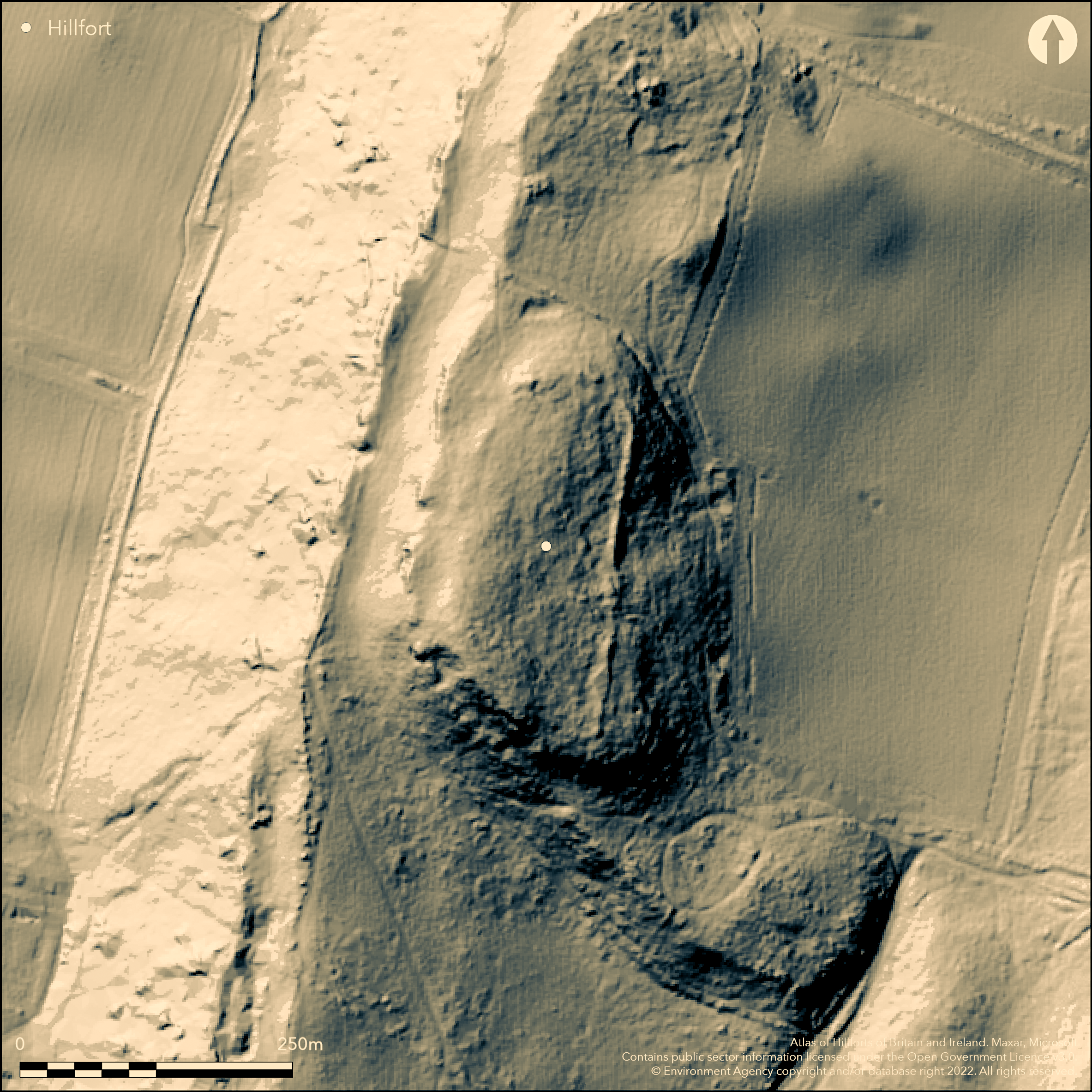
LiDAR 1m DTM Hillshade
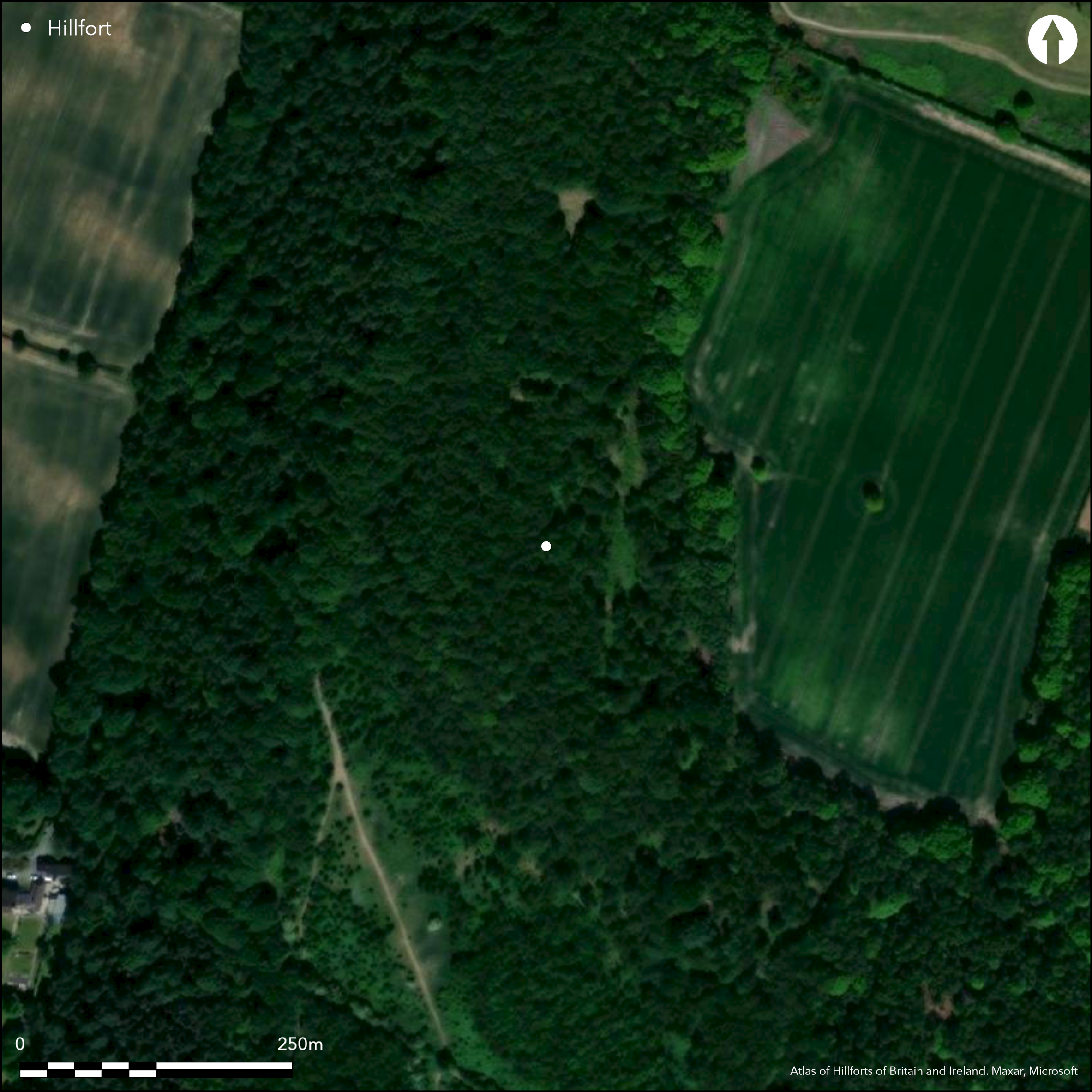
Satellite Imagery
LiDAR 1m DTM Hillshade
Satellite Imagery
Scroll left/right to view further images.
HER: Cheshire MCH8405 (970/1)
NMR: SJ 57 NW (71527)
SM: 1013297
NGR: SJ51077573
X: 351070 Y: 375730 (OSGB36)
Strategically situated, univallate, partial contour hillfort located at N end of Mid-Cheshire Ridge on the crest of the prominent sandstone ridge of Woodhouse Hill overlooking the River Mersey Estuary and coastal plain to NW and confluence of the River Mersey and River Weaver to N. and adjacent to Helsby Hill Camp (Atlas No. 3184) 2km to SW. Precipitous on W quadrants, moderate slopes elsewhere. Roughly rhomboidal in shape, with internal area c. 1.6ha. Full use is made of the natural topography to S and W, but this is strengthened by traces of bank. Discontinuous, but well-defined, rampart on N and E stands to 0.5m-2m high, with no outer ditch visible. Small excavations by T.G.E. Powell and G. Webster in 1949 and 1951 showed bank originally 3m high and 4m wide at the base and revetted on each side with dry stone walling. On NW slight inturning of sides of a gap possibly original entrance. Has been considered unfinished, but not proven. Investigated under the local authority and partners Habitats and Hillforts Landscape Partnership Scheme 2007-2011, with small training excavation 2009 showing rampart construction and possible inhumation burial in interior near rampart. OSL dating showed dates of 891 BC +/- 210 years suggesting late Bronze Age origin for rampart stone retaining wall. Survives well despite dense woodland, bracken and scrub and visitor erosion. On 1st Ed. OS map (1873).
Citizen Science: ✗
Reliability of Data: Confirmed
Reliability of Interpretation: Confirmed
X: -304487 Y: 7034265 (EPSG: 3857)
Longitude: -2.7352559496112807 Latitude: 53.27626973215991 (EPSG:4326)
Country: England
Current County or Unitary Authority: Cheshire West and Chester
Historic County: Cheshire
Current Parish/Community/Council/Townland: Frodsham
Survives well despite dense woodland, bracken and scrub and visitor erosion.
| Extant | ✓ |
| Cropmark | ✗ |
| Likely Destroyed | ✗ |
Dense woodland, bracken and scrub.
| Woodland | ✓ |
| Commercial Forestry Plantation | ✗ |
| Parkland | ✗ |
| Pasture (Grazing) | ✗ |
| Arable | ✗ |
| Scrub/Bracken | ✓ |
| Bare Outcrop | ✗ |
| Heather/Moorland | ✗ |
| Heath | ✗ |
| Built-up | ✗ |
| Coastal Grassland | ✗ |
| Other | ✗ |
Partial contour hillfort located on prominent sandstone ridge of Woodhouse Hill overlooking the Mersey Estuary and coastal plain to W and adjacent to Helsby Hill Camp (Atlas No. 3184) 2km to SW. Precipitous on W quadrants, moderate slopes elsewhere. Site cuts across the contours to SSW.
| Contour Fort | ✗ |
| Partial Contour Fort | ✓ |
| Promontory Fort | ✗ |
| Hillslope Fort | ✗ |
| Level Terrain Fort | ✗ |
| Marsh Fort | ✗ |
| Multiple Enclosure Fort | ✗ |
| Hilltop | ✓ |
| Coastal Promontory | ✗ |
| Inland Promontory | ✗ |
| Valley Bottom | ✗ |
| Knoll/Hillock/Outcrop | ✗ |
| Ridge | ✗ |
| Cliff/Plateau-edge/Scarp | ✗ |
| Hillslope | ✗ |
| Lowland | ✗ |
| Spur | ✗ |
Dominant Topographic Feature: Spur
| North | ✗ |
| Northeast | ✗ |
| East | ✗ |
| Southeast | ✗ |
| South | ✗ |
| Southwest | ✓ |
| West | ✗ |
| Northwest | ✗ |
| Level | ✗ |
Altitude: 137.0m
N/A
OSL dating showed dates of 1101-681 cal BC - 891 BC +/- 210 years suggesting late Bronze Age origin for rampart stone retaining wall.
Reliability: B - Medium
| Pre 1200BC | ✗ |
| 1200BC - 800BC | ✓ |
| 800BC - 400BC | ✓ |
| 400BC - AD50 | ✗ |
| AD50 - AD400 | ✗ |
| AD400 - AD 800 | ✗ |
| Post AD800 | ✗ |
| Unknown | ✗ |
| Pre Hillfort: | None |
| Post Hillfort: | None |
| Other: | OSL |
On 1st Ed. OS map (1873). Small excavations by T.G.E. Powell and G. Webster 1949, 1951. Investigated under the local authorities and partners Habitats and Hillforts Landscape Partnership Scheme 2007-2011, LiDAR. Training excavations by Habitats and Hillforts team and Liverpool University 2009. Measured survey by West Yorkshire Archaeological Service 2009. OSL dating Habitats and Hillforts c 2009.
| 1st Identified Map Depiction (1873): | OS map. |
| Earthwork Survey (2009): | Measured survey by West Yorkshire Archaeological Service. |
| Excavation (2009): | Training excavations by Habitats and Hillforts team and Liverpool University. |
| LiDAR Survey (2009): | None |
| Excavation (None): | T.G.E. Powell and G. Webster. |
| Other (None): | Habitats and Hillforts Landscape Partnership Scheme. |
| Other (None): | OSL dating Habitats and Hillforts Partnership Scheme. |
Quarry pits found by 2009 topographic survey. Possible inhumation burial in interior near rampart. Chance finds of possible slingstones have been reported from area.
None
| None | ✓ |
| Spring | ✗ |
| Stream | ✗ |
| Pool | ✗ |
| Flush | ✗ |
| Well | ✗ |
| Other | ✗ |
Quarry pits found by 2009 topographic survey.
| No Known Features | ✗ |
| Round Stone Structures | ✗ |
| Rectangular Stone Structures | ✗ |
| Curvilinear Platforms | ✗ |
| Other Roundhouse Evidence | ✗ |
| Pits | ✗ |
| Quarry Hollows | ✓ |
| Other | ✗ |
Possible inhumation burial in interior near rampart.
| No Known Excavation | ✗ |
| Pits | ✗ |
| Postholes | ✗ |
| Roundhouses | ✗ |
| Rectangular Structures | ✗ |
| Roads/Tracks | ✗ |
| Quarry Hollows | ✗ |
| Other | ✓ |
| Nothing Found | ✗ |
None
| No Known Geophysics | ✓ |
| Pits | ✗ |
| Roundhouses | ✗ |
| Rectangular Structures | ✗ |
| Roads/Tracks | ✗ |
| Quarry Hollows | ✗ |
| Other | ✗ |
| Nothing Found | ✗ |
Chance finds of possible slingstones have been reported from area (Morgan and Morgan 2004, 145).
| No Known Finds | ✗ |
| Pottery | ✗ |
| Metal | ✗ |
| Metalworking | ✗ |
| Human Bones | ✗ |
| Animal Bones | ✗ |
| Lithics | ✓ |
| Environmental | ✗ |
| Other | ✗ |
None
| APs Not Checked | ✓ |
| None | ✗ |
| Roundhouses | ✗ |
| Rectangular Structures | ✗ |
| Pits | ✗ |
| Postholes | ✗ |
| Roads/Tracks | ✗ |
| Other | ✗ |
On NW slight inturning of sides of a gap possibly original entrance.
| 1: | None |
| 2: | None |
Guard Chambers: ✗
Chevaux de Frise: ✗
| 1. In-turned (North west): | None |
Full use is made of the natural topography to S and W, but this is strengthened by traces of bank. Discontinuous, but well-defined, rampart on N and E stands to 0.5m-2m high, with no outer ditch visible. Small excavation in 1949 showed bank originally 3m high and 4m wide at the base and revetted on each side with dry stone walling. Excavation 2009 showed rampart composed of sandstone and sand with two basal courses of stone retaning wall on outer face. No trace of ditch.
| Area 1: | 1.6ha. |
| Total: | 1.6ha. |
Total Footprint Area: Noneha.
None
| ✗ | None |
| ✓ | Only traces of bank on S and W. |
| NE Quadrant: | 1 |
| SE Quadrant: | 1 |
| SW Quadrant: | 1 |
| NW Quadrant: | 1 |
| Total: | 1 |
| Partial Univallate | ✗ |
| Univallate | ✓ |
| Partial Bivallate | ✗ |
| Bivallate | ✗ |
| Partial Multivallate | ✗ |
| Multivallate | ✗ |
| Unknown | ✗ |
| Partial Univallate | ✗ |
| Univallate | ✗ |
| Partial Bivallate | ✗ |
| Bivallate | ✗ |
| Partial Multivallate | ✗ |
| Multivallate | ✗ |
Has been considered unfinished, but not proven.
| None | ✗ |
| Earthen Bank | ✓ |
| Stone Wall | ✗ |
| Rubble | ✗ |
| Wall-walk | ✗ |
| Evidence of Timber | ✗ |
| Vitrification | ✗ |
| Other Burning | ✗ |
| Palisade | ✗ |
| Counter Scarp Bank | ✗ |
| Berm | ✗ |
| Unfinished | ✓ |
| Other | ✗ |
Small excavation in 1949 showed bank originally 3m high and 4m wide at the base and revetted on each side with dry-stone walling. Excavation 2009 showed rampart composed of sandstone and sand with two basal courses of stone retaning wall on outer face.
| None | ✗ |
| Earthen Bank | ✓ |
| Stone Wall | ✓ |
| Murus Duplex | ✗ |
| Timber-framed | ✗ |
| Timber-laced | ✗ |
| Vitrification | ✗ |
| Other Burning | ✗ |
| Palisade | ✗ |
| Counter Scarp Bank | ✗ |
| Berm | ✗ |
| Unfinished | ✗ |
| No Known Excavation | ✗ |
| Other | ✗ |
| ✗ | None |
| ✗ | No trace of ditch. |
Number of Ditches: 0
| ✗ | None |
Garner, D. 2012. Hillforts of the Cheshire Sandstone Ridge, Monograph, Habitats and Hillforts Landscape Partnership Scheme, Chester: Cheshire West and Chester Council.
Garner, D. 2014. Helsby Hill to Maiden Castle: Prehistoric forts of the Cheshire Ridge, In ed. Saunders, T., Hillforts in the North West and Beyond, Archaeological North West: New Series, 3 (2014), Council for British Archaeology North West, 28-41.
Garner, D. 2016. Hillforts of the Cheshire Ridge. Investigations undertaken by the Habitats and Hillforts Landscape Partnership Scheme 2009-2012. Oxford: Archaeopress.
Morgan, V. and Morgan, P. 2004, Prehistoric Cheshire, Landmark Collector's Library, Ashbourne: Landmark Publishing, 145.
Powell, T.G.E. and Webster, G. 1962. Trans Lancashire Cheshire Antiq Soc, 72 (1962) 17-19.
West Yorkshire Archaeological Sevice 2009. Woodhouse Hill, Frodsham, Cheshire: archaeological topographic survey, Archaeological Services WYAS reports, Pollington M/2009.
Atlas of Hillforts:
Wikidata:
This work is licensed under CC BY-SA 4.0

 and should be cited as:
Lock, Gary and Ralston, Ian. 2024. Atlas of Hillforts of Britain and Ireland. Available at: https://hillforts.arch.ox.ac.uk
Document Version 1.1