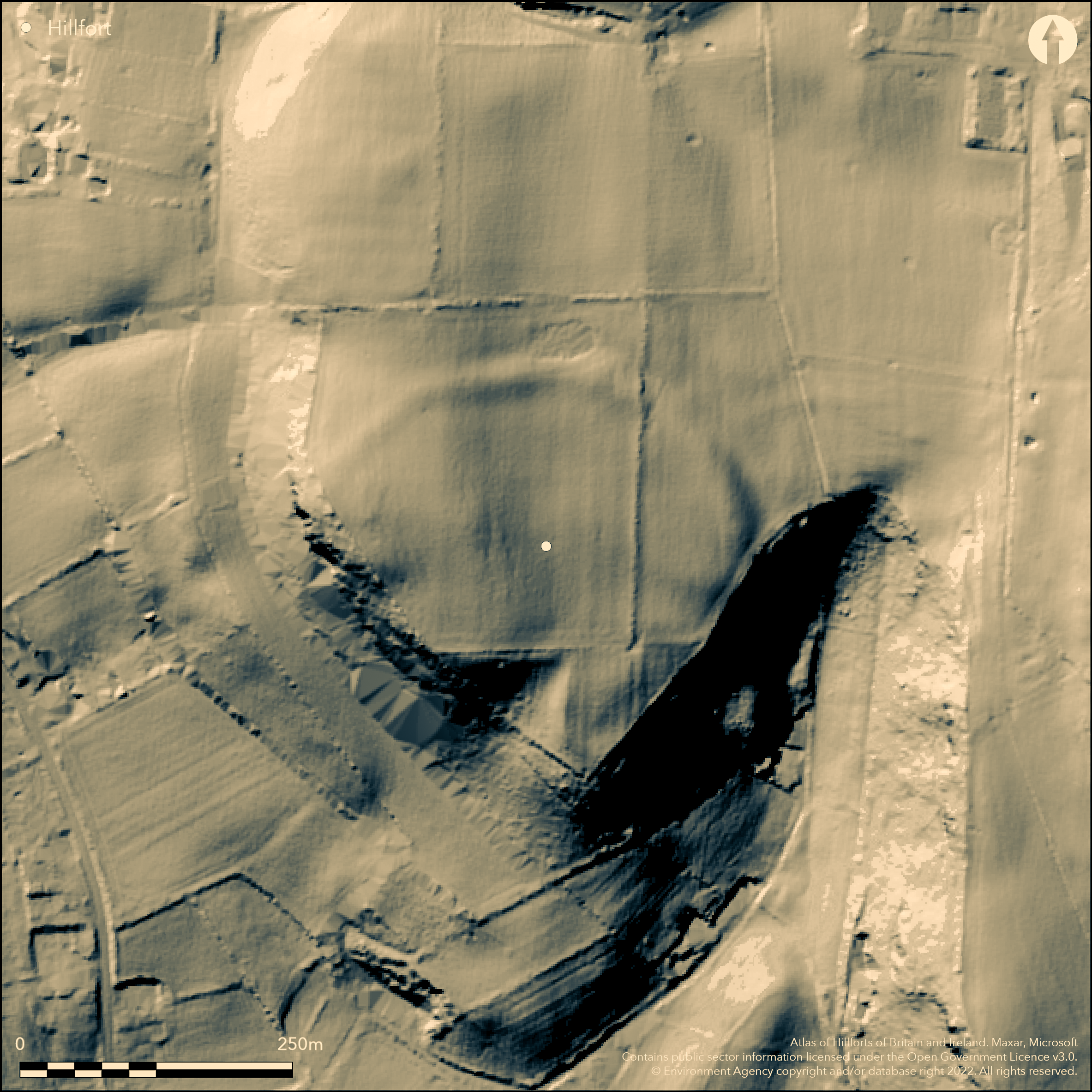
LiDAR 1m DTM Hillshade
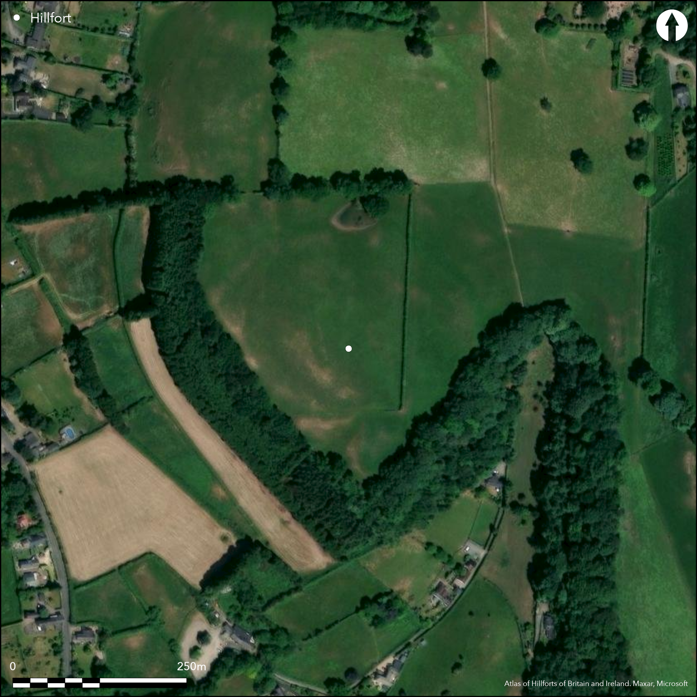
Satellite Imagery
LiDAR 1m DTM Hillshade
Satellite Imagery
Scroll left/right to view further images.
HER: Cheshire MCH8384 (833/1)
NMR: SJ 56 NW 9 (71310)
SM: 1013294
NGR: SJ53156750
X: 353151 Y: 367503 (OSGB36)
Univallate inland promontory fort located on S-facing promontory formed by two dry valleys above gap in Mid Cheshire Ridge at Kelsall. Steep to very steep wooded slopes from SE-NW, moderate from N to E. Overlooked from E. Site enclosed by single arcing bank and outer ditch from NW to SE, only visible on site on E, but visible from air. However, excavation 2011 suggested that ditch is post-medieval, with C14 dates of 17th or 18th century for fill. Possible that this post-medieval ditch obliterated prehistoric features or that no external ditch. Best on NE, where rampart 25m wide and to 1m high internally, dropping 1.7m to foot of 15m wide ditch to 0.3m deep. The 19th century mention by Omerod as 'a strong British camp, formed for the protection of the pass' (Morgan and Morgan 2004, 148). Rampart sectioned by D.G. Coombs and D. Combes 1973. Resistivity survey on W part of site 1996 revealed roughly circular possible roundhouses c. 15m diameter. Possible gap entrance at E end of rampart before break of slope. Possible two antiquarian finds - palstave and fragment of iron sword 1810. Investigated under the local authorities and partners Habitats and Hillforts Landscape Partnership Scheme 2007-2011. C14 dates of 1000-840 BC from charcoal from base of rampart suggest late Bronze Age origins. C14 dates suggest possible re-fortification in early medieval late Mercian or early Norman period. Improved pasture and some scrub. On 1st Ed. OS map (1874-75).
Citizen Science: ✗
Reliability of Data: Confirmed
Reliability of Interpretation: Confirmed
X: -300879 Y: 7020545 (EPSG: 3857)
Longitude: -2.7028379698461715 Latitude: 53.20251123220335 (EPSG:4326)
Country: England
Current County or Unitary Authority: Cheshire West and Chester
Historic County: Cheshire
Current Parish/Community/Council/Townland: Delamere
Badly damaged by ploughing and only an E section visible. NW end of rampart completely ploughed-out. Interior cut by hedge-line.
| Extant | ✓ |
| Cropmark | ✗ |
| Likely Destroyed | ✓ |
Improved pasture and some scrub.
| Woodland | ✗ |
| Commercial Forestry Plantation | ✗ |
| Parkland | ✗ |
| Pasture (Grazing) | ✓ |
| Arable | ✗ |
| Scrub/Bracken | ✓ |
| Bare Outcrop | ✗ |
| Heather/Moorland | ✗ |
| Heath | ✗ |
| Built-up | ✗ |
| Coastal Grassland | ✗ |
| Other | ✗ |
Univallate inland promontory fort located on S-facing promontory formed by two dry valleys above gap in Mid Cheshire Ridge at Kelsall. Steep to very steep wooded slopes from SE-NW, moderate from N to E. Overlooked from E.
| Contour Fort | ✗ |
| Partial Contour Fort | ✗ |
| Promontory Fort | ✓ |
| Hillslope Fort | ✗ |
| Level Terrain Fort | ✗ |
| Marsh Fort | ✗ |
| Multiple Enclosure Fort | ✗ |
| Hilltop | ✗ |
| Coastal Promontory | ✗ |
| Inland Promontory | ✓ |
| Valley Bottom | ✗ |
| Knoll/Hillock/Outcrop | ✗ |
| Ridge | ✗ |
| Cliff/Plateau-edge/Scarp | ✗ |
| Hillslope | ✗ |
| Lowland | ✗ |
| Spur | ✗ |
Dominant Topographic Feature: Promontory
| North | ✗ |
| Northeast | ✗ |
| East | ✗ |
| Southeast | ✗ |
| South | ✓ |
| Southwest | ✗ |
| West | ✗ |
| Northwest | ✗ |
| Level | ✗ |
Altitude: 122.0m
N/A
C14 dates of 1000-840 BC from charcoal from base of rampart suggest late Bronze Age origins. C14 dates of AD 1020-1160 from wood charcoal from early ditch and of AD 990-1120 and AD 690-890 from charcoal-filled pits suggest possible re-fortification in late Mercian or early Norman period. Any Iron Age occupation not found.
Reliability: B - Medium
| Pre 1200BC | ✗ |
| 1200BC - 800BC | ✓ |
| 800BC - 400BC | ✗ |
| 400BC - AD50 | ✗ |
| AD50 - AD400 | ✗ |
| AD400 - AD 800 | ✗ |
| Post AD800 | ✗ |
| Unknown | ✗ |
| Pre Hillfort: | None |
| Post Hillfort: | None |
| C14: | C14 dates of 1000-840 BC from charcoal from base of rampart. C14 dates of AD 1020-1160 from wood charcoal from early ditch and of AD 990-1120 and AD 690-890 from charcoal-filled pits suggest possible re-fortification in late Mercian or early Norman period. Excavation 2011 suggested that ditch post-medieval, with C14 dates of 17th or 18th century for fill. |
Antiquarian reference to 'Celt' find 1810. On 1st Ed. OS map (1874-75). 19th century description by George Ormerod as 'a strong British camp, formed for the protection of the pass' (Morgan and Morgan 148). Rampart sectioned by D.G. Coombs and D. Combes, Manchester University 1973. Resistivity survey by A. Quarterman, Universitry of Durham 1996. Investigated under the local authorities and partners Habitats and Hillforts Landscape Partnership Scheme 2007-2011. Archaeophysica resistivity and caesium magnetometry surveys, LiDAR Habitats and Hillforts Partnership Scheme 2010. Geophysical training survey, Chester University 2010. Training excavation, Habitats and Hillforts Partnership Scheme, 2011.
| Other (1810): | Antiquarian reference to find. |
| Other (1882): | Description by G. Omerod in his 'History of Cheshire'. |
| Excavation (1973): | D.G. Coombs and D. Combes. |
| Geophysical Survey (1996): | Resistivity survey A. Quarterman, University of Durham. |
| LiDAR Survey (2009): | None |
| Geophysical Survey (2010): | Archaeophysica resistivity and caesium magnetometry surveys Habitats and Hillforts Partnership Scheme. |
| Geophysical Survey (2010): | Chester University training exercise, M. Gondek. |
| Excavation (2011): | Habitats and Hillforts training excavation. |
| 1st Identified Map Depiction (None): | OS map. |
| Other (None): | Habitats and Hillforts Landscape Partnership Scheme. |
Resistivity survey on W part of site 1996 revealed roughly circular possible roundhouses c. 15m diameter and possible pits. Chester University survey found possible roundhouse structures. Possible two antiquarian finds - palstave and fragment of iron sword 1810.
Possible underground spring identified by geophysics.
| None | ✗ |
| Spring | ✓ |
| Stream | ✗ |
| Pool | ✗ |
| Flush | ✗ |
| Well | ✗ |
| Other | ✗ |
None
| No Known Features | ✓ |
| Round Stone Structures | ✗ |
| Rectangular Stone Structures | ✗ |
| Curvilinear Platforms | ✗ |
| Other Roundhouse Evidence | ✗ |
| Pits | ✗ |
| Quarry Hollows | ✗ |
| Other | ✗ |
None
| No Known Excavation | ✗ |
| Pits | ✗ |
| Postholes | ✗ |
| Roundhouses | ✗ |
| Rectangular Structures | ✗ |
| Roads/Tracks | ✗ |
| Quarry Hollows | ✗ |
| Other | ✗ |
| Nothing Found | ✓ |
Resistivity survey on W part of site 1996 revealed roughly circular possible roundhouses c. 15m diameter and possible pits. Chester University survey found possible roundhouse structures.
| No Known Geophysics | ✗ |
| Pits | ✓ |
| Roundhouses | ✓ |
| Rectangular Structures | ✗ |
| Roads/Tracks | ✗ |
| Quarry Hollows | ✗ |
| Other | ✗ |
| Nothing Found | ✗ |
Possible two antiquarian finds - palstave and fragment of iron sword 1810.
| No Known Finds | ✗ |
| Pottery | ✗ |
| Metal | ✓ |
| Metalworking | ✗ |
| Human Bones | ✗ |
| Animal Bones | ✗ |
| Lithics | ✗ |
| Environmental | ✗ |
| Other | ✗ |
None
| APs Not Checked | ✓ |
| None | ✗ |
| Roundhouses | ✗ |
| Rectangular Structures | ✗ |
| Pits | ✗ |
| Postholes | ✗ |
| Roads/Tracks | ✗ |
| Other | ✗ |
Possible gap entrance at SE end of rampart before break of slope. Ormerod's map of 1882 shows two additional gaps on NW.
| 3: | Ormerod's map of 1882 shows two additional gaps on NW. |
| 2: | None |
Guard Chambers: ✗
Chevaux de Frise: ✗
| 1. Simple Gap (South east): | None |
Site enclosed by single arcing bank and outer ditch from NW to SE, only visible on site on E, but visible from air. Best on NE, where rampart 25m wide and to 1m high internally, dropping 1.7m to foot of 15m wide ditch to 0.3m deep. Resistivity survey on W part of site 1996 identified W rampart and outer ditch.
| Area 1: | 3.3ha. |
| Total: | 3.3ha. |
Total Footprint Area: 3.64ha.
None
| ✗ | None |
| ✗ | None |
| NE Quadrant: | 1 |
| SE Quadrant: | 1 |
| SW Quadrant: | 0 |
| NW Quadrant: | 1 |
| Total: | 1 |
| Partial Univallate | ✓ |
| Univallate | ✗ |
| Partial Bivallate | ✗ |
| Bivallate | ✗ |
| Partial Multivallate | ✗ |
| Multivallate | ✗ |
| Unknown | ✗ |
| Partial Univallate | ✗ |
| Univallate | ✗ |
| Partial Bivallate | ✗ |
| Bivallate | ✗ |
| Partial Multivallate | ✗ |
| Multivallate | ✗ |
Earthen rampart.
| None | ✗ |
| Earthen Bank | ✓ |
| Stone Wall | ✗ |
| Rubble | ✗ |
| Wall-walk | ✗ |
| Evidence of Timber | ✗ |
| Vitrification | ✗ |
| Other Burning | ✗ |
| Palisade | ✗ |
| Counter Scarp Bank | ✗ |
| Berm | ✗ |
| Unfinished | ✗ |
| Other | ✗ |
Rampart sectioned.
| None | ✗ |
| Earthen Bank | ✓ |
| Stone Wall | ✗ |
| Murus Duplex | ✗ |
| Timber-framed | ✗ |
| Timber-laced | ✗ |
| Vitrification | ✗ |
| Other Burning | ✗ |
| Palisade | ✗ |
| Counter Scarp Bank | ✗ |
| Berm | ✗ |
| Unfinished | ✗ |
| No Known Excavation | ✗ |
| Other | ✗ |
| ✗ | None |
| ✓ | Excavation 2011 suggested that ditch medieval, with C14 dates of 17th or 18th century for fill. Possible that this post-medieval ditch obliterated prehistoric features or that no ditch. |
Number of Ditches: 1
| ✗ | None |
Coombs, D.G. 1988. A note on the rampart of the hillfort of Kelsborrow, Cheshire, Manchester Arch Bull, 3, 64-7.
Garner, D. 2012. Hillforts of the Cheshire Sandstone Ridge, Monograph, Habitats and Hillforts Landscape Partnership Scheme, Chester: Cheshire West and Chester Council.
Garner, D. 2014. Helsby Hill to Maiden Castle: Prehistoric forts of the Cheshire Ridge, In ed. Saunders, T., Hillforts in the North West and Beyond, Archaeological North West: New Series, 3 (2014), Council for British Archaeology North West, 28-41.
Garner, D. 2016. Hillforts of the Cheshire Ridge. Investigations undertaken by the Habitats and Hillforts Landscape Partnership Scheme 2009-2012. Oxford: Archaeopress.
Morgan, V. and Morgan, P. 2004, Prehistoric Cheshire, Landmark Collector's Library, Ashbourne: Landmark Publishing, 148.
Ormerod, G. 1882. The History of Cheshire, 2nd Ed.
Quarterman, A. 2000-01. Note, J Chester Arch Soc, 76.
Atlas of Hillforts:
Wikidata:
This work is licensed under CC BY-SA 4.0

 and should be cited as:
Lock, Gary and Ralston, Ian. 2024. Atlas of Hillforts of Britain and Ireland. Available at: https://hillforts.arch.ox.ac.uk
Document Version 1.1