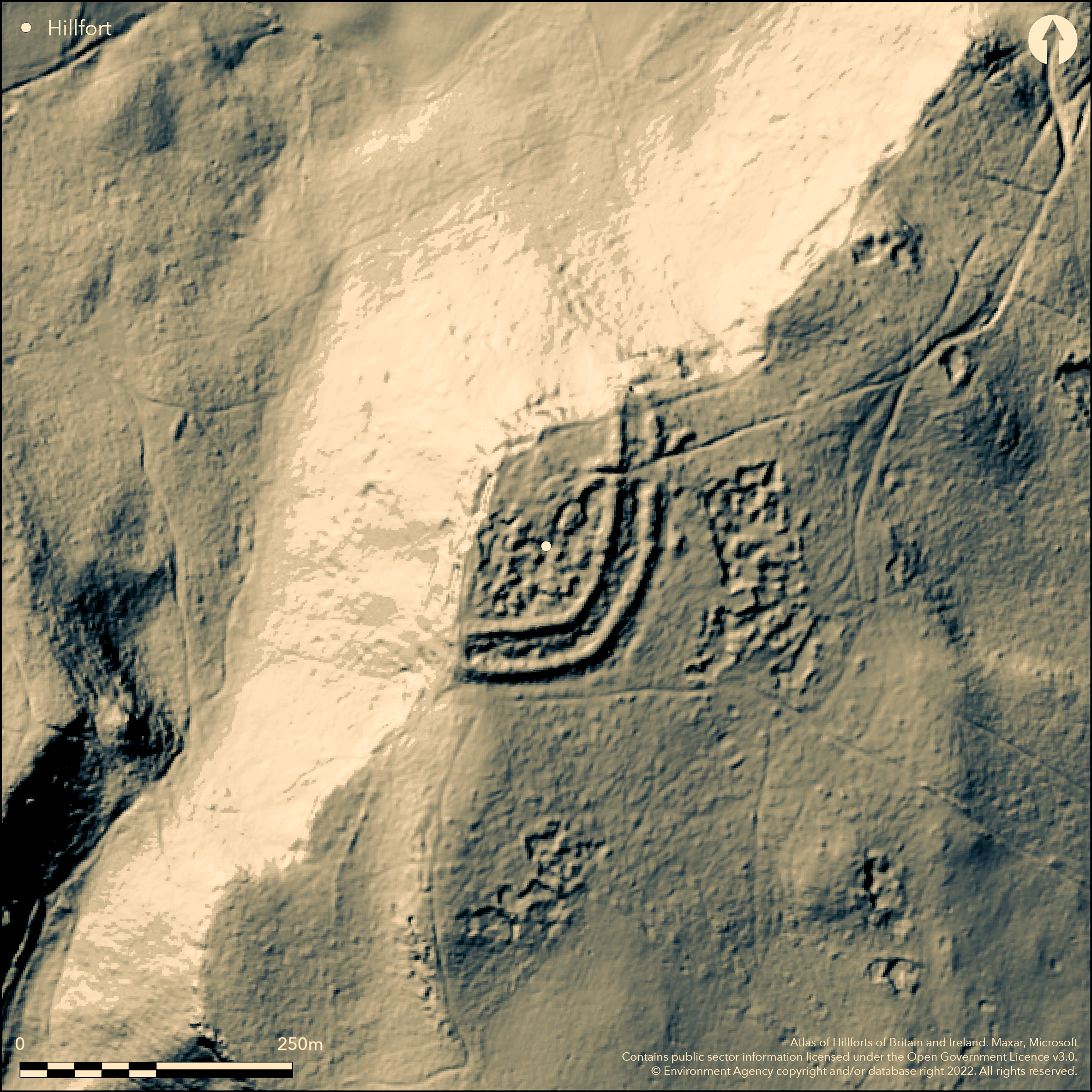
LiDAR 1m DTM Hillshade
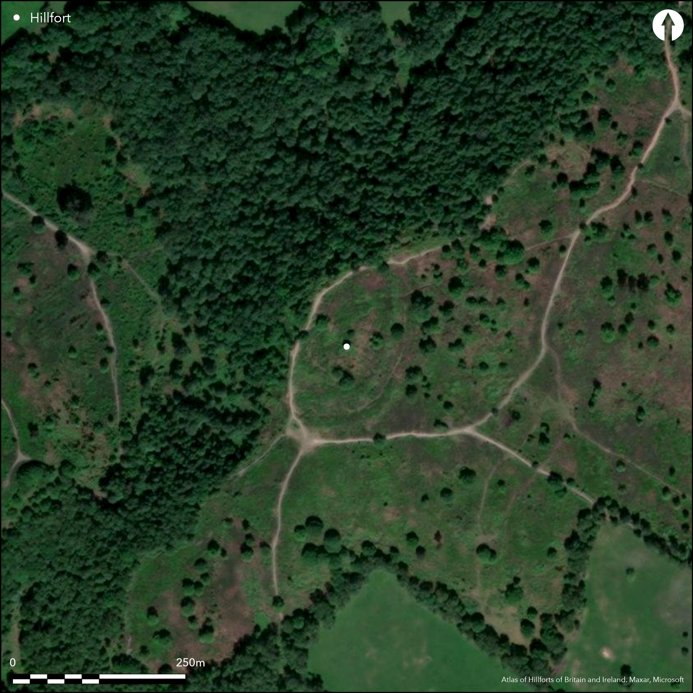
Satellite Imagery
LiDAR 1m DTM Hillshade
Satellite Imagery
Scroll left/right to view further images.
HER: Cheshire MCH5717 (341/1)
NMR: SJ 45 SE 4 (68844)
SM: 1013293
NGR: SJ49775289
X: 349770 Y: 352890 (OSGB36)
Level terrain fort located on edge of wooded precipitous crags from N through to S on summit of Bickerton Hill, one of the highest points of the Mid-Cheshire Ridge at 211m ASL. Dominant views to W over River Dee valley and strategically positioned above the pass between Bickerton Hill and Rawhead. On the level to gentle slopes to E and S two curving ramparts, still to c. 2m high, and medial ditch in semi-circle on this easier approach, enclosing 0.72ha. Excavations by W.J. Varley 1934-35 and J. Taylor 1980 found detail of ramparts. Within inner rampart core of sand and oak timber-lacing of branches and logs laid in all directions in distinct layers alternating with the sand. The timbers were much burnt, possibly deliberately as part of construction, possibly not, but similar to those at Castle Ditch, Eddisbury (Atlas No. 3187) and Beeston Castle (Atlas No. 3185). Outer rampart more complex. Here earliest phase timber palisade with clay bank. Later replaced by cut-back dump earthen bank, eventually revetted on outer face. Possible inner quarry hollow, but no outer ditch found in excavations. Two entrances, one at each end of the ramparts to NE and S, latter found in excavations 1980. Former is interesting inturned entrance on NE before cliff face. Long passageway of dry-stone walling, narrowing from c. 5m wide at outer rampart to c. 2.5m wide at end of inner. Gate located about two-thirds of way down, with postholes found in Varley's 1934-35 excavations. Here sherd of pottery from high-shouldered jar, whetstone and hammer stone found on S side of entrance. The excavations found details of entrances. Excavations by J. Taylor 1980-81 of area of damaged rampart found possible early Iron Age construction. Later geophysical survey found roundhouse evidence when investigated under the local authority and partners Habitats and Hillforts Landscape Partnership Scheme 2007-2011. Numerous 20th century two-main slit trenches in interior. On 1st Ed. OS map (18874-75).
Citizen Science: ✗
Reliability of Data: Confirmed
Reliability of Interpretation: Confirmed
X: -306257 Y: 6996115 (EPSG: 3857)
Longitude: -2.7511555246756862 Latitude: 53.07085494503311 (EPSG:4326)
Country: England
Current County or Unitary Authority: Cheshire West and Chester
Historic County: Cheshire
Current Parish/Community/Council/Townland: Bickerton
Well-preserved National Trust site.
| Extant | ✓ |
| Cropmark | ✗ |
| Likely Destroyed | ✗ |
Bracken and scrub infestation makes interpretation difficult in summer.
| Woodland | ✗ |
| Commercial Forestry Plantation | ✗ |
| Parkland | ✗ |
| Pasture (Grazing) | ✗ |
| Arable | ✗ |
| Scrub/Bracken | ✓ |
| Bare Outcrop | ✗ |
| Heather/Moorland | ✗ |
| Heath | ✗ |
| Built-up | ✗ |
| Coastal Grassland | ✗ |
| Other | ✗ |
Level terrain fort located on edge of precipitous crags from N through to S on summit of Bickerton Hill, one of the highest points of the Mid-Cheshire Ridge at 211m ASL. Dominant views to W over River Dee valley and strategically positioned to control access of pass between Bickerton Hill and Rawhead.
| Contour Fort | ✗ |
| Partial Contour Fort | ✗ |
| Promontory Fort | ✗ |
| Hillslope Fort | ✗ |
| Level Terrain Fort | ✓ |
| Marsh Fort | ✗ |
| Multiple Enclosure Fort | ✗ |
| Hilltop | ✗ |
| Coastal Promontory | ✗ |
| Inland Promontory | ✗ |
| Valley Bottom | ✗ |
| Knoll/Hillock/Outcrop | ✗ |
| Ridge | ✗ |
| Cliff/Plateau-edge/Scarp | ✓ |
| Hillslope | ✗ |
| Lowland | ✗ |
| Spur | ✗ |
Dominant Topographic Feature: Cliff top
| North | ✗ |
| Northeast | ✗ |
| East | ✗ |
| Southeast | ✗ |
| South | ✗ |
| Southwest | ✗ |
| West | ✗ |
| Northwest | ✗ |
| Level | ✓ |
Altitude: 211.0m
N/A
C14 dates of J. Taylor never fully published, but dates from outer rampart of 380-10 BC and 405-390 BC and dates from inner rampart of range 860-330 BC suggest early Iron Age construction.
Reliability: B - Medium
| Pre 1200BC | ✗ |
| 1200BC - 800BC | ✗ |
| 800BC - 400BC | ✓ |
| 400BC - AD50 | ✓ |
| AD50 - AD400 | ✗ |
| AD400 - AD 800 | ✗ |
| Post AD800 | ✗ |
| Unknown | ✗ |
| Pre Hillfort: | None |
| Post Hillfort: | None |
| C14: | C14 dates of J. Taylor never fully published, but dates from outer rampart of 380-10 BC and 405-390 BC and dates from inner rampart of range 860-330 BC. |
On 1st Ed. OS map (18874-75). Described by G. Ormerod in 19th century. Excavation W.J. Varley 1934-35. Small excavation of rampart exposed by erosion J. Taylor, Liverpool University 1980-81. Geophysical survey to locate stray ordnance and archaeeology National Trust and AML 1996. Investigated under the local authority and partners Habitats and Hillforts Landscape Partnership Scheme 2007-2011. Geophysical survey, Engineering Archaeological Services 2011. Full topographic survey West Yorkshire Archaeology Service c. 2011. LiDar survey Habitats and Hillforts Partnership Scheme 2010.
| 1st Identified Written Reference (1882): | Description by G. Ormerod in his 'History of Cheshire'. |
| Geophysical Survey (1996): | AML |
| LiDAR Survey (2010): | Habitats and Hillforts Partnership Scheme. |
| Geophysical Survey (2011): | Engineering Archaeological Services. |
| 1st Identified Map Depiction (None): | OS map. |
| Excavation (None): | W.J. Varley. |
| Excavation (None): | J. Taylor. |
| Other (None): | Habitats and Hillforts Landscape Partnership Scheme |
| Other (None): | Habitats and Hillforts Landscape Partnership Scheme. |
| Earthwork Survey (None): | West Yorkshire Archaeology Service. |
Bracken and scrub obscures any surface features, but many small quarry pits and mounds. Excavations found details of entrances, including dry-stone walling and postholes. Sherd of pottery from high-shouldered jar, whetstone and hammer stone found on S side of NE entrance. Geophysical survey found roundhouse evidence.
None
| None | ✓ |
| Spring | ✗ |
| Stream | ✗ |
| Pool | ✗ |
| Flush | ✗ |
| Well | ✗ |
| Other | ✗ |
Bracken and scrub obscures any surface features, but many small quarry pits and mounds.
| No Known Features | ✓ |
| Round Stone Structures | ✗ |
| Rectangular Stone Structures | ✗ |
| Curvilinear Platforms | ✗ |
| Other Roundhouse Evidence | ✗ |
| Pits | ✗ |
| Quarry Hollows | ✗ |
| Other | ✗ |
Excavations found details of entrances, including dry-stone walling and postholes. Quarry hollow found.
| No Known Excavation | ✗ |
| Pits | ✗ |
| Postholes | ✓ |
| Roundhouses | ✗ |
| Rectangular Structures | ✗ |
| Roads/Tracks | ✗ |
| Quarry Hollows | ✓ |
| Other | ✗ |
| Nothing Found | ✗ |
Geophysical survey found roundhouse evidence close to main entrance.
| No Known Geophysics | ✗ |
| Pits | ✗ |
| Roundhouses | ✓ |
| Rectangular Structures | ✗ |
| Roads/Tracks | ✗ |
| Quarry Hollows | ✗ |
| Other | ✗ |
| Nothing Found | ✗ |
Sherd of pottery from high-shouldered jar, whetstone and hammer stone found on S side of NE entrance.
| No Known Finds | ✗ |
| Pottery | ✓ |
| Metal | ✗ |
| Metalworking | ✗ |
| Human Bones | ✗ |
| Animal Bones | ✗ |
| Lithics | ✓ |
| Environmental | ✗ |
| Other | ✗ |
None
| APs Not Checked | ✓ |
| None | ✗ |
| Roundhouses | ✗ |
| Rectangular Structures | ✗ |
| Pits | ✗ |
| Postholes | ✗ |
| Roads/Tracks | ✗ |
| Other | ✗ |
Two entrances, one at each end of the ramparts to NE and S, latter found in excavations 1980. Former is interesting inturned entrance on NE before cliff face. Long passageway of dry-stone walling, narrowing from c. 5m wide at outer rampart to c. 2.5m wide at end of inner. Gate located about two-thirds of way down, with postholes found in Varley's 1934-35 excavations. Vestigial hornworks to outer gap curving back for 30m on either side.
| 2: | None |
| 2: | None |
Guard Chambers: ✗
Chevaux de Frise: ✗
| 1. In-turned (North east): | Long passageway of dry-stone walling, narrowing from c. 5m wide at outer rampart to c. 2.5m wide at end of inner. Gate located about two-thirds of way down, with postholes found in Varley's 1934-35 excavations. |
| 2. Simple Gap (South): | None |
On the level to gentle slopes to E and S two curving ramparts, still to 2m high, defend this easier approach. Excavations found detail of ramparts. Within inner rampart core of sand and oak timber-lacing of branches and logs laid in all directions in distinct layers alternating with the sand. The timbers were much burnt (possible vitrification?), possibly deliberately as part of construction, possibly not, but similar to those at Castle Ditch, Eddisbury (Atlas No. 3187) and Beeston Castle (Atlas No. 3185). Outer rampart more complex. Here earliest phase timber palisade with clay bank. Later replaced by cut-back dump earthen bank, eventually revetted on outer face. No outer ditch found in excavations.
| Area 1: | 0.72ha. |
| Total: | 0.72ha. |
Total Footprint Area: Noneha.
None
| ✗ | None |
| ✗ | None |
| NE Quadrant: | 2 |
| SE Quadrant: | 2 |
| SW Quadrant: | 2 |
| NW Quadrant: | 0 |
| Total: | 2 |
| Partial Univallate | ✗ |
| Univallate | ✗ |
| Partial Bivallate | ✓ |
| Bivallate | ✗ |
| Partial Multivallate | ✗ |
| Multivallate | ✗ |
| Unknown | ✗ |
| Partial Univallate | ✗ |
| Univallate | ✗ |
| Partial Bivallate | ✗ |
| Bivallate | ✗ |
| Partial Multivallate | ✗ |
| Multivallate | ✗ |
Geophysical survey found evidence of burning of material in inner rampart.
| None | ✗ |
| Earthen Bank | ✓ |
| Stone Wall | ✗ |
| Rubble | ✗ |
| Wall-walk | ✗ |
| Evidence of Timber | ✗ |
| Vitrification | ✗ |
| Other Burning | ✓ |
| Palisade | ✗ |
| Counter Scarp Bank | ✗ |
| Berm | ✗ |
| Unfinished | ✗ |
| Other | ✗ |
Excavations found detail of ramparts. Within inner rampart core of sand and oak timber-lacing of branches and logs laid in all directions in distinct layers alternating with the sand. The timbers were much burnt (possible vitrification?), possibly deliberately as part of construction, possibly not, but similar to those at Castle Ditch, Eddisbury (Atlas No. 3187) and Beeston Castle (Atlas No. 3185). Outer rampart more complex. Here earliest phase timber palisade with clay bank. Later replaced by cut-back dump earthen bank, eventually revetted on outer face. No outer ditch found in excavations.
| None | ✗ |
| Earthen Bank | ✓ |
| Stone Wall | ✓ |
| Murus Duplex | ✗ |
| Timber-framed | ✗ |
| Timber-laced | ✓ |
| Vitrification | ✓ |
| Other Burning | ✓ |
| Palisade | ✓ |
| Counter Scarp Bank | ✗ |
| Berm | ✗ |
| Unfinished | ✗ |
| No Known Excavation | ✗ |
| Other | ✓ |
| ✗ | None |
| ✓ | Medial ditch but no outer ditch found in excavations. |
Number of Ditches: 1
| ✗ | None |
Brooks, I.P. and Williams, S. 2010. Maiden Castle geophysical survey, May 2011, EAS Client Report 2011/08, Blaenau Ffestiniog: Engineering Archaeological Services.
Garner, D. 2012. Hillforts of the Cheshire Sandstone Ridge, Monograph, Habitats and Hillforts Landscape Partnership Scheme, Chester: Cheshire West and Chester Council.
Garner, D. 2014. Helsby Hill to Maiden Castle: Prehistoric forts of the Cheshire Ridge, In ed. Saunders, T., Hillforts in the North West and Beyond, Archaeological North West: New Series, 3 (2014), Council for British Archaeology North West, 28-41.
Garner, D. 2016. Hillforts of the Cheshire Ridge. Investigations undertaken by the Habitats and Hillforts Landscape Partnership Scheme 2009-2012. Oxford: Archaeopress.
Milln J. Undated. Maiden Castle. Report on Archaeological Recording in association with Battle Area Clearance, National Trust.
Ormerod, G. 1882. The History of Cheshire, 2nd Ed.
Taylor, J. 1980-81. Maiden Castle, Bickerton Hill [hillfort excavation summary], Cheshire Archaeol Bull, 7, 34-6.
Varley, W.J. 1935. Maiden Castle, Bickerton, preliminary excavations 1934, Liverpool Annals Archaeol and Anthrop, 22, 97-110.
Varley, W.J. 1936. Further excavations at Maiden Castle, Bickerton, 1935, Liverpool Annals Archaeol and Anthrop, 23, 101-112.
Atlas of Hillforts:
Wikidata:
This work is licensed under CC BY-SA 4.0

 and should be cited as:
Lock, Gary and Ralston, Ian. 2024. Atlas of Hillforts of Britain and Ireland. Available at: https://hillforts.arch.ox.ac.uk
Document Version 1.1