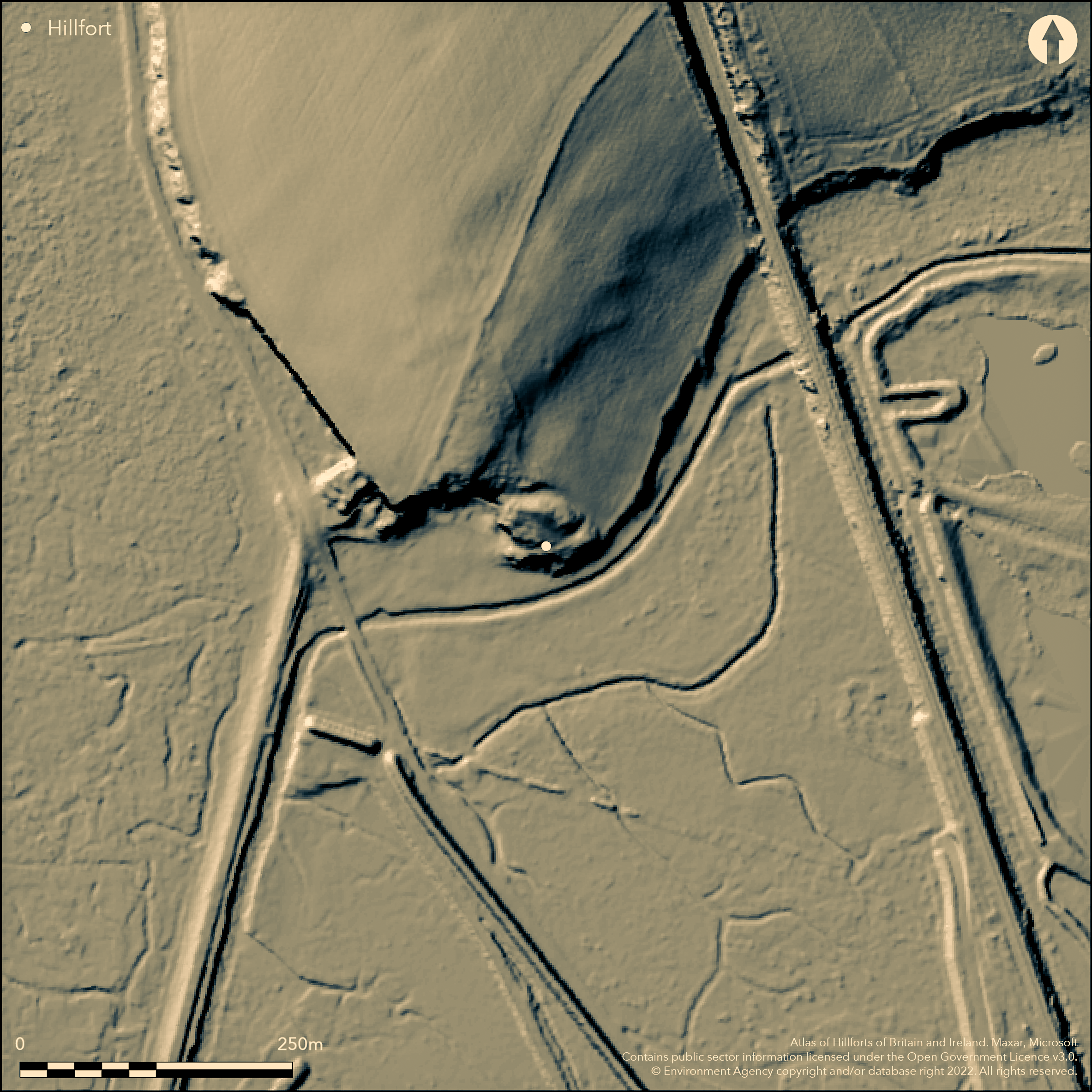
LiDAR 1m DTM Hillshade
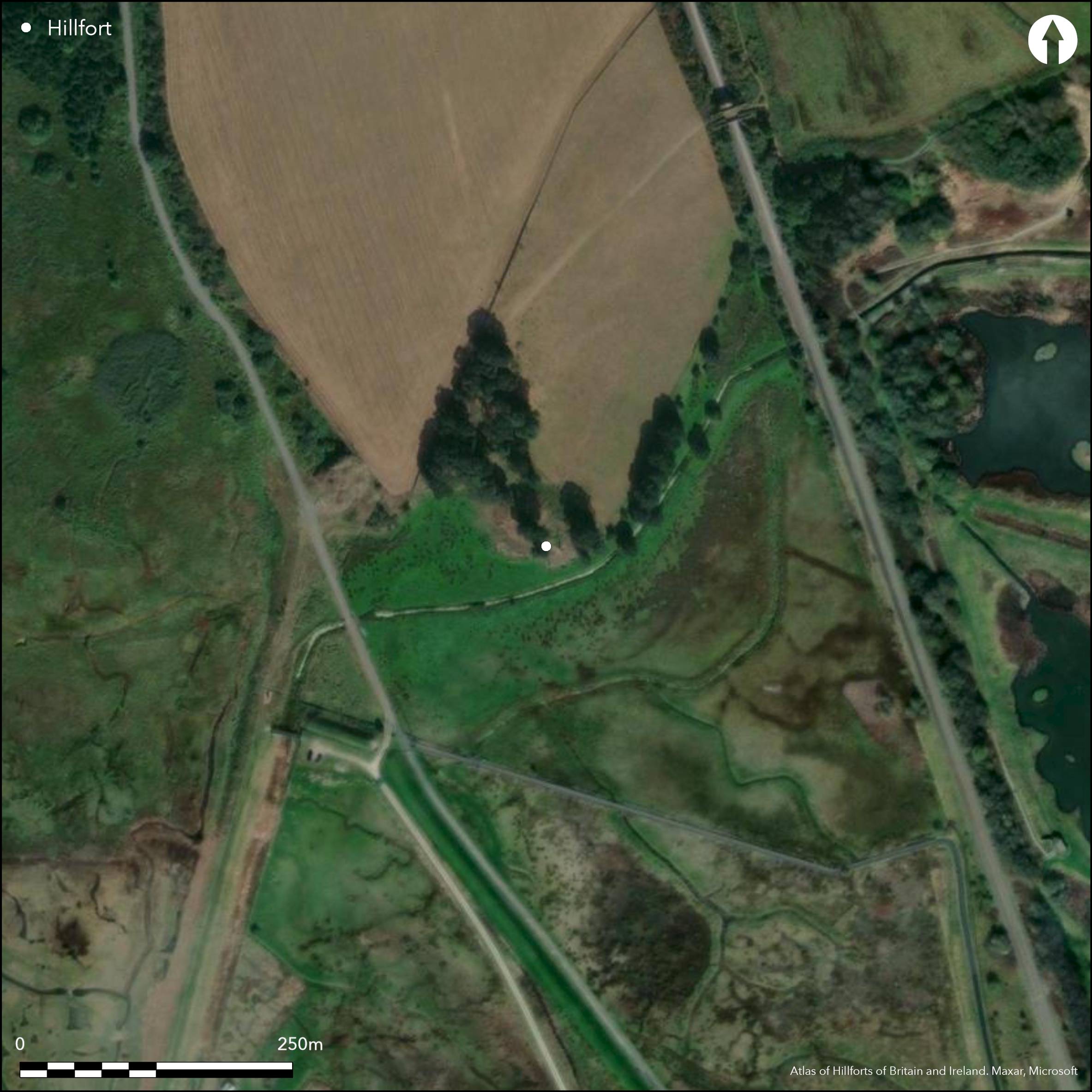
Satellite Imagery
LiDAR 1m DTM Hillshade
Satellite Imagery
Scroll left/right to view further images.
HER: Cheshire MCH6214 (None)
NMR: SJ 37 SW 5 (67150)
SM: 1013298
NGR: SJ30337356
X: 330330 Y: 373560 (OSGB36)
Small inland (formerly coastal) promontory fort in an estuary location sited on low rocky SE-facing Permo-Triassic sandstone promontory overlooking the River Dee salt flats. Before River Dee canalised and river diverted 1737, site would have been directly above the tidal waterline. In prehistory occupied a strategic position of a crossing point of the river. Both ends of site eroded away in the past by the river and extensive quarrying since reign of Edward I when stone used for construction of Flint Castle in 1277. Site of port from c. AD 1200-1500 and to 18th century. Encloses triangular tip of promontory, with internal area 0.9ha. Defended by single bank and ditch in a N-S arc c. 60m long, the bank now to c. 3.5m-5m high from base of external ditch, 2m deep and 12m wide at base, and composed of fine-grained sand and small sandstone boulders (Morgan and Morgan 2004, 152). Ditch possibly ploughed in past. Entrance site uncertain, but track cuts through rampart to SE to quarry below. Under rough pasture with scattered trees and scrub. Much of site eroded away in the past by river and extensive quarrying for sandstone. Ploughed in past and track cuts through rampart to SE to quarry below, but bank that is left impressive and well-preserved. Some animal damage now controlled. On RSPB nature reserve where interpretation board and management measures. On 1st Ed. OS map (1875). Undated.
Citizen Science: ✗
Reliability of Data: Confirmed
Reliability of Interpretation: Confirmed
X: -339053 Y: 7030203 (EPSG: 3857)
Longitude: -3.0457634640966997 Latitude: 53.254443995747074 (EPSG:4326)
Country: England
Current County or Unitary Authority: Cheshire West and Chester
Historic County: Cheshire
Current Parish/Community/Council/Townland: Neston
Much of site eroded away in the past by river and extensive quarrying for sandstone. Ploughed in past and track cuts through rampart to SE to quarry below, but bank that is left impressive and well-preserved. Some animal damage now controlled. On RSPB nature reserve where interpretation board and management measures.
| Extant | ✓ |
| Cropmark | ✗ |
| Likely Destroyed | ✓ |
Under rough pasture with scattered trees and scrub.
| Woodland | ✗ |
| Commercial Forestry Plantation | ✗ |
| Parkland | ✗ |
| Pasture (Grazing) | ✓ |
| Arable | ✗ |
| Scrub/Bracken | ✓ |
| Bare Outcrop | ✗ |
| Heather/Moorland | ✗ |
| Heath | ✗ |
| Built-up | ✗ |
| Coastal Grassland | ✗ |
| Other | ✗ |
Small inland promontory fort in an estuary location sited on low rocky sandstone promontory now overlooking the River Dee salt flats. Site would have been directly above the waterline prior to River Dee being canalised in 18th century and then classified as a coastal promontory fort.
| Contour Fort | ✗ |
| Partial Contour Fort | ✗ |
| Promontory Fort | ✓ |
| Hillslope Fort | ✗ |
| Level Terrain Fort | ✗ |
| Marsh Fort | ✗ |
| Multiple Enclosure Fort | ✗ |
| Hilltop | ✗ |
| Coastal Promontory | ✗ |
| Inland Promontory | ✓ |
| Valley Bottom | ✗ |
| Knoll/Hillock/Outcrop | ✗ |
| Ridge | ✗ |
| Cliff/Plateau-edge/Scarp | ✗ |
| Hillslope | ✗ |
| Lowland | ✗ |
| Spur | ✗ |
Dominant Topographic Feature: Low rocky, formery esturine, promontory.
| North | ✗ |
| Northeast | ✗ |
| East | ✗ |
| Southeast | ✓ |
| South | ✗ |
| Southwest | ✗ |
| West | ✗ |
| Northwest | ✗ |
| Level | ✗ |
Altitude: 15.0m
N/A
No dating for hillfort. Neolithic finds of barbed and tanged arrowhead and Graig Lwyd polished axe. Quarrying on site since Edward I stone used for construction of Flint Castle 1277. Much quarrying by River Dee Co Rock Quarry 1871-86. Causeway runs from Burton Point to Connah's Quary. Site of port AD 1200-1500 and to 18th century. Possible medieval burials on site.
Reliability: D - None
| Pre 1200BC | ✗ |
| 1200BC - 800BC | ✗ |
| 800BC - 400BC | ✗ |
| 400BC - AD50 | ✗ |
| AD50 - AD400 | ✗ |
| AD400 - AD 800 | ✗ |
| Post AD800 | ✗ |
| Unknown | ✓ |
| Pre Hillfort: | None |
| Post Hillfort: | None |
| Artefactual: | Neolithic finds. |
On 1st Ed. OS map (1875). Evaluation and ground survey Brown et al 1978. Ground surveys on site and to N and geophysical survey 150m to N of fort (2005-2006 (Crawford-Coup 2014, 42-3).
| 1st Identified Map Depiction (1875): | OS map. |
| Other (1978): | Evaluation and ground survey Brown et al. |
| Earthwork Survey (None): | Ground surveys on site and to N (Crawford-Coup 2014, 42-3). |
| Geophysical Survey (None): | 150m to N of fort (Crawford-Coup 2014, 42-3). |
Semi-circular platforms visible to N of ditch and rampart, possibly quarry scoops or, more probably, natural.
None
| None | ✓ |
| Spring | ✗ |
| Stream | ✗ |
| Pool | ✗ |
| Flush | ✗ |
| Well | ✗ |
| Other | ✗ |
Semi-circular platforms visible to N of ditch and rampart, possibly quarry scoops or, more probably, natural.
| No Known Features | ✓ |
| Round Stone Structures | ✗ |
| Rectangular Stone Structures | ✗ |
| Curvilinear Platforms | ✗ |
| Other Roundhouse Evidence | ✗ |
| Pits | ✗ |
| Quarry Hollows | ✗ |
| Other | ✗ |
None
| No Known Excavation | ✓ |
| Pits | ✗ |
| Postholes | ✗ |
| Roundhouses | ✗ |
| Rectangular Structures | ✗ |
| Roads/Tracks | ✗ |
| Quarry Hollows | ✗ |
| Other | ✗ |
| Nothing Found | ✗ |
Geophysics 150m to N of fort.
| No Known Geophysics | ✓ |
| Pits | ✗ |
| Roundhouses | ✗ |
| Rectangular Structures | ✗ |
| Roads/Tracks | ✗ |
| Quarry Hollows | ✗ |
| Other | ✗ |
| Nothing Found | ✗ |
Neolithic finds of barbed and tanged arrowhead and Graig Lwyd polished axe.
| No Known Finds | ✗ |
| Pottery | ✗ |
| Metal | ✗ |
| Metalworking | ✗ |
| Human Bones | ✗ |
| Animal Bones | ✗ |
| Lithics | ✓ |
| Environmental | ✗ |
| Other | ✗ |
None
| APs Not Checked | ✓ |
| None | ✗ |
| Roundhouses | ✗ |
| Rectangular Structures | ✗ |
| Pits | ✗ |
| Postholes | ✗ |
| Roads/Tracks | ✗ |
| Other | ✗ |
Entrance site uncertain, but track cuts through rampart to SE to quarry below.
| 0: | Track cuts through rampart to SE to quarry below. |
| 2: | None |
Guard Chambers: ✗
Chevaux de Frise: ✗
Defended by single bank and ditch in a N-S arc c. 60m long, the bank now to c. 3.5m-5m high from base of external ditch (2m deep) and 12m wide at base, and composed of fine-grained sand and small sandstone boulders (Morgan and Morgan 2004, 152).
| Area 1: | 0.9ha. |
| Total: | 0.9ha. |
Total Footprint Area: Noneha.
None
| ✗ | None |
| ✗ | None |
| NE Quadrant: | 0 |
| SE Quadrant: | 1 |
| SW Quadrant: | 0 |
| NW Quadrant: | 1 |
| Total: | 1 |
| Partial Univallate | ✓ |
| Univallate | ✗ |
| Partial Bivallate | ✗ |
| Bivallate | ✗ |
| Partial Multivallate | ✗ |
| Multivallate | ✗ |
| Unknown | ✗ |
| Partial Univallate | ✗ |
| Univallate | ✗ |
| Partial Bivallate | ✗ |
| Bivallate | ✗ |
| Partial Multivallate | ✗ |
| Multivallate | ✗ |
bank composed of fine-grained sand and small sandstone boulders.
| None | ✗ |
| Earthen Bank | ✓ |
| Stone Wall | ✗ |
| Rubble | ✓ |
| Wall-walk | ✗ |
| Evidence of Timber | ✗ |
| Vitrification | ✗ |
| Other Burning | ✗ |
| Palisade | ✗ |
| Counter Scarp Bank | ✗ |
| Berm | ✗ |
| Unfinished | ✗ |
| Other | ✗ |
None
| None | ✗ |
| Earthen Bank | ✗ |
| Stone Wall | ✗ |
| Murus Duplex | ✗ |
| Timber-framed | ✗ |
| Timber-laced | ✗ |
| Vitrification | ✗ |
| Other Burning | ✗ |
| Palisade | ✗ |
| Counter Scarp Bank | ✗ |
| Berm | ✗ |
| Unfinished | ✗ |
| No Known Excavation | ✓ |
| Other | ✗ |
| ✗ | None |
| ✓ | Ploughed in past. |
Number of Ditches: 1
| ✗ | None |
Crawford-Coupe, G. 2014. The promontory fort at Burton Point, In ed. Saunders, T., Hillforts in the North West and Beyond, Archaeological North West: New Series, 3 (2014), Council for British Archaeology North West, 42-50.
Morgan, V. and Morgan, P. 2004, Prehistoric Cheshire, Landmark Collector's Library, Ashbourne: Landmark Publishing, 152.
Atlas of Hillforts:
Wikidata:
This work is licensed under CC BY-SA 4.0

 and should be cited as:
Lock, Gary and Ralston, Ian. 2024. Atlas of Hillforts of Britain and Ireland. Available at: https://hillforts.arch.ox.ac.uk
Document Version 1.1