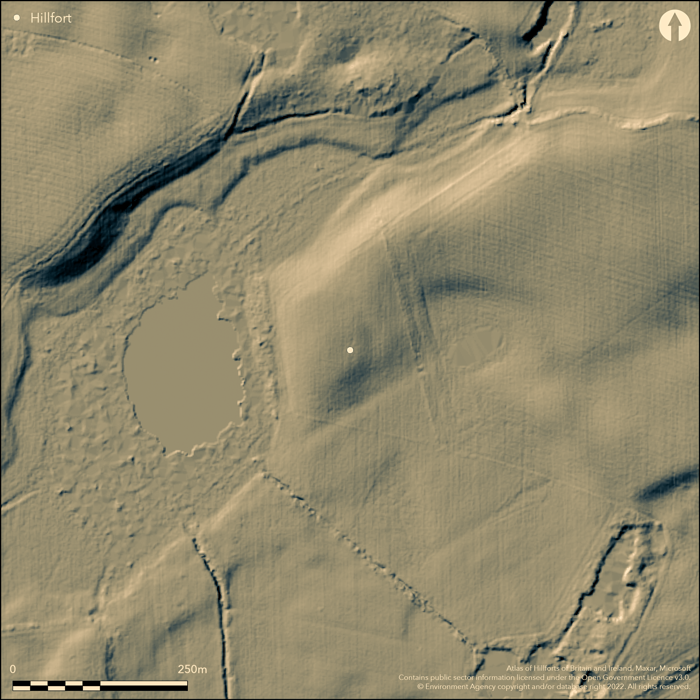
LiDAR 1m DTM Hillshade
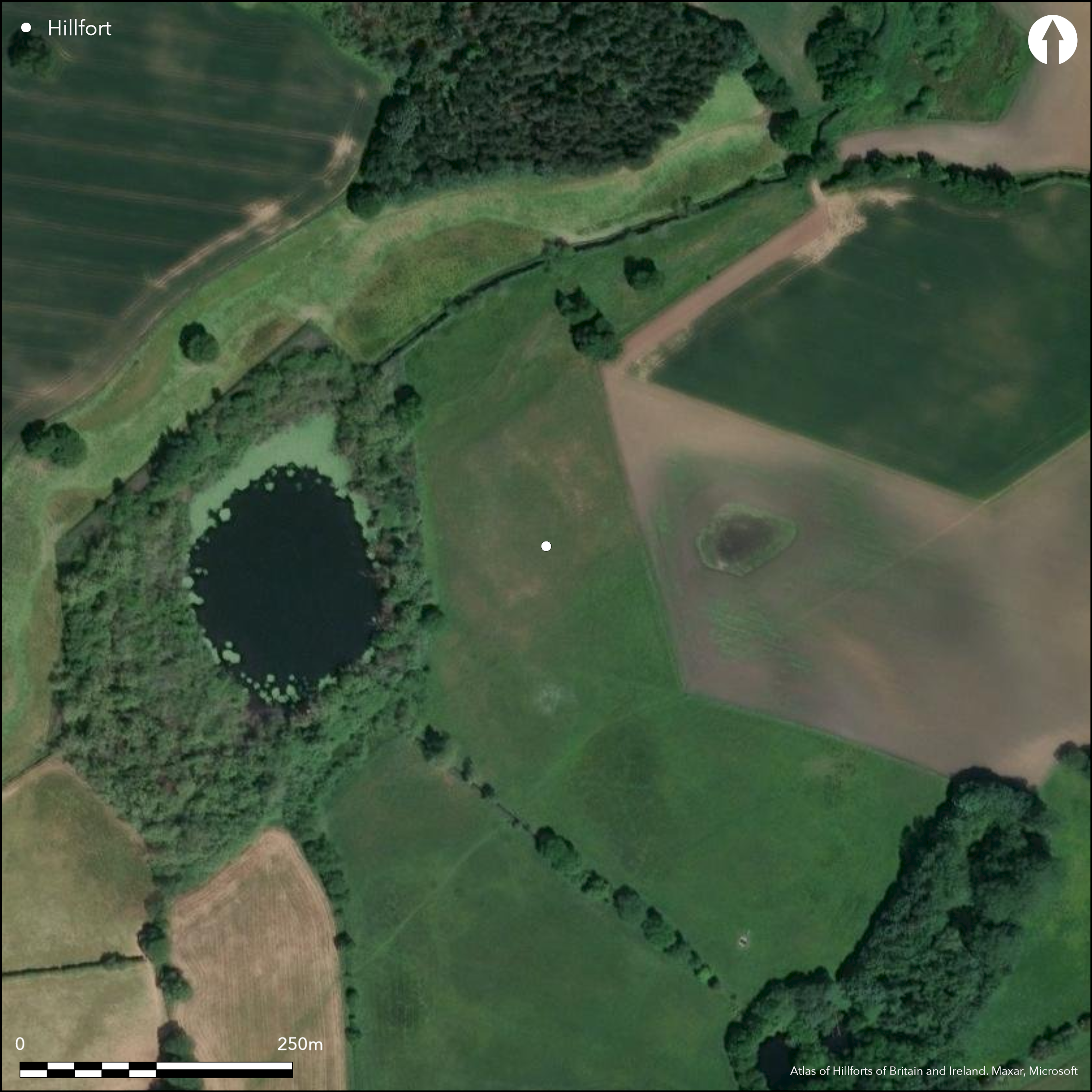
Satellite Imagery
LiDAR 1m DTM Hillshade
Satellite Imagery
Scroll left/right to view further images.
HER: Cheshire MCH5784 (None)
NMR: SJ 55 NW 7 (71085)
SM: 1013481
NGR: SJ54305767
X: 354300 Y: 357670 (OSGB36)
Inland promontory fort located on the Mid-Cheshire Ridge at SW end of a low promontory on E shore of Peckforton Mere. River Gowy flows through mere to E and on W. Ridge c. 10m in height overlooks the mere to SW and former marshland along flanks to SE and NW. Possibly a marsh fort in prehistory and aerial photographs seem to show that the site used both the mere and the watercourse (Longley, 1987, 109). The area around Delamere is notable for wetland sites including peat fringed areas of open water, as well as numerous basin mires (Leah et al 1997, 14). Generally level to E and S. W part quarried or cut away. Badly damaged by ploughing, reducing earthworks to mainly a curving shallow ditch c. 12m wide and 0.5m deep, with only c. 180m of the bank visible, and enclosing area c. 70m SE-NW by 55m, with internal area c. 0.35ha. In places line of in-filled ditch only visible on aerial photographs. Ramparts would only have been required on NE and were probably bank with outer ditch. Suggested by Garner (2012, 42) as possibly having origins in late Bronze Age, otherwise undated. Cultivated/pasture interior. Trees fringe site on W and surround mere. Minimal investigations.
Citizen Science: ✗
Reliability of Data: Confirmed
Reliability of Interpretation: Confirmed
X: -298807 Y: 7004155 (EPSG: 3857)
Longitude: -2.684230857244059 Latitude: 53.11422784596786 (EPSG:4326)
Country: England
Current County or Unitary Authority: Cheshire West and Chester
Historic County: Cheshire
Current Parish/Community/Council/Townland: Peckforton
Badly damaged by ploughing, reducing earthworks to mainly just a shallow ditch. Ramparts mostly gone. W part quarried or cut away.
| Extant | ✓ |
| Cropmark | ✓ |
| Likely Destroyed | ✗ |
Cultivated/pasture interior. Trees fringe site on W and surround mere.
| Woodland | ✓ |
| Commercial Forestry Plantation | ✗ |
| Parkland | ✗ |
| Pasture (Grazing) | ✓ |
| Arable | ✗ |
| Scrub/Bracken | ✗ |
| Bare Outcrop | ✗ |
| Heather/Moorland | ✗ |
| Heath | ✗ |
| Built-up | ✗ |
| Coastal Grassland | ✗ |
| Other | ✗ |
Inland promontory fort located at SW end of a low promontory on E shore of Peckforton Mere. River Gowy flows through mere to E and on W. Ridge c. 10m in height overlooks the mere to SW and former marshland along flanks to SE and NW. Generally level to E and S. possibly a marsh fort in prehistory.
| Contour Fort | ✗ |
| Partial Contour Fort | ✗ |
| Promontory Fort | ✓ |
| Hillslope Fort | ✗ |
| Level Terrain Fort | ✗ |
| Marsh Fort | ✓ |
| Multiple Enclosure Fort | ✗ |
| Hilltop | ✗ |
| Coastal Promontory | ✗ |
| Inland Promontory | ✓ |
| Valley Bottom | ✗ |
| Knoll/Hillock/Outcrop | ✗ |
| Ridge | ✗ |
| Cliff/Plateau-edge/Scarp | ✗ |
| Hillslope | ✗ |
| Lowland | ✗ |
| Spur | ✗ |
Dominant Topographic Feature: Low promontory
| North | ✗ |
| Northeast | ✗ |
| East | ✗ |
| Southeast | ✗ |
| South | ✗ |
| Southwest | ✓ |
| West | ✗ |
| Northwest | ✗ |
| Level | ✗ |
Altitude: 75.0m
N/A
Suggested by Garner (2012, 42) as possibly having origins in late Bronze Age. Deposits suggest wood clearance and cultivation from 1500 BC onwards. Possible two bronze Bronze Age spear heads.
Reliability: C - Low
| Pre 1200BC | ✗ |
| 1200BC - 800BC | ✗ |
| 800BC - 400BC | ✓ |
| 400BC - AD50 | ✓ |
| AD50 - AD400 | ✗ |
| AD400 - AD 800 | ✗ |
| Post AD800 | ✗ |
| Unknown | ✗ |
| Pre Hillfort: | None |
| Post Hillfort: | None |
| Artefactual: | Deposit evidence. |
| Morphology/Earthwork/Typology: | General morphology of site. |
None.
None.
None
| None | ✓ |
| Spring | ✗ |
| Stream | ✗ |
| Pool | ✗ |
| Flush | ✗ |
| Well | ✗ |
| Other | ✗ |
None
| No Known Features | ✓ |
| Round Stone Structures | ✗ |
| Rectangular Stone Structures | ✗ |
| Curvilinear Platforms | ✗ |
| Other Roundhouse Evidence | ✗ |
| Pits | ✗ |
| Quarry Hollows | ✗ |
| Other | ✗ |
None
| No Known Excavation | ✓ |
| Pits | ✗ |
| Postholes | ✗ |
| Roundhouses | ✗ |
| Rectangular Structures | ✗ |
| Roads/Tracks | ✗ |
| Quarry Hollows | ✗ |
| Other | ✗ |
| Nothing Found | ✗ |
None
| No Known Geophysics | ✓ |
| Pits | ✗ |
| Roundhouses | ✗ |
| Rectangular Structures | ✗ |
| Roads/Tracks | ✗ |
| Quarry Hollows | ✗ |
| Other | ✗ |
| Nothing Found | ✗ |
None
| No Known Finds | ✓ |
| Pottery | ✗ |
| Metal | ✗ |
| Metalworking | ✗ |
| Human Bones | ✗ |
| Animal Bones | ✗ |
| Lithics | ✗ |
| Environmental | ✗ |
| Other | ✗ |
None
| APs Not Checked | ✓ |
| None | ✗ |
| Roundhouses | ✗ |
| Rectangular Structures | ✗ |
| Pits | ✗ |
| Postholes | ✗ |
| Roads/Tracks | ✗ |
| Other | ✗ |
Uncertain.
| 0: | None |
| 2: | None |
Guard Chambers: ✗
Chevaux de Frise: ✗
Badly damaged by ploughing, reducing earthworks to mainly a curving shallow ditch c. 12m wide and 0.5m deep, with only c. 180m of the bank visible. In places line of in-filled ditch only visible on aerial photographs. Originally, defence would only have been required on NE and was probably bank with outer ditch.
| Area 1: | 0.35ha. |
| Total: | 0.35ha. |
Total Footprint Area: Noneha.
None
| ✗ | None |
| ✗ | None |
| NE Quadrant: | 1 |
| SE Quadrant: | 0 |
| SW Quadrant: | 0 |
| NW Quadrant: | 0 |
| Total: | 1 |
| Partial Univallate | ✓ |
| Univallate | ✗ |
| Partial Bivallate | ✗ |
| Bivallate | ✗ |
| Partial Multivallate | ✗ |
| Multivallate | ✗ |
| Unknown | ✗ |
| Partial Univallate | ✗ |
| Univallate | ✗ |
| Partial Bivallate | ✗ |
| Bivallate | ✗ |
| Partial Multivallate | ✗ |
| Multivallate | ✗ |
None
| None | ✗ |
| Earthen Bank | ✓ |
| Stone Wall | ✗ |
| Rubble | ✗ |
| Wall-walk | ✗ |
| Evidence of Timber | ✗ |
| Vitrification | ✗ |
| Other Burning | ✗ |
| Palisade | ✗ |
| Counter Scarp Bank | ✗ |
| Berm | ✗ |
| Unfinished | ✗ |
| Other | ✗ |
None
| None | ✗ |
| Earthen Bank | ✗ |
| Stone Wall | ✗ |
| Murus Duplex | ✗ |
| Timber-framed | ✗ |
| Timber-laced | ✗ |
| Vitrification | ✗ |
| Other Burning | ✗ |
| Palisade | ✗ |
| Counter Scarp Bank | ✗ |
| Berm | ✗ |
| Unfinished | ✗ |
| No Known Excavation | ✓ |
| Other | ✗ |
| ✗ | None |
| ✓ | In places line of in-filled ditch only visible on aerial photographs. |
Number of Ditches: 1
| ✗ | None |
Garner, D. 2012. Hillforts of the Cheshire Sandstone Ridge, Monograph, Habitats and Hillforts Landscape Partnership Scheme, Chester: Cheshire West and Chester Council.
Leah, M.D., Wells, C.E., Appleby, C. and Huckerby, E. 1997. The wetlands of Cheshire, North West Wetlands Survey, 4, Lancaster: Lancaster Imprints.
Longley, D.M.T. 1987. Prehistory, in eds B.E. Harris and Thacker, A.T. The Victoria County History of the County of Chester, I, Oxford: Oxford University Press.
Morgan, V. and Morgan, P. 2004, Prehistoric Cheshire, Landmark Collector's Library, Ashbourne: Landmark Publishing, 155.
Atlas of Hillforts:
Wikidata:
This work is licensed under CC BY-SA 4.0

 and should be cited as:
Lock, Gary and Ralston, Ian. 2024. Atlas of Hillforts of Britain and Ireland. Available at: https://hillforts.arch.ox.ac.uk
Document Version 1.1