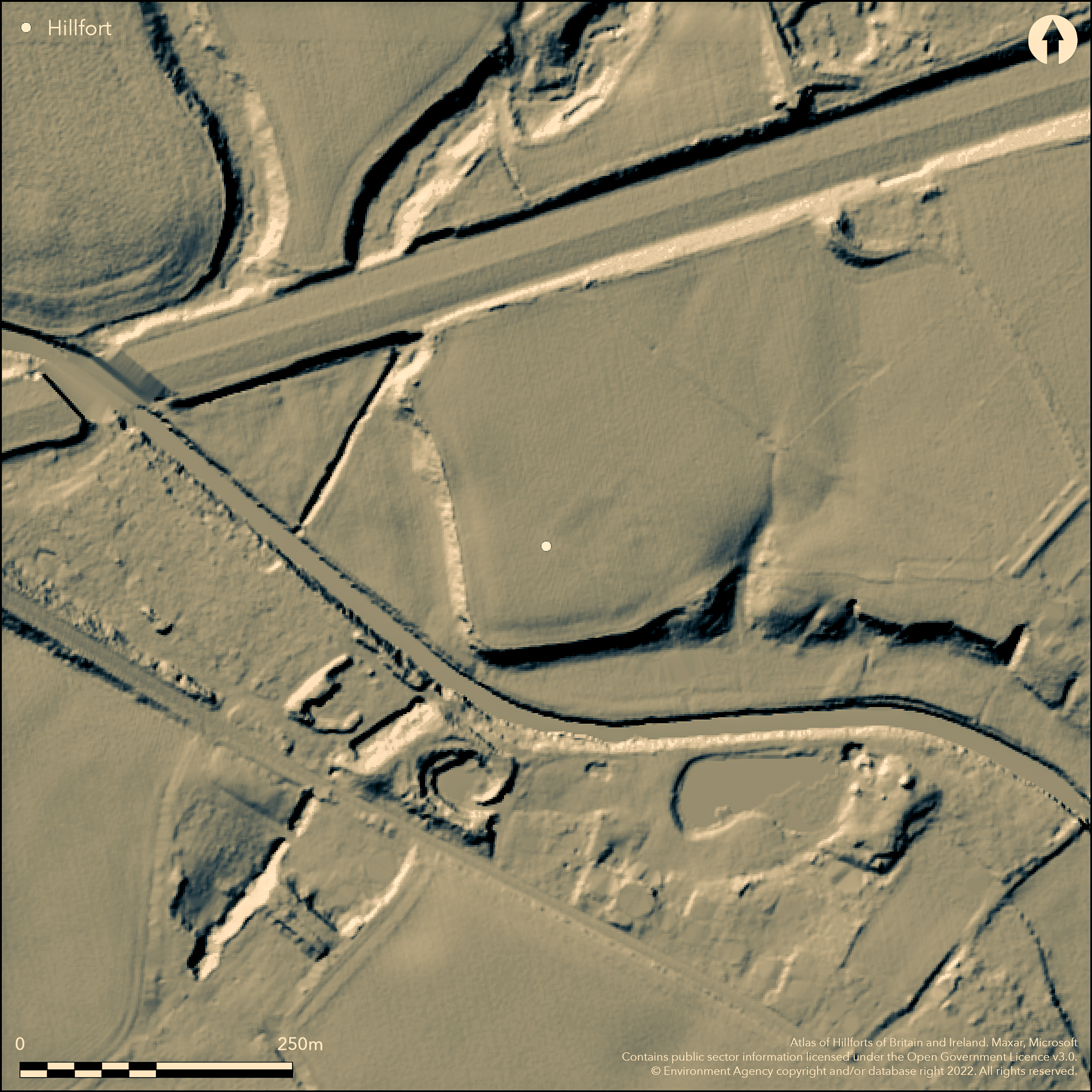
LiDAR 1m DTM Hillshade
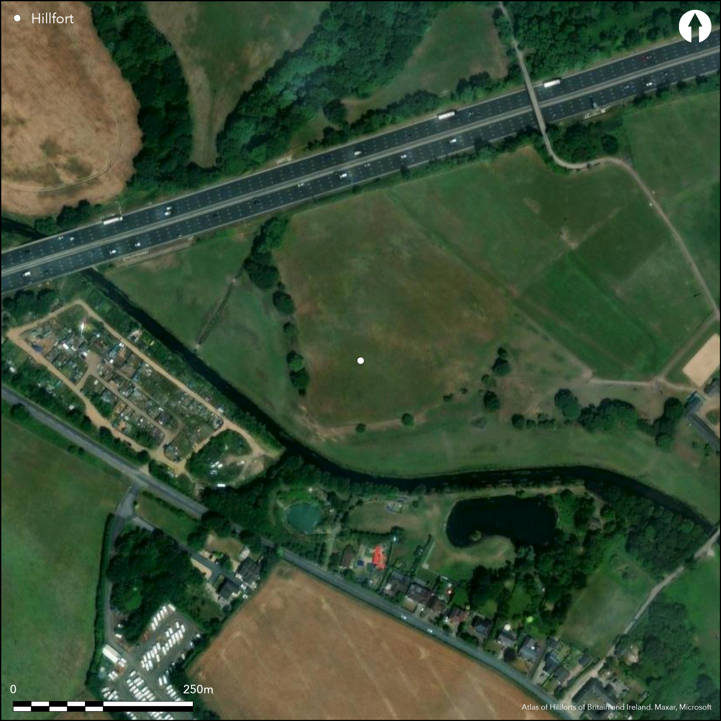
Satellite Imagery
LiDAR 1m DTM Hillshade
Satellite Imagery
Scroll left/right to view further images.
HER: Greater Manchester 1907 (None)
NMR: SJ 69 SE 16 (27594; 73547)
SM: 1015127
NGR: SJ6910 9356
X: 369100 Y: 393560 (OSGB36)
Cropmark of bivallate inland promontory fort located on sandy alluvium surrounded by peat on SW-facing promontory of 15m river terrace on E side of the Glaze Brook stream and valley Salford. Chat Moss to NE of site. Steep slopes to E, S and W. First recorded by N.J. Higham 1986. Almost rectangular interior measures c. 12m by 100m with internal area c. 1.2ha. Two curving ditches, c. 4m wide and c. 10m apart, cut off the promontory on NE. Natural terrace scarp provides defence S and W. Possible E entrance. Excavations by Greater Manchester Archaeological Unit 1986-88 confirmed the ditches. Two hut circles each set within compounds, one palisade the other ditch. Each hut built of posts or stakes with central post and roof. Drip gully to one. Inside huts possible clay hearths/ovens, with Cheshire VCP and Romano British coaresewares. Size of huts c. 5m-15 diameter. C14 gave date range of c. 500 BC to c. AD 200. Site well-preserved despite plough damage and under improved pasture.
Citizen Science: ✗
Reliability of Data: Confirmed
Reliability of Interpretation: Confirmed
X: -274583 Y: 7064411 (EPSG: 3857)
Longitude: -2.4666251286570815 Latitude: 53.43789535525829 (EPSG:4326)
Country: England
Current County or Unitary Authority: Salford
Historic County: Cheshire
Current Parish/Community/Council/Townland: Barton-upon-Irwell
Setting affected by M62.
| Extant | ✗ |
| Cropmark | ✓ |
| Likely Destroyed | ✓ |
Improved pasture.
| Woodland | ✗ |
| Commercial Forestry Plantation | ✗ |
| Parkland | ✗ |
| Pasture (Grazing) | ✓ |
| Arable | ✗ |
| Scrub/Bracken | ✗ |
| Bare Outcrop | ✗ |
| Heather/Moorland | ✗ |
| Heath | ✗ |
| Built-up | ✗ |
| Coastal Grassland | ✗ |
| Other | ✗ |
Cropmark of bivallate inland promontory fort located on SW-facing promontory of 15m river terrace on E side of the Glaze Brook stream and valley Salford. Chat Moss to NE of site.
| Contour Fort | ✗ |
| Partial Contour Fort | ✗ |
| Promontory Fort | ✓ |
| Hillslope Fort | ✗ |
| Level Terrain Fort | ✗ |
| Marsh Fort | ✗ |
| Multiple Enclosure Fort | ✗ |
| Hilltop | ✗ |
| Coastal Promontory | ✗ |
| Inland Promontory | ✓ |
| Valley Bottom | ✗ |
| Knoll/Hillock/Outcrop | ✗ |
| Ridge | ✗ |
| Cliff/Plateau-edge/Scarp | ✗ |
| Hillslope | ✗ |
| Lowland | ✗ |
| Spur | ✗ |
Dominant Topographic Feature: Promontory.
| North | ✗ |
| Northeast | ✗ |
| East | ✗ |
| Southeast | ✗ |
| South | ✗ |
| Southwest | ✓ |
| West | ✗ |
| Northwest | ✗ |
| Level | ✗ |
Altitude: 15.0m
N/A
Cheshire stony VCP (c. 500 BC - AD 100) and Romano-British coarseware pottery. C14 gave date range of c. 500 BC to c. AD 200.
Reliability: B - Medium
| Pre 1200BC | ✗ |
| 1200BC - 800BC | ✗ |
| 800BC - 400BC | ✓ |
| 400BC - AD50 | ✓ |
| AD50 - AD400 | ✓ |
| AD400 - AD 800 | ✗ |
| Post AD800 | ✗ |
| Unknown | ✗ |
| Pre Hillfort: | None |
| Post Hillfort: | None |
| Artefactual: | Cheshire VCP and Romano-British coarseware pottery. |
| C14: | C14 gave date range of c. 500 BC to c. AD 200. |
First observed by N.J. Higham 1986. Excavations by M. Nevell, Greater Manchester Archaeological Unit 1986-88. Resistivity surveys in each excavation season.
| Other (1986): | First observation by N.J. Higham. |
| Excavation (None): | M. Nevell, Greater Manchester Archaeological Unit. |
| Geophysical Survey (None): | Greater Manchester Archaeological Unit. |
Two hut circles each set within compounds, one palisade the other ditch. Each hut built of posts or stakes with central post and roof. Drip gully to one. Inside huts possible clay hearths/ovens, with Cheshire VCP and Romano British coaresewares.
None
| None | ✓ |
| Spring | ✗ |
| Stream | ✗ |
| Pool | ✗ |
| Flush | ✗ |
| Well | ✗ |
| Other | ✗ |
None
| No Known Features | ✓ |
| Round Stone Structures | ✗ |
| Rectangular Stone Structures | ✗ |
| Curvilinear Platforms | ✗ |
| Other Roundhouse Evidence | ✗ |
| Pits | ✗ |
| Quarry Hollows | ✗ |
| Other | ✗ |
Two hut circles each set within compounds, one palisade the other ditch. Each hut built of posts or stakes with central post and roof. Drip gully to one. Inside huts possible clay hearths/ovens.
| No Known Excavation | ✗ |
| Pits | ✗ |
| Postholes | ✓ |
| Roundhouses | ✓ |
| Rectangular Structures | ✗ |
| Roads/Tracks | ✗ |
| Quarry Hollows | ✗ |
| Other | ✓ |
| Nothing Found | ✗ |
None
| No Known Geophysics | ✗ |
| Pits | ✗ |
| Roundhouses | ✗ |
| Rectangular Structures | ✗ |
| Roads/Tracks | ✗ |
| Quarry Hollows | ✗ |
| Other | ✗ |
| Nothing Found | ✓ |
Inside huts Cheshire VCP and Romano British coaresewares.
| No Known Finds | ✗ |
| Pottery | ✓ |
| Metal | ✗ |
| Metalworking | ✗ |
| Human Bones | ✗ |
| Animal Bones | ✗ |
| Lithics | ✗ |
| Environmental | ✗ |
| Other | ✗ |
None
| APs Not Checked | ✓ |
| None | ✗ |
| Roundhouses | ✗ |
| Rectangular Structures | ✗ |
| Pits | ✗ |
| Postholes | ✗ |
| Roads/Tracks | ✗ |
| Other | ✗ |
Possible E entrance.
| 1: | None |
| 2: | None |
Guard Chambers: ✗
Chevaux de Frise: ✗
| 1. Simple Gap (East): | None |
Two ditches cut off the promontory of the 15m river terrace on NE. Natural terrace scarp provides defence S and W.
| Area 1: | 1.2ha. |
| Total: | 1.2ha. |
Total Footprint Area: Noneha.
None
| ✓ | Appears occupied in three phases. |
| ✗ | Suggested by ditches |
| NE Quadrant: | 2 |
| SE Quadrant: | None |
| SW Quadrant: | None |
| NW Quadrant: | None |
| Total: | 2 |
| Partial Univallate | ✗ |
| Univallate | ✗ |
| Partial Bivallate | ✓ |
| Bivallate | ✗ |
| Partial Multivallate | ✗ |
| Multivallate | ✗ |
| Unknown | ✗ |
| Partial Univallate | ✗ |
| Univallate | ✗ |
| Partial Bivallate | ✗ |
| Bivallate | ✗ |
| Partial Multivallate | ✗ |
| Multivallate | ✗ |
Cropmark.
| None | ✓ |
| Earthen Bank | ✗ |
| Stone Wall | ✗ |
| Rubble | ✗ |
| Wall-walk | ✗ |
| Evidence of Timber | ✗ |
| Vitrification | ✗ |
| Other Burning | ✗ |
| Palisade | ✗ |
| Counter Scarp Bank | ✗ |
| Berm | ✗ |
| Unfinished | ✗ |
| Other | ✗ |
Excavations by Greater Manchester Archaeological Unit 1986 confirmed the ditches.
| None | ✗ |
| Earthen Bank | ✗ |
| Stone Wall | ✗ |
| Murus Duplex | ✗ |
| Timber-framed | ✗ |
| Timber-laced | ✗ |
| Vitrification | ✗ |
| Other Burning | ✗ |
| Palisade | ✗ |
| Counter Scarp Bank | ✗ |
| Berm | ✗ |
| Unfinished | ✗ |
| No Known Excavation | ✗ |
| Other | ✓ |
| ✗ | None |
| ✓ | Site defined by two curving ditches. |
Number of Ditches: 2
| ✗ | None |
Greater Manchester Archaeological Unit 1987-88. Archaeol of Greater Manchester J, 3, 1987-8, 35-44.
Hartwell, C. and Neil ,N. 1986. Report on trial excavation and survey of a possible prehistoric enclosure at Great Woolden Hall Farm, Glaze Brook, Irlam, Greater Manchester Archaeological Unit [Assessment and Evaluation Reports], Report No 1986/1.
McNeil, R. and Nevell, M. Undated. Great Woolden Hall. A settlement on the Fringes of the Wetlands, Manchester: Manchester Archaeological Unit.
Atlas of Hillforts:
Wikidata:
This work is licensed under CC BY-SA 4.0

 and should be cited as:
Lock, Gary and Ralston, Ian. 2024. Atlas of Hillforts of Britain and Ireland. Available at: https://hillforts.arch.ox.ac.uk
Document Version 1.1