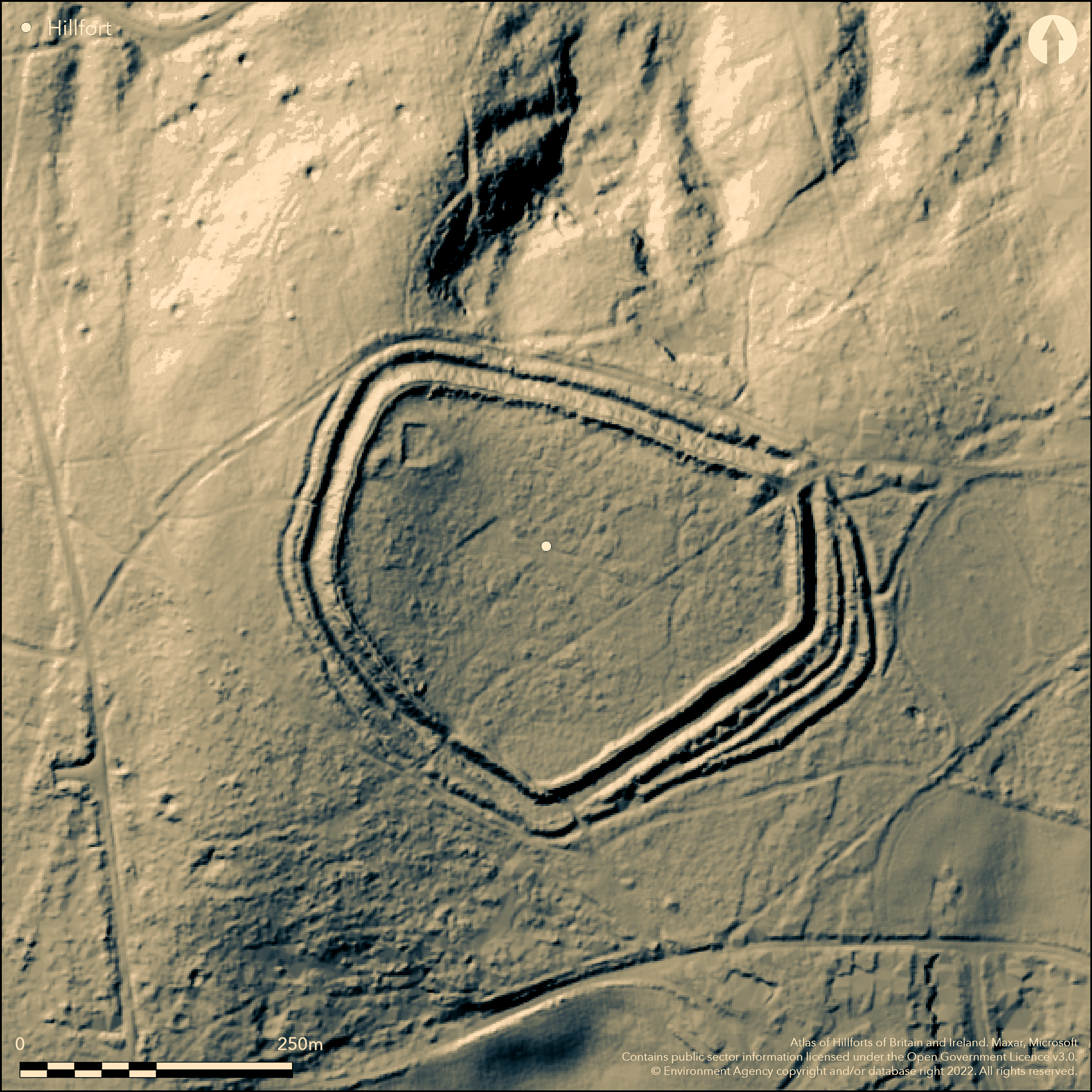
LiDAR 1m DTM Hillshade
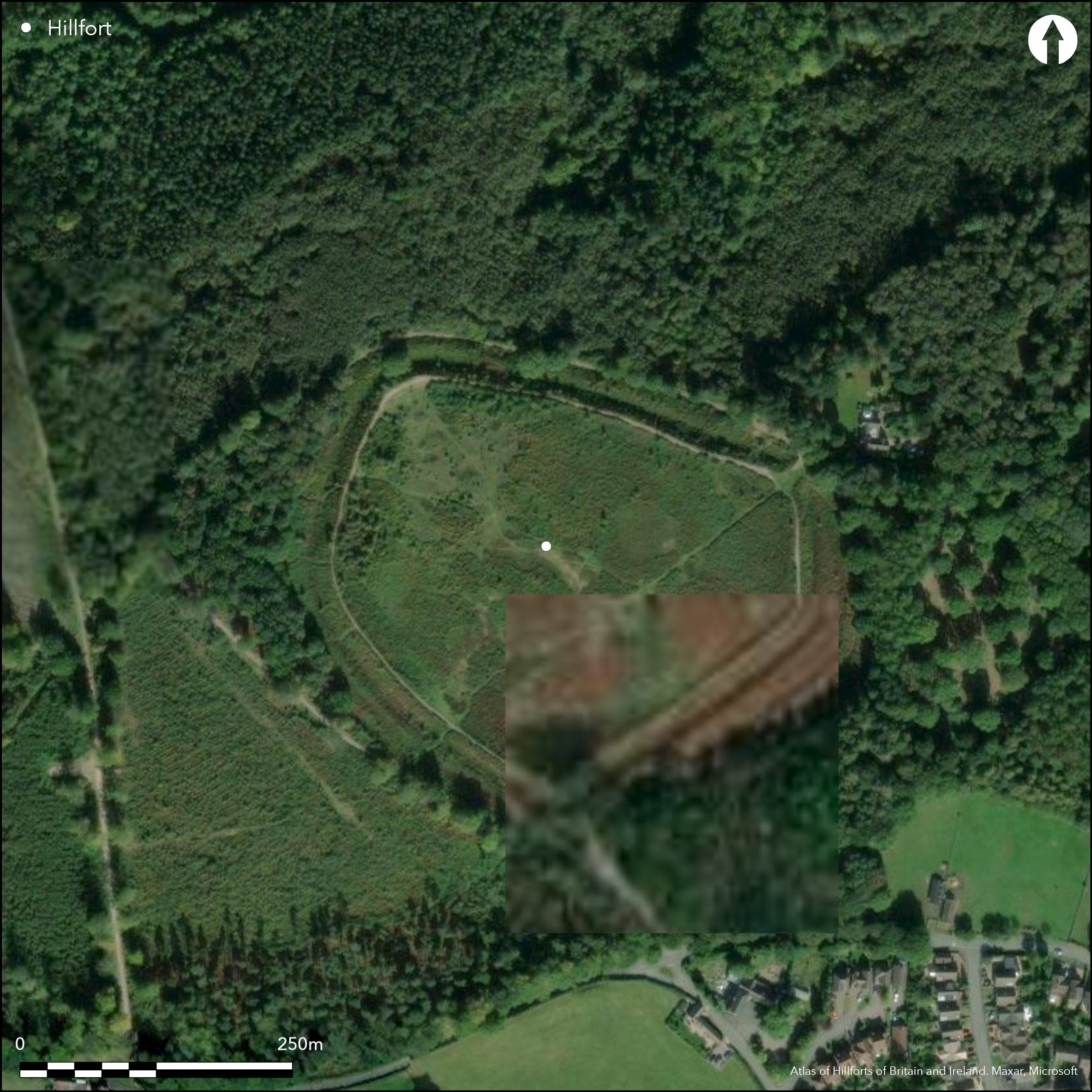
Satellite Imagery
LiDAR 1m DTM Hillshade
Satellite Imagery
Scroll left/right to view further images.
HER: Staffordshire 00025-MST25 (None)
NMR: SK 01 SW 1 (304764)
SM: 1014687
NGR: SK 04421 12847
X: 404421 Y: 312847 (OSGB36)
Lying at 242m OD on a plateau within Forestry Commission plantations on the SE edge of Cannock Chase, a multivallate hillfort of 3.8ha. The summit of a plateau forms the highest point on the Chase, commanding views across the Trent Valley from where seven counties were said to be visible (Page 1908, 336-8). The enclosure comprises an irregular pentagon made up of straight lengths of ramparts of between 65-220m with a substantial inner bank and an outer ditch with external counterscarp. Additional ramparts were constructed where the natural approach of the plateau is weakest. Mostly of three banks and two ditches, the inner bank varies from 3.5-5m above the silted bottom of the ditch and is most substantial on the N and W sides. In the N there is a counterscarp and in the W a second bank, ditch and counterscarp. Where weakest in the E, four banks and ditches increase the overall width of the works from 40m to 60m. The works appear to be multi-phased in this area with the outer ditch possibly incomplete. An original in-turned entrance lies in the NE corner, a gap in the SW is probably later. No internal features contemporary with the earthworks are visible within the interior. The greatest change occurred between 1780-1790 following the development of a landscaped park at Beaudesert when the N and W side of the ramparts were levelled to form a walkway and viewing platform. Two carriageways were created, one of which cuts through the main entrance in the E and through the western ramparts. The other runs along the northern section of the outer ditch which is believed to have been in-filled at that time. In the S and SW, sections of the external bank have been slightly eroded by the encroachment of modern tree planting. A resistance survey in the W of the interior (Strain 1987) identified a series of circular features 10-12m in diameter, possibly hut circles. Possible traces of ridge and furrow have been observed within the interior. A 19th century excavation by William Molyneux, a local historian, unearthed the footings of the medieval hunting lodge in the NW corner which can still be seen. The excavation report was never published and the records are now lost. It is unknown if any evidence for prehistoric activity was discovered. A scraper was found within the interior in 1908 and a further Bronze Age thumb scraper found in 1931. The site is recorded on 1884 1:2,500 OS mapping. It is undated but the ramparts suggest an Iron Age date for its construction and use. Scheduled
Citizen Science: ✗
Reliability of Data: Confirmed
Reliability of Interpretation: Confirmed
X: -215515 Y: 6930130 (EPSG: 3857)
Longitude: -1.9360045933036327 Latitude: 52.71324125903229 (EPSG:4326)
Country: England; None
Current County or Unitary Authority: Staffordshire
Historic County: Staffordshire
Current Parish/Community/Council/Townland: Cannock Wood; Longdon
10-year management plan for 2007-2017 updated in 2012.
| Extant | ✓ |
| Cropmark | ✗ |
| Likely Destroyed | ✗ |
Heathland surrounded by Forestry Commission woodland. SSSI. Registered as a common and a site of biological interest.
| Woodland | ✗ |
| Commercial Forestry Plantation | ✓ |
| Parkland | ✗ |
| Pasture (Grazing) | ✗ |
| Arable | ✗ |
| Scrub/Bracken | ✗ |
| Bare Outcrop | ✗ |
| Heather/Moorland | ✗ |
| Heath | ✓ |
| Built-up | ✗ |
| Coastal Grassland | ✗ |
| Other | ✗ |
A contour fort occupying the summit of a plateau on the highest point on the Chase at 242m OD
| Contour Fort | ✓ |
| Partial Contour Fort | ✗ |
| Promontory Fort | ✗ |
| Hillslope Fort | ✗ |
| Level Terrain Fort | ✗ |
| Marsh Fort | ✗ |
| Multiple Enclosure Fort | ✗ |
| Hilltop | ✓ |
| Coastal Promontory | ✗ |
| Inland Promontory | ✗ |
| Valley Bottom | ✗ |
| Knoll/Hillock/Outcrop | ✗ |
| Ridge | ✗ |
| Cliff/Plateau-edge/Scarp | ✓ |
| Hillslope | ✗ |
| Lowland | ✗ |
| Spur | ✗ |
Dominant Topographic Feature: Commanding position on a plateau
| North | ✓ |
| Northeast | ✗ |
| East | ✗ |
| Southeast | ✗ |
| South | ✗ |
| Southwest | ✗ |
| West | ✗ |
| Northwest | ✗ |
| Level | ✗ |
Altitude: 242.0m
The parish boundary between Cannock Wood and Longdon runs E-W along the ramparts in the N
Boundary Type: Parish/Townland
The site is undated but the ramparts suggest an Iron Age date for its construction and use. 11th-12th century park use.
Reliability: D - None
| Pre 1200BC | ✗ |
| 1200BC - 800BC | ✗ |
| 800BC - 400BC | ✓ |
| 400BC - AD50 | ✓ |
| AD50 - AD400 | ✗ |
| AD400 - AD 800 | ✗ |
| Post AD800 | ✗ |
| Unknown | ✗ |
| Pre Hillfort: | None |
| Post Hillfort: | None |
| Morphology/Earthwork/Typology: | None |
Reference to Castle Ring (then known as Castle Hill) by Plot (1686). 19th century excavation of the medieval building by William Molyneux. Recorded on 1884 1:2,500 OS mapping. First large scale survey of the hillfort carried out in 1884. Field investigations in 1958 and 1974. Resistance survey in 1987. 1996 RCHME desk based assessment and earthwork survey, ref. no. 909530. Management plan created 2007-2017. Scheduled in 1925.
| 1st Identified Written Reference (1686): | None |
| 1st Identified Map Depiction (1884): | None |
| Other (1925): | Scheduled |
| Other (1958): | Field investigation |
| Other (1974): | Field investigation |
| Geophysical Survey (1987): | Resistance Survey |
| Earthwork Survey (1996): | RCHME desk based assessment and earthwork survey |
| Excavation (None): | Evidence for hunting lodge only |
No surface features contemporary with the hillfort are known. Round houses from geophysics.
Springs and wells in the general vicinity of the hillfort
| None | ✓ |
| Spring | ✗ |
| Stream | ✗ |
| Pool | ✗ |
| Flush | ✗ |
| Well | ✗ |
| Other | ✗ |
None
| No Known Features | ✓ |
| Round Stone Structures | ✗ |
| Rectangular Stone Structures | ✗ |
| Curvilinear Platforms | ✗ |
| Other Roundhouse Evidence | ✗ |
| Pits | ✗ |
| Quarry Hollows | ✗ |
| Other | ✗ |
11th-12th century hunting lodge in NE quadrant
| No Known Excavation | ✗ |
| Pits | ✗ |
| Postholes | ✗ |
| Roundhouses | ✗ |
| Rectangular Structures | ✗ |
| Roads/Tracks | ✗ |
| Quarry Hollows | ✗ |
| Other | ✓ |
| Nothing Found | ✗ |
None
| No Known Geophysics | ✗ |
| Pits | ✗ |
| Roundhouses | ✓ |
| Rectangular Structures | ✗ |
| Roads/Tracks | ✗ |
| Quarry Hollows | ✗ |
| Other | ✗ |
| Nothing Found | ✗ |
Scraper found within the interior in 1908; Bronze Age thumb scraper found in 1931
| No Known Finds | ✗ |
| Pottery | ✗ |
| Metal | ✗ |
| Metalworking | ✗ |
| Human Bones | ✗ |
| Animal Bones | ✗ |
| Lithics | ✓ |
| Environmental | ✗ |
| Other | ✗ |
None
| APs Not Checked | ✓ |
| None | ✗ |
| Roundhouses | ✗ |
| Rectangular Structures | ✗ |
| Pits | ✗ |
| Postholes | ✗ |
| Roads/Tracks | ✗ |
| Other | ✗ |
An original entrance, in-turned on the inner rampart lies in the NE corner. A gap in the SW is probably later.
| 2: | None |
| 2: | None |
Guard Chambers: ✗
Chevaux de Frise: ✗
| 1. In-turned (North east): | Inner rampart |
| 1. Simple Gap (North east): | Outer rampart |
Multivallate hillfort of 3.8ha. It comprises an irregular pentagon made up of straight lengths of defences between 65-220m in length with a substantial inner bank and outer ditch with external counterscarp and additional defences where the natural defence of the plateau is weakest. Mostly of three banks and two ditches, the inner bank varies from 3.5-5m above the silted bottom of the ditch and is most substantial on the N and W sides. In the N there is a counterscarp and in the W there is a second bank, ditch and counterscarp. Where weakest in the E, four banks and ditches increase the overall width of the defences from 40m to 60m. The defences appear to be multi-phased in this area with the outer ditch possibly incomplete.
| Area 1: | 3.8ha. |
| Total: | 3.8ha. |
Total Footprint Area: 6.3ha.
None
| ✓ | Area measurements taken from satellite imagery |
| ✓ | None |
| NE Quadrant: | 4 |
| SE Quadrant: | 4 |
| SW Quadrant: | 3 |
| NW Quadrant: | 2 |
| Total: | 4 |
| Partial Univallate | ✗ |
| Univallate | ✗ |
| Partial Bivallate | ✓ |
| Bivallate | ✗ |
| Partial Multivallate | ✓ |
| Multivallate | ✗ |
| Unknown | ✗ |
| Partial Univallate | ✗ |
| Univallate | ✗ |
| Partial Bivallate | ✓ |
| Bivallate | ✗ |
| Partial Multivallate | ✓ |
| Multivallate | ✗ |
None
| None | ✗ |
| Earthen Bank | ✓ |
| Stone Wall | ✗ |
| Rubble | ✗ |
| Wall-walk | ✗ |
| Evidence of Timber | ✗ |
| Vitrification | ✗ |
| Other Burning | ✗ |
| Palisade | ✗ |
| Counter Scarp Bank | ✓ |
| Berm | ✗ |
| Unfinished | ✓ |
| Other | ✗ |
No excavation of the ramparts
| None | ✗ |
| Earthen Bank | ✗ |
| Stone Wall | ✗ |
| Murus Duplex | ✗ |
| Timber-framed | ✗ |
| Timber-laced | ✗ |
| Vitrification | ✗ |
| Other Burning | ✗ |
| Palisade | ✗ |
| Counter Scarp Bank | ✗ |
| Berm | ✗ |
| Unfinished | ✗ |
| No Known Excavation | ✗ |
| Other | ✓ |
| ✗ | None |
| ✓ | Up to four ditches in the E |
Number of Ditches: 4
| ✗ | None |
Castle Ring: A large multivallate hillfort. Management Plan 2007-2014. https://www.cannockchasedc.gov.uk/downloads/file/4089/castle-ring-management-plan-2012. Accessed August 2015
Cocroft, W. Jecock, M and Ainsworth, S. 1987. RCHME Staffordshire Hillforts Project. Unpublished
Page, W. 1908. The Victoria History of the Counties of England. A History of the County of Stafford, Vol. I, 336-338
Plot, R. 1686. Natural History of Staffordshire.
Shaw, S., 1798. The History and Antiquities of Staffordshire. J. Nichols and Son. (Republished 1976 by EP Publishing) Vol. 1, 40
Strain, R. 1987. A Geophysical Survey of the Iron Age Hillfort of Castle Ring Staffordshire. Unpublished BA dissertation. Leicester University
Atlas of Hillforts:
Wikidata:
This work is licensed under CC BY-SA 4.0

 and should be cited as:
Lock, Gary and Ralston, Ian. 2024. Atlas of Hillforts of Britain and Ireland. Available at: https://hillforts.arch.ox.ac.uk
Document Version 1.1