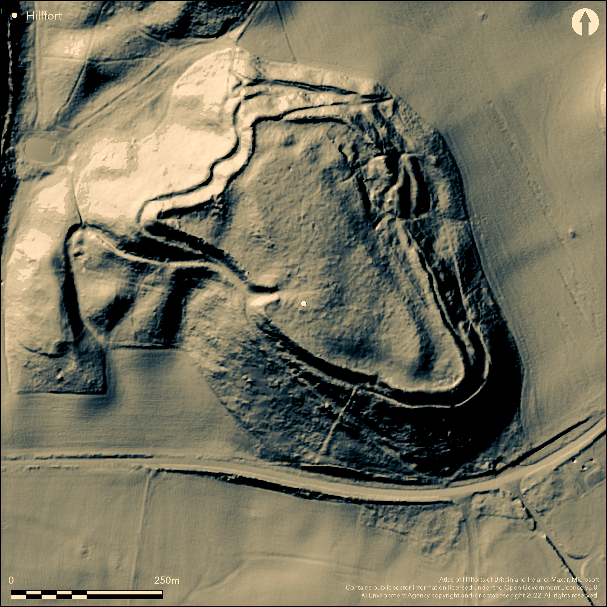
LiDAR 1m DTM Hillshade
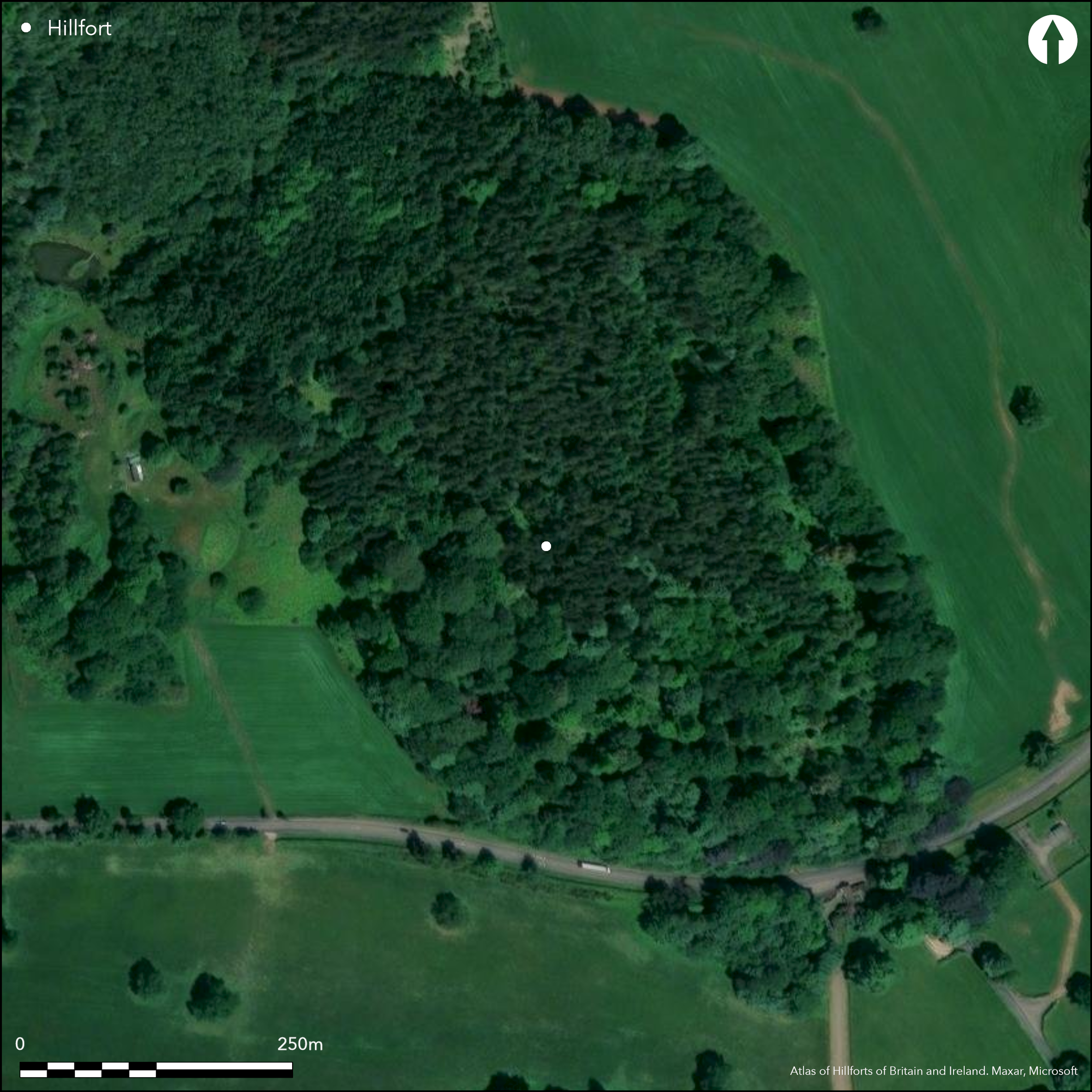
Satellite Imagery
LiDAR 1m DTM Hillshade
Satellite Imagery
Scroll left/right to view further images.
HER: Staffordshire 00023-MST23 (None)
NMR: SJ 73 NE 7 (74227)
SM: 1009771
NGR: SJ 78756 39002
X: 378756 Y: 339002 (OSGB36)
Approximately 600m NW of Maer Hall on the SE edge of the Maer Hills at 175m OD, a multivallate contour fort of 4.0 ha situated on a prominent sandstone outcrop. The enclosure, which now lies in plantation woodland, measures approximately 320m NW-SE by 150m transversely, its form dictated by the natural contours of the hill, the NW angle lying on a sharp projecting promontory. In places pathways, the remains of a 19th century ornamental landscaped garden, have modified the earthworks. Two substantial ramparts lie around most of the circuit increasing to three in the N and NE where the approach is weakest. The flat-topped, inner rampart which measures up to 15m wide and rises to a height of 0.8m internally, is constructed of earth and stone. In the S the inner rampart has been created by cutting into and over the hillside and probably created over three stages, each stage slightly offset from the previous giving a stepped appearance. Excavation in 1975 and earlier (unspecified) (Emery 1975) showed a dump rampart overlying an earlier timber-framed box rampart. The outer rampart is of simple dump construction. The V-shaped ditch, 2m deep and 3m wide was cut into the rock. It appears to have rapidly silted up and in the second phase partly filled-in (ibid.). A terrace lies between the banks with a low discontinuous bank along the outer lip, which gives the appearance of a ditch. The rampart following the SW promontory and the W side of the hill appears to have been constructed over several phases but this might have been constructional, to prevent the downslope movement of the rampart. A second ditch and third rampart commence at the NW corner running eastwards. Beyond the NW corner the inner terrace ditch and what is now the middle rampart peter out into a steep fall down from the base of the inner rampart to the bottom of a further ditch. The inner ditch and middle rampart recommence in the NE corner and with the second ditch and third rampart continuing to mid-way down the E side. The ramparts in this region are mutilated by what are possibly ornamental garden walks. Beyond the NE corner, a fence line running along the bottom of the middle rampart marks the boundary with modern fields which have been ploughed in the past, reducing the height of the outer ramparts. Mid-way down the E side of the hillfort the land becomes steeper with the two outermost ramparts terminating on a natural gully, with only the inner rampart continuing for a further 100m. The ramparts in this area have been damaged by terracing for an aqueduct leading from a spring in the NE corner. What appears to be an ornamental garden walk runs at the base of the rampart continuing around the side of the hill. A 2-3m wide in-turned entrances lies in the SW, approached by an embanked track up the NW slope built along a steep sided gully. A simple entrance with a rounded terminal lies in N end of the eastern ramparts. A break in the N appears to be a later feature and revetted by a dry-stone wall thought to relate to the 19th century landscaped garden. No internal features are recorded and the interior is currently planted with conifer with much of ramparts and hillside covered by nineteenth century ornamental trees, birch scrub and self-seeded conifer. The site is recorded on 1880 1:2,500 OS mapping. Post medieval quarrying and forestry has damaged parts of the site. The site is undated. Scheduled
Citizen Science: ✗
Reliability of Data: Confirmed
Reliability of Interpretation: Confirmed
X: -257997 Y: 6973377 (EPSG: 3857)
Longitude: -2.317626391941671 Latitude: 52.94795733219926 (EPSG:4326)
Country: England
Current County or Unitary Authority: Staffordshire
Historic County: Staffordshire
Current Parish/Community/Council/Townland: Maer
None
| Extant | ✓ |
| Cropmark | ✗ |
| Likely Destroyed | ✗ |
None
| Woodland | ✗ |
| Commercial Forestry Plantation | ✓ |
| Parkland | ✗ |
| Pasture (Grazing) | ✗ |
| Arable | ✗ |
| Scrub/Bracken | ✗ |
| Bare Outcrop | ✗ |
| Heather/Moorland | ✗ |
| Heath | ✗ |
| Built-up | ✗ |
| Coastal Grassland | ✗ |
| Other | ✗ |
A multivallate contour fort of 4.0 ha situated on a prominent sandstone outcrop on the SE edge of the Maer Hills at 175m OD. Its form is dictated by the natural contours of the hill, the NW angle lying on a sharp projecting promontory.
| Contour Fort | ✓ |
| Partial Contour Fort | ✗ |
| Promontory Fort | ✗ |
| Hillslope Fort | ✗ |
| Level Terrain Fort | ✗ |
| Marsh Fort | ✗ |
| Multiple Enclosure Fort | ✗ |
| Hilltop | ✓ |
| Coastal Promontory | ✗ |
| Inland Promontory | ✓ |
| Valley Bottom | ✗ |
| Knoll/Hillock/Outcrop | ✗ |
| Ridge | ✗ |
| Cliff/Plateau-edge/Scarp | ✗ |
| Hillslope | ✗ |
| Lowland | ✗ |
| Spur | ✗ |
Dominant Topographic Feature: Prominent sandstone outcrop
| North | ✗ |
| Northeast | ✗ |
| East | ✗ |
| Southeast | ✓ |
| South | ✗ |
| Southwest | ✗ |
| West | ✗ |
| Northwest | ✗ |
| Level | ✗ |
Altitude: 175.0m
N/A
The site is undated but presumed Iron Age. Later landscaping.
Reliability: D - None
| Pre 1200BC | ✗ |
| 1200BC - 800BC | ✗ |
| 800BC - 400BC | ✗ |
| 400BC - AD50 | ✗ |
| AD50 - AD400 | ✗ |
| AD400 - AD 800 | ✗ |
| Post AD800 | ✗ |
| Unknown | ✓ |
| Pre Hillfort: | None |
| Post Hillfort: | None |
Recorded on 1880 OS mapping. General reference in Pennant (1782). Excavation of the ramparts in 1975 and earlier (unspecified). Surveyed during 1989 as part of the Staffordshire Hillforts Project, ref. no. 908982. Field investigations 1958, 1974. Scheduled.
| 1st Identified Written Reference (1782): | None |
| 1st Identified Map Depiction (1880): | None |
| Other (1925): | Scheduled |
| Other (1958): | Field investigation |
| Other (1974): | Field investigation |
| Excavation (1975): | None |
| Earthwork Survey (1989): | None |
| Excavation (None): | None |
No internal features are recorded
A spring flows from the eastern rampart
| None | ✗ |
| Spring | ✓ |
| Stream | ✗ |
| Pool | ✗ |
| Flush | ✗ |
| Well | ✗ |
| Other | ✗ |
None
| No Known Features | ✓ |
| Round Stone Structures | ✗ |
| Rectangular Stone Structures | ✗ |
| Curvilinear Platforms | ✗ |
| Other Roundhouse Evidence | ✗ |
| Pits | ✗ |
| Quarry Hollows | ✗ |
| Other | ✗ |
Ramparts only excavated
| No Known Excavation | ✓ |
| Pits | ✗ |
| Postholes | ✗ |
| Roundhouses | ✗ |
| Rectangular Structures | ✗ |
| Roads/Tracks | ✗ |
| Quarry Hollows | ✗ |
| Other | ✗ |
| Nothing Found | ✗ |
None
| No Known Geophysics | ✓ |
| Pits | ✗ |
| Roundhouses | ✗ |
| Rectangular Structures | ✗ |
| Roads/Tracks | ✗ |
| Quarry Hollows | ✗ |
| Other | ✗ |
| Nothing Found | ✗ |
None
| No Known Finds | ✓ |
| Pottery | ✗ |
| Metal | ✗ |
| Metalworking | ✗ |
| Human Bones | ✗ |
| Animal Bones | ✗ |
| Lithics | ✗ |
| Environmental | ✗ |
| Other | ✗ |
Woodland
| APs Not Checked | ✓ |
| None | ✗ |
| Roundhouses | ✗ |
| Rectangular Structures | ✗ |
| Pits | ✗ |
| Postholes | ✗ |
| Roads/Tracks | ✗ |
| Other | ✗ |
A 2-3m wide in-turned entrances lies in the SW forming a funnel-shaped entrance, approached by an embanked track up the NW slope built along a steep sided gully. A simple break with a rounded terminal lies in N end of the eastern defences. A break in the N appears to be a later feature revetted by a dry-stone wall thought to relate to the 19th century landscaped garden.
| 3: | None |
| 2: | None |
Guard Chambers: ✗
Chevaux de Frise: ✗
| 1. In-turned (South west): | Inner rampart |
| 2. In-turned (South west): | Outer rampart |
| 2. Simple Gap (North east): | Inner rampart |
Two substantial ramparts around most of the circuit, increasing to three in the N and NE where the approach is weakest. Flat-topped, inner rampart which measures up to 15m wide and rises to a height of 0.8m internally constructed of earth and stone. The inner rampart in the S created by cutting back into and over the hillside probably over three phases, each stage slightly offset from the previous giving a stepped appearance. Excavation showed a dump construction overlying earlier box ramparts. The outer rampart is of simple dump construction. V-shaped ditch, 2m deep and 3m wide cut into the rock. It appears to have rapidly silted up and in the second phase partly filled-in (ibid.). A terrace lies between the banks with a low discontinuous bank along the outer lip, which gives the appearance of a ditch. The rampart following the SW promontory and the W side of the hill appears to have been constructed over several phases but this might have been constructional, to prevent the downslope movement of the rampart. A second ditch and third rampart commence at the NW corner running eastwards. Beyond the NW corner the inner terrace ditch and what is now the middle rampart peter out into a steep fall down from the base of the inner rampart to the bottom of a further ditch. The inner ditch and middle rampart recommence in the NE corner and with the second ditch and third rampart continue to mid-way down the E side. Mid-way down the E side of the hillfort the land becomes steeper with the two outermost ramparts terminating on a natural gully, with only the inner rampart continuing for a further 100m.
| Area 1: | 4.0ha. |
| Total: | 4.0ha. |
Total Footprint Area: Noneha.
None
| ✓ | The inner rampart has been created by cutting back into and over the hillside and probably created over three phases, each stage slightly offset from the previous giving a stepped appearance. Excavation in 1975 and earlier showed a dump rampart overlying earlier timber-framed box rampart. |
| ✗ | Two substantial ramparts around most of the circuit increasing to three in the N and NE where the approach is weakest. A second ditch and third rampart commence at the NW corner running eastwards |
| NE Quadrant: | 3 |
| SE Quadrant: | 2 |
| SW Quadrant: | 2 |
| NW Quadrant: | 3 |
| Total: | 3 |
| Partial Univallate | ✗ |
| Univallate | ✗ |
| Partial Bivallate | ✓ |
| Bivallate | ✗ |
| Partial Multivallate | ✓ |
| Multivallate | ✗ |
| Unknown | ✗ |
| Partial Univallate | ✗ |
| Univallate | ✗ |
| Partial Bivallate | ✗ |
| Bivallate | ✗ |
| Partial Multivallate | ✗ |
| Multivallate | ✗ |
Terrace
| None | ✗ |
| Earthen Bank | ✓ |
| Stone Wall | ✗ |
| Rubble | ✗ |
| Wall-walk | ✗ |
| Evidence of Timber | ✗ |
| Vitrification | ✗ |
| Other Burning | ✗ |
| Palisade | ✗ |
| Counter Scarp Bank | ✗ |
| Berm | ✗ |
| Unfinished | ✗ |
| Other | ✓ |
Dump rampart overlying timber-framed box ramparts
| None | ✗ |
| Earthen Bank | ✓ |
| Stone Wall | ✗ |
| Murus Duplex | ✗ |
| Timber-framed | ✓ |
| Timber-laced | ✗ |
| Vitrification | ✗ |
| Other Burning | ✗ |
| Palisade | ✗ |
| Counter Scarp Bank | ✗ |
| Berm | ✗ |
| Unfinished | ✗ |
| No Known Excavation | ✗ |
| Other | ✗ |
| ✗ | None |
| ✓ | None |
Number of Ditches: 2
| ✗ | None |
Jecock, M. 1989. RCHME: Staffordshire Hillforts Project. Unpublished
Pennant, T. 1782. The Journey from Chester to London. London. 47
Emery, G. 1975. Berth Hill, Staffs (SJ/788391). CBA Group 8 West Midlands Archaeology News Sheet, 18, 40-1.
Atlas of Hillforts:
Wikidata:
This work is licensed under CC BY-SA 4.0

 and should be cited as:
Lock, Gary and Ralston, Ian. 2024. Atlas of Hillforts of Britain and Ireland. Available at: https://hillforts.arch.ox.ac.uk
Document Version 1.1