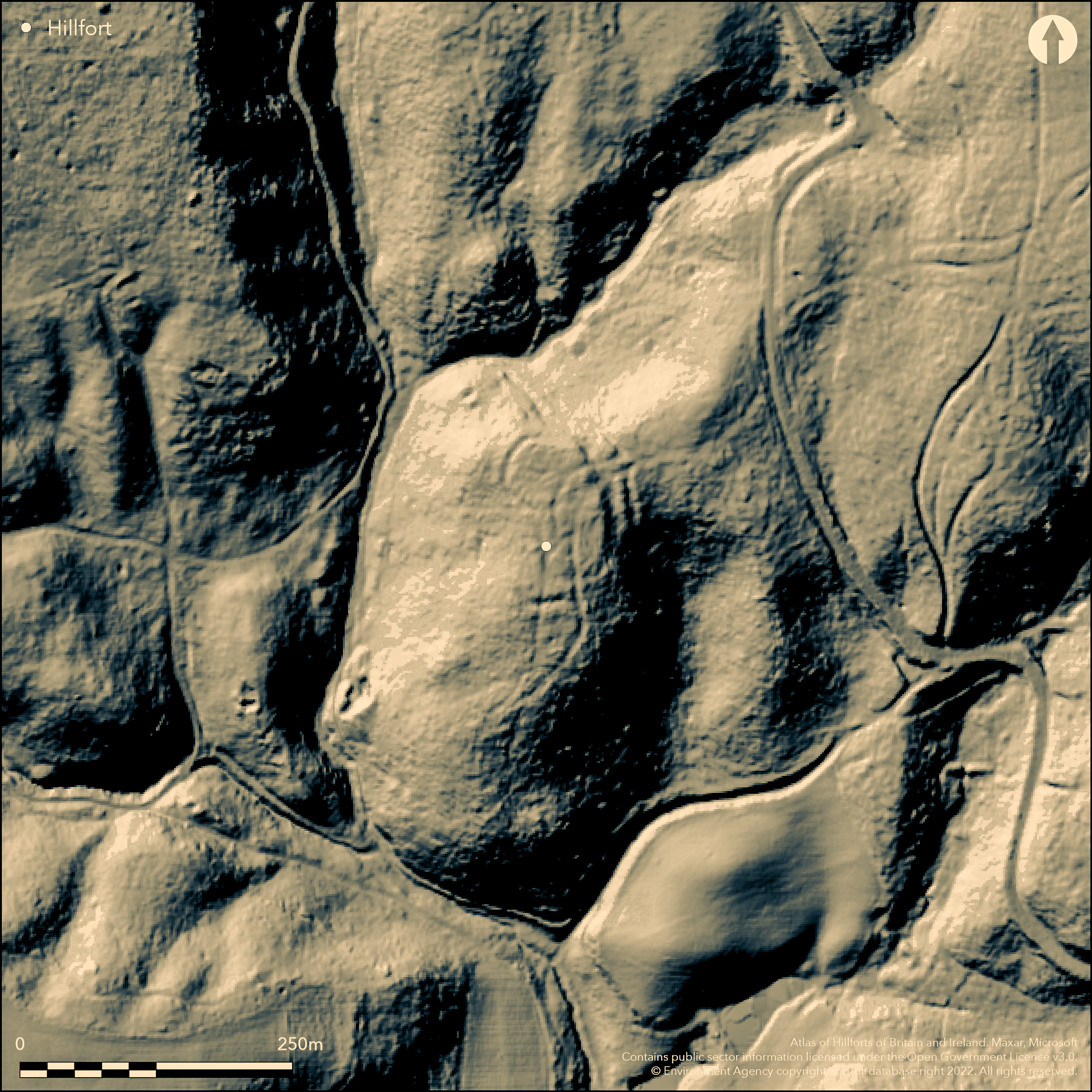
LiDAR 1m DTM Hillshade
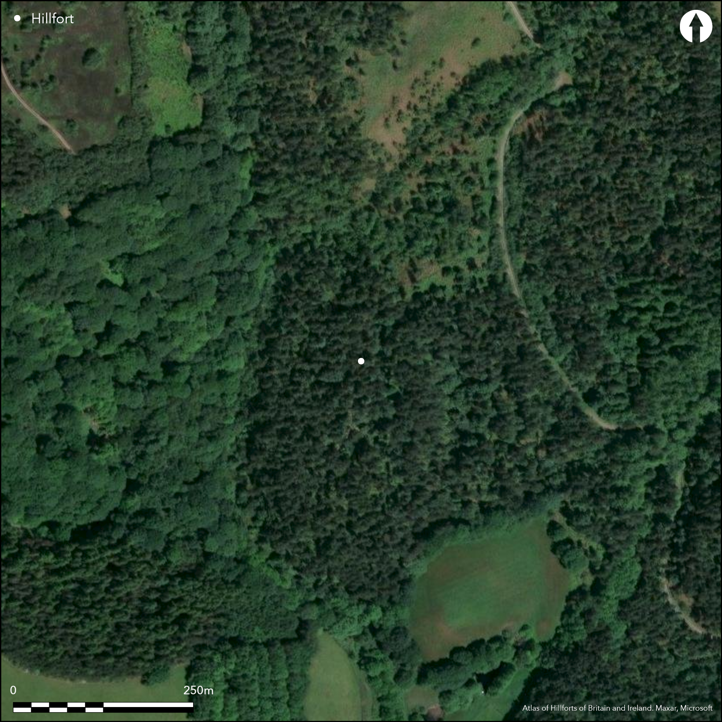
Satellite Imagery
LiDAR 1m DTM Hillshade
Satellite Imagery
Scroll left/right to view further images.
HER: Staffordshire 00633-MST633 (None)
NMR: SJ 73 SW 4 (74391)
SM: None
NGR: SJ 74472 33541
X: 374472 Y: 333541 (OSGB36)
Lying at 160m OD at the south-western end of a steep-sided promontory within Bishop's Wood, a small fort of approximately 0.2ha. Its location overlooks minor tributaries of the Coal Brook. The site was first identified from aerial photographs taken in 1948 following woodland clearance. The enclosed area measures approximately 80m NS by 50m EW and comprises a discontinuous line of banks where the natural topography is weakest. Double ditches cut off the neck of the promontory in the NE, the inner ditch possibly continuing around the crest of the promontory. A further short length of bank and ditch crosses the weaker approach in the S. Two possible phases have been identified (Cocroft and Jecock 1988), the original enclosure is probably represented by the inner rampart and ditch except in the NW where the they appear to run inside the later works to form a small oval enclosure. It is possible that a second outer bank on a parallel with the W side existed at that time. The NW corner of the main enclosure was later extended westwards by 10m. A gap in the centre of the earthworks across the neck of the promontory, now used as a forest track, is probably the location of the original entrance. No internal features are recorded. The site is recorded on 1965-67 1:2,500 OS mapping. Undated.
Citizen Science: ✗
Reliability of Data: Confirmed
Reliability of Interpretation: Confirmed
X: -265046 Y: 6964278 (EPSG: 3857)
Longitude: -2.380951877440817 Latitude: 52.898679455872376 (EPSG:4326)
Country: England; None
Current County or Unitary Authority: Staffordshire
Historic County: Staffordshire
Current Parish/Community/Council/Townland: Eccleshall; Loggerheads
None
| Extant | ✓ |
| Cropmark | ✗ |
| Likely Destroyed | ✗ |
None
| Woodland | ✓ |
| Commercial Forestry Plantation | ✗ |
| Parkland | ✗ |
| Pasture (Grazing) | ✗ |
| Arable | ✗ |
| Scrub/Bracken | ✗ |
| Bare Outcrop | ✗ |
| Heather/Moorland | ✗ |
| Heath | ✗ |
| Built-up | ✗ |
| Coastal Grassland | ✗ |
| Other | ✗ |
A promontory fort lying at 160m OD at the south-western end of a steep-sided promontory
| Contour Fort | ✗ |
| Partial Contour Fort | ✗ |
| Promontory Fort | ✓ |
| Hillslope Fort | ✗ |
| Level Terrain Fort | ✗ |
| Marsh Fort | ✗ |
| Multiple Enclosure Fort | ✗ |
| Hilltop | ✓ |
| Coastal Promontory | ✗ |
| Inland Promontory | ✓ |
| Valley Bottom | ✗ |
| Knoll/Hillock/Outcrop | ✗ |
| Ridge | ✗ |
| Cliff/Plateau-edge/Scarp | ✗ |
| Hillslope | ✗ |
| Lowland | ✗ |
| Spur | ✗ |
Dominant Topographic Feature: Steep-sided promontory
| North | ✗ |
| Northeast | ✗ |
| East | ✗ |
| Southeast | ✗ |
| South | ✗ |
| Southwest | ✗ |
| West | ✗ |
| Northwest | ✗ |
| Level | ✓ |
Altitude: 160.0m
The parish boundary between Eccleshall and Loggerheads runs N-S to the E of the enclosed area
Boundary Type: Parish/Townland
The site is undated
Reliability: D - None
| Pre 1200BC | ✗ |
| 1200BC - 800BC | ✗ |
| 800BC - 400BC | ✗ |
| 400BC - AD50 | ✗ |
| AD50 - AD400 | ✗ |
| AD400 - AD 800 | ✗ |
| Post AD800 | ✗ |
| Unknown | ✓ |
| Pre Hillfort: | None |
| Post Hillfort: | None |
First recorded on aerial photographs taken in 1948. Field investigations 1958 and 1974. General reference in Challis and Harding (1975). Recorded on 1965-67 1:2,500 OS mapping. RCHME survey, ref. no. 908982, part of Staffordshire Hillforts Project.
| Other (1958): | Field investigation |
| Other (1974): | Field investigation |
| 1st Identified Written Reference (1975): | None |
| Earthwork Survey (1997): | None |
| 1st Identified Map Depiction (None): | None |
No internal features are recorded
Overlooks tributaries of the Coal Brook
| None | ✓ |
| Spring | ✗ |
| Stream | ✗ |
| Pool | ✗ |
| Flush | ✗ |
| Well | ✗ |
| Other | ✗ |
None
| No Known Features | ✓ |
| Round Stone Structures | ✗ |
| Rectangular Stone Structures | ✗ |
| Curvilinear Platforms | ✗ |
| Other Roundhouse Evidence | ✗ |
| Pits | ✗ |
| Quarry Hollows | ✗ |
| Other | ✗ |
None
| No Known Excavation | ✓ |
| Pits | ✗ |
| Postholes | ✗ |
| Roundhouses | ✗ |
| Rectangular Structures | ✗ |
| Roads/Tracks | ✗ |
| Quarry Hollows | ✗ |
| Other | ✗ |
| Nothing Found | ✗ |
None
| No Known Geophysics | ✓ |
| Pits | ✗ |
| Roundhouses | ✗ |
| Rectangular Structures | ✗ |
| Roads/Tracks | ✗ |
| Quarry Hollows | ✗ |
| Other | ✗ |
| Nothing Found | ✗ |
None
| No Known Finds | ✓ |
| Pottery | ✗ |
| Metal | ✗ |
| Metalworking | ✗ |
| Human Bones | ✗ |
| Animal Bones | ✗ |
| Lithics | ✗ |
| Environmental | ✗ |
| Other | ✗ |
Woodland
| APs Not Checked | ✓ |
| None | ✗ |
| Roundhouses | ✗ |
| Rectangular Structures | ✗ |
| Pits | ✗ |
| Postholes | ✗ |
| Roads/Tracks | ✗ |
| Other | ✗ |
A gap in the centre of the earthworks across the neck of the promontory in the NE, now used as a forest track, is probably the location of the original entrance
| 1: | None |
| 2: | None |
Guard Chambers: ✗
Chevaux de Frise: ✗
| 1. Simple Gap (North east): | None |
Small promontory fort of approximately 0.2ha. It measures approximately 80m NS by 50m EW and comprises a discontinuous line of defences where the natural topography is weakest. Double ditches cut off the neck of the promontory in the NE, the inner ditch possibly continuing around the crest of the promontory. A further short length of bank and ditch defends the weaker approach in the S. Two possible phases have been identified (Cocroft & Jecock 1988), the original enclosure is probably represented by the inner rampart and ditch except in the NW where the defences appear to run inside the present defences to form a small oval enclosure. It is possible that a second outer defence on a parallel with the W side existed at that time. The NW corner of the main enclosure was later extended westwards by 10m.
| Area 1: | 0.2ha. |
| Total: | 0.2ha. |
Total Footprint Area: Noneha.
None
| ✓ | None |
| ✗ | None |
| NE Quadrant: | 2 |
| SE Quadrant: | 2 |
| SW Quadrant: | None |
| NW Quadrant: | None |
| Total: | 2 |
| Partial Univallate | ✗ |
| Univallate | ✗ |
| Partial Bivallate | ✓ |
| Bivallate | ✗ |
| Partial Multivallate | ✗ |
| Multivallate | ✗ |
| Unknown | ✗ |
| Partial Univallate | ✗ |
| Univallate | ✓ |
| Partial Bivallate | ✗ |
| Bivallate | ✗ |
| Partial Multivallate | ✗ |
| Multivallate | ✗ |
None
| None | ✗ |
| Earthen Bank | ✓ |
| Stone Wall | ✗ |
| Rubble | ✗ |
| Wall-walk | ✗ |
| Evidence of Timber | ✗ |
| Vitrification | ✗ |
| Other Burning | ✗ |
| Palisade | ✗ |
| Counter Scarp Bank | ✗ |
| Berm | ✗ |
| Unfinished | ✗ |
| Other | ✗ |
None
| None | ✗ |
| Earthen Bank | ✗ |
| Stone Wall | ✗ |
| Murus Duplex | ✗ |
| Timber-framed | ✗ |
| Timber-laced | ✗ |
| Vitrification | ✗ |
| Other Burning | ✗ |
| Palisade | ✗ |
| Counter Scarp Bank | ✗ |
| Berm | ✗ |
| Unfinished | ✗ |
| No Known Excavation | ✓ |
| Other | ✗ |
| ✗ | None |
| ✓ | None |
Number of Ditches: 2
| ✗ | None |
Challis, A. J. and Harding, D. 1975. Later Prehistory from Trent to the Tyne. BAR 20 PtII . 47.
Cocroft, W. and Jecock, M. 1988. RCHME: Staffordshire Hillforts Project. 15-MAY-1988. Unpublished
Atlas of Hillforts:
Wikidata:
This work is licensed under CC BY-SA 4.0

 and should be cited as:
Lock, Gary and Ralston, Ian. 2024. Atlas of Hillforts of Britain and Ireland. Available at: https://hillforts.arch.ox.ac.uk
Document Version 1.1