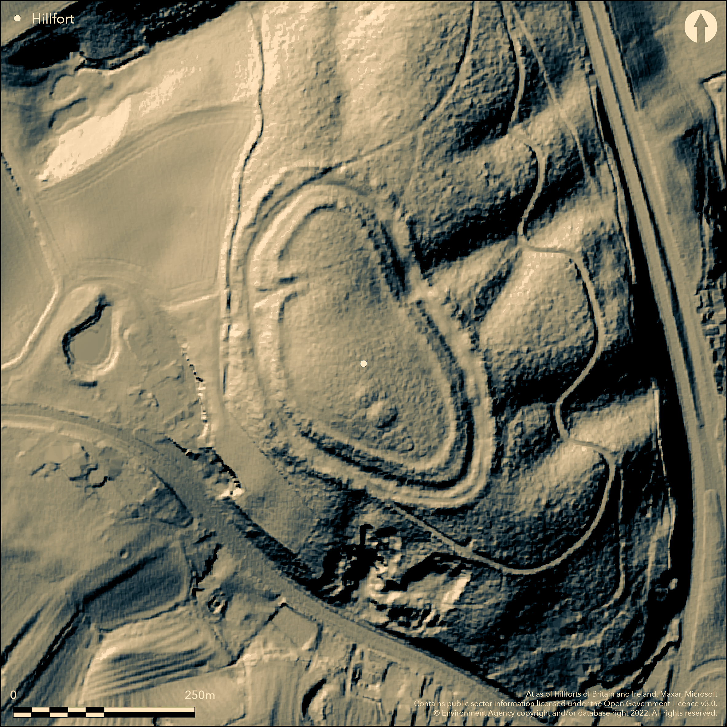
LiDAR 1m DTM Hillshade
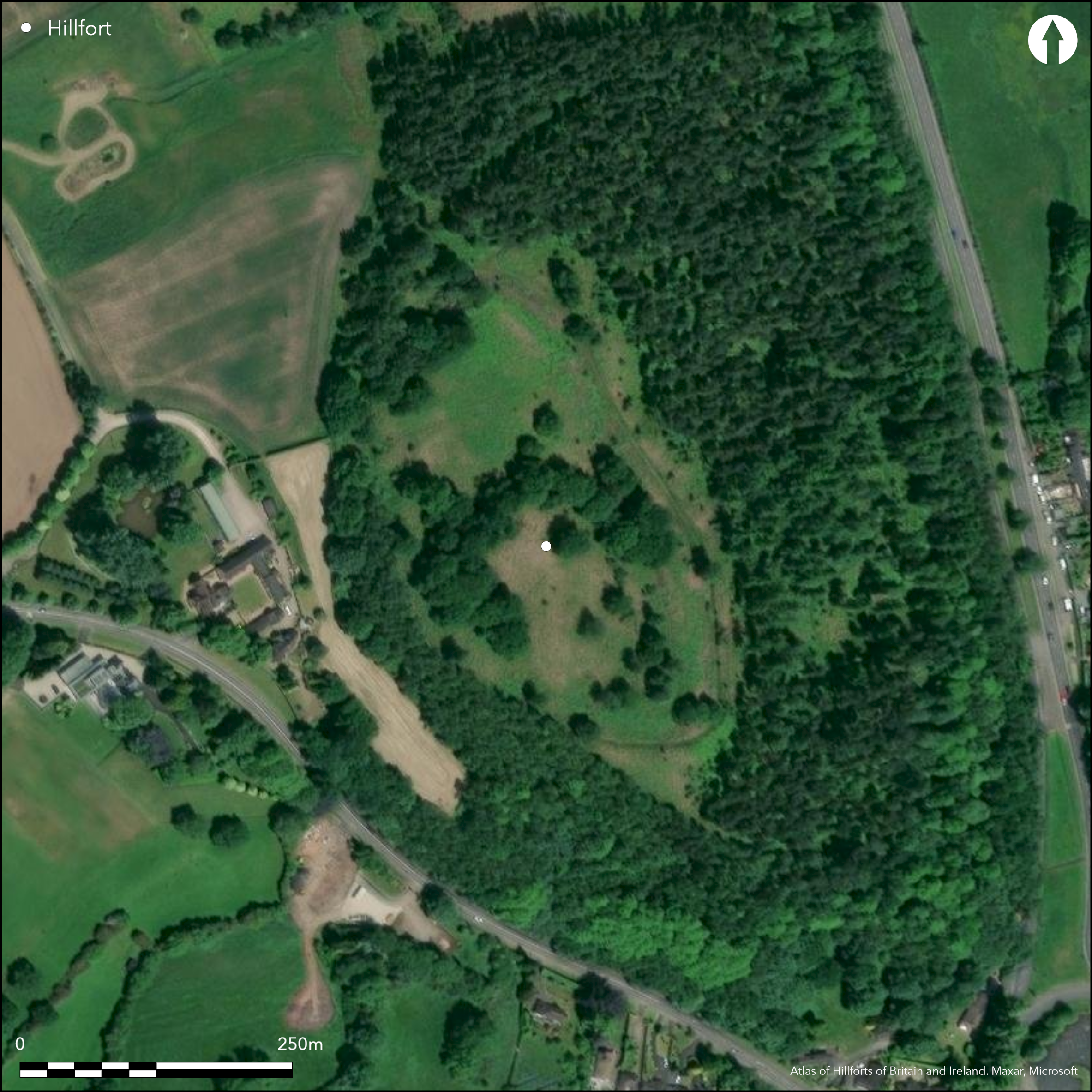
Satellite Imagery
LiDAR 1m DTM Hillshade
Satellite Imagery
Scroll left/right to view further images.
HER: Staffordshire 00022-MST22 (None)
NMR: SJ 83 NE 1 (75648)
SM: 1008548
NGR: SJ 88225 35911
X: 388225 Y: 335911 (OSGB36)
Lying at 150m OD approximately 65m to the E of Bury Bank Farm, a small sub-oval hillfort of 2.2ha. The enclosing works follow the contours of a small hog-backed hill which slopes to the NE, SE and W and are separated by a broad terrace cut into the hillside which is currently used as a vehicle track. The inner rampart is discontinuous and survives to height of 0.7m internally, the internal quarry ditch silted up with material from the eroding bank. A further shallow discontinuous ditch runs along the base of the terrace. In the S up to 10m of level ground lies between the inner rampart and the terrace, suggesting this part of the rampart represent a later contraction of the enclosed area (Cocroft et al. 1991). The outer bank or counterscarp survives to height of 0.5m internally and 3m externally and would have originally risen above the level of the terrace although it is reduced on the N and W sides and in places is absent. Where surviving it measures 20m across the base. A small excavation in 1892 (Lynham 1908) across the inner rampart showed it was constructed from earth and rubble. Both ramparts are damaged by quarrying, with 50m of rampart now lost to quarrying in the E and elsewhere affected by erosion. The outer rampart is also affected by modern trackways which breach the outer lines in the NE and S and partially modified in the SW by a modern access track. An inturned funnel-shaped entrance 30m in length, lies at the northern end of the western defences built over the internal quarry ditch. The domed interior contains two Bronze Age barrows and slight traces of possible ridge and furrow ploughing but no features contemporary with the enclosure have been recorded. One of the barrows was excavated in 1859, when charcoal and bone fragments were recovered. The second barrow was subsequently excavated but no record of the excavations could be found (Cocroft et al. 1991). The site has historically been associated with the Mercian king Wulfhere who reigned between AD 658-674 and was also known as Wulferecester or King Wulfhere's castle by Leland (Toulmin-Smith 1910). Recorded on 1880 1,2:500 OS mapping. Undated. Scheduled
Citizen Science: ✓
Reliability of Data: Confirmed
Reliability of Interpretation: Confirmed
X: -242297 Y: 6968299 (EPSG: 3857)
Longitude: -2.1765887983620056 Latitude: 52.92046412694091 (EPSG:4326)
Country: England
Current County or Unitary Authority: Staffordshire
Historic County: Staffordshire
Current Parish/Community/Council/Townland: Stone Rural
None
| Extant | ✓ |
| Cropmark | ✗ |
| Likely Destroyed | ✗ |
Satellite imagery available through the NLS website shows modern ploughing
| Woodland | ✓ |
| Commercial Forestry Plantation | ✓ |
| Parkland | ✗ |
| Pasture (Grazing) | ✗ |
| Arable | ✓ |
| Scrub/Bracken | ✓ |
| Bare Outcrop | ✗ |
| Heather/Moorland | ✗ |
| Heath | ✗ |
| Built-up | ✗ |
| Coastal Grassland | ✗ |
| Other | ✗ |
A contour fort lying at 150m OD on a small hog-backed hill. The land slopes away in the NE, SE and W
| Contour Fort | ✓ |
| Partial Contour Fort | ✗ |
| Promontory Fort | ✗ |
| Hillslope Fort | ✗ |
| Level Terrain Fort | ✗ |
| Marsh Fort | ✗ |
| Multiple Enclosure Fort | ✗ |
| Hilltop | ✓ |
| Coastal Promontory | ✗ |
| Inland Promontory | ✗ |
| Valley Bottom | ✗ |
| Knoll/Hillock/Outcrop | ✗ |
| Ridge | ✗ |
| Cliff/Plateau-edge/Scarp | ✗ |
| Hillslope | ✗ |
| Lowland | ✗ |
| Spur | ✗ |
Dominant Topographic Feature: Small hog-backed hill
| North | ✗ |
| Northeast | ✓ |
| East | ✗ |
| Southeast | ✓ |
| South | ✗ |
| Southwest | ✗ |
| West | ✓ |
| Northwest | ✗ |
| Level | ✗ |
Altitude: 150.0m
N/A
The site is undated but presumed Iron Age. BA barrows within the interior
Reliability: D - None
| Pre 1200BC | ✗ |
| 1200BC - 800BC | ✗ |
| 800BC - 400BC | ✗ |
| 400BC - AD50 | ✗ |
| AD50 - AD400 | ✗ |
| AD400 - AD 800 | ✗ |
| Post AD800 | ✗ |
| Unknown | ✓ |
| Pre Hillfort: | None |
| Post Hillfort: | Rectangular enclosure |
Recorded on 1880 OS mapping. Described as King Wulfhere's castle by Leland (c. 1535-43). Field investigations in 1957 and 1974. Surveyed at 1:1000 by RCHME, ref. no. 908982, in 1991 as part of the Staffordshire Hillforts Project (Cocroft et al. 1991). Scheduled. A small excavation in 1892 (Lynham 1908). Scheduled
| 1st Identified Map Depiction (1880): | None |
| Excavation (1892): | None |
| Other (1925): | Scheduled |
| Other (1957): | Field investigation |
| Other (1974): | Field investigation |
| Earthwork Survey (1991): | None |
| 1st Identified Written Reference (None): | None |
The domed interior contains two Bronze Age barrows and slight traces of possible ridge and furrow ploughing but no features contemporary with the enclosure have been recorded.
The River Trent lies to the E
| None | ✓ |
| Spring | ✗ |
| Stream | ✗ |
| Pool | ✗ |
| Flush | ✗ |
| Well | ✗ |
| Other | ✗ |
None
| No Known Features | ✓ |
| Round Stone Structures | ✗ |
| Rectangular Stone Structures | ✗ |
| Curvilinear Platforms | ✗ |
| Other Roundhouse Evidence | ✗ |
| Pits | ✗ |
| Quarry Hollows | ✗ |
| Other | ✗ |
Interior not investigated
| No Known Excavation | ✓ |
| Pits | ✗ |
| Postholes | ✗ |
| Roundhouses | ✗ |
| Rectangular Structures | ✗ |
| Roads/Tracks | ✗ |
| Quarry Hollows | ✗ |
| Other | ✗ |
| Nothing Found | ✗ |
None
| No Known Geophysics | ✓ |
| Pits | ✗ |
| Roundhouses | ✗ |
| Rectangular Structures | ✗ |
| Roads/Tracks | ✗ |
| Quarry Hollows | ✗ |
| Other | ✗ |
| Nothing Found | ✗ |
None
| No Known Finds | ✓ |
| Pottery | ✗ |
| Metal | ✗ |
| Metalworking | ✗ |
| Human Bones | ✗ |
| Animal Bones | ✗ |
| Lithics | ✗ |
| Environmental | ✗ |
| Other | ✗ |
Some tree cover
| APs Not Checked | ✓ |
| None | ✗ |
| Roundhouses | ✗ |
| Rectangular Structures | ✗ |
| Pits | ✗ |
| Postholes | ✗ |
| Roads/Tracks | ✗ |
| Other | ✗ |
An inturned funnel-shaped entrance 30m in length, lies at the northern end of the western defences built over the internal quarry ditch.
| 1: | None |
| 2: | None |
Guard Chambers: ✗
Chevaux de Frise: ✗
| 1. In-turned (North west): | None |
Small sub-oval hillfort of 2.2ha. The defences follow the contours of a small hog-backed hill which slopes to the NE, SE and W, separated by a broad terrace cut into the hillside. The inner rampart is discontinuous and survives to height of 0.7m internally, the internal quarry ditch silted up with material from the eroding bank. A further shallow discontinuous ditch runs along the base of the terrace. In the S up to 10m of level ground lies between the inner rampart and the terrace, suggesting this part of the rampart represent a later contraction of the defended area (Cocroft et al. 1991). The outer bank or counterscarp survives to a height of 0.5m internally and 3m externally and would have originally risen above the level of the terrace although it is reduced on the N and W sides and in places is absent. Where surviving it measures 20m across the base. A small excavation in 1892 (Lynham 1908) across the inner rampart showed it was constructed from earth and rubble.
| Area 1: | 2.2ha. |
| Total: | 2.2ha. |
Total Footprint Area: Noneha.
None
| ✓ | None |
| ✓ | Rampart number based on evidence for a second discontinuous ditch |
| NE Quadrant: | 2 |
| SE Quadrant: | 2 |
| SW Quadrant: | 2 |
| NW Quadrant: | 2 |
| Total: | 2 |
| Partial Univallate | ✗ |
| Univallate | ✗ |
| Partial Bivallate | ✗ |
| Bivallate | ✓ |
| Partial Multivallate | ✗ |
| Multivallate | ✗ |
| Unknown | ✗ |
| Partial Univallate | ✗ |
| Univallate | ✗ |
| Partial Bivallate | ✗ |
| Bivallate | ✗ |
| Partial Multivallate | ✗ |
| Multivallate | ✗ |
None
| None | ✗ |
| Earthen Bank | ✓ |
| Stone Wall | ✗ |
| Rubble | ✗ |
| Wall-walk | ✗ |
| Evidence of Timber | ✗ |
| Vitrification | ✗ |
| Other Burning | ✗ |
| Palisade | ✗ |
| Counter Scarp Bank | ✓ |
| Berm | ✗ |
| Unfinished | ✗ |
| Other | ✗ |
Bank constructed of earth and rubble
| None | ✗ |
| Earthen Bank | ✗ |
| Stone Wall | ✗ |
| Murus Duplex | ✗ |
| Timber-framed | ✗ |
| Timber-laced | ✗ |
| Vitrification | ✗ |
| Other Burning | ✗ |
| Palisade | ✗ |
| Counter Scarp Bank | ✓ |
| Berm | ✗ |
| Unfinished | ✗ |
| No Known Excavation | ✗ |
| Other | ✗ |
| ✗ | None |
| ✓ | Second discontinuous ditch |
Number of Ditches: 2
| ✗ | None |
Cocroft, W. Everson. P. Jecock, M. Ainsworth, S. and Reid, M. 1991. RCHME: Staffordshire Hillforts Project. Jan-1991. Unpublished
Toulmin-Smith, L. (ed), 1910. The itinerary of John Leland in or about the years 1535-1543. London: Bell and Sons,Vol. 5, 20
Lynam, C. 1908. Ancient Earthworks. in Page, Wm. (ed), The Victoria History of the Counties of England. A History of the County of Staffordshire. Vol. 1. 342-4
Atlas of Hillforts:
Wikidata:
This work is licensed under CC BY-SA 4.0

 and should be cited as:
Lock, Gary and Ralston, Ian. 2024. Atlas of Hillforts of Britain and Ireland. Available at: https://hillforts.arch.ox.ac.uk
Document Version 1.1