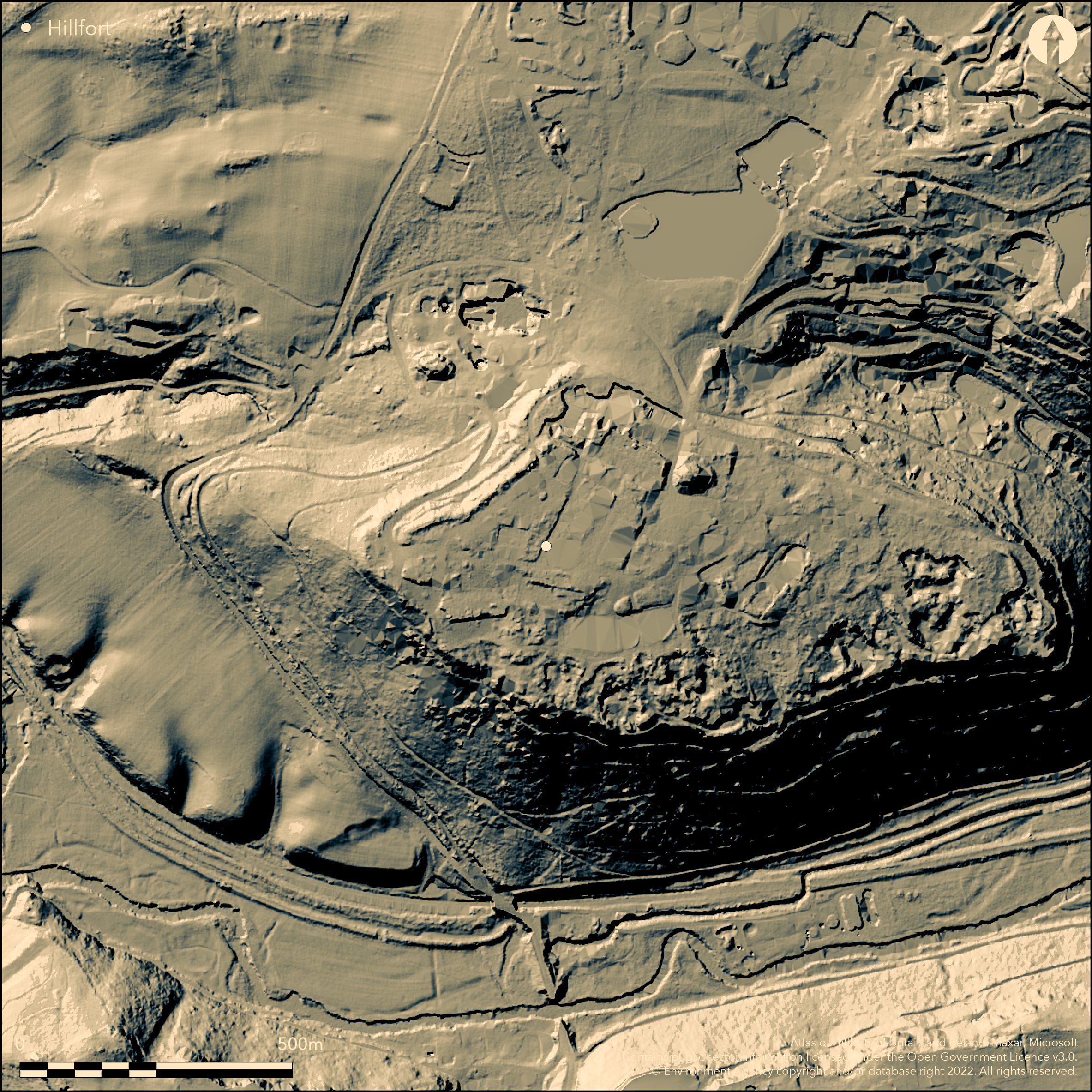
LiDAR 1m DTM Hillshade
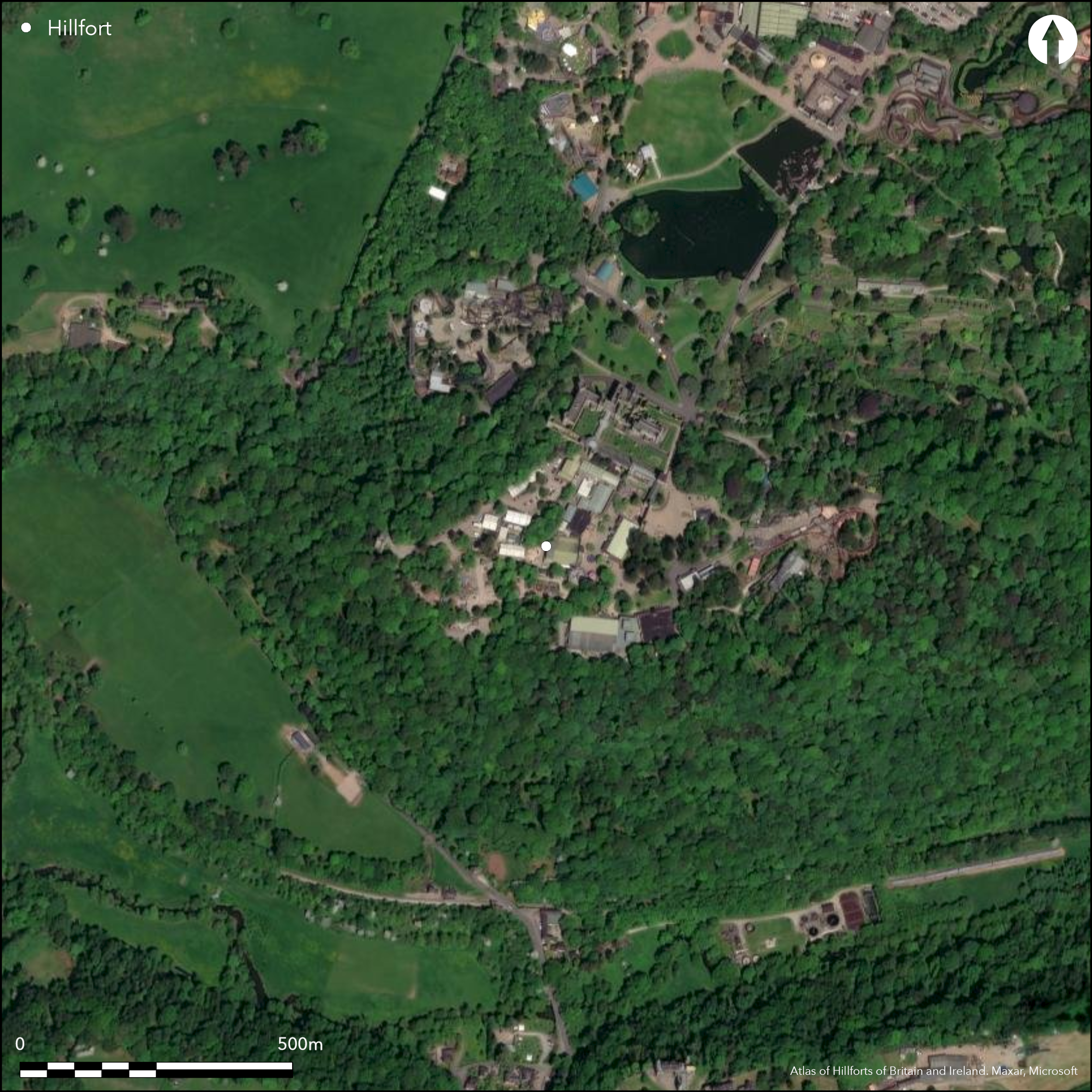
Satellite Imagery
LiDAR 1m DTM Hillshade
Satellite Imagery
Scroll left/right to view further images.
HER: Staffordshire 00064-MST64 (None)
NMR: SK 04 SE 11 (305379)
SM: 1014686
NGR: SK 07168 43072
X: 407168 Y: 343072 (OSGB36)
A univallate hillfort situated within the grounds of Alton Towers, a 19th century mansion and later, a leisure park. Possibly once having double and triple ramparts (Plot 1686) but now mostly destroyed and its original extent is unknown. It lies on a steep spur at 193m OD which falls away towards the River Churnet in the W, and in the N and E by the steep valley of Slain Hollow, a natural valley cut into the side of the Churnet valley. The surviving works comprise two lengths of rampart that run NW and SW along the edges of the escarpment, the summit of the NW rampart flattened by a later garden walkway. A building platform at the western end of the NW rampart probably relates to war-time use of the estate. It is preserved in the NW where it has a maximum width of 18m, running for approximately 195m, before being breached in the E by an entrance. Beyond this a further 20m long section of the bank is visible before being truncated at its eastern end by the retaining wall behind the mansion. A terrace in the hillside to the N of the rampart is possibly an infilled ditch that was reused in the 19th century as a garden walk. The slighter, 55m length of the south-western defences have been interpreted as a later boundary bank, although current thinking is that it is part of the hillfort rampart. It survives up to 1.2m high above the interior and 9m wide and is constructed from sandstone blocks but has been damaged through quarrying activities. It terminates abruptly where the hillside has been quarried. The natural steepness of the escarpment in this region probably precluded the need for a defensive ditch. Excavation of the ramparts in 1963 (cited in Thomas et al. 1963, 261-2) revealed a massive drystone wall. It has been truncated by quarrying and overlaid by dumped material in the NE. A slight counterscarp bank has been recorded in places. An isolated length of bank lying in the middle of the amusement park was probably once part of the original circuit. An excavation in 1961 suggested clearing and burning of the undergrowth prior to the construction of the rampart. The NW ramparts were visible on 2m-resolution lidar flown in 2012 and mapped as part of the Staffordshire National Mapping Programme Project. Three trenches were excavated in 1999 in what was considered to be the interior of the hillfort but only 19th century pottery was recovered (Dark 1999). The earthworks in the NW are recorded on 1881 1:2,500 OS mapping.
Citizen Science: ✗
Reliability of Data: Confirmed
Reliability of Interpretation: Confirmed
X: -210915 Y: 6980209 (EPSG: 3857)
Longitude: -1.8946858658532688 Latitude: 52.98492195976855 (EPSG:4326)
Country: England
Current County or Unitary Authority: Staffordshire
Historic County: Staffordshire
Current Parish/Community/Council/Townland: Farley
Very little of the earthworks now survive
| Extant | ✓ |
| Cropmark | ✗ |
| Likely Destroyed | ✓ |
Leisure park, mansion.
| Woodland | ✗ |
| Commercial Forestry Plantation | ✗ |
| Parkland | ✗ |
| Pasture (Grazing) | ✗ |
| Arable | ✗ |
| Scrub/Bracken | ✗ |
| Bare Outcrop | ✗ |
| Heather/Moorland | ✗ |
| Heath | ✗ |
| Built-up | ✓ |
| Coastal Grassland | ✗ |
| Other | ✓ |
The remains of a possible contour fort lying on a steep spur at 193m. The ground falls away steeply to the W.
| Contour Fort | ✓ |
| Partial Contour Fort | ✗ |
| Promontory Fort | ✗ |
| Hillslope Fort | ✗ |
| Level Terrain Fort | ✗ |
| Marsh Fort | ✗ |
| Multiple Enclosure Fort | ✗ |
| Hilltop | ✓ |
| Coastal Promontory | ✗ |
| Inland Promontory | ✗ |
| Valley Bottom | ✗ |
| Knoll/Hillock/Outcrop | ✗ |
| Ridge | ✗ |
| Cliff/Plateau-edge/Scarp | ✗ |
| Hillslope | ✗ |
| Lowland | ✗ |
| Spur | ✓ |
Dominant Topographic Feature: Steep spur
| North | ✗ |
| Northeast | ✗ |
| East | ✗ |
| Southeast | ✗ |
| South | ✗ |
| Southwest | ✗ |
| West | ✓ |
| Northwest | ✗ |
| Level | ✗ |
Altitude: 193.0m
N/A
The site is undated
Reliability: D - None
| Pre 1200BC | ✗ |
| 1200BC - 800BC | ✗ |
| 800BC - 400BC | ✗ |
| 400BC - AD50 | ✗ |
| AD50 - AD400 | ✗ |
| AD400 - AD 800 | ✗ |
| Post AD800 | ✗ |
| Unknown | ✓ |
| Pre Hillfort: | None |
| Post Hillfort: | Mansion and leisure park |
General reference in Plot (1686). Recorded on 1881 OS mapping. Excavated in 1963 and 1999. RCHME survey, ref. no. 908982, part of Staffordshire Hillforts Project. Scheduled
| 1st Identified Written Reference (1686): | None |
| 1st Identified Map Depiction (1881): | None |
| Other (1956): | Scheduled |
| Excavation (1963): | None |
| Earthwork Survey (1997): | None |
| Other (1999): | Desk based assesment |
| Excavation (1999): | None |
| LiDAR Survey (2012): | None |
No internal features have been recorded
The River Churnet lies to the W
| None | ✓ |
| Spring | ✗ |
| Stream | ✗ |
| Pool | ✗ |
| Flush | ✗ |
| Well | ✗ |
| Other | ✗ |
None
| No Known Features | ✓ |
| Round Stone Structures | ✗ |
| Rectangular Stone Structures | ✗ |
| Curvilinear Platforms | ✗ |
| Other Roundhouse Evidence | ✗ |
| Pits | ✗ |
| Quarry Hollows | ✗ |
| Other | ✗ |
None
| No Known Excavation | ✓ |
| Pits | ✗ |
| Postholes | ✗ |
| Roundhouses | ✗ |
| Rectangular Structures | ✗ |
| Roads/Tracks | ✗ |
| Quarry Hollows | ✗ |
| Other | ✗ |
| Nothing Found | ✗ |
None
| No Known Geophysics | ✓ |
| Pits | ✗ |
| Roundhouses | ✗ |
| Rectangular Structures | ✗ |
| Roads/Tracks | ✗ |
| Quarry Hollows | ✗ |
| Other | ✗ |
| Nothing Found | ✗ |
None
| No Known Finds | ✓ |
| Pottery | ✗ |
| Metal | ✗ |
| Metalworking | ✗ |
| Human Bones | ✗ |
| Animal Bones | ✗ |
| Lithics | ✗ |
| Environmental | ✗ |
| Other | ✗ |
None
| APs Not Checked | ✓ |
| None | ✗ |
| Roundhouses | ✗ |
| Rectangular Structures | ✗ |
| Pits | ✗ |
| Postholes | ✗ |
| Roads/Tracks | ✗ |
| Other | ✗ |
A length of rampart is preserved in the NW breached in the E by an entrance.
| None: | Defences are incomplete |
| 2: | None |
Guard Chambers: ✗
Chevaux de Frise: ✗
| 1. Simple Gap (East): | None |
Survives as two lengths of rampart that run NW and SW along the edges of the escarpment. In the NW the rampart has a maximum width of 18m and runs for approximately 195m, before being breached in the E by an entrance. Beyond this a further 20m long section is visible before being truncated at its eastern end by the retaining wall behind the mansion. A terrace in the hillside to the N of the rampart is possibly an infilled ditch. The slighter, 55m length of the south-western defences survive up to 1.2m high above the interior and 9m wide constructed from sandstone blocks it terminates abruptly where the hillside has been quarried.
| Area 1: | 5.8ha. |
| Total: | 5.8ha. |
Total Footprint Area: Noneha.
None
| ✗ | The enclosed area is estimated |
| ✗ | Now destroyed |
| NE Quadrant: | None |
| SE Quadrant: | None |
| SW Quadrant: | 1 |
| NW Quadrant: | 1 |
| Total: | 1 |
| Partial Univallate | ✓ |
| Univallate | ✗ |
| Partial Bivallate | ✗ |
| Bivallate | ✗ |
| Partial Multivallate | ✗ |
| Multivallate | ✗ |
| Unknown | ✗ |
| Partial Univallate | ✗ |
| Univallate | ✗ |
| Partial Bivallate | ✗ |
| Bivallate | ✗ |
| Partial Multivallate | ✗ |
| Multivallate | ✗ |
None
| None | ✗ |
| Earthen Bank | ✓ |
| Stone Wall | ✗ |
| Rubble | ✗ |
| Wall-walk | ✗ |
| Evidence of Timber | ✗ |
| Vitrification | ✗ |
| Other Burning | ✗ |
| Palisade | ✗ |
| Counter Scarp Bank | ✓ |
| Berm | ✗ |
| Unfinished | ✗ |
| Other | ✗ |
None
| None | ✗ |
| Earthen Bank | ✗ |
| Stone Wall | ✓ |
| Murus Duplex | ✗ |
| Timber-framed | ✗ |
| Timber-laced | ✗ |
| Vitrification | ✗ |
| Other Burning | ✗ |
| Palisade | ✗ |
| Counter Scarp Bank | ✗ |
| Berm | ✗ |
| Unfinished | ✗ |
| No Known Excavation | ✗ |
| Other | ✗ |
| ✗ | None |
| ✓ | Only one is recorded |
Number of Ditches: 1
| ✗ | None |
Anon. 1961. Keele Archaeological Group Newsletter, 1, November, Addendum.
Bell, C. 1999. Proposed New Ride at Alton Towers, Farley, Staffordshire: Desk Based Assessment. Oxford Archaeological Unit. Unpublished
Dark J. 1999. The Dark Ride, Alton Towers, Farley, Staffordshire: Archaeological Watching Brief Report. Oxford Archaeological Unit. Unpublished
Dark J. 1999. The Dark Ride, Alton Towers, Farley, Staffordshire: Archaeological Evaluation Report. Oxford Archaeological Unit. Unpublished
Cocroft, W., Jecock M. and Johnston, D. 1988. RCHME: Staffordshire Hillforts Project. Unpublished
Plot R. 1686. The Natural History of Staffordshire. 140
Thomas, N., Gunstone, J., Forde-Johnston, A.J.H., Weaver, O.J. and Sherlock, R. 1963. Report of the Summer Meeting of the Royal Archaeological Institute at Keele in 1963. Archaeol J, 120, 261-2
Atlas of Hillforts:
Wikidata:
This work is licensed under CC BY-SA 4.0

 and should be cited as:
Lock, Gary and Ralston, Ian. 2024. Atlas of Hillforts of Britain and Ireland. Available at: https://hillforts.arch.ox.ac.uk
Document Version 1.1