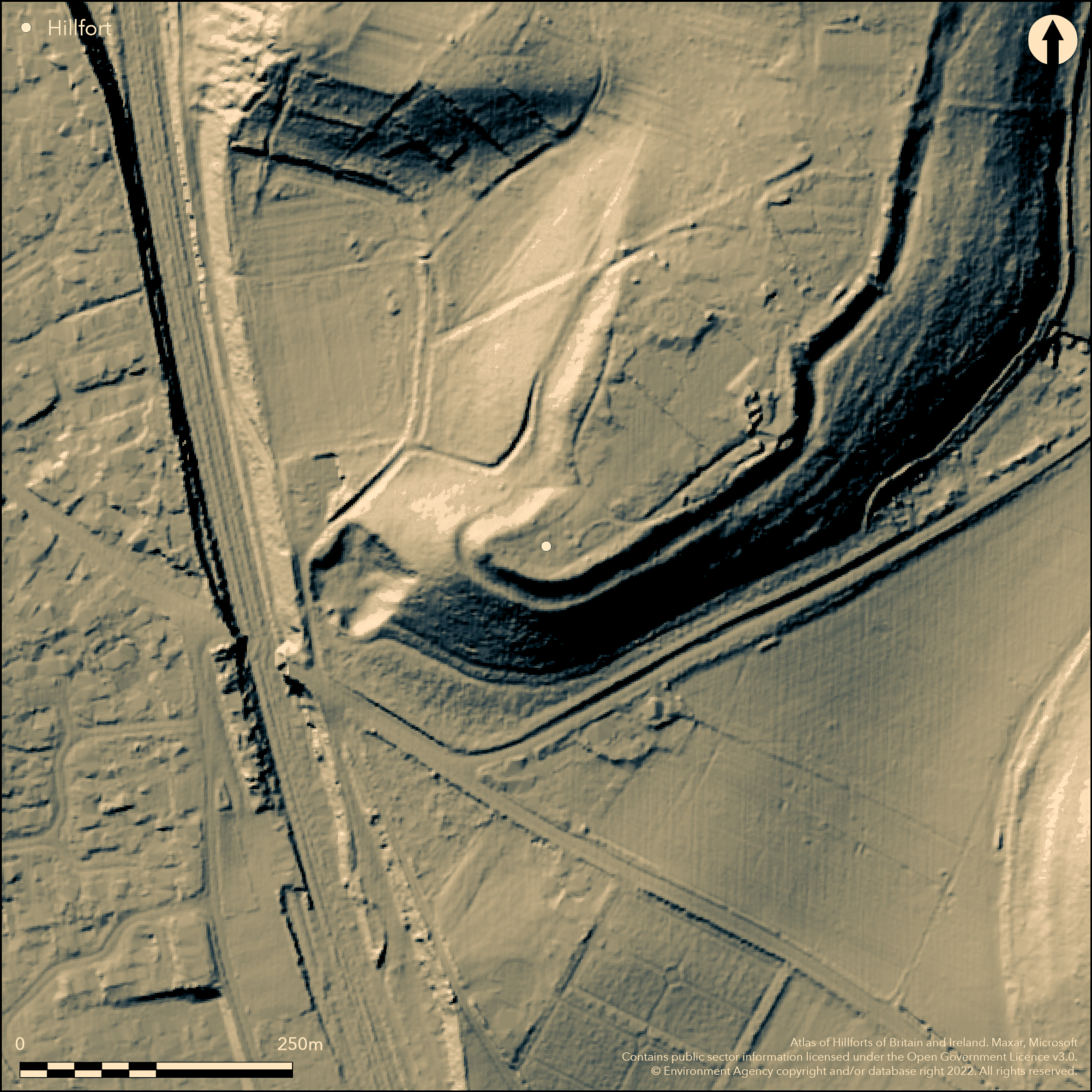
LiDAR 1m DTM Hillshade
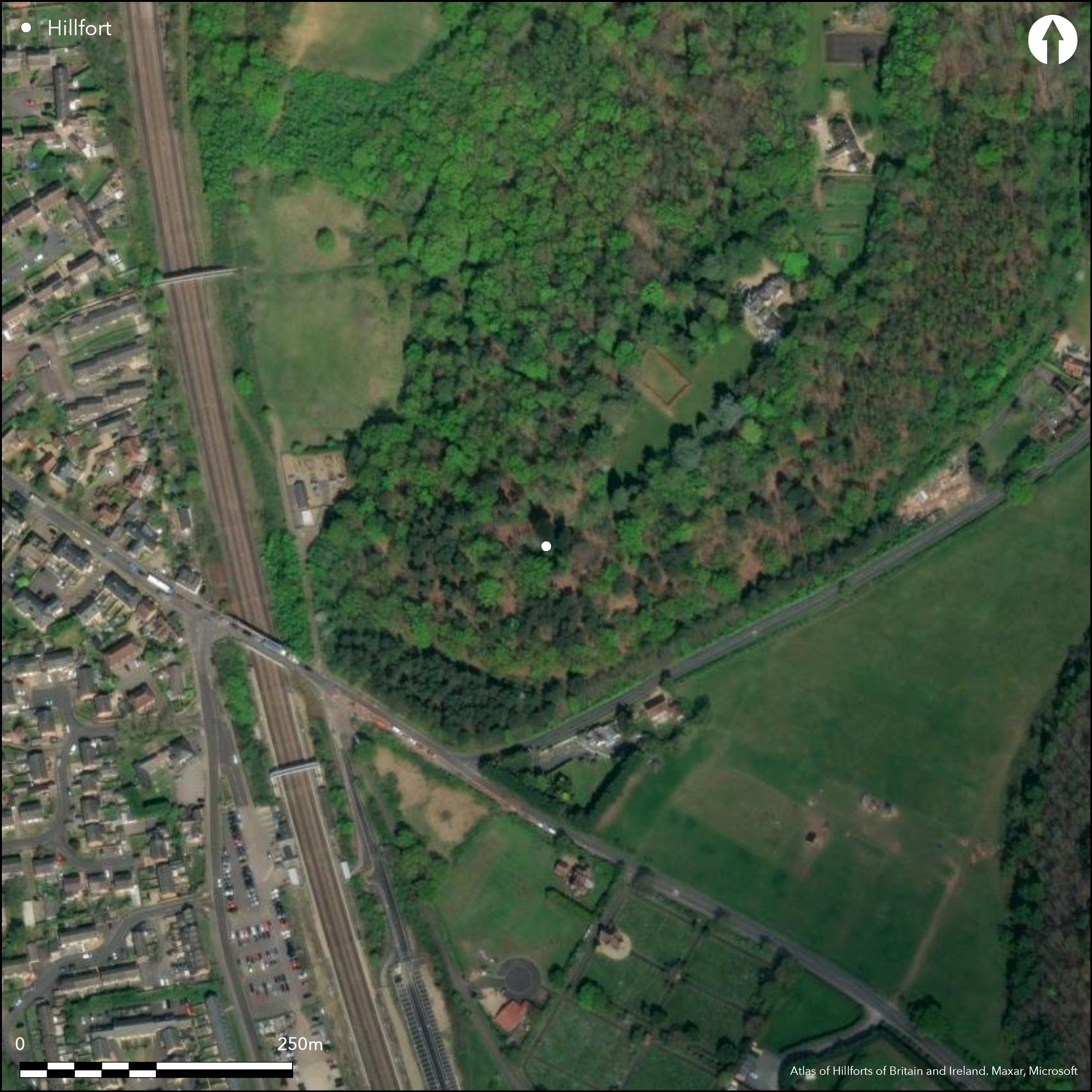
Satellite Imagery
LiDAR 1m DTM Hillshade
Satellite Imagery
Scroll left/right to view further images.
HER: Central Bedfordshire and Luton 442 (None)
NMR: TL 14 NE 4 (362654)
SM: None
NGR: TL 17911 48953
X: 517911 Y: 248953 (OSGB36)
A univallate hillfort lying at 56m OD on a steep-sided wooded spur 1.2km to the NW of Galley Hill (Atlas No. 3298). The ramparts, which appear to have comprised a single bank and ditch, follow the outline of the spur and the site commands views over the valley of the River Ivel to the W. The site is now damaged and the ramparts survive best on the southern and eastern sides where they stand 2.4m internally and 6m externally at the southern angle. They survive less well in the W and are no longer visible in the N and NW. Its original extent is uncertain although it was estimated to have once enclosed 2.8ha (Doubleday 1904, 271-3). A simple gap entrance in the SW was damaged by the landscaping for a house built within the interior in the late 19th century from where up to seven early Iron Age pots are said to have been found in the garden on the slopes of the hillfort in 1905 (Albion Archaeology 2003). Mesolithic flakes, late Iron Age pottery and Roman coins have also been found within the interior although no significant archaeological remains have been uncovered. The site is recorded on 1884 1:2,500 OS mapping as extant except in the NW where a road possibly follows the line of the original ramparts. It also shows the entrance as slightly staggered and inturned on the southern side. A further break, possibly with rounded terminals lies in the E, slightly in-turned on the southern side and out-turned in the N. No archaeological investigation has taken place.
Citizen Science: ✗
Reliability of Data: Confirmed
Reliability of Interpretation: Confirmed
X: -31055 Y: 6822990 (EPSG: 3857)
Longitude: -0.2789758745633559 Latitude: 52.12627800103504 (EPSG:4326)
Country: England
Current County or Unitary Authority: Central Bedfordshire
Historic County: Bedfordshire
Current Parish/Community/Council/Townland: Sandy
Destroyed in the N and NW
| Extant | ✓ |
| Cropmark | ✗ |
| Likely Destroyed | ✓ |
None
| Woodland | ✓ |
| Commercial Forestry Plantation | ✗ |
| Parkland | ✓ |
| Pasture (Grazing) | ✗ |
| Arable | ✗ |
| Scrub/Bracken | ✗ |
| Bare Outcrop | ✗ |
| Heather/Moorland | ✗ |
| Heath | ✗ |
| Built-up | ✓ |
| Coastal Grassland | ✗ |
| Other | ✗ |
A contour fort lying at 56m OD on a steep sided wooded spur overlooking the valley of the River Ivel
| Contour Fort | ✓ |
| Partial Contour Fort | ✗ |
| Promontory Fort | ✗ |
| Hillslope Fort | ✗ |
| Level Terrain Fort | ✗ |
| Marsh Fort | ✗ |
| Multiple Enclosure Fort | ✗ |
| Hilltop | ✓ |
| Coastal Promontory | ✗ |
| Inland Promontory | ✗ |
| Valley Bottom | ✗ |
| Knoll/Hillock/Outcrop | ✗ |
| Ridge | ✗ |
| Cliff/Plateau-edge/Scarp | ✗ |
| Hillslope | ✗ |
| Lowland | ✓ |
| Spur | ✓ |
Dominant Topographic Feature: Spur
| North | ✗ |
| Northeast | ✗ |
| East | ✗ |
| Southeast | ✗ |
| South | ✗ |
| Southwest | ✓ |
| West | ✗ |
| Northwest | ✗ |
| Level | ✗ |
Altitude: 56.0m
N/A
Mesolithic flakes and Roman coins suggest some activity in these periods. 19th century house and garden constructed within the interior. Up to seven early Iron Age pots are said to have been found in a garden on the slopes of the hillfort in 1905 (Albion Archaeology report 2003).
Reliability: B - Medium
| Pre 1200BC | ✗ |
| 1200BC - 800BC | ✗ |
| 800BC - 400BC | ✓ |
| 400BC - AD50 | ✓ |
| AD50 - AD400 | ✗ |
| AD400 - AD 800 | ✗ |
| Post AD800 | ✗ |
| Unknown | ✗ |
| Pre Hillfort: | None |
| Post Hillfort: | None |
| Artefactual: | None |
General reference in Lysons (1806); Recorded on 1884 OS mapping, field investigation in 1968
| 1st Identified Written Reference (1806): | None |
| 1st Identified Map Depiction (1884): | None |
| Other (1968): | Field investigation |
No significant archaeological remains have been uncovered. Mesolithic flakes, late Iron Age pottery and Roman coins as stray finds.
River Ivel to the SW
| None | ✓ |
| Spring | ✗ |
| Stream | ✗ |
| Pool | ✗ |
| Flush | ✗ |
| Well | ✗ |
| Other | ✗ |
None
| No Known Features | ✓ |
| Round Stone Structures | ✗ |
| Rectangular Stone Structures | ✗ |
| Curvilinear Platforms | ✗ |
| Other Roundhouse Evidence | ✗ |
| Pits | ✗ |
| Quarry Hollows | ✗ |
| Other | ✗ |
None
| No Known Excavation | ✓ |
| Pits | ✗ |
| Postholes | ✗ |
| Roundhouses | ✗ |
| Rectangular Structures | ✗ |
| Roads/Tracks | ✗ |
| Quarry Hollows | ✗ |
| Other | ✗ |
| Nothing Found | ✗ |
None
| No Known Geophysics | ✓ |
| Pits | ✗ |
| Roundhouses | ✗ |
| Rectangular Structures | ✗ |
| Roads/Tracks | ✗ |
| Quarry Hollows | ✗ |
| Other | ✗ |
| Nothing Found | ✗ |
None
| No Known Finds | ✗ |
| Pottery | ✓ |
| Metal | ✗ |
| Metalworking | ✗ |
| Human Bones | ✗ |
| Animal Bones | ✗ |
| Lithics | ✓ |
| Environmental | ✗ |
| Other | ✓ |
None
| APs Not Checked | ✓ |
| None | ✗ |
| Roundhouses | ✗ |
| Rectangular Structures | ✗ |
| Pits | ✗ |
| Postholes | ✗ |
| Roads/Tracks | ✗ |
| Other | ✗ |
A simple gap entrance lies in the SW which was damaged by landscaping for a house. Possible entrance In the E slightly in-turned on the southern side and out-turned in the N (as depicted on 1884 OS mapping)
| 3: | None |
| 2: | Uncertain |
Guard Chambers: ✗
Chevaux de Frise: ✗
| 1. Simple Gap (South west): | Damaged, original form unknown |
| 2. In-turned (East): | Uncertain, shown on early OS mapping. Slightly in-turned on the southern side and out-turned in the N |
| 2. Out-turned (East): | Uncertain, shown on early OS mapping. Slightly in-turned on the southern side and out-turned in the N |
The ramparts comprised a single bank and ditch which followed the outline of the spur. Now damaged they survive best on the southern and eastern sides where the ramparts stand 2.4m internally and 6m externally at the southern angle. They survive less well in the W and are no longer visible in the N and NW. Its original extent is uncertain although it was estimated to have once enclosed 2.8ha
| Area 1: | 2.8ha. |
| Total: | 2.8ha. |
Total Footprint Area: Noneha.
None
| ✗ | None |
| ✗ | None |
| NE Quadrant: | 1 |
| SE Quadrant: | 1 |
| SW Quadrant: | 1 |
| NW Quadrant: | None |
| Total: | 1 |
| Partial Univallate | ✓ |
| Univallate | ✗ |
| Partial Bivallate | ✗ |
| Bivallate | ✗ |
| Partial Multivallate | ✗ |
| Multivallate | ✗ |
| Unknown | ✗ |
| Partial Univallate | ✗ |
| Univallate | ✗ |
| Partial Bivallate | ✗ |
| Bivallate | ✗ |
| Partial Multivallate | ✗ |
| Multivallate | ✗ |
None
| None | ✗ |
| Earthen Bank | ✓ |
| Stone Wall | ✗ |
| Rubble | ✗ |
| Wall-walk | ✗ |
| Evidence of Timber | ✗ |
| Vitrification | ✗ |
| Other Burning | ✗ |
| Palisade | ✗ |
| Counter Scarp Bank | ✗ |
| Berm | ✗ |
| Unfinished | ✗ |
| Other | ✗ |
None
| None | ✗ |
| Earthen Bank | ✗ |
| Stone Wall | ✗ |
| Murus Duplex | ✗ |
| Timber-framed | ✗ |
| Timber-laced | ✗ |
| Vitrification | ✗ |
| Other Burning | ✗ |
| Palisade | ✗ |
| Counter Scarp Bank | ✗ |
| Berm | ✗ |
| Unfinished | ✗ |
| No Known Excavation | ✓ |
| Other | ✗ |
| ✗ | None |
| ✓ | None |
Number of Ditches: 1
| ✗ | None |
Doubleday, H. A. 1904. Victoria County History, Bedfordshire. Vol. 1, pp. 271-273.
Lysons, D. and S. 1806. Magna Britannia. Bedfordshire. p. 35.
Albion Archaeology 2003. Extensive Urban Survey for Bedfordshire. The Roman Town of Sandy. Archaeological Assessment. Produced for: Bedfordshire County Council and English Heritage. Revised 2005.
Atlas of Hillforts:
Wikidata:
This work is licensed under CC BY-SA 4.0

 and should be cited as:
Lock, Gary and Ralston, Ian. 2024. Atlas of Hillforts of Britain and Ireland. Available at: https://hillforts.arch.ox.ac.uk
Document Version 1.1