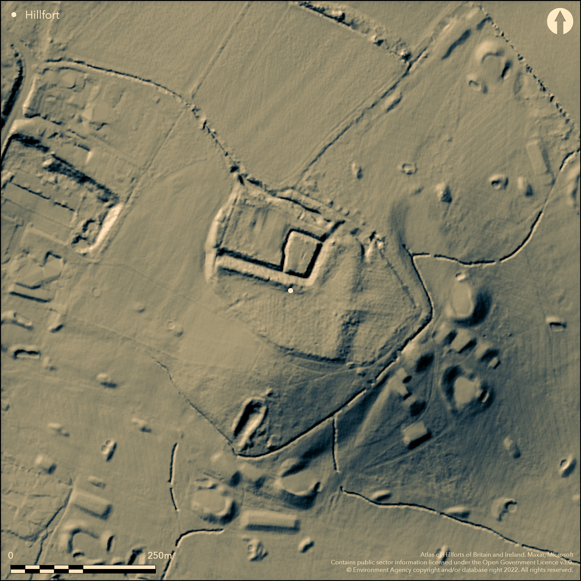
LiDAR 1m DTM Hillshade
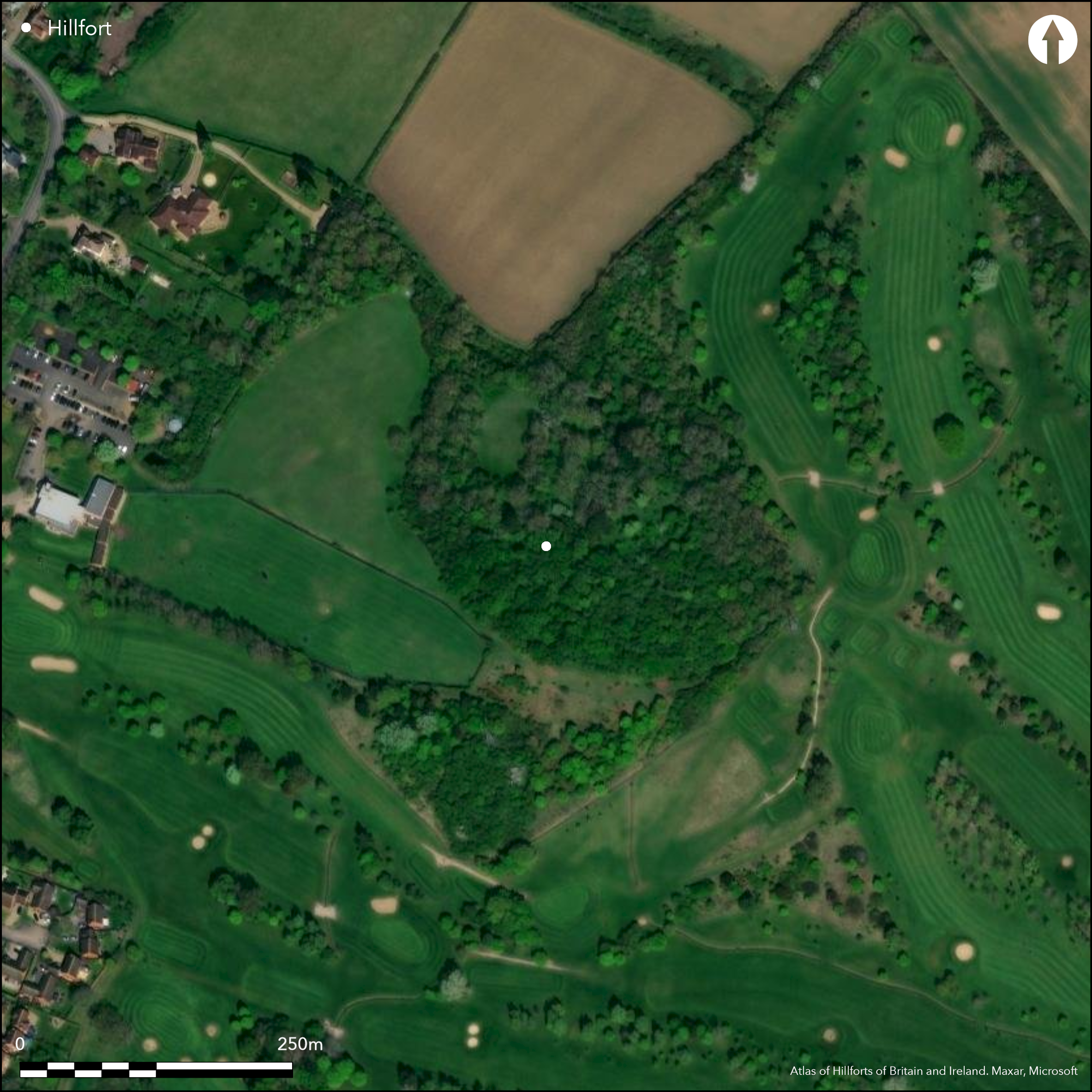
Satellite Imagery
LiDAR 1m DTM Hillshade
Satellite Imagery
Scroll left/right to view further images.
HER: Bedford Borough 332 (None)
NMR: TL 05 SE 1 (360543)
SM: 1015588
NGR: TL 06610 53189
X: 506610 Y: 253189 (OSGB36)
A slight univallate hillfort lying mostly within woodland on the south-eastern tip of a spur to the N of Bedford and bordering the northern edge of Mowsbury Golf Course. It lies at 64m OD with steeply inclined natural slopes to the S and SW, commanding views across the Ouse Valley. A medieval moated site was later incorporated into the central and north-western part of the enclosure, with the northern section of the moat utilising the hillfort ditch. The hillfort bank survives only as a slight scarp in the S and it was consequently not identified as a hillfort until excavations in 1971-2 when a ditch surrounding the reduced ramparts was confirmed through excavation and the fills dated from pottery (Dring 1971; Kennett 1972). The oval form of the earthworks was confirmed by geophysics (Clark 1972) and shown to measure approximately 290m NW-SE by 200m transversely. It comprises a large ditch measuring 4.3m wide and 2m deep now infilled with material from the bank. A 3-6m wide berm separates the ditch from the bank. The bank was originally supported by a timber framework with postholes 61cm in diameter. It is believed the rampart was destroyed by fire shortly after construction (Kennett 1972) and pushed into the ditch. Impressions of longitudinal and transverse timbers and the end of a nail have been found in a pieced of baked clay recovered from the ditch. A fragment of human skull was found on the destruction layers behind the rampart. Prehistoric and Roman pottery recovered from the surface during the course of the 19th and 20th century and those sealed within the fills of the hillfort ditch give an early Iron Age date with occupation for a limited period. Internally a circle of cobbles was interpreted as a possible hut circle. The site was surveyed in 1985 and an earthwork plan produced (Simco and Coleman 1986). The name Mowsbury probably derives from ÇMorsebury' recorded in a 16th century field name which included the area of the hillfort. The moat only is recorded on OS mapping.
Citizen Science: ✓
Reliability of Data: Confirmed
Reliability of Interpretation: Confirmed
X: -49277 Y: 6830313 (EPSG: 3857)
Longitude: -0.4426644458112984 Latitude: 52.166641644242105 (EPSG:4326)
Country: England; None
Current County or Unitary Authority: Central Bedfordshire
Historic County: Bedfordshire
Current Parish/Community/Council/Townland: Ravensden; Renhold
The rampart survives as a slght scarp in the S. Continuing damage by rabbits, damage to banks from tree roots and fallen trees, excessive scrub in some areas. For the last three years The Friends of Putnoe Wood and Mowsbury Hillfort have been working with Beds Borough Council to overcome these issues
| Extant | ✓ |
| Cropmark | ✗ |
| Likely Destroyed | ✓ |
None
| Woodland | ✓ |
| Commercial Forestry Plantation | ✗ |
| Parkland | ✗ |
| Pasture (Grazing) | ✗ |
| Arable | ✗ |
| Scrub/Bracken | ✓ |
| Bare Outcrop | ✗ |
| Heather/Moorland | ✗ |
| Heath | ✗ |
| Built-up | ✗ |
| Coastal Grassland | ✗ |
| Other | ✗ |
Contour fort occupying the summit of a spur at 64m OD
| Contour Fort | ✓ |
| Partial Contour Fort | ✗ |
| Promontory Fort | ✗ |
| Hillslope Fort | ✗ |
| Level Terrain Fort | ✗ |
| Marsh Fort | ✗ |
| Multiple Enclosure Fort | ✗ |
| Hilltop | ✓ |
| Coastal Promontory | ✗ |
| Inland Promontory | ✗ |
| Valley Bottom | ✗ |
| Knoll/Hillock/Outcrop | ✗ |
| Ridge | ✗ |
| Cliff/Plateau-edge/Scarp | ✗ |
| Hillslope | ✗ |
| Lowland | ✗ |
| Spur | ✓ |
Dominant Topographic Feature: Tip of a spur
| North | ✗ |
| Northeast | ✗ |
| East | ✗ |
| Southeast | ✗ |
| South | ✗ |
| Southwest | ✗ |
| West | ✗ |
| Northwest | ✗ |
| Level | ✓ |
Altitude: 64.0m
The parish boundary between Renhold and Ravensden lies to the E of the hillfort
Boundary Type: Parish/Townland
Dated by pottery (Dring 1971)
Reliability: B - Medium
| Pre 1200BC | ✗ |
| 1200BC - 800BC | ✗ |
| 800BC - 400BC | ✓ |
| 400BC - AD50 | ✗ |
| AD50 - AD400 | ✗ |
| AD400 - AD 800 | ✗ |
| Post AD800 | ✗ |
| Unknown | ✗ |
| Pre Hillfort: | None |
| Post Hillfort: | None |
| Artefactual: | None |
Excavation in 1971-2 (Dring 1971; Kennett 1972); Geophysical survey 1972; earthwork survey and plan undertaken in 1985 (Simco and Coleman 1985). Scheduled
| Other (1965): | Scheduled |
| 1st Identified Written Reference (1971): | None |
| Excavation (1971): | None |
| Geophysical Survey (1972): | None |
| Earthwork Survey (1985): | Earthwork survey and plan |
A medieval moated site incorporated into the central and north-western part of the enclosure. A circle of cobbles interpreted as a possible hut circle. Pottery and human bones.
A leat and small springs and streams lie in the vicinity
| None | ✓ |
| Spring | ✗ |
| Stream | ✗ |
| Pool | ✗ |
| Flush | ✗ |
| Well | ✗ |
| Other | ✗ |
None
| No Known Features | ✓ |
| Round Stone Structures | ✗ |
| Rectangular Stone Structures | ✗ |
| Curvilinear Platforms | ✗ |
| Other Roundhouse Evidence | ✗ |
| Pits | ✗ |
| Quarry Hollows | ✗ |
| Other | ✗ |
Circle of cobbles
| No Known Excavation | ✗ |
| Pits | ✗ |
| Postholes | ✗ |
| Roundhouses | ✗ |
| Rectangular Structures | ✗ |
| Roads/Tracks | ✗ |
| Quarry Hollows | ✗ |
| Other | ✓ |
| Nothing Found | ✗ |
None
| No Known Geophysics | ✗ |
| Pits | ✗ |
| Roundhouses | ✗ |
| Rectangular Structures | ✗ |
| Roads/Tracks | ✗ |
| Quarry Hollows | ✗ |
| Other | ✗ |
| Nothing Found | ✓ |
Fragment of human skull
| No Known Finds | ✗ |
| Pottery | ✓ |
| Metal | ✗ |
| Metalworking | ✗ |
| Human Bones | ✓ |
| Animal Bones | ✗ |
| Lithics | ✗ |
| Environmental | ✗ |
| Other | ✗ |
Wooded
| APs Not Checked | ✓ |
| None | ✗ |
| Roundhouses | ✗ |
| Rectangular Structures | ✗ |
| Pits | ✗ |
| Postholes | ✗ |
| Roads/Tracks | ✗ |
| Other | ✗ |
The location of entrances is not recorded. The earthwork plan of Simco and Coleman (1986) show out-turned banks lying centrally in the E of the hillfort, but these are considered to be a recent feature
| 1: | None |
| 2: | None |
Guard Chambers: ✗
Chevaux de Frise: ✗
The bank survives only as a slight scarp in the S. Oval in form measuring approximately 290m NW-SE by 200m transversely. The ditch measures 4.3m wide and 2m deep and is now infilled with material from the bank. A 3-6m wide berm separates the ditch from the bank. The bank was originally supported by a timber framework, similar to that at Hollingbury with postholes 61cm in diameter.
| Area 1: | 4.55ha. |
| Total: | 4.55ha. |
Total Footprint Area: Noneha.
None
| ✗ | None |
| ✗ | The bank survives only as a slight scarp in the S. The oval ditch seen by geophysics suggests the bank once formed a complete circuit |
| NE Quadrant: | None |
| SE Quadrant: | 1 |
| SW Quadrant: | 1 |
| NW Quadrant: | None |
| Total: | 1 |
| Partial Univallate | ✓ |
| Univallate | ✗ |
| Partial Bivallate | ✗ |
| Bivallate | ✗ |
| Partial Multivallate | ✗ |
| Multivallate | ✗ |
| Unknown | ✗ |
| Partial Univallate | ✗ |
| Univallate | ✗ |
| Partial Bivallate | ✗ |
| Bivallate | ✗ |
| Partial Multivallate | ✗ |
| Multivallate | ✗ |
None
| None | ✗ |
| Earthen Bank | ✓ |
| Stone Wall | ✗ |
| Rubble | ✗ |
| Wall-walk | ✗ |
| Evidence of Timber | ✗ |
| Vitrification | ✗ |
| Other Burning | ✗ |
| Palisade | ✗ |
| Counter Scarp Bank | ✗ |
| Berm | ✓ |
| Unfinished | ✗ |
| Other | ✗ |
Timber framework, similar to that at Hollingbury (Atlas No. 3751) with postholes 61cm in diameter.
| None | ✗ |
| Earthen Bank | ✓ |
| Stone Wall | ✗ |
| Murus Duplex | ✗ |
| Timber-framed | ✓ |
| Timber-laced | ✗ |
| Vitrification | ✗ |
| Other Burning | ✓ |
| Palisade | ✗ |
| Counter Scarp Bank | ✗ |
| Berm | ✗ |
| Unfinished | ✗ |
| No Known Excavation | ✗ |
| Other | ✓ |
| ✗ | None |
| ✓ | None |
Number of Ditches: 1
| ✗ | None |
Clark, A. J. 1972. Mowsbury. Geophysical Survey results
Dring, G.J. 1971. Iron Age pottery from Mowsbury Camp, Ravensden, near Bedford. Bedfordshire Archaeol J . 6 68-9
Kennett, D. 1972. Bedfordshire Archaeology, 1971-72. Bedfordshire Archaeol J. 7, 95
Simco, A. and Coleman, S. 1986. Mowsbury Hill, Ravensdon, Bedfordshire. CBA South Midlands 16, 20-21
Atlas of Hillforts:
Wikidata:
This work is licensed under CC BY-SA 4.0

 and should be cited as:
Lock, Gary and Ralston, Ian. 2024. Atlas of Hillforts of Britain and Ireland. Available at: https://hillforts.arch.ox.ac.uk
Document Version 1.1