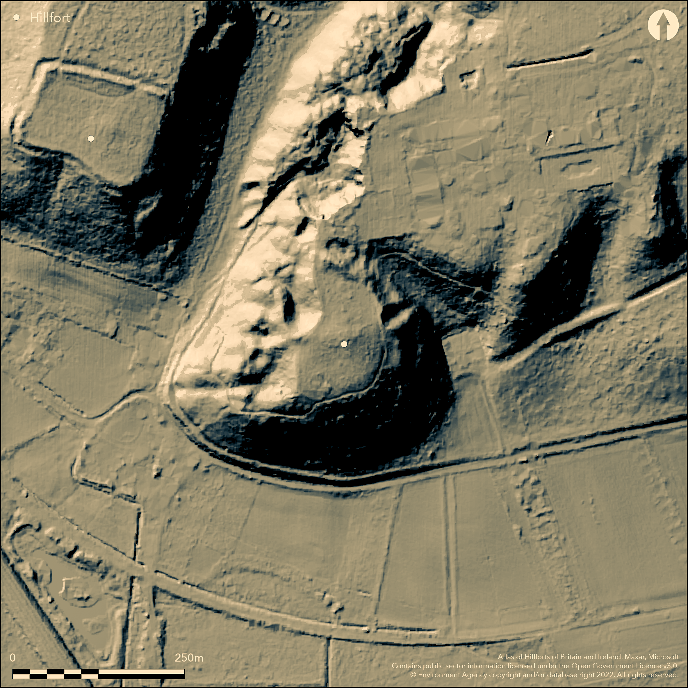
LiDAR 1m DTM Hillshade
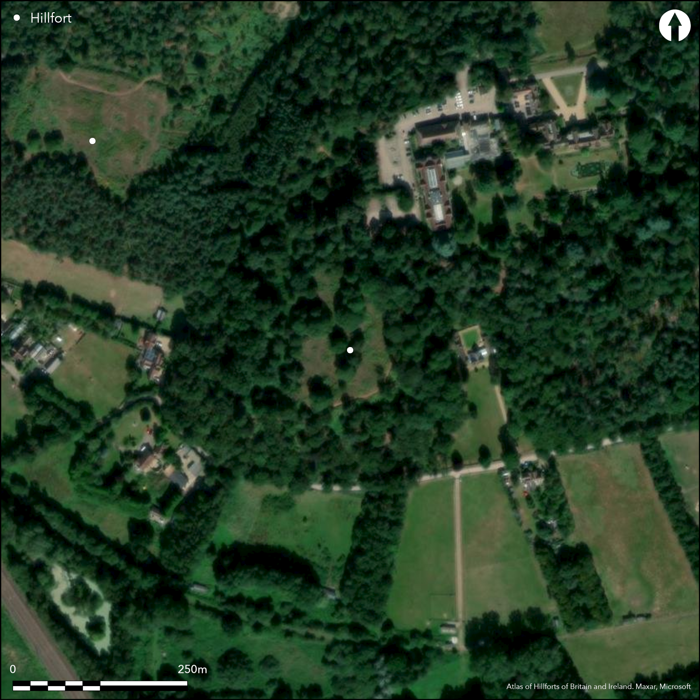
Satellite Imagery
LiDAR 1m DTM Hillshade
Satellite Imagery
Scroll left/right to view further images.
HER: Central Bedfordshire and Luton 1164 (None)
NMR: TL 14 NE 19 (362679)
SM: 1015006
NGR: TL 1872 4764
X: 518722 Y: 247646 (OSGB36)
Discovered in 1967 within the grounds of the RSPB Bird Sanctuary at Sandy Lodge, a small hillfort of 0.8 ha lying on a promontory 236m to the SE of Galley Hill (Atlas No. 3298). The two sites are separated by a narrow dry valley and clearly visible from each other (Dyer 1971). Oval in plan it measures 75m E-W by 150m transversely and is naturally defined on all sides except in the N where a 10m wide and 3m deep ditch cuts across the neck of the spur. Limited excavation by Dyer in 1969 across the rampart showed that the ditch was created from an artificially deepened natural dry valley that cut across the neck of the spur in the N. It had an irregular, stepped appearance suggesting it was deepened as a series of pits that had not been joined together and therefore possibly unfinished. The angular rock-cut surface appeared unweathered, suggesting it was open only for a short time (ibid.). Sandy material from the ditch had been used to construct a glacis rampart 1.7m high but diminishing in the E where the natural depth of the dry valley required no additional clearing out. Thin lines of grey sand within the bank were interpreted as possible residue from former branches or wattle, with stacked turves used the stablise the rear of the bank near the entrance. The front of the bank had been faced with a low sandstone blocks approximately six courses deep, some of which had tumbled into the ditch. An entrance lies In the NW, 20m from the eastern side of the spur surviving as a rounded ditch terminal and a relatively unworn causeway 10.3m wide. A single post-hole 0.6m in diameter, possibly for a gate was found at the northern end. The western side of the entrance along with the bank and ditch were quarried for sand in the 19th century and the causeway might have once been wider. No structural features were discovered within the interior during the investigations in 1968 but a number of early Iron Age pottery sherds were recovered, together with Mesolithic flints. The incomplete nature of the features and small number of finds, and the lack of evidence for use of the causeway was seen as evidence for short-lived occupation (Dyer 1971, 14). The site is not recorded on OS mapping.
Citizen Science: ✗
Reliability of Data: Confirmed
Reliability of Interpretation: Confirmed
X: -29788 Y: 6820830 (EPSG: 3857)
Longitude: -0.26759013886721444 Latitude: 52.114359088225704 (EPSG:4326)
Country: England
Current County or Unitary Authority: Central Bedfordshire
Historic County: Bedfordshire
Current Parish/Community/Council/Townland: Sandy
Land under higher level stewardship (RSPB). A 19th century sand quarry had destroyed the defences in the NW
| Extant | ✓ |
| Cropmark | ✗ |
| Likely Destroyed | ✓ |
Heathland bordered by woodland.
| Woodland | ✓ |
| Commercial Forestry Plantation | ✗ |
| Parkland | ✗ |
| Pasture (Grazing) | ✗ |
| Arable | ✗ |
| Scrub/Bracken | ✗ |
| Bare Outcrop | ✗ |
| Heather/Moorland | ✗ |
| Heath | ✓ |
| Built-up | ✗ |
| Coastal Grassland | ✗ |
| Other | ✗ |
A small promontory fort lying at 58m OD on the edge of the Greensand ridge above Sandy. It occupies the tip of a spur which extends southwards from the ridge
| Contour Fort | ✗ |
| Partial Contour Fort | ✗ |
| Promontory Fort | ✓ |
| Hillslope Fort | ✗ |
| Level Terrain Fort | ✗ |
| Marsh Fort | ✗ |
| Multiple Enclosure Fort | ✗ |
| Hilltop | ✓ |
| Coastal Promontory | ✗ |
| Inland Promontory | ✓ |
| Valley Bottom | ✗ |
| Knoll/Hillock/Outcrop | ✗ |
| Ridge | ✗ |
| Cliff/Plateau-edge/Scarp | ✗ |
| Hillslope | ✗ |
| Lowland | ✗ |
| Spur | ✓ |
Dominant Topographic Feature: Spur
| North | ✗ |
| Northeast | ✗ |
| East | ✗ |
| Southeast | ✗ |
| South | ✗ |
| Southwest | ✓ |
| West | ✗ |
| Northwest | ✗ |
| Level | ✗ |
Altitude: 58.0m
N/A
Small amount of early Iron Age pottery. Mesolithic cores and scrapers, microliths and a sickle blade suggest pre-hillfort activity
Reliability: B - Medium
| Pre 1200BC | ✗ |
| 1200BC - 800BC | ✗ |
| 800BC - 400BC | ✓ |
| 400BC - AD50 | ✗ |
| AD50 - AD400 | ✗ |
| AD400 - AD 800 | ✗ |
| Post AD800 | ✗ |
| Unknown | ✗ |
| Pre Hillfort: | None |
| Post Hillfort: | None |
| Artefactual: | None |
Excavated in 1968-9 (Dyer 1971) when a contour survey by the Geography Department of Putteridge Bury College was also undertaken. Scheduled
| Earthwork Survey (1971): | None |
| Other (1996): | Scheduled |
| Excavation (None): | None |
No structural features have been discovered within the interior. Pottery and lithics through excavation.
None
| None | ✓ |
| Spring | ✗ |
| Stream | ✗ |
| Pool | ✗ |
| Flush | ✗ |
| Well | ✗ |
| Other | ✗ |
None
| No Known Features | ✓ |
| Round Stone Structures | ✗ |
| Rectangular Stone Structures | ✗ |
| Curvilinear Platforms | ✗ |
| Other Roundhouse Evidence | ✗ |
| Pits | ✗ |
| Quarry Hollows | ✗ |
| Other | ✗ |
None
| No Known Excavation | ✗ |
| Pits | ✗ |
| Postholes | ✗ |
| Roundhouses | ✗ |
| Rectangular Structures | ✗ |
| Roads/Tracks | ✗ |
| Quarry Hollows | ✗ |
| Other | ✗ |
| Nothing Found | ✓ |
None
| No Known Geophysics | ✓ |
| Pits | ✗ |
| Roundhouses | ✗ |
| Rectangular Structures | ✗ |
| Roads/Tracks | ✗ |
| Quarry Hollows | ✗ |
| Other | ✗ |
| Nothing Found | ✗ |
None
| No Known Finds | ✗ |
| Pottery | ✓ |
| Metal | ✗ |
| Metalworking | ✗ |
| Human Bones | ✗ |
| Animal Bones | ✗ |
| Lithics | ✓ |
| Environmental | ✗ |
| Other | ✗ |
Wooded
| APs Not Checked | ✓ |
| None | ✗ |
| Roundhouses | ✗ |
| Rectangular Structures | ✗ |
| Pits | ✗ |
| Postholes | ✗ |
| Roads/Tracks | ✗ |
| Other | ✗ |
An entrance lies In the NW, 20m from the eastern side of the spur surviving as a rounded ditch terminal and a relatively unworn causeway 10.3m wide. A single post-hole 0.6m in diameter, possibly for a gate was found at the northern end. The western side of the entrance along with the bank and ditch were quarried for sand in the 19th century and the causeway might have once been wider.
| 1: | None |
| 2: | None |
Guard Chambers: ✗
Chevaux de Frise: ✗
| 1. Simple Gap (North west): | Causeway across the ditch |
Original oval in plan enclosing 0.8ha, now destroyed in the NW. The ditch is an artificially deepened natural dry valley that cut across the neck of the spur in the N. It had an irregular, stepped appearance suggesting it was deepened as a series of pits that had not been joined together and possibly unfinished. Sandy material from the ditch used to construct a glacis rampart 1.7m high but diminishing in the E where the natural depth of the dry valley required no additional clearing out. Thin lines of grey sand within the bank were interpreted as possible residue from former branches or wattle, with stacked turves used the stabilise the rear of the bank near the entrance. The front of the bank had been faced with a low sandstone blocks approximately six courses deep.
| Area 1: | 0.8ha. |
| Total: | 0.8ha. |
Total Footprint Area: Noneha.
None
| ✗ | None |
| ✗ | None |
| NE Quadrant: | 1 |
| SE Quadrant: | None |
| SW Quadrant: | None |
| NW Quadrant: | 1 |
| Total: | 1 |
| Partial Univallate | ✓ |
| Univallate | ✗ |
| Partial Bivallate | ✗ |
| Bivallate | ✗ |
| Partial Multivallate | ✗ |
| Multivallate | ✗ |
| Unknown | ✗ |
| Partial Univallate | ✗ |
| Univallate | ✗ |
| Partial Bivallate | ✗ |
| Bivallate | ✗ |
| Partial Multivallate | ✗ |
| Multivallate | ✗ |
Ditch possibly unfinished
| None | ✗ |
| Earthen Bank | ✓ |
| Stone Wall | ✗ |
| Rubble | ✗ |
| Wall-walk | ✗ |
| Evidence of Timber | ✗ |
| Vitrification | ✗ |
| Other Burning | ✗ |
| Palisade | ✗ |
| Counter Scarp Bank | ✗ |
| Berm | ✗ |
| Unfinished | ✓ |
| Other | ✗ |
Wattle with stacked turves
| None | ✗ |
| Earthen Bank | ✓ |
| Stone Wall | ✓ |
| Murus Duplex | ✗ |
| Timber-framed | ✗ |
| Timber-laced | ✗ |
| Vitrification | ✗ |
| Other Burning | ✗ |
| Palisade | ✗ |
| Counter Scarp Bank | ✗ |
| Berm | ✗ |
| Unfinished | ✓ |
| No Known Excavation | ✗ |
| Other | ✓ |
| ✗ | None |
| ✓ | Ditch created from an artificially deepened natural dry valley that cut across the neck of the spur in the N. The irregular, stepped appearance suggested to Dyer (1971) it was deepened as a series of pits that had not been joined together and therefore possibly unfinished. |
Number of Ditches: 1
| ✗ | None |
Dyer, J. 1971. Excavations at Sandy Lodge Bedfordshire. Bedfordshire Archaeol J. 9-15
Simco, A. 1973. The Iron Age in Central Bedfordshire Bedfordshire Archaeol J. 16, 21
Atlas of Hillforts:
Wikidata:
This work is licensed under CC BY-SA 4.0

 and should be cited as:
Lock, Gary and Ralston, Ian. 2024. Atlas of Hillforts of Britain and Ireland. Available at: https://hillforts.arch.ox.ac.uk
Document Version 1.1