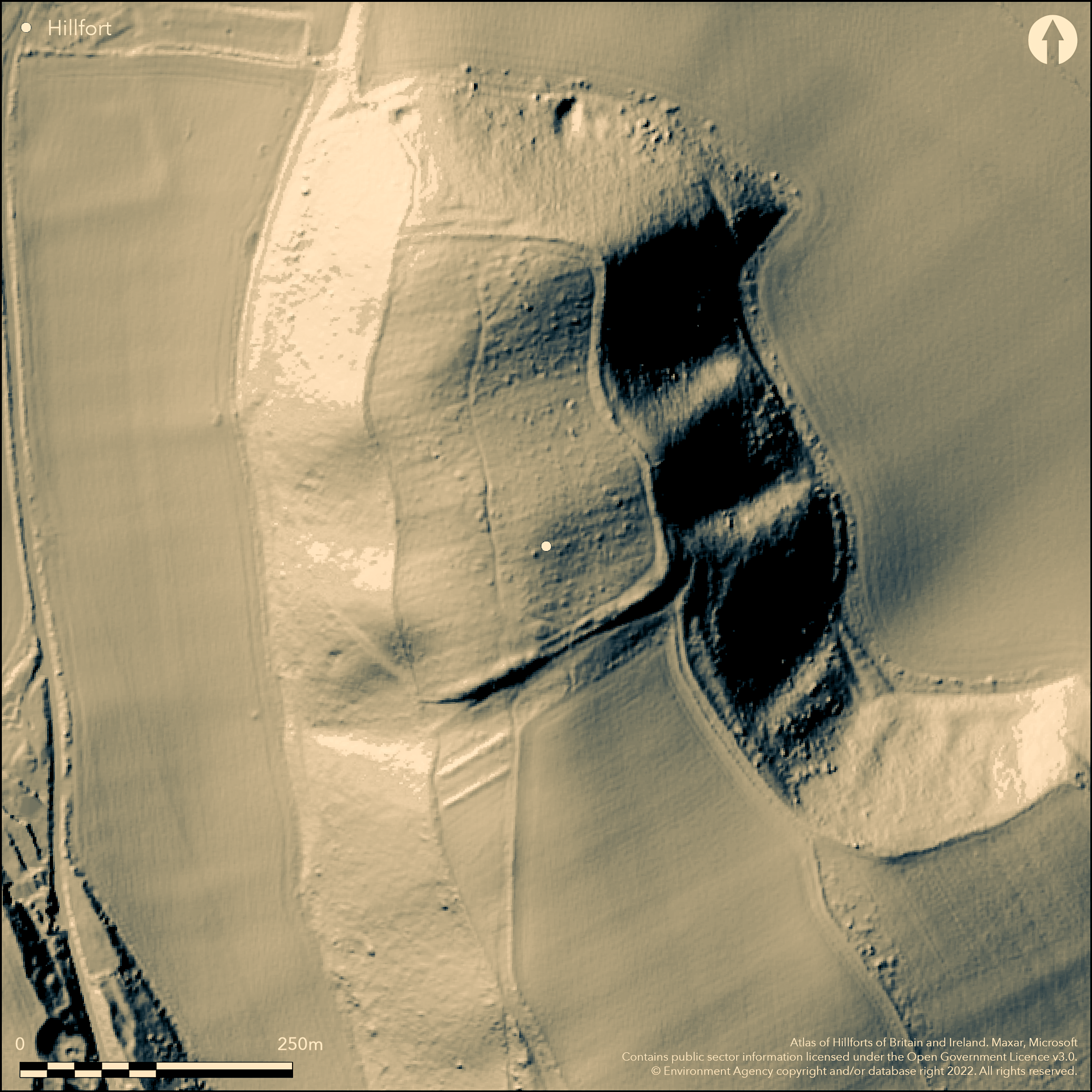
LiDAR 1m DTM Hillshade
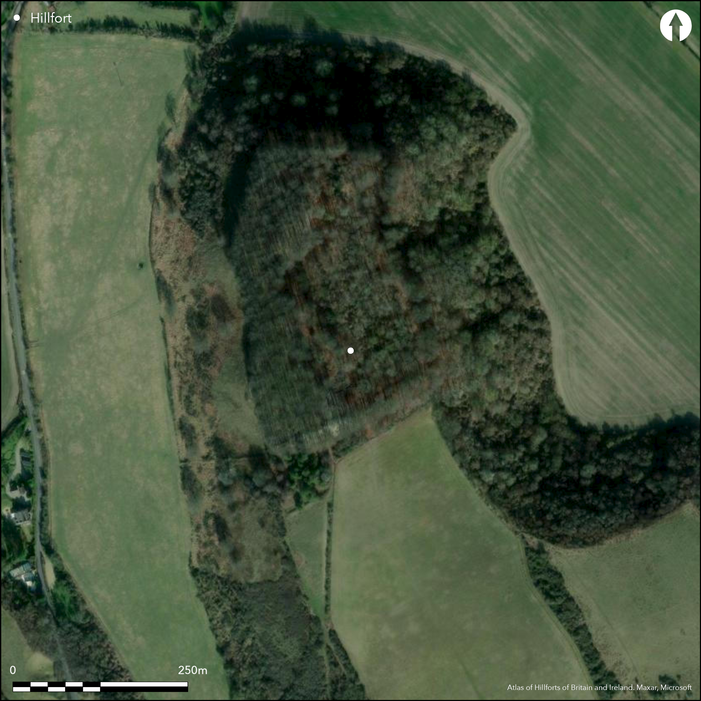
Satellite Imagery
LiDAR 1m DTM Hillshade
Satellite Imagery
Scroll left/right to view further images.
HER: Central Bedfordshire and Luton 238 (None)
NMR: TL 03 SE 2 (360055)
SM: 1009400
NGR: TL 0665 3020
X: 506650 Y: 230200 (OSGB36)
Lying within Beech woodland on a chalk spur on the northern edge of the Chiltern Hills, approximately 1.5km to the SW of Barton le Clay, a promontory fort of approximately 3.75ha. The steep slopes of the spur offer a natural defence in the E and W, with the N enhanced by shallow terraces cut into the slope, although these are undated. Today the visible remains comprise two lengths of bank running E-W across the neck of spur in the S which excavation (Dix 1983) has shown to be medieval with an underlying palisade trench suggesting possible Iron Age origins. The medieval chalk banks cut off a rectangular area measuring 250m N-S by 150m E-W. Excavation in 1979 in advance of replanting, showed the western bank had been constructed as a pillow mound which overlay a buried surface from which Iron Age and Roman pottery was recovered. The U-shaped palisade trench 0.5m wide, retained impressions of posts with a 4-5m wide entrance in the E of the western bank marked by two large post holes. A hollow lying externally to the palisade trench in the W, 1.5m deep and 4.5m wide, represents a possible terminal of an external defensive ditch. Traces of toolmarks were also recorded cutting into the chalk. A geophysical survey in 1980 revealed the buried remains of a similar ditch to the E of the entrance. The site is now robbed in the E. There is no evidence for occupation within the interior. Roman potttery sherds and fragments of Iron Age vessels were recovered from beneath the bank. A U-shaped channel cut into the chalk contained fragments of early Iron Age pottery. The site was first identified as a `British Camp' in 1874 (ibid.). The banks are recorded on 1977 1:2,500 OS mapping. Scheduled as an Iron Age promontory fort.
Citizen Science: ✗
Reliability of Data: Confirmed
Reliability of Interpretation: Confirmed
X: -50011 Y: 6792900 (EPSG: 3857)
Longitude: -0.44925379593114456 Latitude: 51.960020946162885 (EPSG:4326)
Country: England
Current County or Unitary Authority: Central Bedfordshire
Historic County: Bedfordshire
Current Parish/Community/Council/Townland: Streatley
Robbed in the E
| Extant | ✓ |
| Cropmark | ✗ |
| Likely Destroyed | ✓ |
Pasture until the 1840's. Now owned by the National Trust, the land comprises a beech plantation and nature reserve. SSSI.
| Woodland | ✗ |
| Commercial Forestry Plantation | ✓ |
| Parkland | ✗ |
| Pasture (Grazing) | ✗ |
| Arable | ✗ |
| Scrub/Bracken | ✗ |
| Bare Outcrop | ✗ |
| Heather/Moorland | ✗ |
| Heath | ✗ |
| Built-up | ✗ |
| Coastal Grassland | ✗ |
| Other | ✗ |
Lying at the northern end of a spur commanding views in the N, E and W, a promontory fort lying on a level plateau at 140m OD
| Contour Fort | ✗ |
| Partial Contour Fort | ✗ |
| Promontory Fort | ✓ |
| Hillslope Fort | ✗ |
| Level Terrain Fort | ✗ |
| Marsh Fort | ✗ |
| Multiple Enclosure Fort | ✗ |
| Hilltop | ✗ |
| Coastal Promontory | ✗ |
| Inland Promontory | ✓ |
| Valley Bottom | ✗ |
| Knoll/Hillock/Outcrop | ✗ |
| Ridge | ✗ |
| Cliff/Plateau-edge/Scarp | ✗ |
| Hillslope | ✗ |
| Lowland | ✗ |
| Spur | ✓ |
Dominant Topographic Feature: Spur
| North | ✗ |
| Northeast | ✗ |
| East | ✗ |
| Southeast | ✗ |
| South | ✗ |
| Southwest | ✗ |
| West | ✗ |
| Northwest | ✗ |
| Level | ✓ |
Altitude: 140.0m
N/A
Roman and Iron Age pottery sherds were recovered from beneath the bank.
Reliability: B - Medium
| Pre 1200BC | ✗ |
| 1200BC - 800BC | ✗ |
| 800BC - 400BC | ✓ |
| 400BC - AD50 | ✓ |
| AD50 - AD400 | ✗ |
| AD400 - AD 800 | ✗ |
| Post AD800 | ✗ |
| Unknown | ✗ |
| Pre Hillfort: | None |
| Post Hillfort: | None |
| Artefactual: | None |
Field investigation in 1973. Recorded on 1977 1:2,500 OS mapping. Excavated in 1979. Scheduled. Magnetometry and resistance survey in 1980, AML
| Other (1973): | Field investigation |
| 1st Identified Map Depiction (1977): | None |
| Excavation (1979): | None |
| Geophysical Survey (1980): | AML |
| Other (1982): | Scheduled |
No internal features are recorded. Pottery.
None
| None | ✓ |
| Spring | ✗ |
| Stream | ✗ |
| Pool | ✗ |
| Flush | ✗ |
| Well | ✗ |
| Other | ✗ |
None
| No Known Features | ✓ |
| Round Stone Structures | ✗ |
| Rectangular Stone Structures | ✗ |
| Curvilinear Platforms | ✗ |
| Other Roundhouse Evidence | ✗ |
| Pits | ✗ |
| Quarry Hollows | ✗ |
| Other | ✗ |
Ramparts only excavated
| No Known Excavation | ✓ |
| Pits | ✗ |
| Postholes | ✗ |
| Roundhouses | ✗ |
| Rectangular Structures | ✗ |
| Roads/Tracks | ✗ |
| Quarry Hollows | ✗ |
| Other | ✗ |
| Nothing Found | ✗ |
Exterior only
| No Known Geophysics | ✓ |
| Pits | ✗ |
| Roundhouses | ✗ |
| Rectangular Structures | ✗ |
| Roads/Tracks | ✗ |
| Quarry Hollows | ✗ |
| Other | ✗ |
| Nothing Found | ✗ |
None
| No Known Finds | ✗ |
| Pottery | ✓ |
| Metal | ✗ |
| Metalworking | ✗ |
| Human Bones | ✗ |
| Animal Bones | ✗ |
| Lithics | ✗ |
| Environmental | ✗ |
| Other | ✗ |
Wooded
| APs Not Checked | ✓ |
| None | ✗ |
| Roundhouses | ✗ |
| Rectangular Structures | ✗ |
| Pits | ✗ |
| Postholes | ✗ |
| Roads/Tracks | ✗ |
| Other | ✗ |
A 4-5m wide entrance in the western rampart marked by two large post holes
| 1: | None |
| 2: | None |
Guard Chambers: ✗
Chevaux de Frise: ✗
| 1. Simple Gap (West): | None |
Palisade trench 0.5m wide underlying medieval banks. A possible entrance lies in the E of the western rampart
| Area 1: | 3.75ha. |
| Total: | 3.75ha. |
Total Footprint Area: Noneha.
None
| ✗ | None |
| ✗ | None |
| NE Quadrant: | None |
| SE Quadrant: | 1 |
| SW Quadrant: | 1 |
| NW Quadrant: | None |
| Total: | 1 |
| Partial Univallate | ✓ |
| Univallate | ✗ |
| Partial Bivallate | ✗ |
| Bivallate | ✗ |
| Partial Multivallate | ✗ |
| Multivallate | ✗ |
| Unknown | ✗ |
| Partial Univallate | ✗ |
| Univallate | ✗ |
| Partial Bivallate | ✗ |
| Bivallate | ✗ |
| Partial Multivallate | ✗ |
| Multivallate | ✗ |
None
| None | ✗ |
| Earthen Bank | ✓ |
| Stone Wall | ✗ |
| Rubble | ✗ |
| Wall-walk | ✗ |
| Evidence of Timber | ✗ |
| Vitrification | ✗ |
| Other Burning | ✗ |
| Palisade | ✗ |
| Counter Scarp Bank | ✗ |
| Berm | ✗ |
| Unfinished | ✗ |
| Other | ✗ |
Several postholes were recorded although none were dated.
| None | ✗ |
| Earthen Bank | ✗ |
| Stone Wall | ✗ |
| Murus Duplex | ✗ |
| Timber-framed | ✗ |
| Timber-laced | ✗ |
| Vitrification | ✗ |
| Other Burning | ✗ |
| Palisade | ✓ |
| Counter Scarp Bank | ✗ |
| Berm | ✗ |
| Unfinished | ✗ |
| No Known Excavation | ✗ |
| Other | ✗ |
| ✗ | None |
| ✓ | None |
Number of Ditches: 1
| ✗ | None |
Bartlett, A. and David, A. 1980. Geophysics G 2/80, Sharpenhoe. AML Rep No 3252. DOE AM Lab report
Dix, B. 1983. An excavation at Sharpenhoe Clapper, Streatley, Bedfordshire. Bedfordshire Archaeol J. Vol. 16, 65-74
Atlas of Hillforts:
Wikidata:
This work is licensed under CC BY-SA 4.0

 and should be cited as:
Lock, Gary and Ralston, Ian. 2024. Atlas of Hillforts of Britain and Ireland. Available at: https://hillforts.arch.ox.ac.uk
Document Version 1.1