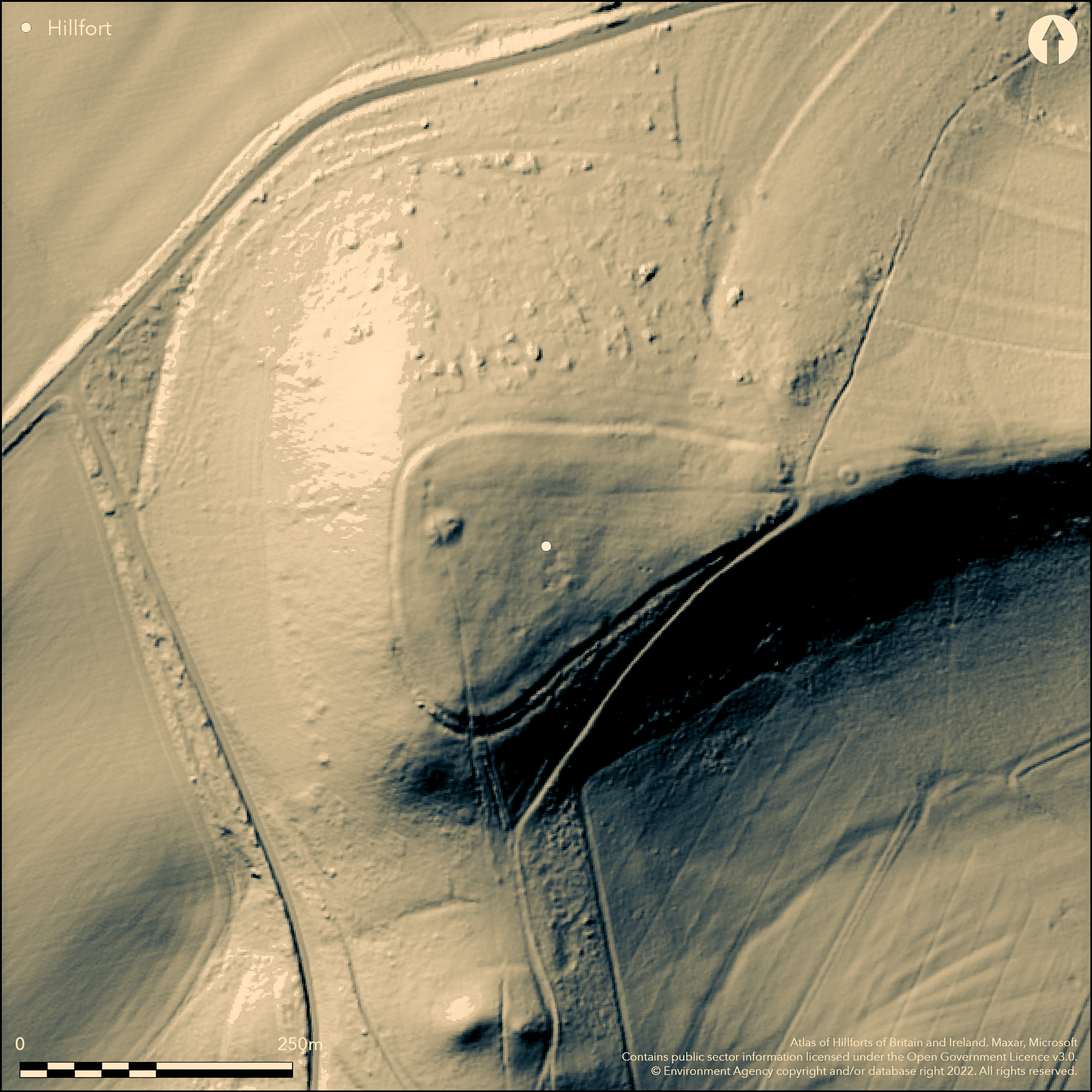
LiDAR 1m DTM Hillshade
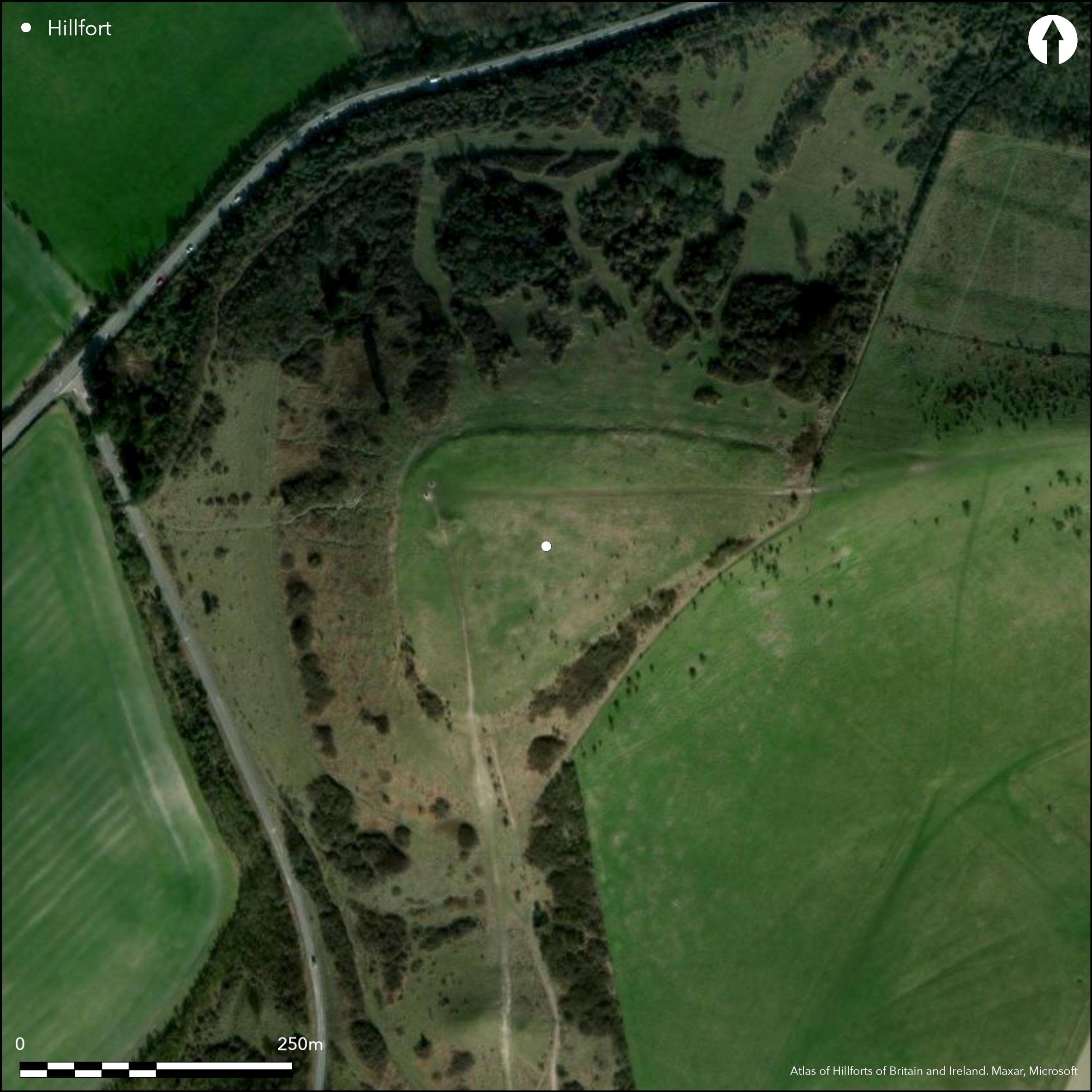
Satellite Imagery
LiDAR 1m DTM Hillshade
Satellite Imagery
Scroll left/right to view further images.
HER: Buckinghamshire 124500000 (151510 (NT))
NMR: SP 91 NE 19 (346375)
SM: 1009544
NGR: SP 9603 1683
X: 496033 Y: 216839 (OSGB36)
On Ivinghoe Beacon, the highest point on the Chiltern escarpment, overlooking the Aylesbury Vale, a mostly univallate hillfort of 2.2ha. The site is roughly triangular in plan, with a single bank following the 200m contour, enclosing the summit of the hill. The line of the Icknield Way, a possible prehistoric routeway between East Anglia and Wessex, passes directly beneath the eastern side of the hill and The Ridgeway Natiional Trail terminates at its summit. The ramparts survive up to 2m high in places, originally constructed as a box rampart as evidenced by a double row of irregularly spaced posts, with a rubble fill (Cotton and Frere 1968). Traces of a ditch and counterscarp bank have been recorded in the N. A second 60m length of bank lies to the S. Excavation has shown that the main ditch was once 3.1m wide and 2.2m deep. A probable entrance lies in the eastern corner at the easiest line of ascent, marked by a slight lowering and in-turning of the banks and the lack of a ditch in this area. The interior was ploughed in the post medieval period and lacks surface features contemporary with the use of the hillfort, although excavations between 1963-5 (ibid.) which included stripping parts of the interior, revealed a number of post holes, some interpreted as possible square or rectangular buildings, and a circular hut, and a semi-circular structure which butted against the rampart. Pottery and artefacts recovered from the excavations suggest that this is an early hillfort, constructed in the early 6th century BC. Radiocarbon dates obtained from bone from a midden deposit also provided a late Bronze Age date for the occupation of the hillfort (Green 1981). Cotton and Frere's interpretion of it being settled only for a short time, possibly by a single generation has recently been questioned by a geophysical survey (Gover 2000), which recorded anomalies consistent with a palisade, possibly rebuilt over time, a D-shaped enclosure and a Neolithic cursus or mortuary enclosure running NE/SW across the site. Bronze Age barrows lie inside the hillfort, with a third immediately outside the entrance. Outside the enclosure in the N are slight traces of a settlement comprising house platforms aligning a central street. The site is first recorded on 1925 1:2,500 OS mapping. Scheduled
Citizen Science: ✓
Reliability of Data: Confirmed
Reliability of Interpretation: Confirmed
X: -67620 Y: 6771582 (EPSG: 3857)
Longitude: -0.6074387900818988 Latitude: 51.8418606517767 (EPSG:4326)
Country: England
Current County or Unitary Authority: Buckinghamshire
Historic County: Buckinghamshire
Current Parish/Community/Council/Townland: Ivinghoe
Erosion occurring in the NW corner. The site is owned by the National Trust
| Extant | ✓ |
| Cropmark | ✗ |
| Likely Destroyed | ✗ |
SSSI
| Woodland | ✗ |
| Commercial Forestry Plantation | ✗ |
| Parkland | ✗ |
| Pasture (Grazing) | ✓ |
| Arable | ✗ |
| Scrub/Bracken | ✗ |
| Bare Outcrop | ✗ |
| Heather/Moorland | ✗ |
| Heath | ✗ |
| Built-up | ✗ |
| Coastal Grassland | ✗ |
| Other | ✗ |
A univallate fort the ramparts of which follow the 200m contour enclosing the summit of the hill. A trig point shows the interior to be slightly higher at 232m OD
| Contour Fort | ✓ |
| Partial Contour Fort | ✗ |
| Promontory Fort | ✗ |
| Hillslope Fort | ✗ |
| Level Terrain Fort | ✗ |
| Marsh Fort | ✗ |
| Multiple Enclosure Fort | ✗ |
| Hilltop | ✓ |
| Coastal Promontory | ✗ |
| Inland Promontory | ✗ |
| Valley Bottom | ✗ |
| Knoll/Hillock/Outcrop | ✗ |
| Ridge | ✗ |
| Cliff/Plateau-edge/Scarp | ✗ |
| Hillslope | ✗ |
| Lowland | ✗ |
| Spur | ✗ |
Dominant Topographic Feature: Summit of a hill
| North | ✗ |
| Northeast | ✗ |
| East | ✗ |
| Southeast | ✗ |
| South | ✗ |
| Southwest | ✗ |
| West | ✗ |
| Northwest | ✗ |
| Level | ✓ |
Altitude: 232.0m
N/A
Radiocarbon dates: 720 +/- 100 bc; 520 +/- 100 bc; 350 +/- 100 bc (Green 1981). Fragments of early Iron Age pottery found in 1932 when digging the foundation for the direction dial on the top of the hill. Early Iron Age fragments found in the 1960s (Cotton and Frere 1968). Flint flakes, animal bones and Bronze Age pottery sherds recovered from two small holes during work in 1920. In 2002 a late Bronze Age Wilburton-type sword dated c. 1150-1000 BC was recovered from the N side of the fort after illegal metal-detecting. A geophysical survey (Gover 2000) recorded anomalies consistent with a palisade, possibly rebuilt over time, a D-shaped enclosure and a Neolithic cursus or mortuary enclosure running NE/SW across the site
Reliability: B - Medium
| Pre 1200BC | ✗ |
| 1200BC - 800BC | ✗ |
| 800BC - 400BC | ✓ |
| 400BC - AD50 | ✗ |
| AD50 - AD400 | ✗ |
| AD400 - AD 800 | ✗ |
| Post AD800 | ✗ |
| Unknown | ✗ |
| Pre Hillfort: | None |
| Post Hillfort: | None |
| Artefactual: | Pottery, Bronze Age metal artefacts |
| C14: | Green (1981) |
Recorded on 1925 1:2,500 OS mapping. Excavation between 1963-5 including plan (Cotton and Frere 1968). C14 dating (Green 1981). Field investigation 1971. English Heritage earthwork survey 2000. Geophysical survey 2000. Small excavation in 2000 following unauthorised metal detecting and the discovery of a Wilburton-type sword. Scheduled
| 1st Identified Map Depiction (1925): | None |
| Other (1958): | Scheduled |
| Other (1971): | Field investigation |
| Other (1974): | Visit by Hillfort Study Group |
| Earthwork Survey (2000): | M. Brown |
| Geophysical Survey (2000): | J. Gover |
| Excavation (None): | None |
Interior ploughed in the post medieval period. Lacks surface features contemporary with the use of the hillfort. Excavations between 1963-5 (Cotton and Frere 1968) revealed a number of post holes, some interpreted as possible square or rectangular buildings and a circular hut, and a semi-circular structure which butted against the rampart. A geophysical survey (Gover 2000), recorded anomalies consistent with a palisade, possibly rebuilt over time, a D-shaped enclosure and a Neolithic cursus or mortuary enclosure running NE/SW across the site. Bronze Age barrows lie inside the hillfort,
None
| None | ✓ |
| Spring | ✗ |
| Stream | ✗ |
| Pool | ✗ |
| Flush | ✗ |
| Well | ✗ |
| Other | ✗ |
Bronze Age barrow
| No Known Features | ✗ |
| Round Stone Structures | ✗ |
| Rectangular Stone Structures | ✗ |
| Curvilinear Platforms | ✗ |
| Other Roundhouse Evidence | ✗ |
| Pits | ✗ |
| Quarry Hollows | ✗ |
| Other | ✓ |
Bronze Age barrows
| No Known Excavation | ✗ |
| Pits | ✗ |
| Postholes | ✓ |
| Roundhouses | ✓ |
| Rectangular Structures | ✓ |
| Roads/Tracks | ✗ |
| Quarry Hollows | ✗ |
| Other | ✗ |
| Nothing Found | ✗ |
Possible palisade, D-shaped enclosure and a Neolithic cursus or mortuary enclosure
| No Known Geophysics | ✗ |
| Pits | ✗ |
| Roundhouses | ✗ |
| Rectangular Structures | ✗ |
| Roads/Tracks | ✗ |
| Quarry Hollows | ✗ |
| Other | ✓ |
| Nothing Found | ✗ |
Late Bronze Age fine and coarsewares, loom weights, quern fragments, bones from cattle, sheep and pig. Wilburton-type late Bronze Age sword
| No Known Finds | ✗ |
| Pottery | ✓ |
| Metal | ✓ |
| Metalworking | ✗ |
| Human Bones | ✗ |
| Animal Bones | ✓ |
| Lithics | ✗ |
| Environmental | ✗ |
| Other | ✓ |
None
| APs Not Checked | ✓ |
| None | ✗ |
| Roundhouses | ✗ |
| Rectangular Structures | ✗ |
| Pits | ✗ |
| Postholes | ✗ |
| Roads/Tracks | ✗ |
| Other | ✗ |
Probable entrance lies in the eastern corner at the easiest line of ascent, marked by a slight lowering and in-turning of the banks and the lack of a ditch in this area.
| 1: | None |
| 2: | None |
Guard Chambers: ✗
Chevaux de Frise: ✗
| 1. In-turned (East): | Slight inturning |
A mostly univallate hillfort of 2.2ha. Roughly triangular in plan, with the single bank following the 200m contour. The ramparts survive up to 2m high in places, probably originally constructed as a box rampart as evidenced by a double row of irregularly spaced posts, with a rubble fill (Cotton and Frere 1968). Traces of a ditch and counterscarp bank have been recorded in the N. A second 60m length of bank lies to the S. Excavation has shown that the main ditch was once 3.1m wide by 2.2m deep.
| Area 1: | 2.2ha. |
| Total: | 2.2ha. |
Total Footprint Area: Noneha.
None
| ✓ | Possible earlier palisade |
| ✓ | None |
| NE Quadrant: | 1 |
| SE Quadrant: | 1 |
| SW Quadrant: | 2 |
| NW Quadrant: | 1 |
| Total: | 2 |
| Partial Univallate | ✓ |
| Univallate | ✗ |
| Partial Bivallate | ✓ |
| Bivallate | ✗ |
| Partial Multivallate | ✗ |
| Multivallate | ✗ |
| Unknown | ✗ |
| Partial Univallate | ✗ |
| Univallate | ✗ |
| Partial Bivallate | ✗ |
| Bivallate | ✗ |
| Partial Multivallate | ✗ |
| Multivallate | ✗ |
None
| None | ✗ |
| Earthen Bank | ✓ |
| Stone Wall | ✗ |
| Rubble | ✗ |
| Wall-walk | ✗ |
| Evidence of Timber | ✗ |
| Vitrification | ✗ |
| Other Burning | ✗ |
| Palisade | ✗ |
| Counter Scarp Bank | ✓ |
| Berm | ✗ |
| Unfinished | ✗ |
| Other | ✗ |
Box rampart infilled with stone rubble
| None | ✗ |
| Earthen Bank | ✓ |
| Stone Wall | ✗ |
| Murus Duplex | ✗ |
| Timber-framed | ✓ |
| Timber-laced | ✗ |
| Vitrification | ✗ |
| Other Burning | ✗ |
| Palisade | ✗ |
| Counter Scarp Bank | ✓ |
| Berm | ✗ |
| Unfinished | ✗ |
| No Known Excavation | ✗ |
| Other | ✗ |
| ✗ | None |
| ✓ | None |
Number of Ditches: 1
| ✗ | None |
Brown M. 2001. Ivinghoe Beacon, Ivinghoe: English Heritage Survey Report. Archaeological Investigation Report Series: AI/15/2001. Unpublished
Cotton, M.A. & Frere S. S. 1968. Ivinghoe Beacon Excavations 1963-1965, Rec Buckinghamshire, 18(3),187-260
Gover, J. 2000. A Geophysical Investigation of Ivinghoe Beacon. Unpublished
Green, H. S. 1981. The dating of Ivinghoe Beacon. Rec Buckinghamshire 23, 1981 1-3
Marshall, G. and Northover, P. 2003. The excavation and metallographical analysis of a Bronze Age sword recovered from Ivinghoe Beacon. Rec Buckinghamshire. 43, 27-37
Atlas of Hillforts:
Wikidata:
This work is licensed under CC BY-SA 4.0

 and should be cited as:
Lock, Gary and Ralston, Ian. 2024. Atlas of Hillforts of Britain and Ireland. Available at: https://hillforts.arch.ox.ac.uk
Document Version 1.1