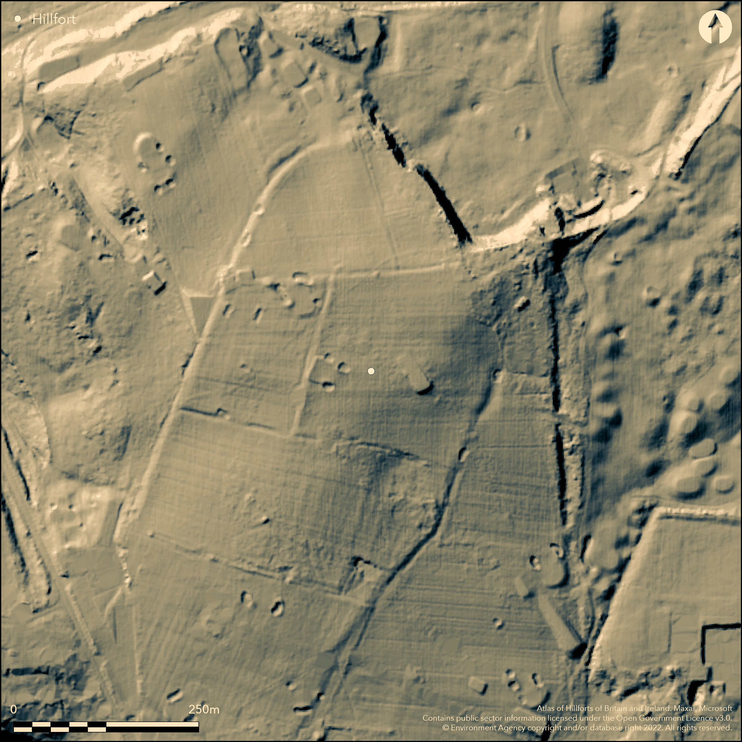
LiDAR 1m DTM Hillshade
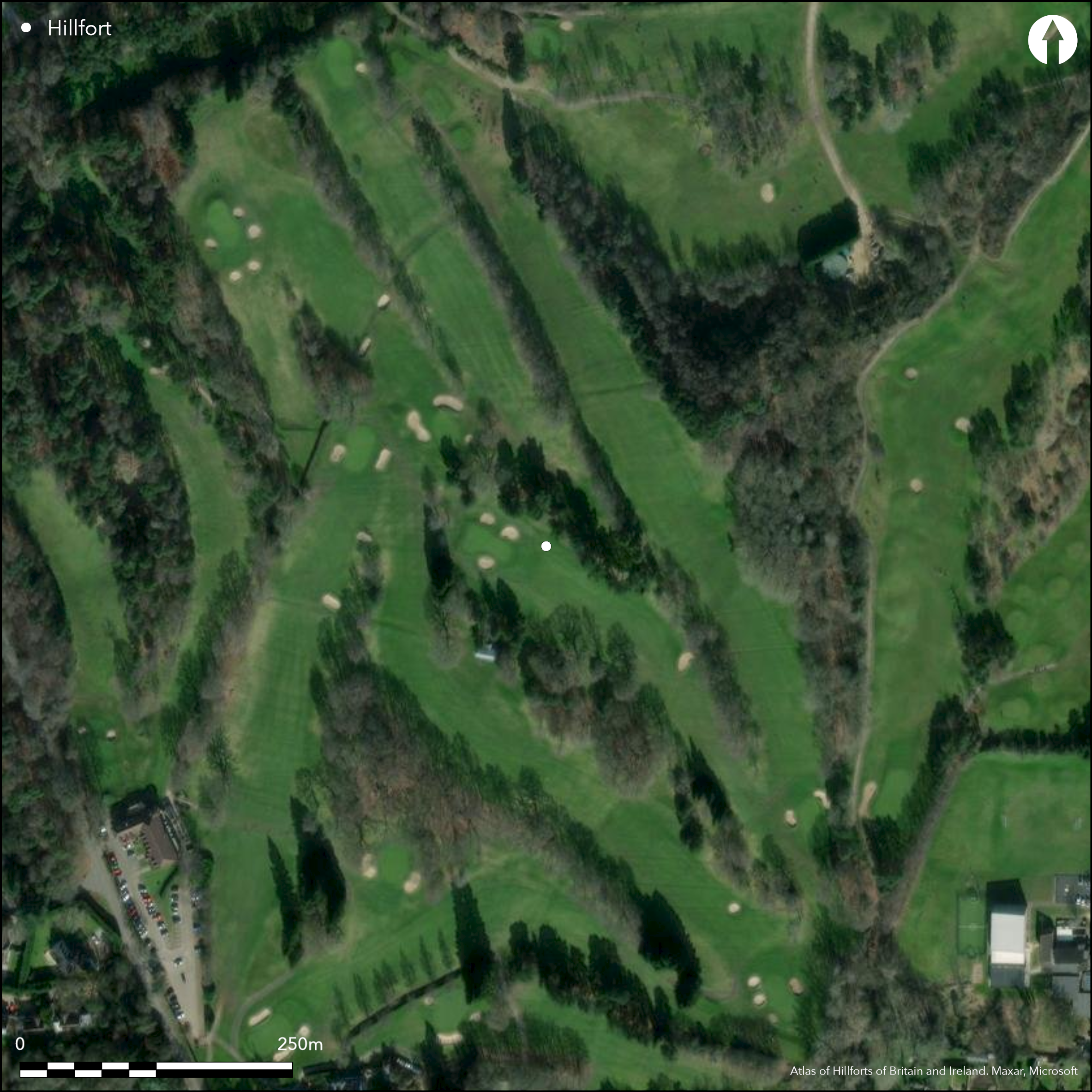
Satellite Imagery
LiDAR 1m DTM Hillshade
Satellite Imagery
Scroll left/right to view further images.
HER: Central Bedfordshire and Luton 4 (None)
NMR: SP 92 NW 4 (346518)
SM: None
NGR: SP 9194 2759
X: 491940 Y: 227590 (OSGB36)
The site of a conjectured hillfort known from antiquarian records and now destroyed. The site is shown on the 1841 Enclosure map as an oval area of land subdivided into fields all called Craddocks approximately 545m to the SW of St Leonard's Church, Heath and Reach. A holloway called Craddocks Lane bounded the land in the E. The site most probably comprised a single bank and ditch which enclosed a large hilltop. It was sub-divided during and after Enclosure. Agriculture and the use of the site in the 20th century as a golf course has destroyed most of the boundaries, although traces of a bank and ditch in the NW were visible in the early 1980's, the ditch being utilised as a golf course bunker. The site was described in Camden's Britannia (1695) as a 'Roman camp'. Gurvey (1920) suggests that this was the site of a Norman motte and a large castle yard, destroyed around 1820. Not recorded on OS mapping. Minimal investigations, undated.
Citizen Science: ✗
Reliability of Data: Irreconciled issues
Reliability of Interpretation: Irreconciled issues
X: -73913 Y: 6789137 (EPSG: 3857)
Longitude: -0.6639705982599338 Latitude: 51.93918539293498 (EPSG:4326)
Country: England; None
Current County or Unitary Authority: Central Bedfordshire
Historic County: Bedfordshire
Current Parish/Community/Council/Townland: Heath and Reach; Leighton-Linslade
None
| Extant | ✗ |
| Cropmark | ✗ |
| Likely Destroyed | ✓ |
Open heathland to the N, W and S; golf course since the 20th century
| Woodland | ✗ |
| Commercial Forestry Plantation | ✗ |
| Parkland | ✗ |
| Pasture (Grazing) | ✗ |
| Arable | ✗ |
| Scrub/Bracken | ✗ |
| Bare Outcrop | ✗ |
| Heather/Moorland | ✗ |
| Heath | ✓ |
| Built-up | ✗ |
| Coastal Grassland | ✗ |
| Other | ✓ |
A conjectured hillfort lying on a hilltop at 118m OD
| Contour Fort | ✓ |
| Partial Contour Fort | ✗ |
| Promontory Fort | ✗ |
| Hillslope Fort | ✗ |
| Level Terrain Fort | ✗ |
| Marsh Fort | ✗ |
| Multiple Enclosure Fort | ✗ |
| Hilltop | ✓ |
| Coastal Promontory | ✗ |
| Inland Promontory | ✗ |
| Valley Bottom | ✗ |
| Knoll/Hillock/Outcrop | ✗ |
| Ridge | ✗ |
| Cliff/Plateau-edge/Scarp | ✗ |
| Hillslope | ✗ |
| Lowland | ✗ |
| Spur | ✗ |
Dominant Topographic Feature: Hilltop
| North | ✓ |
| Northeast | ✗ |
| East | ✓ |
| Southeast | ✗ |
| South | ✓ |
| Southwest | ✗ |
| West | ✗ |
| Northwest | ✗ |
| Level | ✗ |
Altitude: 118.0m
Boundary between Heath and Reach and Leighton-Linslade lies to the W, S and E
Boundary Type: Parish/Townland
The site is undated
Reliability: D - None
| Pre 1200BC | ✗ |
| 1200BC - 800BC | ✗ |
| 800BC - 400BC | ✗ |
| 400BC - AD50 | ✗ |
| AD50 - AD400 | ✗ |
| AD400 - AD 800 | ✗ |
| Post AD800 | ✗ |
| Unknown | ✓ |
| Pre Hillfort: | None |
| Post Hillfort: | None |
The site was described in Camden's Britannia (1695) as a 'Roman camp'.
| 1st Identified Written Reference (1695): | None |
No internal features are recorded
None
| None | ✓ |
| Spring | ✗ |
| Stream | ✗ |
| Pool | ✗ |
| Flush | ✗ |
| Well | ✗ |
| Other | ✗ |
None
| No Known Features | ✓ |
| Round Stone Structures | ✗ |
| Rectangular Stone Structures | ✗ |
| Curvilinear Platforms | ✗ |
| Other Roundhouse Evidence | ✗ |
| Pits | ✗ |
| Quarry Hollows | ✗ |
| Other | ✗ |
None
| No Known Excavation | ✓ |
| Pits | ✗ |
| Postholes | ✗ |
| Roundhouses | ✗ |
| Rectangular Structures | ✗ |
| Roads/Tracks | ✗ |
| Quarry Hollows | ✗ |
| Other | ✗ |
| Nothing Found | ✗ |
None
| No Known Geophysics | ✓ |
| Pits | ✗ |
| Roundhouses | ✗ |
| Rectangular Structures | ✗ |
| Roads/Tracks | ✗ |
| Quarry Hollows | ✗ |
| Other | ✗ |
| Nothing Found | ✗ |
None
| No Known Finds | ✓ |
| Pottery | ✗ |
| Metal | ✗ |
| Metalworking | ✗ |
| Human Bones | ✗ |
| Animal Bones | ✗ |
| Lithics | ✗ |
| Environmental | ✗ |
| Other | ✗ |
None
| APs Not Checked | ✓ |
| None | ✗ |
| Roundhouses | ✗ |
| Rectangular Structures | ✗ |
| Pits | ✗ |
| Postholes | ✗ |
| Roads/Tracks | ✗ |
| Other | ✗ |
The location of entrances is not recorded
| 0: | None |
| 2: | None |
Guard Chambers: ✗
Chevaux de Frise: ✗
Shown on the 1841 Enclosure map as an oval area of land It most probably comprised a single bank and ditch which enclosed the large hilltop. Traces of the bank and ditch in the NW were visible in the early 1980's, the ditch being utilised as a golf course bunker.
| Area 1: | Noneha. |
| Total: | Noneha. |
Total Footprint Area: Noneha.
None
| ✗ | None |
| ✗ | Ramparts destroyed prior to recording |
| NE Quadrant: | None |
| SE Quadrant: | None |
| SW Quadrant: | None |
| NW Quadrant: | None |
| Total: | None |
| Partial Univallate | ✗ |
| Univallate | ✗ |
| Partial Bivallate | ✗ |
| Bivallate | ✗ |
| Partial Multivallate | ✗ |
| Multivallate | ✗ |
| Unknown | ✓ |
| Partial Univallate | ✗ |
| Univallate | ✗ |
| Partial Bivallate | ✗ |
| Bivallate | ✗ |
| Partial Multivallate | ✗ |
| Multivallate | ✗ |
None
| None | ✓ |
| Earthen Bank | ✗ |
| Stone Wall | ✗ |
| Rubble | ✗ |
| Wall-walk | ✗ |
| Evidence of Timber | ✗ |
| Vitrification | ✗ |
| Other Burning | ✗ |
| Palisade | ✗ |
| Counter Scarp Bank | ✗ |
| Berm | ✗ |
| Unfinished | ✗ |
| Other | ✗ |
None
| None | ✗ |
| Earthen Bank | ✗ |
| Stone Wall | ✗ |
| Murus Duplex | ✗ |
| Timber-framed | ✗ |
| Timber-laced | ✗ |
| Vitrification | ✗ |
| Other Burning | ✗ |
| Palisade | ✗ |
| Counter Scarp Bank | ✗ |
| Berm | ✗ |
| Unfinished | ✗ |
| No Known Excavation | ✓ |
| Other | ✗ |
| ✗ | None |
| ✗ | Presumed one ditch but now destroyed |
Number of Ditches: 0
| ✗ | None |
Camden, W. 1695. Britannia. Second edition. Edmund Gibson, Gibson, London.
Gurvey, F.G. 1920. Bedfordshire Historic Records Society Vol. 5, 178
Atlas of Hillforts:
Wikidata:
This work is licensed under CC BY-SA 4.0

 and should be cited as:
Lock, Gary and Ralston, Ian. 2024. Atlas of Hillforts of Britain and Ireland. Available at: https://hillforts.arch.ox.ac.uk
Document Version 1.1