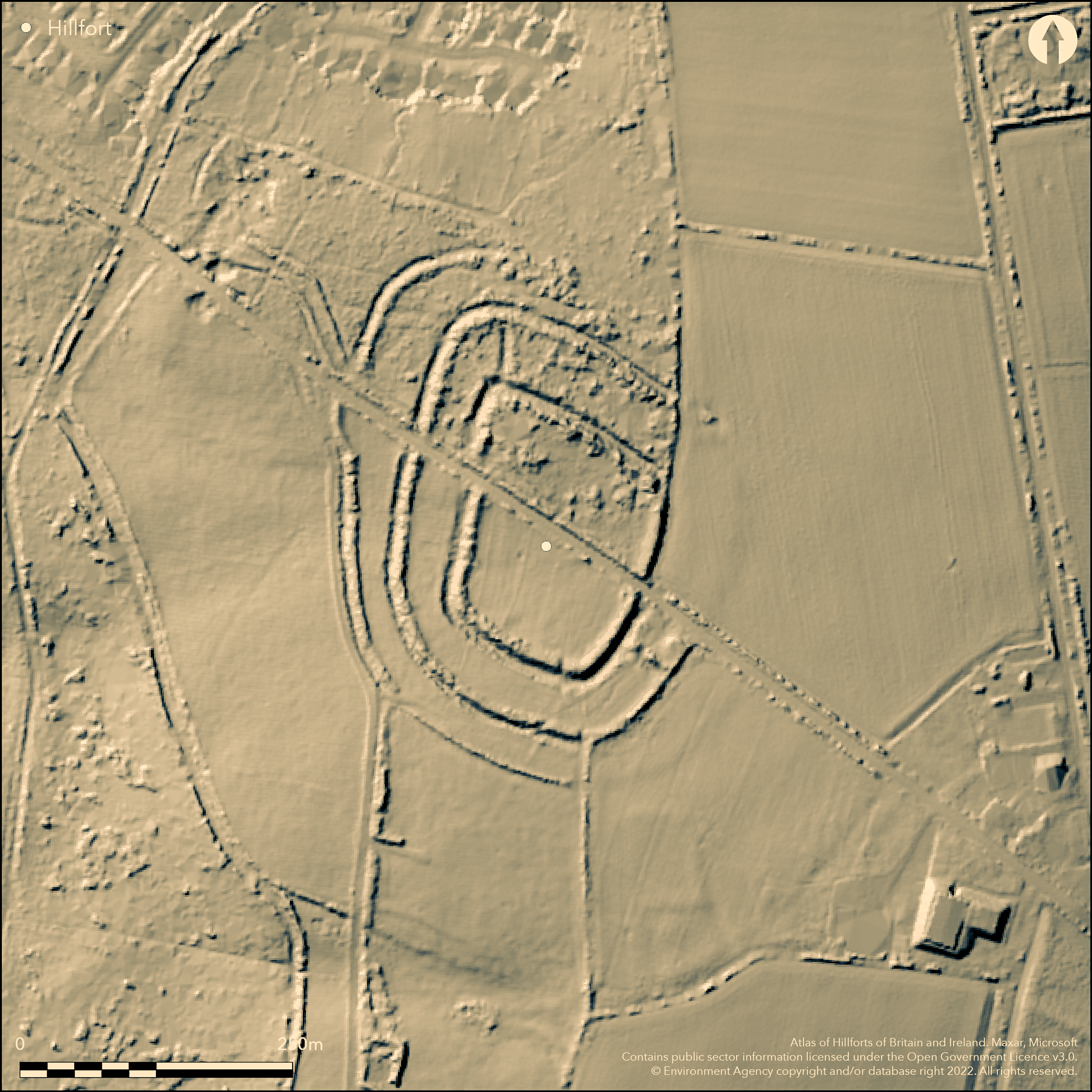
LiDAR 1m DTM Hillshade
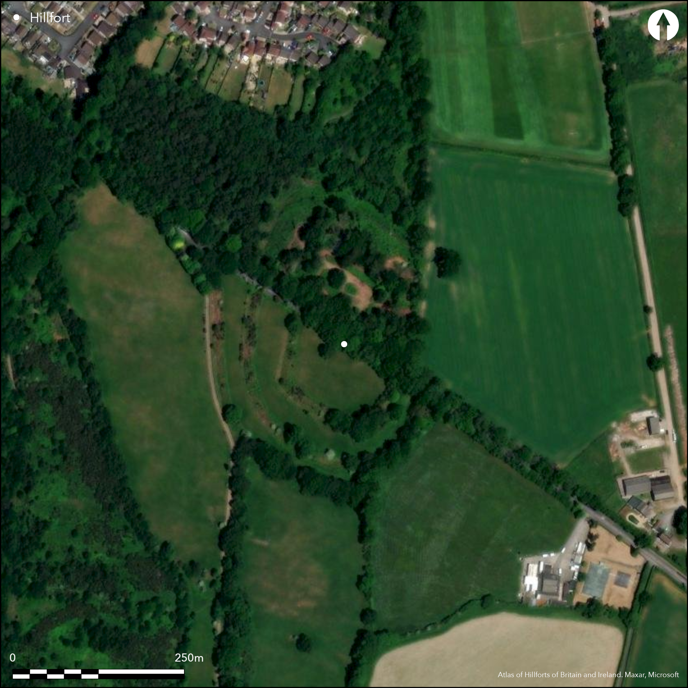
Satellite Imagery
LiDAR 1m DTM Hillshade
Satellite Imagery
Scroll left/right to view further images.
HER: Devon MDV8649 (None)
NMR: SX 86 NE 3 (446096)
SM: 1003178
NGR: SX88456985
X: 288446 Y: 69854 (OSGB36)
Complex multiple enclosure fort located on W-facing slope above Aller Brook, a tributary of River Teign, S of its estuary and below the lowest crossing point. Good views to Dartmoor on NW, with Denbury hillfort (Atlas No 3345) clearly visible to W. Suggested by Fox (1952) as paired with Denbury to SW. Site defined by four roughly concentric enclosures and banks surrounding entire circuit, with the inner three enclosing approximately 1.1ha, 1.3ha and 2.3ha respectively. The inner enclosure is the most substantial with banks to 1.5m high and a ditch to 3m deep. Leaving a space c. 25m away around the first is the second enclosure, divided into sections by at least three radial banks, but the earthworks are less than the first. The third enclosure, again with substantial space from the second, again has slighter banks, but those on the NE not visible. A modern road, runs NW-SE splitting up the site, and presumably going through two entrances to the two inner enclosures of the fort. It is possible that the entrance to the third enclosure, and indeed the main gate into the site, lies just N of the road, where rampart stops 10m away and low parallel banks flanking slight hollow way lead down through the fourth enclosure, funelling access from the NW and location of nearest water supply, the Aller Brook. The fourth enclosure banks are slight and virtually ploughed-out throughout circumference. Excavation by F. Cottrill 1937-38 for Devon Archaeological Society, published later by Fox et al (1949-50), which showed ramparts of simple dump construction and site single phased. Ditch to fourth enclosure c. 3m deep. Middle Iron Age South Western Decorated ware found in inner and second ditches with important group of bronze figurines of a bird, stag and duck (see Brown 2009, 143), showing perhaps Roman influence. Part of iron dagger hilt came from small trench from inner bank. S of the road, immediately SW of fourth enclosure small rectangular earthwork, Milber Down Little Camp (EHNMR 636745), and possibly part of prehistoric field systems. Trenches dug here found Roman military pottery of c. AD 55-75. Pasture with banks, scrub and trees to S of road, scrubby woodland to N of road. Development to NW. On 1st Ed. OS map (1888-90).
Citizen Science: ✗
Reliability of Data: Confirmed
Reliability of Interpretation: Confirmed
X: -397959 Y: 6536427 (EPSG: 3857)
Longitude: -3.574925396838474 Latitude: 50.51774281986222 (EPSG:4326)
Country: England; None
Current County or Unitary Authority: Devon
Historic County: Devon
Current Parish/Community/Council/Townland: Coffinswell; Haccombe with Combe
Inner bank most substantial, others less and fourth circuit slight and virtually ploughed-out. Road runs NW-SE through the site. Development to NW. On Heritage at Risk Register (2015).
| Extant | ✓ |
| Cropmark | ✗ |
| Likely Destroyed | ✗ |
Pasture with banks, scrub and trees to S of road, scrubby woodland to N of road.
| Woodland | ✓ |
| Commercial Forestry Plantation | ✗ |
| Parkland | ✗ |
| Pasture (Grazing) | ✓ |
| Arable | ✗ |
| Scrub/Bracken | ✓ |
| Bare Outcrop | ✗ |
| Heather/Moorland | ✗ |
| Heath | ✗ |
| Built-up | ✗ |
| Coastal Grassland | ✗ |
| Other | ✓ |
Multiple enclosure fort located on W-facing slope above Aller Brook, a tributary of River Teign, S of its estuary and below the lowest crossing point. Good views to Dartmoor on W.
| Contour Fort | ✗ |
| Partial Contour Fort | ✗ |
| Promontory Fort | ✗ |
| Hillslope Fort | ✗ |
| Level Terrain Fort | ✗ |
| Marsh Fort | ✗ |
| Multiple Enclosure Fort | ✓ |
| Hilltop | ✗ |
| Coastal Promontory | ✗ |
| Inland Promontory | ✗ |
| Valley Bottom | ✗ |
| Knoll/Hillock/Outcrop | ✗ |
| Ridge | ✗ |
| Cliff/Plateau-edge/Scarp | ✗ |
| Hillslope | ✓ |
| Lowland | ✗ |
| Spur | ✗ |
Dominant Topographic Feature: Hillslope
| North | ✗ |
| Northeast | ✗ |
| East | ✗ |
| Southeast | ✗ |
| South | ✗ |
| Southwest | ✗ |
| West | ✓ |
| Northwest | ✗ |
| Level | ✗ |
Altitude: 125.0m
Boundary Type: Parish/Townland
Middle Iron Age South Western Decorated ware of third to 2nd century BC found in inner and second ditches with important group of bronze figurines of a bird, stag and duck (see Brown 2009, 143), showing perhaps Roman influence and of c. 1st century BC. Trenches dug into Milber Down Small Camp found Roman military pottery of c. AD 55-75.
Reliability: B - Medium
| Pre 1200BC | ✗ |
| 1200BC - 800BC | ✗ |
| 800BC - 400BC | ✗ |
| 400BC - AD50 | ✓ |
| AD50 - AD400 | ✓ |
| AD400 - AD 800 | ✗ |
| Post AD800 | ✗ |
| Unknown | ✗ |
| Pre Hillfort: | None |
| Post Hillfort: | None |
| Artefactual: | Pottery and bronze figurines. |
On 1st Ed. OS map (1888-90). Excavation by F. Cottrill 1937-38. Recent work on site by Exeter Archaeology - no details.
| Other (1972): | Visited by Hillfort Study Group |
| Other (2013): | Visited by Hillfort Study Group |
| 1st Identified Map Depiction (None): | OS map. |
| Excavation (None): | F. Cottrill. |
| Other (None): | Exeter Archaeology. |
Decorated (SWD) ware found with important group of bronze figurines of a bird, stag and duck (see Brown 2009, 143).
Nearest water Aller Brook.
| None | ✓ |
| Spring | ✗ |
| Stream | ✗ |
| Pool | ✗ |
| Flush | ✗ |
| Well | ✗ |
| Other | ✗ |
None
| No Known Features | ✓ |
| Round Stone Structures | ✗ |
| Rectangular Stone Structures | ✗ |
| Curvilinear Platforms | ✗ |
| Other Roundhouse Evidence | ✗ |
| Pits | ✗ |
| Quarry Hollows | ✗ |
| Other | ✗ |
None
| No Known Excavation | ✗ |
| Pits | ✗ |
| Postholes | ✗ |
| Roundhouses | ✗ |
| Rectangular Structures | ✗ |
| Roads/Tracks | ✗ |
| Quarry Hollows | ✗ |
| Other | ✗ |
| Nothing Found | ✓ |
None
| No Known Geophysics | ✓ |
| Pits | ✗ |
| Roundhouses | ✗ |
| Rectangular Structures | ✗ |
| Roads/Tracks | ✗ |
| Quarry Hollows | ✗ |
| Other | ✗ |
| Nothing Found | ✗ |
Decorated (SWD) ware found with important group of bronze figurines of a bird, stag and duck (see Brown 2009, 143).
| No Known Finds | ✗ |
| Pottery | ✓ |
| Metal | ✓ |
| Metalworking | ✗ |
| Human Bones | ✗ |
| Animal Bones | ✗ |
| Lithics | ✗ |
| Environmental | ✗ |
| Other | ✗ |
None
| APs Not Checked | ✓ |
| None | ✗ |
| Roundhouses | ✗ |
| Rectangular Structures | ✗ |
| Pits | ✗ |
| Postholes | ✗ |
| Roads/Tracks | ✗ |
| Other | ✗ |
Modern road, runs NW-SE splitting up the site, and presumably going through two entrances to the two inner enclosures of the fort. It is possible that the entrance to the third enclosure, and indeed the main gate into the site, lies just N of the road, where rampart stops 10m away and low parallel banks flanking slight hollow way lead down through the fourth enclosure, funnelling access from the NW and location of nearest water supply, the Aller Brook.
| 3: | None |
| 2: | None |
Guard Chambers: ✗
Chevaux de Frise: ✗
| 1. Simple Gap (North west): | Road cuts through possible entrance to two inner enclosures. |
| 2. Simple Gap (South east): | Road cuts through pssible entrance to two inner enclosure. |
| 3. Hollow Way (North west): | Possible main gate and entrance to third enclosure may lie just N of road to NW. |
Site defined by four roughly concentric enclosures and banks surrounding entire circuit. The inner enclosure is the most substantial with banks to 1.5m high and a ditch to 3m deep. Leaving a space c. 25m away around the first is the second enclosure, divided into sections by at least three radial banks, but the earthworks are less than the first. The third enclosure, again with substantial space from the second, again has slighter banks, but those on the NE not visible. Fourth enclosure banks slight and virtually ploughed-out throughout circumference. Ramparts of simple dump construction.
| Area 1: | 1.1ha. |
| Area 2: | 1.3ha. |
| Area 3: | 2.3ha. |
| Total: | 2.3ha. |
Total Footprint Area: Noneha.
None
| ✓ | Multiple enclosure suggests phased construction. |
| ✓ | None |
| NE Quadrant: | 4 |
| SE Quadrant: | 4 |
| SW Quadrant: | 4 |
| NW Quadrant: | 4 |
| Total: | 4 |
| Partial Univallate | ✗ |
| Univallate | ✗ |
| Partial Bivallate | ✗ |
| Bivallate | ✗ |
| Partial Multivallate | ✗ |
| Multivallate | ✓ |
| Unknown | ✗ |
| Partial Univallate | ✗ |
| Univallate | ✓ |
| Partial Bivallate | ✗ |
| Bivallate | ✗ |
| Partial Multivallate | ✗ |
| Multivallate | ✗ |
None
| None | ✗ |
| Earthen Bank | ✓ |
| Stone Wall | ✗ |
| Rubble | ✗ |
| Wall-walk | ✗ |
| Evidence of Timber | ✗ |
| Vitrification | ✗ |
| Other Burning | ✗ |
| Palisade | ✗ |
| Counter Scarp Bank | ✗ |
| Berm | ✗ |
| Unfinished | ✗ |
| Other | ✗ |
Ramparts of simple dump construction. Ditch to fourth enclosure c. 3m deep.
| None | ✗ |
| Earthen Bank | ✓ |
| Stone Wall | ✗ |
| Murus Duplex | ✗ |
| Timber-framed | ✗ |
| Timber-laced | ✗ |
| Vitrification | ✗ |
| Other Burning | ✗ |
| Palisade | ✗ |
| Counter Scarp Bank | ✗ |
| Berm | ✗ |
| Unfinished | ✗ |
| No Known Excavation | ✗ |
| Other | ✓ |
| ✗ | None |
| ✓ | Ditch to fourth enclosure c. 3m deep. |
Number of Ditches: 4
| ✗ | None |
Brown, I. 2009. Beacons in the landscape. The hillforts of England and Wales, Oxford: Windgather Press/Oxbow Books.
Fox, A., Radford, C.A.R. and Shorter, A.H. 1949-50. Report on the excavations at Milber Down, 1937-38, Proc Devonshire Archaeol Explor Soc, 4, 27-66.
Fox, A. 1952. Hill-slope forts and related earthworks in South-West England and South Wales, Archaeol J, 109, 1-22.
Griffith, F.M. and Wilkes, E.M. 2011. In the footsteps of pioneering women: some recent work on Devon hillforts, In Pearce, S, (ed). Recent archaeological work in South-Western Britain, BAR British Series 548.
Atlas of Hillforts:
Wikidata:
This work is licensed under CC BY-SA 4.0

 and should be cited as:
Lock, Gary and Ralston, Ian. 2024. Atlas of Hillforts of Britain and Ireland. Available at: https://hillforts.arch.ox.ac.uk
Document Version 1.1