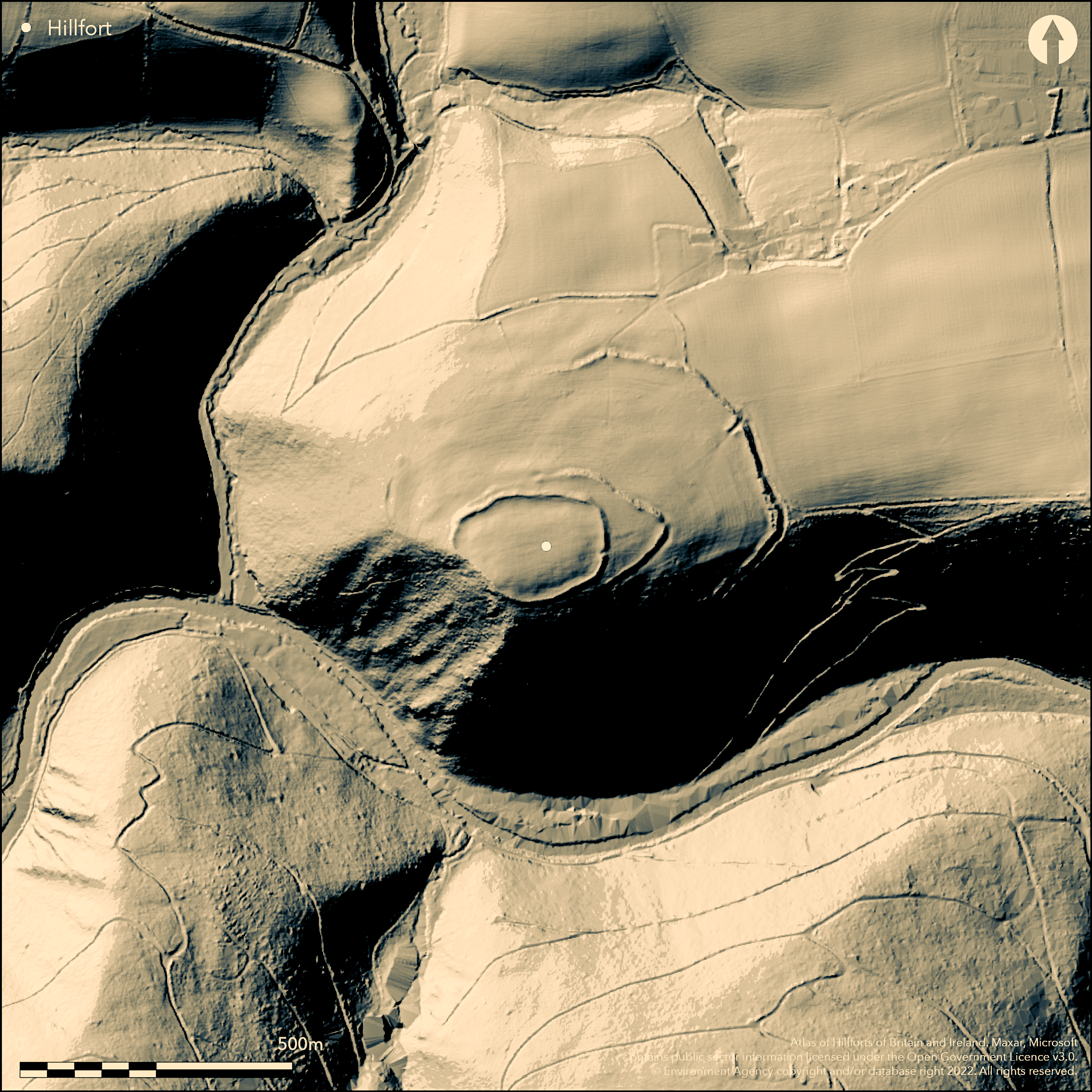
LiDAR 1m DTM Hillshade
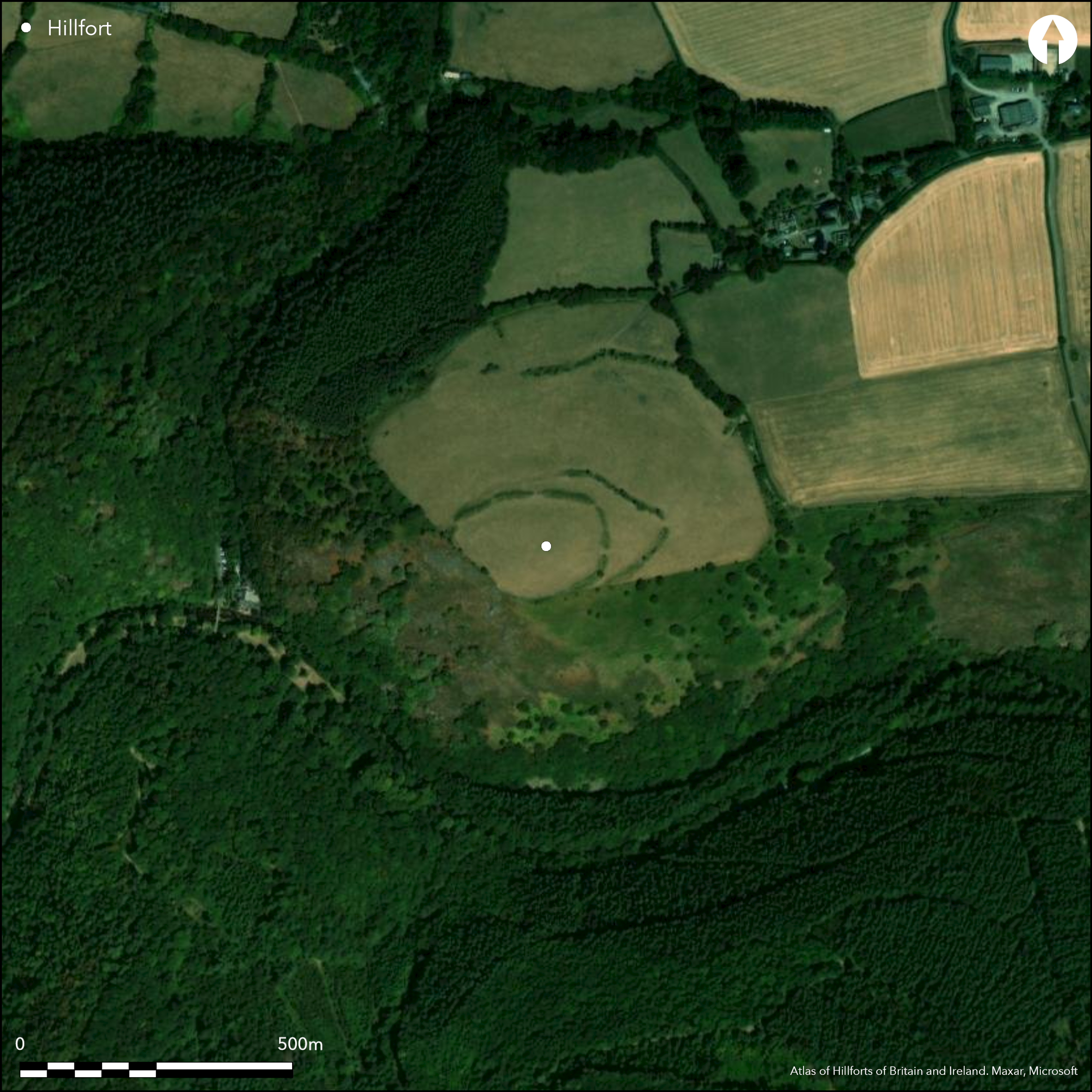
Satellite Imagery
LiDAR 1m DTM Hillshade
Satellite Imagery
Scroll left/right to view further images.
HER: Devon MDV8439 (None)
NMR: SX 79 SW 5 (445780)
SM: 1003861
NGR: SX746900
X: 274693 Y: 90015 (OSGB36)
Partial contour multiple enclosure located on summit of hill on N side of River Teign and between two steep gorges where a tributary joins the river. Commanding position with very steep to precipitous slopes to S quadrants and W, steep to NW and N and moderate to NE. Defined by a main inner enclosure rampart surrounding the summit of the hill, with two additional widely-spaced ramparts in two arcs downhill to the NE, middle bank much nearer main circuit than outer. Main enclosure bank almost non-existent on steepest SW side, with bank to 1.2m high and no ditch elsewhere. Site ploughed in past with some quarrying, so possible that ditch now a buried feature, but uncertain. Bank appears to have been scarped below in some places, so adding degree of monumentality. An E entrance nearly lines up with entrance of middle and second rampart downhill, which, on N side, seems to be merely a break of slope. Further downhill, the outer bank sweeps round in an arc from N to SE. Bank is substantial in places with large ditch, but mere break of slope to N and non-existent where it meets the precipitous Teign gorge on SE. It has a fine inturned entrance to NE and at this point bank rises to c. 3m high plus. Inner enclosure c. 1.4ha, second enclosure extends this to 2.6ha with the outer enclosure being c.9.0ha. Much debate as to whether these widely-spaced banks indicate a phased development of the site or not, a similar situation at Cranbrook (Atlas No 3347) sited directly across the Teign. Ploughing has certainly affected the site to its detriment and now under improved pasture. On 1st Ed. OS map (1885). Minimal investigations, undated.
Citizen Science: ✓
Reliability of Data: Confirmed
Reliability of Interpretation: Confirmed
X: -420302 Y: 6567726 (EPSG: 3857)
Longitude: -3.7756370542560633 Latitude: 50.69617950077666 (EPSG:4326)
Country: England; None
Current County or Unitary Authority: Devon
Historic County: Devon
Current Parish/Community/Council/Townland: Drewsteignton; Mortonhampstead
Ploughing has certainly affected the site to its detriment. On Heritage at Risk Register (2015).
| Extant | ✓ |
| Cropmark | ✗ |
| Likely Destroyed | ✗ |
Site now under improved pasture.
| Woodland | ✗ |
| Commercial Forestry Plantation | ✗ |
| Parkland | ✗ |
| Pasture (Grazing) | ✓ |
| Arable | ✗ |
| Scrub/Bracken | ✗ |
| Bare Outcrop | ✗ |
| Heather/Moorland | ✗ |
| Heath | ✗ |
| Built-up | ✗ |
| Coastal Grassland | ✗ |
| Other | ✗ |
Partial contour multiple enclosure located on summit of hill on N side of River Teign and between two steep gorges where a tributary joins the river. Commanding position with very steep to precipitous slopes to S quadrants, less to NW and moderate to N and NE.
| Contour Fort | ✓ |
| Partial Contour Fort | ✗ |
| Promontory Fort | ✗ |
| Hillslope Fort | ✗ |
| Level Terrain Fort | ✗ |
| Marsh Fort | ✗ |
| Multiple Enclosure Fort | ✓ |
| Hilltop | ✓ |
| Coastal Promontory | ✗ |
| Inland Promontory | ✗ |
| Valley Bottom | ✗ |
| Knoll/Hillock/Outcrop | ✗ |
| Ridge | ✗ |
| Cliff/Plateau-edge/Scarp | ✗ |
| Hillslope | ✗ |
| Lowland | ✗ |
| Spur | ✗ |
Dominant Topographic Feature: Hill top
| North | ✗ |
| Northeast | ✓ |
| East | ✗ |
| Southeast | ✗ |
| South | ✗ |
| Southwest | ✗ |
| West | ✗ |
| Northwest | ✗ |
| Level | ✗ |
Altitude: 244.0m
Parish boundary along river to S
Boundary Type: Parish/Townland
None.
Reliability: D - None
| Pre 1200BC | ✗ |
| 1200BC - 800BC | ✗ |
| 800BC - 400BC | ✗ |
| 400BC - AD50 | ✗ |
| AD50 - AD400 | ✗ |
| AD400 - AD 800 | ✗ |
| Post AD800 | ✗ |
| Unknown | ✓ |
| Pre Hillfort: | None |
| Post Hillfort: | None |
On 1st Ed. OS map (1885).
| 1st Identified Map Depiction (1885): | OS map. |
| Other (1972): | Visited by Hillfort Study Group |
| Other (2013): | Visited by Hillfort Study Group |
None.
None
| None | ✓ |
| Spring | ✗ |
| Stream | ✗ |
| Pool | ✗ |
| Flush | ✗ |
| Well | ✗ |
| Other | ✗ |
None
| No Known Features | ✓ |
| Round Stone Structures | ✗ |
| Rectangular Stone Structures | ✗ |
| Curvilinear Platforms | ✗ |
| Other Roundhouse Evidence | ✗ |
| Pits | ✗ |
| Quarry Hollows | ✗ |
| Other | ✗ |
None
| No Known Excavation | ✓ |
| Pits | ✗ |
| Postholes | ✗ |
| Roundhouses | ✗ |
| Rectangular Structures | ✗ |
| Roads/Tracks | ✗ |
| Quarry Hollows | ✗ |
| Other | ✗ |
| Nothing Found | ✗ |
None
| No Known Geophysics | ✓ |
| Pits | ✗ |
| Roundhouses | ✗ |
| Rectangular Structures | ✗ |
| Roads/Tracks | ✗ |
| Quarry Hollows | ✗ |
| Other | ✗ |
| Nothing Found | ✗ |
None
| No Known Finds | ✓ |
| Pottery | ✗ |
| Metal | ✗ |
| Metalworking | ✗ |
| Human Bones | ✗ |
| Animal Bones | ✗ |
| Lithics | ✗ |
| Environmental | ✗ |
| Other | ✗ |
None
| APs Not Checked | ✓ |
| None | ✗ |
| Roundhouses | ✗ |
| Rectangular Structures | ✗ |
| Pits | ✗ |
| Postholes | ✗ |
| Roads/Tracks | ✗ |
| Other | ✗ |
E entrance nearly lines up with entrance of middle and second rampart downhill. Third and outer rampart has fine inturned entrance on NE.
| 3: | None |
| 2: | None |
Guard Chambers: ✗
Chevaux de Frise: ✗
| 1. Simple Gap (East): | Through inner main rampart. |
| 2. Simple Gap (East): | Through second and middle rampart. |
| 3. In-turned (North east): | Through outer rampart. |
Defined by a main inner enclosure rampart surrounding the summit of the hill, with two additional widely-spaced ramparts in two arcs downhill to the NE, the middle bank much nearer the main circuit than the outer. Main enclosure bank almost non-existent on the steepest SW side, with bank to 1.2m high and no ditch elsewhere. Site ploughed in the past with some quarrying, so possible that ditch now buried feature, but uncertain. Bank appears to have been scarped below in some places, so adding a degree of monumentality. Middle and second rampart downhill, on N side seems merely a break of slope. Further downhill, outer bank sweeps round in an arc from N to SE. Bank is substantial in places with large ditch, but mere break of slope to N and non-existent where it meets the precipitous Teign gorge on the SE.
| Area 1: | 1.4ha. |
| Area 2: | 2.6ha. |
| Area 3: | 9ha. |
| Total: | 9.0ha. |
Total Footprint Area: Noneha.
None
| ✓ | Outer enclosure area an approximation. Multiple enclosure suggests phased construction. |
| ✓ | Main enclosure bank almost non-existent on the steepest SW side. |
| NE Quadrant: | 3 |
| SE Quadrant: | 3 |
| SW Quadrant: | 1 |
| NW Quadrant: | 1 |
| Total: | 3 |
| Partial Univallate | ✓ |
| Univallate | ✗ |
| Partial Bivallate | ✗ |
| Bivallate | ✗ |
| Partial Multivallate | ✓ |
| Multivallate | ✗ |
| Unknown | ✗ |
| Partial Univallate | ✗ |
| Univallate | ✓ |
| Partial Bivallate | ✗ |
| Bivallate | ✗ |
| Partial Multivallate | ✗ |
| Multivallate | ✗ |
ADS suggests outer ramparts never finished.
| None | ✗ |
| Earthen Bank | ✓ |
| Stone Wall | ✗ |
| Rubble | ✗ |
| Wall-walk | ✗ |
| Evidence of Timber | ✗ |
| Vitrification | ✗ |
| Other Burning | ✗ |
| Palisade | ✗ |
| Counter Scarp Bank | ✗ |
| Berm | ✗ |
| Unfinished | ✓ |
| Other | ✗ |
None
| None | ✗ |
| Earthen Bank | ✗ |
| Stone Wall | ✗ |
| Murus Duplex | ✗ |
| Timber-framed | ✗ |
| Timber-laced | ✗ |
| Vitrification | ✗ |
| Other Burning | ✗ |
| Palisade | ✗ |
| Counter Scarp Bank | ✗ |
| Berm | ✗ |
| Unfinished | ✗ |
| No Known Excavation | ✓ |
| Other | ✗ |
| ✗ | None |
| ✓ | Site ploughed in the past with some quarrying, so possible that any ditch to inner main rampart now buried feature, but uncertain. Large outer ditch to outer ramparts. |
Number of Ditches: 1
| ✗ | None |
Griffith, F.M. and Wilkes, E.M. 2011. In the footsteps of pioneering women: some recent work on Devon hillforts, In Pearce, S (ed). Recent archaeological work in South-Western Britain, BAR British Series 548.
Wall, J.C. 1906. Ancient Earthworks, In ed W. Page, The Victoria County History of the County of Devon, Vol I, 595, London: James Street, Haymarket.
Atlas of Hillforts:
Wikidata:
This work is licensed under CC BY-SA 4.0

 and should be cited as:
Lock, Gary and Ralston, Ian. 2024. Atlas of Hillforts of Britain and Ireland. Available at: https://hillforts.arch.ox.ac.uk
Document Version 1.1