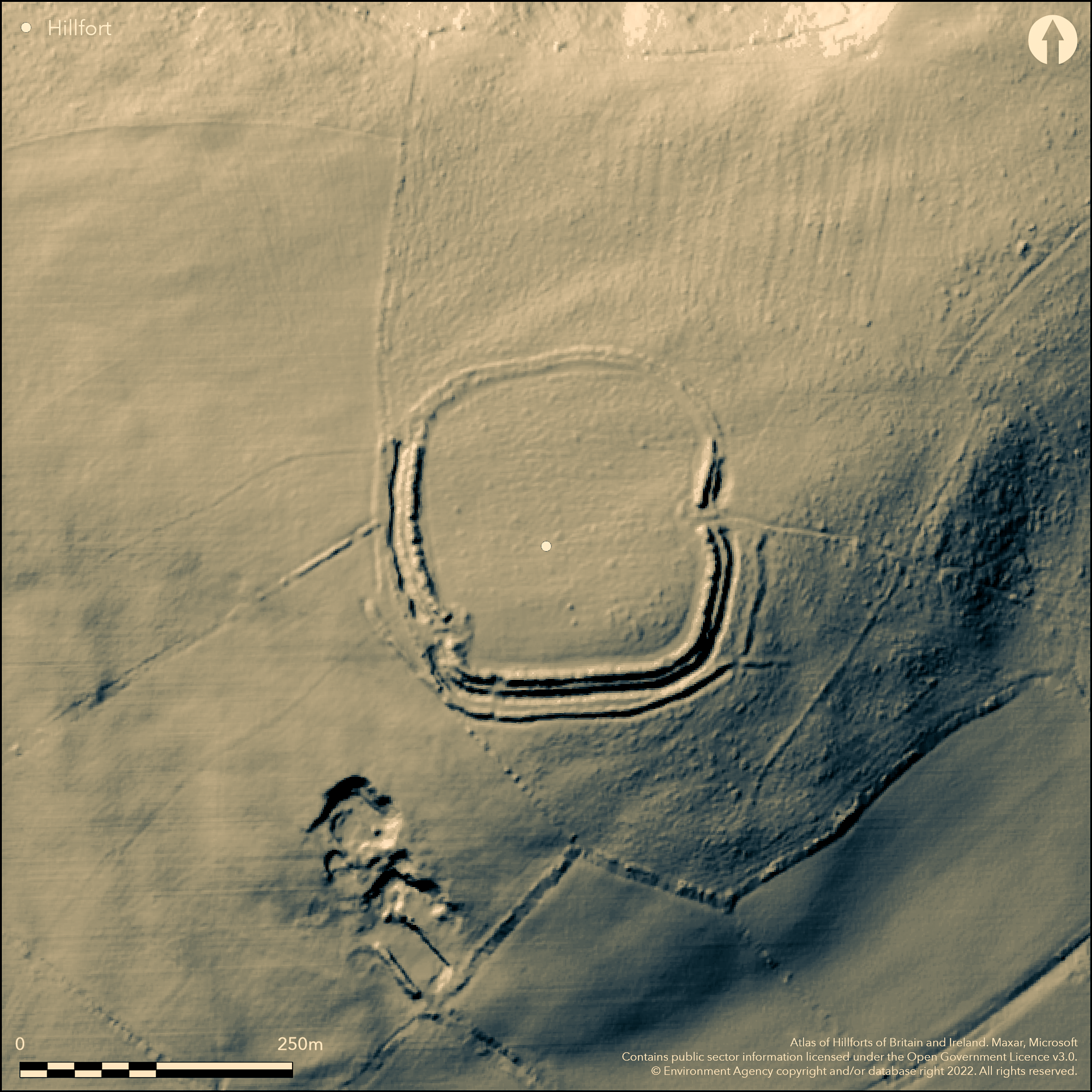
LiDAR 1m DTM Hillshade
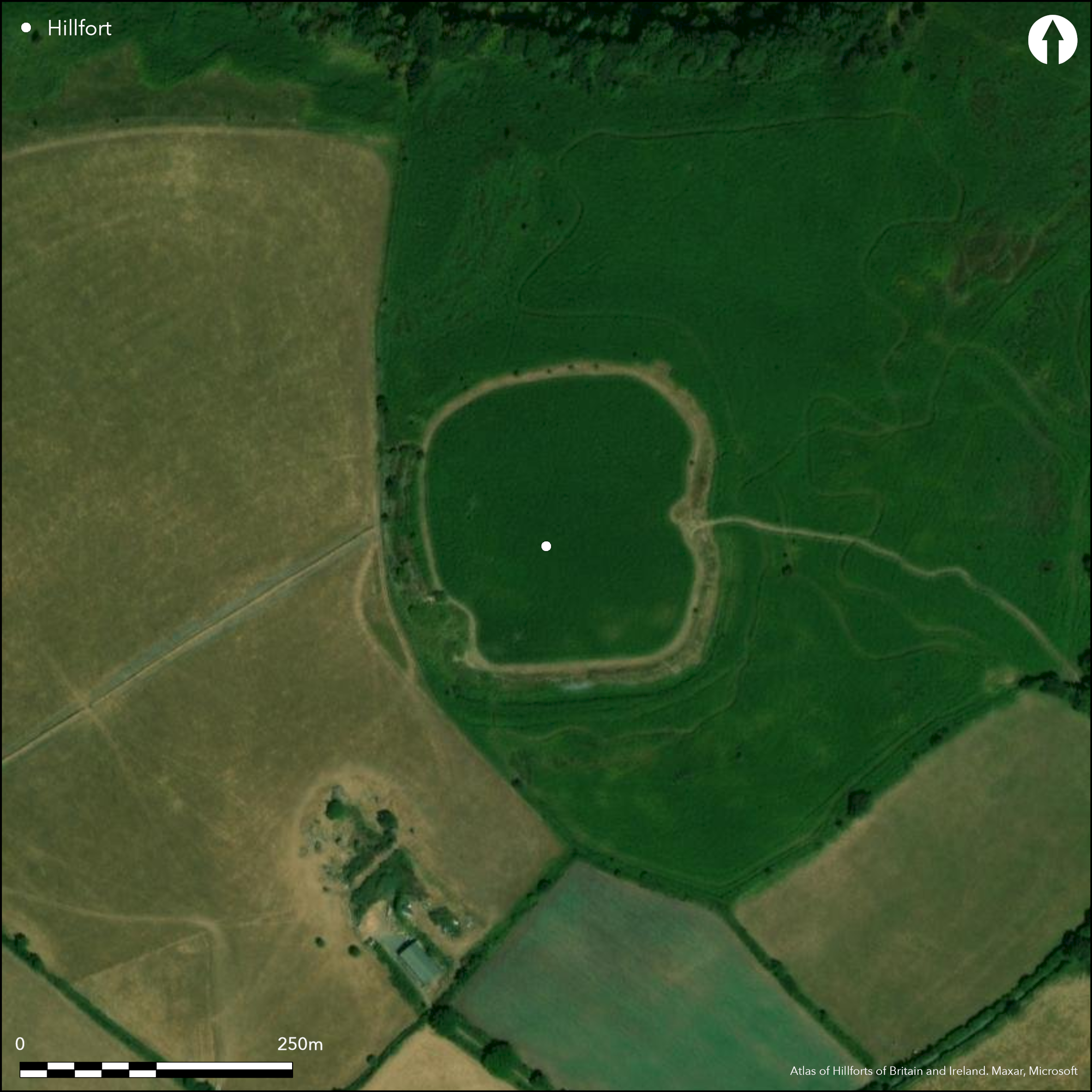
Satellite Imagery
LiDAR 1m DTM Hillshade
Satellite Imagery
Scroll left/right to view further images.
HER: Devon MDV8221 (None)
NMR: SX 78 NW 6 (445462)
SM: 1003860
NGR: SX73858900
X: 273851 Y: 89007 (OSGB36)
Multivallate contour hillfort in commanding position on hill top overlooking the S side of the River Teign valley. Opposite to Prestonbury Castle (Atlas No 3346). Steep surrounding slopes. Probably the best stone-built fort in Devon (unusual in Devon) and well-preserved, with faces visible in parts. Sub-square if form enclosing c. 4ha. Defined by three ramparts to S, curving to SE and SW, with two on E and W and one to N. Entrances on E and SW sides. Small excavation by Rev S. Baring Gould for Devon Exploration Society 1900 showed evidence of hut circles. Survey by J. Collis 1972, 1979. Survey by N. Quinell for RCHME. Collis suggests that site only example of a reave/hillfort relationship on the Moor (Collis 1979) with c.30 clearance cairns in interior. Various interpreations of the site. Collis (1972, 1979) suggests that fort phased construction, whilst Silvester and Quinell (1993) suggest one phase and never completed. Recently Griffiths and Wilkes (2011) view that, rather than being unfinished, site shows strong defences and monumental display to the S, but to the N, and opposite to Prestonbury hillfort across the Teign valley, less conspicuous display was necessary. Site now rough moorland and scrub, but heavily overgrown and undergrazed. On 1st Ed. OS map (1885). Undated.
Citizen Science: ✗
Reliability of Data: Confirmed
Reliability of Interpretation: Confirmed
X: -421590 Y: 6566102 (EPSG: 3857)
Longitude: -3.7872085687394677 Latitude: 50.68693691219915 (EPSG:4326)
Country: England
Current County or Unitary Authority: Devon
Historic County: Devon
Current Parish/Community/Council/Townland: Moretonhampstead
Stone-walled site well-preserved with faces visible.
| Extant | ✓ |
| Cropmark | ✗ |
| Likely Destroyed | ✗ |
Rough moorland and scrub, but heavily overgrown and undergrazed. SSSI.
| Woodland | ✗ |
| Commercial Forestry Plantation | ✗ |
| Parkland | ✗ |
| Pasture (Grazing) | ✗ |
| Arable | ✗ |
| Scrub/Bracken | ✓ |
| Bare Outcrop | ✗ |
| Heather/Moorland | ✓ |
| Heath | ✗ |
| Built-up | ✗ |
| Coastal Grassland | ✗ |
| Other | ✗ |
Multivallate contour hillfort in commanding position on hill top overlooking the S side of the River Teign valley. Steep surrounding slopes.
| Contour Fort | ✓ |
| Partial Contour Fort | ✗ |
| Promontory Fort | ✗ |
| Hillslope Fort | ✗ |
| Level Terrain Fort | ✗ |
| Marsh Fort | ✗ |
| Multiple Enclosure Fort | ✗ |
| Hilltop | ✓ |
| Coastal Promontory | ✗ |
| Inland Promontory | ✗ |
| Valley Bottom | ✗ |
| Knoll/Hillock/Outcrop | ✗ |
| Ridge | ✗ |
| Cliff/Plateau-edge/Scarp | ✗ |
| Hillslope | ✗ |
| Lowland | ✗ |
| Spur | ✗ |
Dominant Topographic Feature: Hill top
| North | ✗ |
| Northeast | ✗ |
| East | ✗ |
| Southeast | ✗ |
| South | ✗ |
| Southwest | ✗ |
| West | ✗ |
| Northwest | ✗ |
| Level | ✓ |
Altitude: 335.0m
N/A
None.
Reliability: D - None
| Pre 1200BC | ✗ |
| 1200BC - 800BC | ✗ |
| 800BC - 400BC | ✗ |
| 400BC - AD50 | ✗ |
| AD50 - AD400 | ✗ |
| AD400 - AD 800 | ✗ |
| Post AD800 | ✗ |
| Unknown | ✓ |
| Pre Hillfort: | None |
| Post Hillfort: | None |
On 1st Ed. OS map (1885). Small excavation by Rev S. Baring Gould for Devon Exploration Society 1900. Survey by J. Collis 1972, 1979. Survey by N. Quinell for RCHME.
| 1st Identified Map Depiction (1885): | OS map. |
| Excavation (1900): | Rev S. Baring Gould for Devon Exploration Society |
| Other (1972): | Visited by Hillfort Study Group |
| Other (2013): | Visited by Hillfort Study Group |
| Earthwork Survey (None): | J. Collis. |
| Earthwork Survey (None): | N. Quinell for RCHME. |
C. 30 clearance cairns in interior. Excavation showed evidence of hut circles.
None
| None | ✓ |
| Spring | ✗ |
| Stream | ✗ |
| Pool | ✗ |
| Flush | ✗ |
| Well | ✗ |
| Other | ✗ |
C. 30 clearance cairns in interior.
| No Known Features | ✗ |
| Round Stone Structures | ✗ |
| Rectangular Stone Structures | ✗ |
| Curvilinear Platforms | ✗ |
| Other Roundhouse Evidence | ✗ |
| Pits | ✗ |
| Quarry Hollows | ✗ |
| Other | ✓ |
Evidence of hut circles.
| No Known Excavation | ✗ |
| Pits | ✗ |
| Postholes | ✗ |
| Roundhouses | ✓ |
| Rectangular Structures | ✗ |
| Roads/Tracks | ✗ |
| Quarry Hollows | ✗ |
| Other | ✗ |
| Nothing Found | ✗ |
None
| No Known Geophysics | ✓ |
| Pits | ✗ |
| Roundhouses | ✗ |
| Rectangular Structures | ✗ |
| Roads/Tracks | ✗ |
| Quarry Hollows | ✗ |
| Other | ✗ |
| Nothing Found | ✗ |
None
| No Known Finds | ✓ |
| Pottery | ✗ |
| Metal | ✗ |
| Metalworking | ✗ |
| Human Bones | ✗ |
| Animal Bones | ✗ |
| Lithics | ✗ |
| Environmental | ✗ |
| Other | ✗ |
None
| APs Not Checked | ✓ |
| None | ✗ |
| Roundhouses | ✗ |
| Rectangular Structures | ✗ |
| Pits | ✗ |
| Postholes | ✗ |
| Roads/Tracks | ✗ |
| Other | ✗ |
Entrances to E and SW, latter slightly inturned.
| 2: | None |
| 2: | None |
Guard Chambers: ✗
Chevaux de Frise: ✗
| 1. Simple Gap (East): | None |
| 2. In-turned (South west): | Slightly inturned. |
Stone-built hillfort defined by three ramparts to S, curving to SE and SW, with two on E and W and one to N.
| Area 1: | 4.0ha. |
| Total: | 4.0ha. |
Total Footprint Area: Noneha.
None
| ✓ | Possibly phased construction according to Collis (1972, 1979). |
| ✓ | None |
| NE Quadrant: | 1 |
| SE Quadrant: | 3 |
| SW Quadrant: | 3 |
| NW Quadrant: | 1 |
| Total: | 3 |
| Partial Univallate | ✓ |
| Univallate | ✗ |
| Partial Bivallate | ✗ |
| Bivallate | ✗ |
| Partial Multivallate | ✓ |
| Multivallate | ✗ |
| Unknown | ✗ |
| Partial Univallate | ✗ |
| Univallate | ✓ |
| Partial Bivallate | ✗ |
| Bivallate | ✗ |
| Partial Multivallate | ✗ |
| Multivallate | ✗ |
Stone-walled site - unusual in Devon. Suggested as unfinished by Silvester and Quinell (1993).
| None | ✗ |
| Earthen Bank | ✗ |
| Stone Wall | ✓ |
| Rubble | ✗ |
| Wall-walk | ✗ |
| Evidence of Timber | ✗ |
| Vitrification | ✗ |
| Other Burning | ✗ |
| Palisade | ✗ |
| Counter Scarp Bank | ✗ |
| Berm | ✗ |
| Unfinished | ✓ |
| Other | ✗ |
None
| None | ✓ |
| Earthen Bank | ✗ |
| Stone Wall | ✗ |
| Murus Duplex | ✗ |
| Timber-framed | ✗ |
| Timber-laced | ✗ |
| Vitrification | ✗ |
| Other Burning | ✗ |
| Palisade | ✗ |
| Counter Scarp Bank | ✗ |
| Berm | ✗ |
| Unfinished | ✗ |
| No Known Excavation | ✗ |
| Other | ✗ |
| ✗ | None |
| ✓ | None |
Number of Ditches: 2
| ✗ | None |
Baring Gould, S. 1901. Report Devonshire Association reports and transactions 33/1901/129-135.
Collis, J. 1972. Cranbrook Castle, Moretonhampstead. A new survey, Proc. Devon Archaeol. Soc, 30, 216-21.
Collis, J. 1979. Cranbrook Castle revisted, Proc. Devon Archaeol. Soc, 37, 191-94.
Griffith, F.M. and Wilkes, E.M. 2011. In the footsteps of pioneering women: some recent work on Devon hillforts, In Pearce, S (ed). Recent archaeological work in South-Western Britain, BAR British Series 548.
Silvester, R. and Quinell, N. 1993. Unfinished hillforts on the Devon moors, Proc. Devon Archaeol. Soc, 51, 17-31.
Atlas of Hillforts:
Wikidata:
This work is licensed under CC BY-SA 4.0

 and should be cited as:
Lock, Gary and Ralston, Ian. 2024. Atlas of Hillforts of Britain and Ireland. Available at: https://hillforts.arch.ox.ac.uk
Document Version 1.1