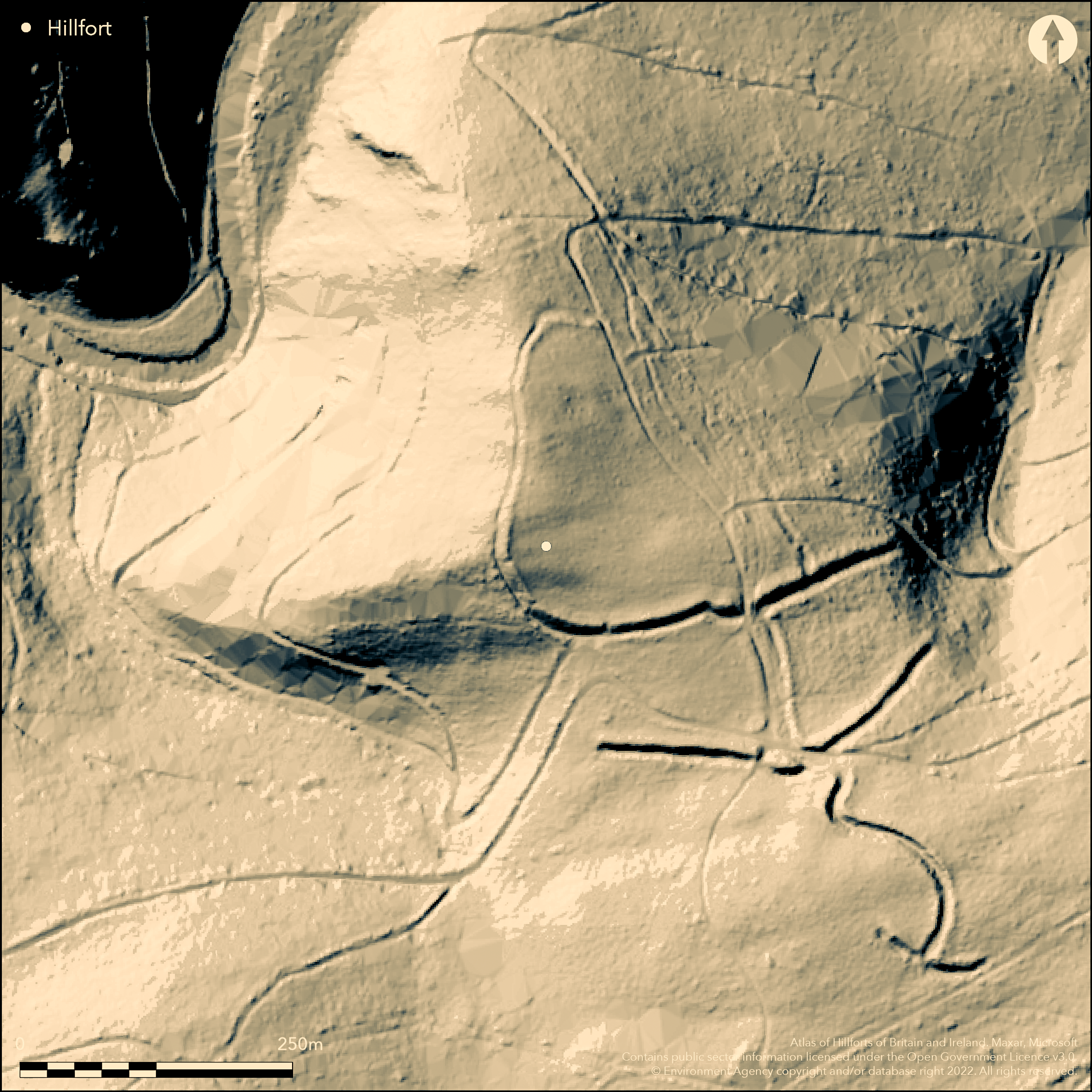
LiDAR 1m DTM Hillshade
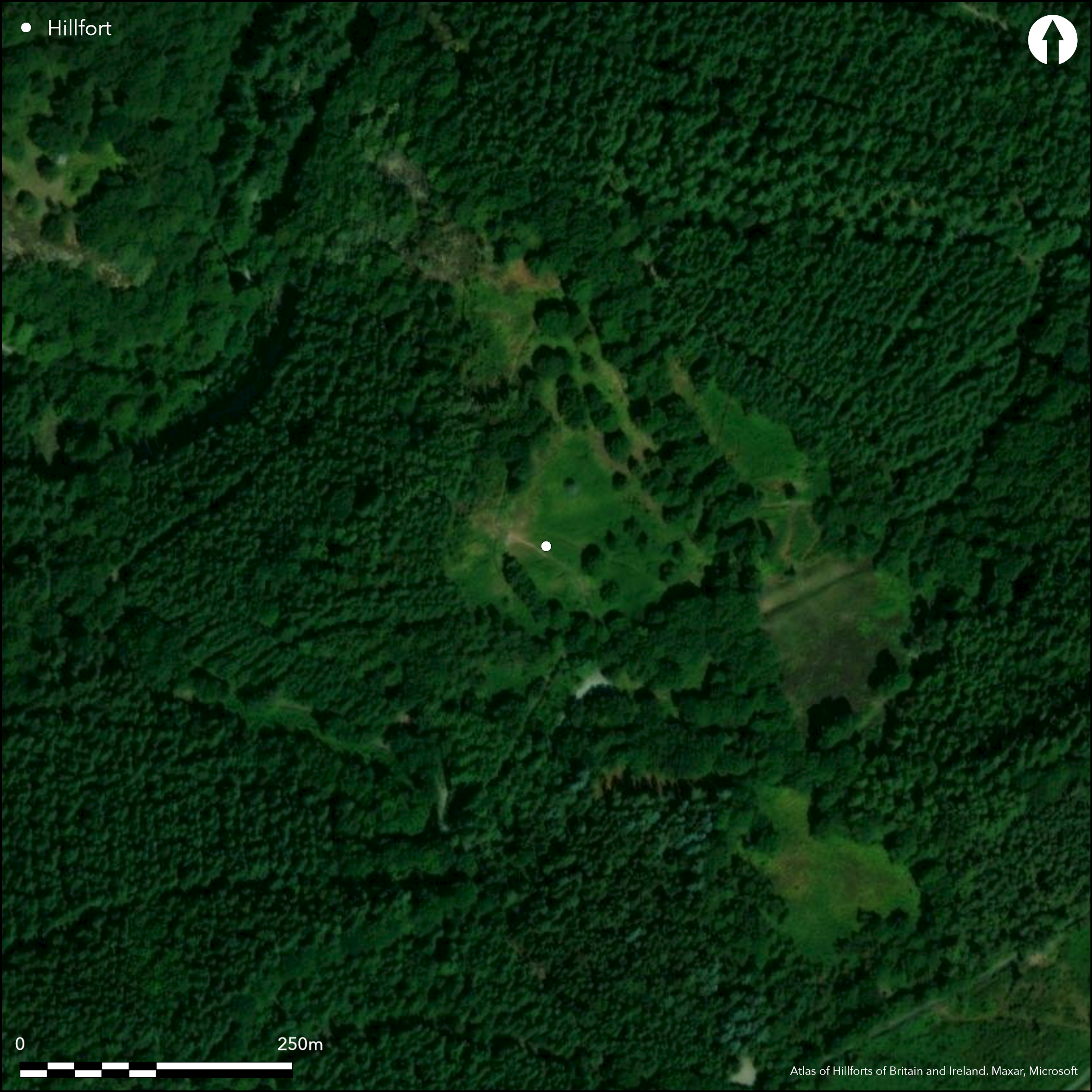
Satellite Imagery
LiDAR 1m DTM Hillshade
Satellite Imagery
Scroll left/right to view further images.
HER: Devon MDV8292 (None)
NMR: SX 78 NE 2 (445354)
SM: 1003822
NGR: SX764896
X: 276453 Y: 89660 (OSGB36)
Unusual partial contour hillfort located on hill top above the RIver Teign to N. Very steep surrounding slopes to N, E and W, steep to S. Pear-shaped in form, its internal area not defined, but probably in excess of 1.5ha. Four widely-separated ramparts with ditches sited on S and uphill side running roughly in line with contours. To far S, and at highest point of site, rampart runs NE-WSW, greater on W, with seemingly no entrance gap through and confused by modern field boundaries and modern pit, with ends not against any particular natural feature. To c. 75m to N, short second rampart curving SE-NW straddles an inturned entrance, which forms start of what described as a hollow way, at least 2m deep and seemingly dug rather than natural feature, and running, with two marked bends, to a curving oblique entrance through third, and longer, rampart. This again has two arms each side, that on E curving and ending at steep slope to NE and that on W ending abruptly straight to WNW. E arm of rampart also bends round at entrance to N, running downslope to meet ditch of fourth rampart. Hollow way damaged by modern access tracks here, with no record that it is modern feature. Seems also to end here, but again visible to N where seems to run into the fourth rampart ditch alongside,and W, of E arm rampart. Fourth rampart runs c. 200m across hillside, with damaged entrance, an E arm stopping abruptly, with a W arm curving downhill to N for c. 75m before stopping. Scarping then continues N then S to form a triangular enclosure, meeting the E arm of main rampart E of its entrance. Interpretation of features difficult and, apart from N enclosure formed by fourth rampart and scarping, the other ramparts do not seem to form any coherent enclosures. No excavations, but annotated plan by N. Quinell 1981. Dense bracken and scrub with scattered trees, more on banks. Wooded surrounds, less on S where scheduled area affected by two NE-SW tracks. Entrances damaged by modern access, but site generally well-preserved. On 1st Ed. OS map (1885). Minimal investigations, undated.
Citizen Science: ✗
Reliability of Data: Confirmed
Reliability of Interpretation: Confirmed
X: -417516 Y: 6567232 (EPSG: 3857)
Longitude: -3.7506104683442154 Latitude: 50.6933653438827 (EPSG:4326)
Country: England; None
Current County or Unitary Authority: Devon
Historic County: Devon
Current Parish/Community/Council/Townland: Moretonhampstead; Drewsreignton
General good condition despite dense scrub and damaged entrances. On Heritage at Risk Register (2015).
| Extant | ✓ |
| Cropmark | ✗ |
| Likely Destroyed | ✗ |
Dense bracken and scrub with scattered trees, more on banks. Wooded surrounds, less on S where scheduled area affected by two NE-SW tracks.
| Woodland | ✓ |
| Commercial Forestry Plantation | ✗ |
| Parkland | ✗ |
| Pasture (Grazing) | ✗ |
| Arable | ✗ |
| Scrub/Bracken | ✓ |
| Bare Outcrop | ✗ |
| Heather/Moorland | ✗ |
| Heath | ✗ |
| Built-up | ✗ |
| Coastal Grassland | ✗ |
| Other | ✗ |
Unusual partial contour hillfort located on hill top above the RIver Teign to N. Very steep surrounding slopes to N, E and W, steep to S. Site slopes steeply N to river.
| Contour Fort | ✗ |
| Partial Contour Fort | ✓ |
| Promontory Fort | ✗ |
| Hillslope Fort | ✗ |
| Level Terrain Fort | ✗ |
| Marsh Fort | ✗ |
| Multiple Enclosure Fort | ✗ |
| Hilltop | ✓ |
| Coastal Promontory | ✗ |
| Inland Promontory | ✗ |
| Valley Bottom | ✗ |
| Knoll/Hillock/Outcrop | ✗ |
| Ridge | ✗ |
| Cliff/Plateau-edge/Scarp | ✗ |
| Hillslope | ✗ |
| Lowland | ✗ |
| Spur | ✓ |
Dominant Topographic Feature: Hill top
| North | ✓ |
| Northeast | ✗ |
| East | ✗ |
| Southeast | ✗ |
| South | ✗ |
| Southwest | ✗ |
| West | ✗ |
| Northwest | ✗ |
| Level | ✗ |
Altitude: 198.0m
150m to N
Boundary Type: Parish/Townland
None.
Reliability: D - None
| Pre 1200BC | ✗ |
| 1200BC - 800BC | ✗ |
| 800BC - 400BC | ✗ |
| 400BC - AD50 | ✗ |
| AD50 - AD400 | ✗ |
| AD400 - AD 800 | ✗ |
| Post AD800 | ✗ |
| Unknown | ✓ |
| Pre Hillfort: | None |
| Post Hillfort: | None |
On 1st Ed. OS map (1885). Annotated plan by N. Quinnell 1981.
| 1st Identified Map Depiction (1885): | OS map. |
| Earthwork Survey (1981): | Annotated plan by N. Quinnell |
| Other (2013): | Visited by Hillfort Study Group |
None
None
| None | ✓ |
| Spring | ✗ |
| Stream | ✗ |
| Pool | ✗ |
| Flush | ✗ |
| Well | ✗ |
| Other | ✗ |
None
| No Known Features | ✓ |
| Round Stone Structures | ✗ |
| Rectangular Stone Structures | ✗ |
| Curvilinear Platforms | ✗ |
| Other Roundhouse Evidence | ✗ |
| Pits | ✗ |
| Quarry Hollows | ✗ |
| Other | ✗ |
None
| No Known Excavation | ✓ |
| Pits | ✗ |
| Postholes | ✗ |
| Roundhouses | ✗ |
| Rectangular Structures | ✗ |
| Roads/Tracks | ✗ |
| Quarry Hollows | ✗ |
| Other | ✗ |
| Nothing Found | ✗ |
None
| No Known Geophysics | ✓ |
| Pits | ✗ |
| Roundhouses | ✗ |
| Rectangular Structures | ✗ |
| Roads/Tracks | ✗ |
| Quarry Hollows | ✗ |
| Other | ✗ |
| Nothing Found | ✗ |
None
| No Known Finds | ✓ |
| Pottery | ✗ |
| Metal | ✗ |
| Metalworking | ✗ |
| Human Bones | ✗ |
| Animal Bones | ✗ |
| Lithics | ✗ |
| Environmental | ✗ |
| Other | ✗ |
None
| APs Not Checked | ✓ |
| None | ✗ |
| Roundhouses | ✗ |
| Rectangular Structures | ✗ |
| Pits | ✗ |
| Postholes | ✗ |
| Roads/Tracks | ✗ |
| Other | ✗ |
Hollow way runs N, with entrance through each of second, third and fourth ramparts. Entrances damaged by modern access and modern gap through third rampart W of entrance.
| 4: | Modern gap through third rampart W of entrance. |
| 2: | Entrances damaged by modern access. |
Guard Chambers: ✗
Chevaux de Frise: ✗
| 1. Hollow Way (North west): | Inturned entrance through second rampart faces NW. |
| 1. In-turned (North west): | None |
| 2. Hollow Way (North west): | Oblique entrance through third rampart faces NW. |
| 2. Oblique (North west): | None |
| 3. Hollow Way (North): | Simple gap entrance through fourth rampart. |
Four widely-separated ramparts with ditches sited on S and uphill side running roughly in line with contours. To far S, and at highest point of site, rampart runs NE-WSW, greater on W, with ends not against any particular natural feature. To c. 75m to N, short second rampart curving SE-NW. To N third, and longer, rampart. This again has two arms each side, that on E curving and ending at the steep slope to NE and that on W ending abruptly straight to WNW. The E arm of the rampart bends to N, running downslope to meet ditch of fourth rampart. Fourth rampart runs c. 200m across hillside, an E arm stopping abruptly, with a W arm curving downhill to N for c. 75m before stopping. Scarping then continues N then S, to form a triangular enclosure, meeting the E arm of the main rampart E of its entrance.
| Area 1: | 1.5ha. |
| Total: | 1.5ha. |
Total Footprint Area: Noneha.
None
| ✗ | Area uncertain. |
| ✓ | Only triangular N enclosure defined. |
| NE Quadrant: | 1 |
| SE Quadrant: | 1 |
| SW Quadrant: | 1 |
| NW Quadrant: | 1 |
| Total: | 1 |
| Partial Univallate | ✗ |
| Univallate | ✓ |
| Partial Bivallate | ✗ |
| Bivallate | ✗ |
| Partial Multivallate | ✗ |
| Multivallate | ✗ |
| Unknown | ✗ |
| Partial Univallate | ✗ |
| Univallate | ✗ |
| Partial Bivallate | ✗ |
| Bivallate | ✗ |
| Partial Multivallate | ✗ |
| Multivallate | ✗ |
Possibly earthen bank with rubble.
| None | ✗ |
| Earthen Bank | ✓ |
| Stone Wall | ✗ |
| Rubble | ✓ |
| Wall-walk | ✗ |
| Evidence of Timber | ✗ |
| Vitrification | ✗ |
| Other Burning | ✗ |
| Palisade | ✗ |
| Counter Scarp Bank | ✗ |
| Berm | ✗ |
| Unfinished | ✗ |
| Other | ✗ |
None
| None | ✗ |
| Earthen Bank | ✗ |
| Stone Wall | ✗ |
| Murus Duplex | ✗ |
| Timber-framed | ✗ |
| Timber-laced | ✗ |
| Vitrification | ✗ |
| Other Burning | ✗ |
| Palisade | ✗ |
| Counter Scarp Bank | ✗ |
| Berm | ✗ |
| Unfinished | ✗ |
| No Known Excavation | ✓ |
| Other | ✗ |
| ✗ | None |
| ✓ | None |
Number of Ditches: 4
| ✗ | None |
Fox, A. 1996. Prehistoric hillforts in Devon, Tiverton: Devon Books.
Griffith, F.M. and Wilkes, E.M. 2011. In the footsteps of pioneering women: some recent work on Devon hillforts, In Pearce, S (ed). Recent archaeological work in South-Western Britain, BAR British Series 548.
Atlas of Hillforts:
Wikidata:
This work is licensed under CC BY-SA 4.0

 and should be cited as:
Lock, Gary and Ralston, Ian. 2024. Atlas of Hillforts of Britain and Ireland. Available at: https://hillforts.arch.ox.ac.uk
Document Version 1.1